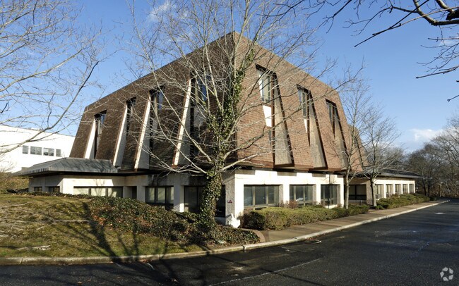
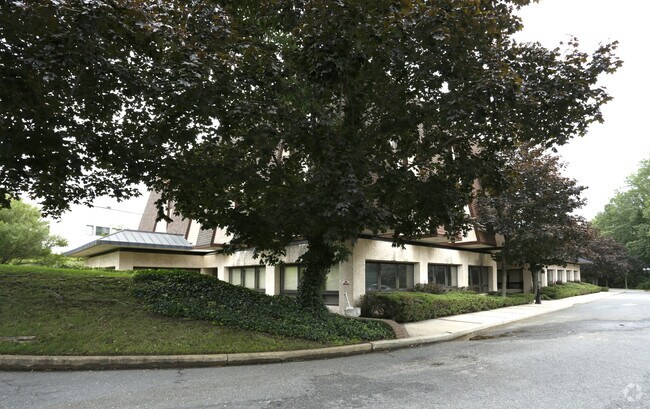
Property Record
2520 Highway 35, Manasquan, NJ 08736

Property Detail
2520 Highway 35
52-00337-0000-00036
Monmouth
Commercialnec
New Jersey
OP-2
36
AE The base floodplain where base flood elevations are provided. AE Zones are now used on new format FIRMs instead of A1-A30 Zones.
2.08 AC
2024
Southern Monmouth
2025
Northern New Jersey
808800
Lakewood-New Brunswick, NJ
24,710 SF
NEARBY LISTINGS FOR SALE OR LEASE
DEMOGRAPHICS near 2520 Highway 35
1 mile
3 mile
5 mile
2025 Total Population
8,909
59,877
136,099
2030 Population
8,917
61,467
139,296
Pop Growth 2025-2030
+ 0.09%
+ 2.66%
+ 2.35%
Average Age
45
45
44
2025 Total Households
3,445
24,188
54,683
HH Growth 2025-2030
(0.03%)
+ 2.57%
+ 2.19%
Median Household Inc
$171,821
$122,884
$116,612
Avg Household Size
2.50
2.40
2.40
2025 Avg HH Vehicles
2.00
2.00
2.00
Median Home Value
$793,162
$741,734
$630,488
Median Year Built
1972
1970
1972
Nearby Places
Map Layers
Map Styles
 Street
 Aerial
Layers
 Traffic
 Biking
Places
Listings with unknown addresses are not visible on the map
- Restaurants
- Banks
- Shops
- Fitness
- Groceries
PUBLIC TRANSPORTATION
COMMUTER RAIL
Manasquan (North Jersey Coast Line - NJ Transit Commuter Rail (NJ Transit))
Drive
Walk
Distance
Manasquan (North Jersey Coast Line - NJ Transit Commuter Rail (NJ Transit))
5 min
2.2 mi
Point Pleasant Beach (North Jersey Coast Line - NJ Transit Commuter Rail (NJ Transit))
Drive
Walk
Distance
Point Pleasant Beach (North Jersey Coast Line - NJ Transit Commuter Rail (NJ Transit))
6 min
3.2 mi
Freight Ports
New York Container Terminal
Drive
Walk
Distance
New York Container Terminal
63 min
47.9 mi
SALE & LEASE HISTORY
LISTING DATE
SALE/LEASE

Sep 24, 2016
For Lease
Jun 25, 2024
For Lease
Jun 23, 2023
For Lease
Aug 13, 2021
For Lease
Nearby Properties
Address
Land Use
TOTAL SIZE
Lot Size
Zoning
Address
Land Use
TOTAL SIZE
Lot Size
Zoning
22,660 SF
164.35 AC
4
Address
Land Use
TOTAL SIZE
Lot Size
Zoning
23,868 SF
137.35 AC
SF40
Address
Land Use
TOTAL SIZE
Lot Size
Zoning
4,078 SF
11.84 AC
SF05
Address
Land Use
TOTAL SIZE
Lot Size
Zoning
11,900 SF
30.98 AC
R-1A
Address
Land Use
TOTAL SIZE
Lot Size
Zoning
3.46 AC
SF05
Address
Land Use
TOTAL SIZE
Lot Size
Zoning
5,000 SF
22.50 AC
CONREC
Address
Land Use
TOTAL SIZE
Lot Size
Zoning
17.66 AC
1E
Address
Land Use
TOTAL SIZE
Lot Size
Zoning
35,639 SF
99.30 AC
SF20
Address
Land Use
TOTAL SIZE
Lot Size
Zoning
71,070 SF
11.81 AC
MLHB
Address
Land Use
TOTAL SIZE
Lot Size
Zoning
49,657 SF
11.22 AC
HB80
Address
Land Use
TOTAL SIZE
Lot Size
Zoning
61,432 SF
3.44 AC
SF05
Address
Land Use
TOTAL SIZE
Lot Size
Zoning
7.79 AC
MLCC
Address
Land Use
TOTAL SIZE
Lot Size
Zoning
84,297 SF
42.37 AC
CR40
Address
Land Use
TOTAL SIZE
Lot Size
Zoning
145,918 SF
20.31 AC
OR-5
Address
Land Use
TOTAL SIZE
Lot Size
Zoning
49,170 SF
8.38 AC
HB80
Address
Land Use
TOTAL SIZE
Lot Size
Zoning
45,236 SF
48.30 AC
POS
Address
Land Use
TOTAL SIZE
Lot Size
Zoning
26.05 AC
SF10
Address
Land Use
TOTAL SIZE
Lot Size
Zoning
3,792 SF
7.64 AC
R-1A
Address
Land Use
TOTAL SIZE
Lot Size
Zoning
115,960 SF
17.93 AC
OR-5
Address
Land Use
TOTAL SIZE
Lot Size
Zoning
111,580 SF
25 AC
POS
Address
Land Use
TOTAL SIZE
Lot Size
Zoning
8.83 AC
R-2
Address
Land Use
TOTAL SIZE
Lot Size
Zoning
48,984 SF
5.53 AC
R-5
Address
Land Use
TOTAL SIZE
Lot Size
Zoning
2,568 SF
6.97 AC
SF05
Address
Land Use
TOTAL SIZE
Lot Size
Zoning
65,900 SF
10.52 AC
R-5
Address
Land Use
TOTAL SIZE
Lot Size
Zoning
13,094 SF
1.43 AC
HB80
Address
Land Use
TOTAL SIZE
Lot Size
Zoning
192 SF
12.50 AC
HD12
Address
Land Use
TOTAL SIZE
Lot Size
Zoning
81,656 SF
8.15 AC
HB80
Address
Land Use
TOTAL SIZE
Lot Size
Zoning
15.94 AC
R-2
Address
Land Use
TOTAL SIZE
Lot Size
Zoning
13.21 AC
HD12
Address
Land Use
TOTAL SIZE
Lot Size
Zoning
5.37 AC
R-5
The World's #1 Commercial Real Estate Marketplace
Connect with us
© 2026 CoStar Group
The information above has been obtained from sources believed reliable. While we do not doubt its accuracy we have not verified it and make no guarantee, warranty or representation about it. It is your responsibility to independently confirm its accuracy and completeness. Any projections, opinions, assumptions, or estimates used are for example only and do not represent the current or future performance of the property. The value of this transaction to you depends on tax and other factors which should be evaluated by your tax, financial, and legal advisors. You and your advisors should conduct a careful, independent investigation of the property to determine to your satisfaction the suitability of the property for your needs.