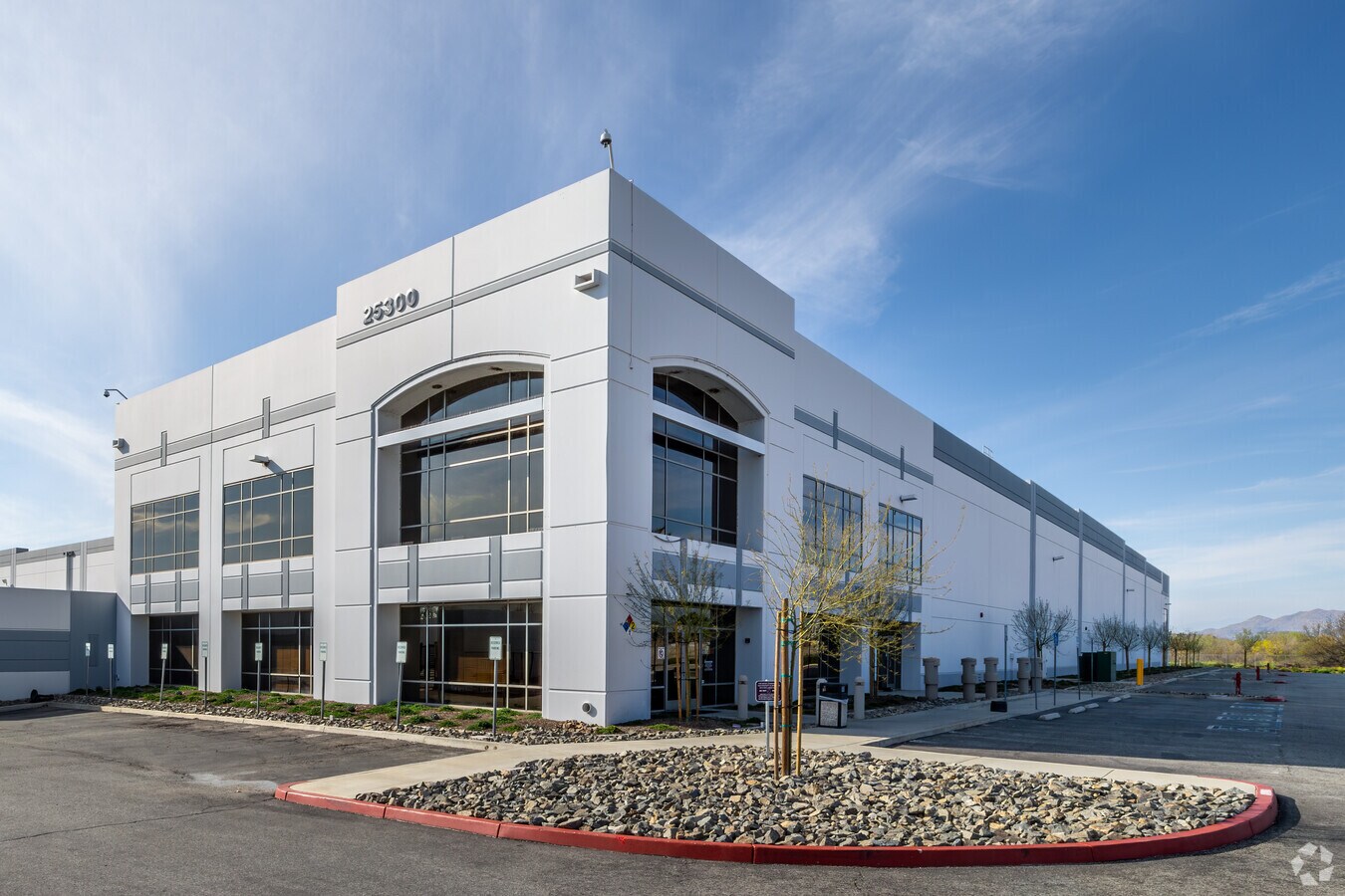
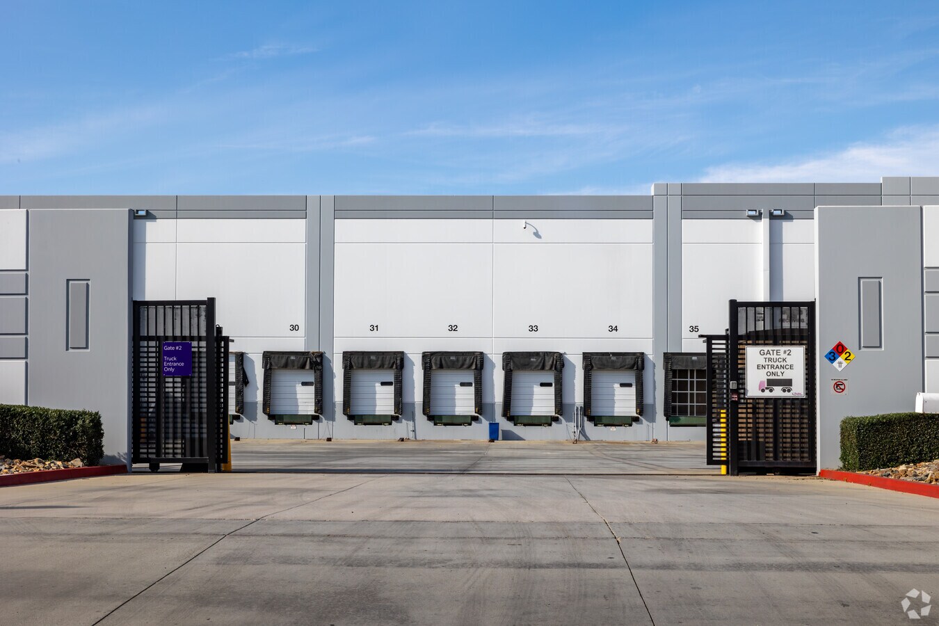
Property Record
25300 Globe St, Perris, CA 92570


NEARBY LISTINGS FOR SALE OR LEASE
Property Detail
25300 Globe St
Riverside-San Bernardino-Ontario, CA
Parcel Map 31034
312-270-036
18.98 ACRES NET IN LOT 2 MB 211/087 TR 31034
Warehouse
Riverside
X
California
06065C1430H
2
2023
18.98 AC
2023
Moreno Valley/Perris
042903
Inland Empire (California)
402,540 SF
DEMOGRAPHICS near 25300 Globe St
1 Mile
3 Mile
5 Mile
2024 Total Population
6,665
71,901
189,648
2029 Population
6,954
75,267
198,873
Pop Growth 2024-2029
+ 4.34%
+ 4.68%
+ 4.86%
Average Age
34
33
34
2024 Total Households
1,550
17,450
46,536
HH Growth 2024-2029
+ 3.61%
+ 4.18%
+ 4.45%
Median Household Inc
$106,060
$82,432
$75,607
Avg Household Size
3.90
3.90
3.90
2024 Avg HH Vehicles
3.00
3.00
3.00
Median Home Value
$420,518
$385,848
$381,044
Median Year Built
2000
1996
1990
Nearby Places
- Restaurants
- Banks
- Shops
- Fitness
- Groceries
PUBLIC TRANSPORTATION
COMMUTER RAIL
Perris Downtown (Metrolink 91-Perris Valley Line - Metrolink Trains)
DRIVE
WALK
Distance
Perris Downtown (Metrolink 91-Perris Valley Line - Metrolink Trains)
12 min
6.1 mi
Moreno Valley/March Field (Metrolink 91-Perris Valley Line - Metrolink Trains)
DRIVE
WALK
Distance
Moreno Valley/March Field (Metrolink 91-Perris Valley Line - Metrolink Trains)
13 min
7.2 mi
AIRPORT
Ontario International
DRIVE
WALK
Distance
Ontario International
42 min
31.2 mi
Freight Ports
Port of Long Beach
DRIVE
WALK
Distance
Port of Long Beach
92 min
66.0 mi
Nearby Properties
Address
Land Use
TOTAL SIZE
Lot Size
Zoning
Address
Land Use
TOTAL SIZE
Lot Size
Zoning
1,189,664 SF
55.26 AC
Address
Land Use
TOTAL SIZE
Lot Size
Zoning
1,138,800 SF
43.93 AC
Address
Land Use
TOTAL SIZE
Lot Size
Zoning
1,309,754 SF
57.79 AC
IL
Address
Land Use
TOTAL SIZE
Lot Size
Zoning
1,530,974 SF
71.21 AC
Address
Land Use
TOTAL SIZE
Lot Size
Zoning
1,331,763 SF
62.60 AC
Address
Land Use
TOTAL SIZE
Lot Size
Zoning
579,708 SF
17.70 AC
LI
Address
Land Use
TOTAL SIZE
Lot Size
Zoning
343 SF
83.52 AC
LI
Address
Land Use
TOTAL SIZE
Lot Size
Zoning
83.15 AC
Address
Land Use
TOTAL SIZE
Lot Size
Zoning
1,461,146 SF
72.62 AC
Address
Land Use
TOTAL SIZE
Lot Size
Zoning
436,350 SF
19.47 AC
Address
Land Use
TOTAL SIZE
Lot Size
Zoning
1,364,580 SF
80.02 AC
Address
Land Use
TOTAL SIZE
Lot Size
Zoning
1,224,874 SF
59.05 AC
Address
Land Use
TOTAL SIZE
Lot Size
Zoning
1,297,200 SF
57.36 AC
Address
Land Use
TOTAL SIZE
Lot Size
Zoning
912,338 SF
41.82 AC
Address
Land Use
TOTAL SIZE
Lot Size
Zoning
1,582,985 SF
83.28 AC
LI
Address
Land Use
TOTAL SIZE
Lot Size
Zoning
285,482 SF
9.65 AC
Address
Land Use
TOTAL SIZE
Lot Size
Zoning
355,031 SF
16.29 AC
LI
Address
Land Use
TOTAL SIZE
Lot Size
Zoning
800,218 SF
37.43 AC
Address
Land Use
TOTAL SIZE
Lot Size
Zoning
1,387,899 SF
49.40 AC
Address
Land Use
TOTAL SIZE
Lot Size
Zoning
406,650 SF
21.49 AC
Address
Land Use
TOTAL SIZE
Lot Size
Zoning
63,962 SF
11.43 AC
H
Address
Land Use
TOTAL SIZE
Lot Size
Zoning
1,103,003 SF
47.64 AC
LI
Address
Land Use
TOTAL SIZE
Lot Size
Zoning
864,000 SF
43.64 AC
RA10
Address
Land Use
TOTAL SIZE
Lot Size
Zoning
656,695 SF
30.75 AC
RA5
Address
Land Use
TOTAL SIZE
Lot Size
Zoning
545,441 SF
92.37 AC
Address
Land Use
TOTAL SIZE
Lot Size
Zoning
753,895 SF
36.38 AC
The World's #1 Commercial Real Estate Marketplace
Connect with us
© 2025 CoStar Group
The information above has been obtained from sources believed reliable. While we do not doubt its accuracy we have not verified it and make no guarantee, warranty or representation about it. It is your responsibility to independently confirm its accuracy and completeness. Any projections, opinions, assumptions, or estimates used are for example only and do not represent the current or future performance of the property. The value of this transaction to you depends on tax and other factors which should be evaluated by your tax, financial, and legal advisors. You and your advisors should conduct a careful, independent investigation of the property to determine to your satisfaction the suitability of the property for your needs.