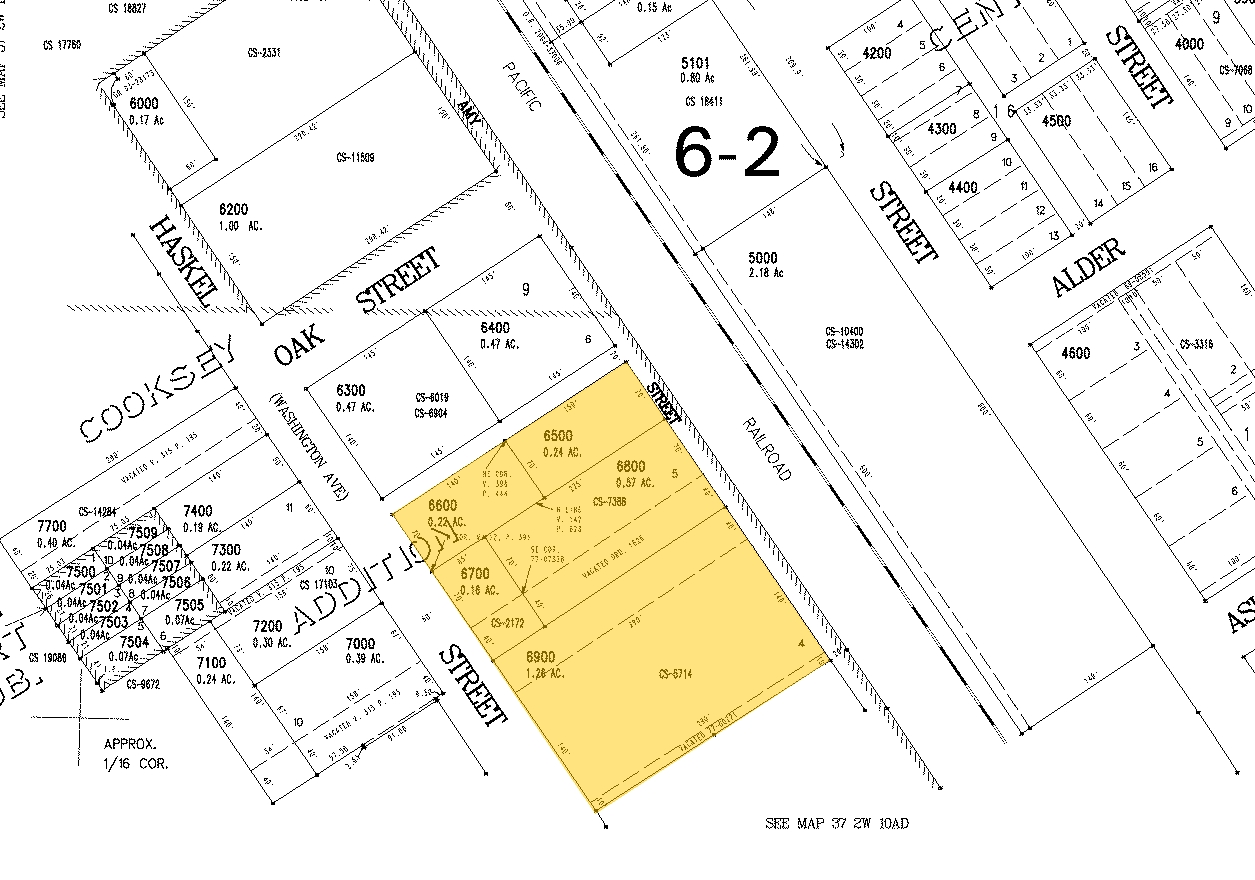
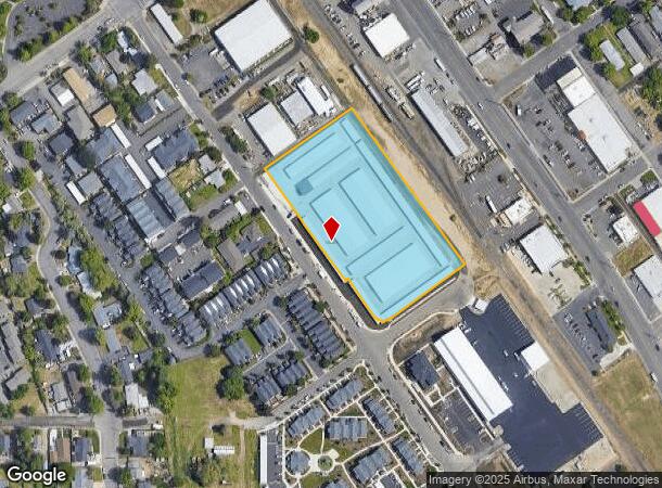
Property Record
157 S Haskell St, Central Point, OR 97502
NEARBY LISTINGS FOR SALE OR LEASE
Property Detail
157 S Haskell St
10143024
Cooksey Add
Commercialbuilding
Jackson
X
Oregon
41029C1956F
4
2023
3.42 AC
2024
Medford/Grants Pass
000902
Other Market Areas
43,710 SF
Medford, OR
DEMOGRAPHICS near 157 S Haskell St
1 Mile
3 Mile
5 Mile
2024 Total Population
13,111
34,713
93,428
2029 Population
13,128
34,563
92,736
Pop Growth 2024-2029
+ 0.13%
(0.43%)
(0.74%)
Average Age
41
41
41
2024 Total Households
5,210
13,311
36,421
HH Growth 2024-2029
+ 0.04%
(0.47%)
(0.79%)
Median Household Inc
$70,518
$66,949
$62,718
Avg Household Size
2.50
2.50
2.50
2024 Avg HH Vehicles
2.00
2.00
2.00
Median Home Value
$324,143
$315,063
$329,367
Median Year Built
1991
1990
1980
Nearby Places
- Restaurants
- Banks
- Shops
- Fitness
- Groceries
PUBLIC TRANSPORTATION
AIRPORT
Rogue Valley International - Medford
DRIVE
WALK
Distance
Rogue Valley International - Medford
7 min
3.1 mi
Freight Ports
Port of Coos Bay, OR
DRIVE
WALK
Distance
Port of Coos Bay, OR
212 min
160.8 mi
Nearby Properties
Address
Land Use
TOTAL SIZE
Lot Size
Zoning
Address
Land Use
TOTAL SIZE
Lot Size
Zoning
291.02 AC
I-L
Address
Land Use
TOTAL SIZE
Lot Size
Zoning
22.07 AC
GI
Address
Land Use
TOTAL SIZE
Lot Size
Zoning
600,000 SF
18.27 AC
M-1
Address
Land Use
TOTAL SIZE
Lot Size
Zoning
31.96 AC
GI
Address
Land Use
TOTAL SIZE
Lot Size
Zoning
11,180 SF
1.58 AC
MFR-20
Address
Land Use
TOTAL SIZE
Lot Size
Zoning
531,599 SF
26.34 AC
C-R
Address
Land Use
TOTAL SIZE
Lot Size
Zoning
176,910 SF
17.78 AC
C-R
Address
Land Use
TOTAL SIZE
Lot Size
Zoning
88,434 SF
12.10 AC
I-L
Address
Land Use
TOTAL SIZE
Lot Size
Zoning
30.87 AC
CIVIC
Address
Land Use
TOTAL SIZE
Lot Size
Zoning
88.67 AC
I-L
Address
Land Use
TOTAL SIZE
Lot Size
Zoning
125,910 SF
14.29 AC
C-R
Address
Land Use
TOTAL SIZE
Lot Size
Zoning
177.42 AC
GI
Address
Land Use
TOTAL SIZE
Lot Size
Zoning
109,042 SF
7.06 AC
C-R
Address
Land Use
TOTAL SIZE
Lot Size
Zoning
6,039 SF
5.26 AC
MMR
Address
Land Use
TOTAL SIZE
Lot Size
Zoning
77,232 SF
1.46 AC
MFR-20
Address
Land Use
TOTAL SIZE
Lot Size
Zoning
15.97 AC
GI
Address
Land Use
TOTAL SIZE
Lot Size
Zoning
102,184 SF
5.82 AC
I-L
Address
Land Use
TOTAL SIZE
Lot Size
Zoning
164,324 SF
7.40 AC
C-R
Address
Land Use
TOTAL SIZE
Lot Size
Zoning
98,547 SF
4.36 AC
I-L
Address
Land Use
TOTAL SIZE
Lot Size
Zoning
164,324 SF
6.42 AC
C-R
Address
Land Use
TOTAL SIZE
Lot Size
Zoning
80,753 SF
7.68 AC
C-R
Address
Land Use
TOTAL SIZE
Lot Size
Zoning
62.39 AC
GI
Address
Land Use
TOTAL SIZE
Lot Size
Zoning
60,561 SF
2.72 AC
HMR
Address
Land Use
TOTAL SIZE
Lot Size
Zoning
32,614 SF
8.27 AC
M-1
Address
Land Use
TOTAL SIZE
Lot Size
Zoning
32,240 SF
20.24 AC
M-2
Address
Land Use
TOTAL SIZE
Lot Size
Zoning
1,170 SF
4.25 AC
MMR
Address
Land Use
TOTAL SIZE
Lot Size
Zoning
46,624 SF
3.29 AC
MMR
Address
Land Use
TOTAL SIZE
Lot Size
Zoning
13.58 AC
CIVIC
Address
Land Use
TOTAL SIZE
Lot Size
Zoning
100,000 SF
5.77 AC
I-G
Address
Land Use
TOTAL SIZE
Lot Size
Zoning
92,750 SF
102.77 AC
I-L
The World's #1 Commercial Real Estate Marketplace
Connect with us
© 2025 CoStar Group
The information above has been obtained from sources believed reliable. While we do not doubt its accuracy we have not verified it and make no guarantee, warranty or representation about it. It is your responsibility to independently confirm its accuracy and completeness. Any projections, opinions, assumptions, or estimates used are for example only and do not represent the current or future performance of the property. The value of this transaction to you depends on tax and other factors which should be evaluated by your tax, financial, and legal advisors. You and your advisors should conduct a careful, independent investigation of the property to determine to your satisfaction the suitability of the property for your needs.