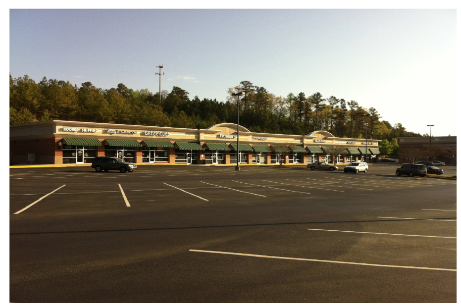
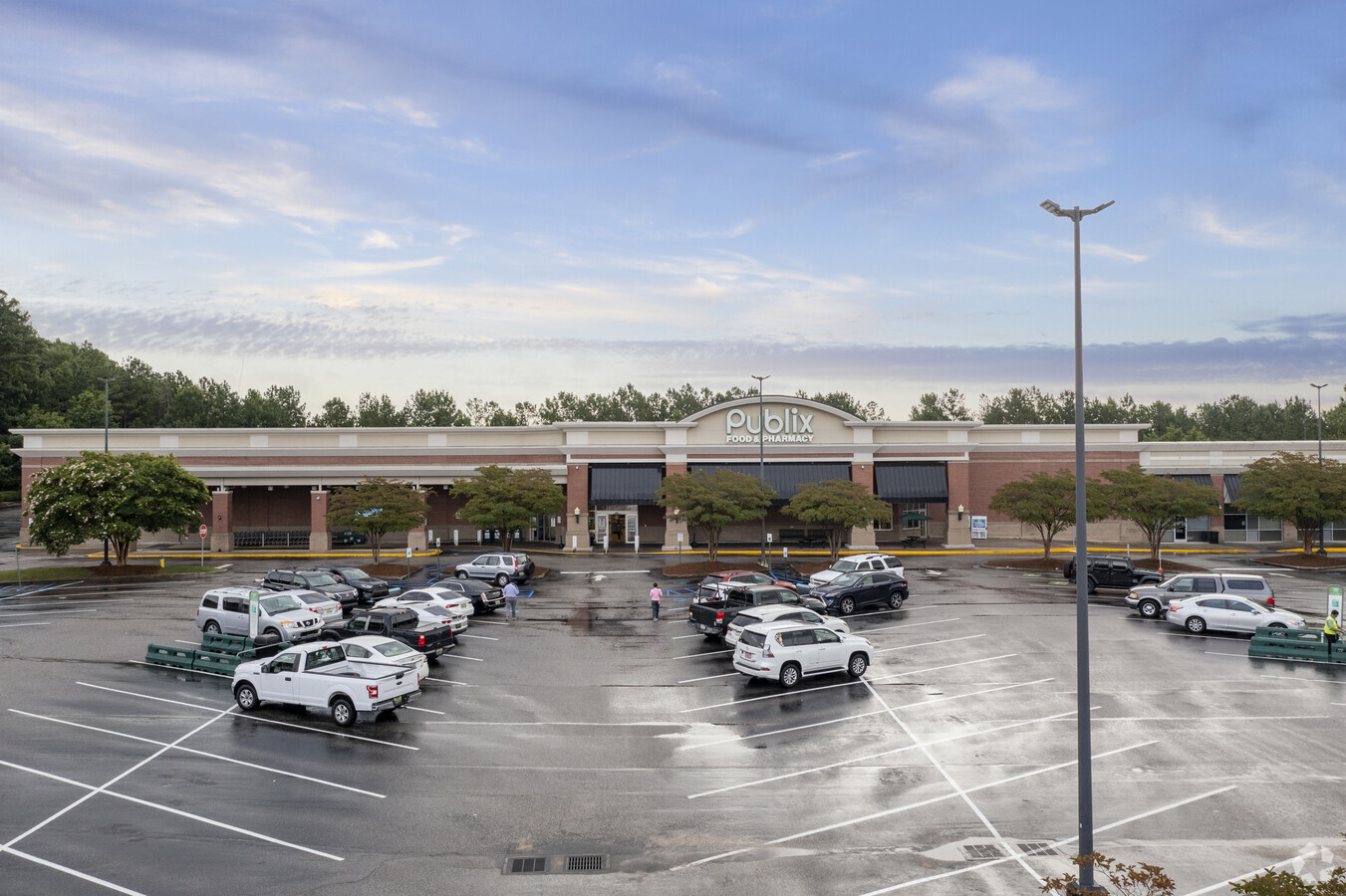
Property Record
2547 John Hawkins Pkwy, Hoover, AL 35244
NEARBY LISTINGS FOR SALE OR LEASE
Property Detail
2547 John Hawkins Pkwy
Birmingham-Hoover, AL
Trace Crossings Commerica
39-00-27-2-000-001.010
LOT 5B-1 TRACE CROSSING COMMERCIAL SUB RESURVEY NO 3 PB 37 PG 14
Supermarket
Jefferson
X
Alabama
01117C0202F
5b-1
2023
11.40 AC
2024
Hoover
0144102002
Birmingham
76,255 SF
DEMOGRAPHICS near 2547 John Hawkins Pkwy
1 Mile
3 Mile
5 Mile
2024 Total Population
3,366
38,701
103,384
2029 Population
3,277
38,814
104,308
Pop Growth 2024-2029
(2.64%)
+ 0.29%
+ 0.89%
Average Age
40
41
39
2024 Total Households
1,354
15,230
41,192
HH Growth 2024-2029
(2.95%)
+ 0.37%
+ 0.68%
Median Household Inc
$104,747
$97,953
$86,281
Avg Household Size
2.40
2.50
2.40
2024 Avg HH Vehicles
2.00
2.00
2.00
Median Home Value
$362,401
$347,133
$305,445
Median Year Built
1993
1993
1990
Nearby Places
- Restaurants
- Banks
- Shops
- Fitness
- Groceries
PUBLIC TRANSPORTATION
AIRPORT
Birmingham-Shuttlesworth International
DRIVE
WALK
Distance
Birmingham-Shuttlesworth International
30 min
19.8 mi
Freight Ports
Port of Mobile
DRIVE
WALK
Distance
Port of Mobile
274 min
250.5 mi
Nearby Properties
Address
Land Use
TOTAL SIZE
Lot Size
Zoning
Address
Land Use
TOTAL SIZE
Lot Size
Zoning
515,818 SF
38 AC
CP
Address
Land Use
TOTAL SIZE
Lot Size
Zoning
745,655 SF
16 AC
C-1
Address
Land Use
TOTAL SIZE
Lot Size
Zoning
Address
Land Use
TOTAL SIZE
Lot Size
Zoning
333,513 SF
40.80 AC
C2
Address
Land Use
TOTAL SIZE
Lot Size
Zoning
442,000 SF
36.44 AC
Address
Land Use
TOTAL SIZE
Lot Size
Zoning
582,638 SF
43.76 AC
PUDP
Address
Land Use
TOTAL SIZE
Lot Size
Zoning
80,269 SF
2.50 AC
C-1
Address
Land Use
TOTAL SIZE
Lot Size
Zoning
12,200 SF
28.77 AC
Address
Land Use
TOTAL SIZE
Lot Size
Zoning
69,151 SF
4.90 AC
PC
Address
Land Use
TOTAL SIZE
Lot Size
Zoning
186,953 SF
20 AC
PR2
Address
Land Use
TOTAL SIZE
Lot Size
Zoning
237,921 SF
6.35 AC
PUDP
Address
Land Use
TOTAL SIZE
Lot Size
Zoning
284,436 SF
40.98 AC
PUDP
Address
Land Use
TOTAL SIZE
Lot Size
Zoning
41,980 SF
26.70 AC
PC
Address
Land Use
TOTAL SIZE
Lot Size
Zoning
2,199 SF
23 AC
Address
Land Use
TOTAL SIZE
Lot Size
Zoning
241,232 SF
15.01 AC
PR2
Address
Land Use
TOTAL SIZE
Lot Size
Zoning
94,094 SF
14.40 AC
PO-P
Address
Land Use
TOTAL SIZE
Lot Size
Zoning
165,474 SF
90 AC
PR2
Address
Land Use
TOTAL SIZE
Lot Size
Zoning
160,443 SF
23 AC
C-2
Address
Land Use
TOTAL SIZE
Lot Size
Zoning
238,304 SF
18.90 AC
PR-2
Address
Land Use
TOTAL SIZE
Lot Size
Zoning
200,679 SF
20 AC
PR2
Address
Land Use
TOTAL SIZE
Lot Size
Zoning
210,033 SF
7.85 AC
Address
Land Use
TOTAL SIZE
Lot Size
Zoning
176,949 SF
19 AC
PC
Address
Land Use
TOTAL SIZE
Lot Size
Zoning
224,746 SF
46 AC
C2
Address
Land Use
TOTAL SIZE
Lot Size
Zoning
231,385 SF
50.40 AC
R6
Address
Land Use
TOTAL SIZE
Lot Size
Zoning
152,027 SF
9.10 AC
R1
Address
Land Use
TOTAL SIZE
Lot Size
Zoning
172,648 SF
39.45 AC
Address
Land Use
TOTAL SIZE
Lot Size
Zoning
121,049 SF
9.10 AC
PR2
Address
Land Use
TOTAL SIZE
Lot Size
Zoning
185,856 SF
6.70 AC
PC
Address
Land Use
TOTAL SIZE
Lot Size
Zoning
152,735 SF
9.80 AC
R-4
Address
Land Use
TOTAL SIZE
Lot Size
Zoning
105,299 SF
25.50 AC
T3
The World's #1 Commercial Real Estate Marketplace
Connect with us
© 2025 CoStar Group
The information above has been obtained from sources believed reliable. While we do not doubt its accuracy we have not verified it and make no guarantee, warranty or representation about it. It is your responsibility to independently confirm its accuracy and completeness. Any projections, opinions, assumptions, or estimates used are for example only and do not represent the current or future performance of the property. The value of this transaction to you depends on tax and other factors which should be evaluated by your tax, financial, and legal advisors. You and your advisors should conduct a careful, independent investigation of the property to determine to your satisfaction the suitability of the property for your needs.