Property Record
255 S Waterman Ave, San Bernardino, CA 92408


NEARBY LISTINGS FOR SALE OR LEASE
Property Detail
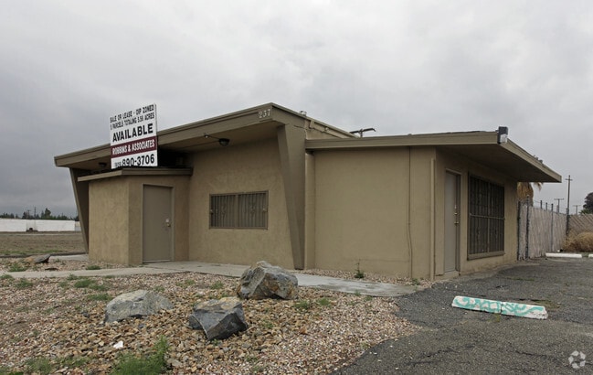
255 S Waterman Ave
0279-321-66
San Bernardino Rho
Miscellaneous
PARCEL MAP 19573 PARCEL 1 BOOK 246 PAGE 45
A
San Bernardino
06071C8682J
California
2024
19.58 AC
2025
San Bernardino
007202
Inland Empire (California)
413,953 SF
Riverside-San Bernardino-Ontario, CA
DEMOGRAPHICS near 255 S Waterman Ave
1 Mile
3 Mile
5 Mile
2024 Total Population
9,063
123,246
344,689
2029 Population
9,204
124,949
350,660
Pop Growth 2024-2029
+ 1.56%
+ 1.38%
+ 1.73%
Average Age
34
34
35
2024 Total Households
2,573
34,177
100,723
HH Growth 2024-2029
+ 1.94%
+ 1.52%
+ 1.87%
Median Household Inc
$35,647
$48,608
$59,347
Avg Household Size
3.10
3.40
3.30
2024 Avg HH Vehicles
1.00
2.00
2.00
Median Home Value
$317,766
$291,149
$344,087
Median Year Built
1971
1963
1970
Nearby Places
Map Layers
Map Styles
 Street
 Aerial
- Restaurants
- Banks
- Shops
- Fitness
- Groceries
PUBLIC TRANSPORTATION
COMMUTER RAIL
DRIVE
WALK
Distance
5 min
1.5 mi
San Bernardino (Inland Empire-Orange County Line - Southern California Regional Rail Authority (Metrolink), San Bernardino Line - Southern California Regional Rail Authority (Metrolink))
DRIVE
WALK
Distance
San Bernardino (Inland Empire-Orange County Line - Southern California Regional Rail Authority (Metrolink), San Bernardino Line - Southern California Regional Rail Authority (Metrolink))
6 min
2.3 mi
AIRPORT
Ontario International
DRIVE
WALK
Distance
Ontario International
29 min
20.8 mi
Nearby Properties
Address
Land Use
TOTAL SIZE
Lot Size
Zoning
Address
Land Use
TOTAL SIZE
Lot Size
Zoning
2,134,798 SF
153.92 AC
Address
Land Use
TOTAL SIZE
Lot Size
Zoning
708,500 SF
97.74 AC
Address
Land Use
TOTAL SIZE
Lot Size
Zoning
778,653 SF
19.31 AC
Address
Land Use
TOTAL SIZE
Lot Size
Zoning
457,253 SF
20.14 AC
Address
Land Use
TOTAL SIZE
Lot Size
Zoning
589,602 SF
36.89 AC
Address
Land Use
TOTAL SIZE
Lot Size
Zoning
497,664 SF
56.39 AC
Address
Land Use
TOTAL SIZE
Lot Size
Zoning
1,032,072 SF
61.74 AC
Address
Land Use
TOTAL SIZE
Lot Size
Zoning
330,420 SF
15.31 AC
Address
Land Use
TOTAL SIZE
Lot Size
Zoning
417,188 SF
21.54 AC
Address
Land Use
TOTAL SIZE
Lot Size
Zoning
1,081,199 SF
49.77 AC
Address
Land Use
TOTAL SIZE
Lot Size
Zoning
300,188 SF
11.98 AC
Address
Land Use
TOTAL SIZE
Lot Size
Zoning
1,139,976 SF
49.56 AC
Address
Land Use
TOTAL SIZE
Lot Size
Zoning
406,710 SF
20.10 AC
Address
Land Use
TOTAL SIZE
Lot Size
Zoning
758,180 SF
31.86 AC
Address
Land Use
TOTAL SIZE
Lot Size
Zoning
983,986 SF
47.60 AC
Address
Land Use
TOTAL SIZE
Lot Size
Zoning
391,468 SF
16.73 AC
Address
Land Use
TOTAL SIZE
Lot Size
Zoning
1,205,400 SF
58.05 AC
Address
Land Use
TOTAL SIZE
Lot Size
Zoning
210,418 SF
12.09 AC
Address
Land Use
TOTAL SIZE
Lot Size
Zoning
951,686 SF
47.90 AC
Address
Land Use
TOTAL SIZE
Lot Size
Zoning
913,716 SF
20 AC
Address
Land Use
TOTAL SIZE
Lot Size
Zoning
474,680 SF
17.95 AC
Address
Land Use
TOTAL SIZE
Lot Size
Zoning
683,406 SF
31.38 AC
Address
Land Use
TOTAL SIZE
Lot Size
Zoning
404,725 SF
19.29 AC
Address
Land Use
TOTAL SIZE
Lot Size
Zoning
472,962 SF
23.28 AC
Address
Land Use
TOTAL SIZE
Lot Size
Zoning
178,926 SF
9.12 AC
IC
Address
Land Use
TOTAL SIZE
Lot Size
Zoning
549,796 SF
13.61 AC
Address
Land Use
TOTAL SIZE
Lot Size
Zoning
425,285 SF
24.41 AC
Address
Land Use
TOTAL SIZE
Lot Size
Zoning
344,757 SF
14.89 AC
Address
Land Use
TOTAL SIZE
Lot Size
Zoning
699,350 SF
32.11 AC
Address
Land Use
TOTAL SIZE
Lot Size
Zoning
335,000 SF
8.44 AC
The World's #1 Commercial Real Estate Marketplace
Connect with us
© 2026 CoStar Group
The information above has been obtained from sources believed reliable. While we do not doubt its accuracy we have not verified it and make no guarantee, warranty or representation about it. It is your responsibility to independently confirm its accuracy and completeness. Any projections, opinions, assumptions, or estimates used are for example only and do not represent the current or future performance of the property. The value of this transaction to you depends on tax and other factors which should be evaluated by your tax, financial, and legal advisors. You and your advisors should conduct a careful, independent investigation of the property to determine to your satisfaction the suitability of the property for your needs.