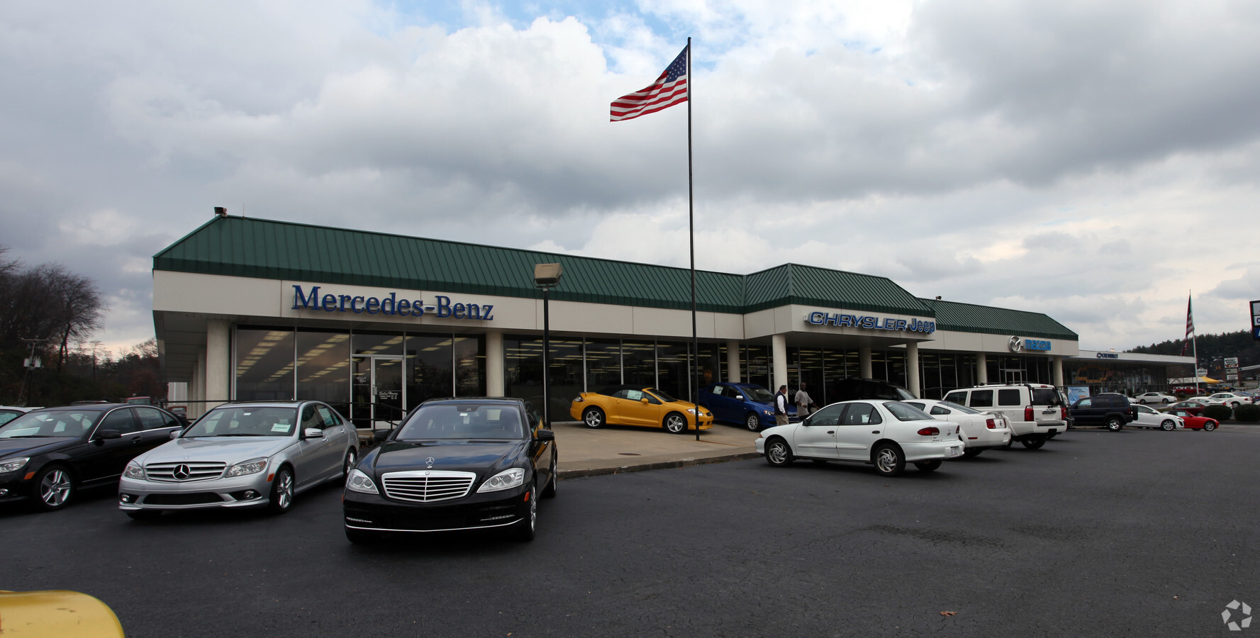
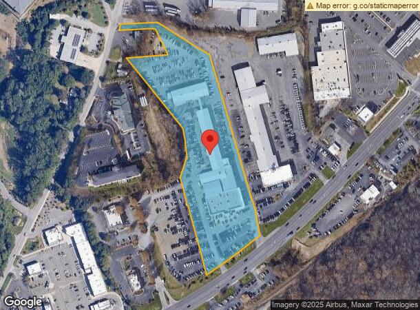
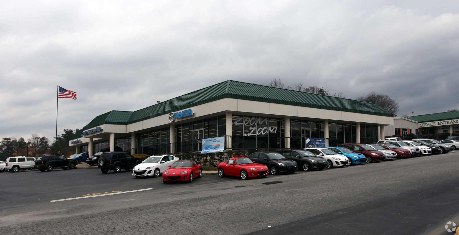
Property Record
255 Smokey Park Hwy, Asheville, NC 28806
NEARBY LISTINGS FOR SALE OR LEASE
Property Detail
255 Smokey Park Hwy
Asheville, NC
Hunter Hunter & Shoff Prop
9627-09-1749-00000
PLAT: 0226-0011
Vehiclerentalsvehiclesales
Buncombe
X
North Carolina
3700962700J
1
2023
6.20 AC
2024
West Asheville
002506
Asheville
45,563 SF
DEMOGRAPHICS near 255 Smokey Park Hwy
1 Mile
3 Mile
5 Mile
2024 Total Population
3,985
36,042
75,575
2029 Population
4,195
37,281
78,353
Pop Growth 2024-2029
+ 5.27%
+ 3.44%
+ 3.68%
Average Age
40
40
40
2024 Total Households
1,684
15,398
32,377
HH Growth 2024-2029
+ 4.69%
+ 2.86%
+ 3.20%
Median Household Inc
$55,064
$63,827
$60,843
Avg Household Size
2.30
2.30
2.20
2024 Avg HH Vehicles
2.00
2.00
2.00
Median Home Value
$279,042
$316,911
$316,488
Median Year Built
1987
1982
1983
Nearby Places
- Restaurants
- Banks
- Shops
- Fitness
- Groceries
PUBLIC TRANSPORTATION
AIRPORT
Asheville Regional
DRIVE
WALK
Distance
Asheville Regional
17 min
11.9 mi
Freight Ports
North Charleston Terminal
DRIVE
WALK
Distance
North Charleston Terminal
288 min
255.6 mi
Nearby Properties
Address
Land Use
TOTAL SIZE
Lot Size
Zoning
Address
Land Use
TOTAL SIZE
Lot Size
Zoning
13,459 SF
3.07 AC
CR
Address
Land Use
TOTAL SIZE
Lot Size
Zoning
251,071 SF
280.55 AC
INST
Address
Land Use
TOTAL SIZE
Lot Size
Zoning
166,747 SF
2,480.61 AC
CR
Address
Land Use
TOTAL SIZE
Lot Size
Zoning
100,712 SF
24.65 AC
CS
Address
Land Use
TOTAL SIZE
Lot Size
Zoning
46,724 SF
2,480.61 AC
CR
Address
Land Use
TOTAL SIZE
Lot Size
Zoning
104,138 SF
33.25 AC
R-2
Address
Land Use
TOTAL SIZE
Lot Size
Zoning
85,997 SF
29.25 AC
R-3
Address
Land Use
TOTAL SIZE
Lot Size
Zoning
50,672 SF
21.21 AC
R-2
Address
Land Use
TOTAL SIZE
Lot Size
Zoning
88,817 SF
19.63 AC
R-2
Address
Land Use
TOTAL SIZE
Lot Size
Zoning
164,080 SF
140.05 AC
PS
Address
Land Use
TOTAL SIZE
Lot Size
Zoning
97,263 SF
17.50 AC
INST
Address
Land Use
TOTAL SIZE
Lot Size
Zoning
151,884 SF
129.72 AC
Address
Land Use
TOTAL SIZE
Lot Size
Zoning
87,857 SF
203.41 AC
INST
Address
Land Use
TOTAL SIZE
Lot Size
Zoning
76,459 SF
7.01 AC
RM8
Address
Land Use
TOTAL SIZE
Lot Size
Zoning
111,000 SF
21.97 AC
EMP
Address
Land Use
TOTAL SIZE
Lot Size
Zoning
98,232 SF
23.24 AC
EMP
Address
Land Use
TOTAL SIZE
Lot Size
Zoning
72,413 SF
18.25 AC
RM16
Address
Land Use
TOTAL SIZE
Lot Size
Zoning
2,171 SF
36.73 AC
PS
Address
Land Use
TOTAL SIZE
Lot Size
Zoning
44,566 SF
7.39 AC
RM8
Address
Land Use
TOTAL SIZE
Lot Size
Zoning
55,153 SF
13.39 AC
RM16
Address
Land Use
TOTAL SIZE
Lot Size
Zoning
30,664 SF
3.26 AC
HR-3:CRDR
Address
Land Use
TOTAL SIZE
Lot Size
Zoning
79,908 SF
60 AC
PS
Address
Land Use
TOTAL SIZE
Lot Size
Zoning
131,946 SF
13.28 AC
EMP
Address
Land Use
TOTAL SIZE
Lot Size
Zoning
145,468 SF
24.91 AC
COM EXP
Address
Land Use
TOTAL SIZE
Lot Size
Zoning
13,347 SF
2.50 AC
RB
Address
Land Use
TOTAL SIZE
Lot Size
Zoning
70,824 SF
12 AC
INST
Address
Land Use
TOTAL SIZE
Lot Size
Zoning
106,000 SF
10.91 AC
HB
Address
Land Use
TOTAL SIZE
Lot Size
Zoning
13,232 SF
2.05 AC
CBII
Address
Land Use
TOTAL SIZE
Lot Size
Zoning
51,518 SF
19.15 AC
RM6
Address
Land Use
TOTAL SIZE
Lot Size
Zoning
117,560 SF
2,480.97 AC
CR
The World's #1 Commercial Real Estate Marketplace
Connect with us
© 2025 CoStar Group
The information above has been obtained from sources believed reliable. While we do not doubt its accuracy we have not verified it and make no guarantee, warranty or representation about it. It is your responsibility to independently confirm its accuracy and completeness. Any projections, opinions, assumptions, or estimates used are for example only and do not represent the current or future performance of the property. The value of this transaction to you depends on tax and other factors which should be evaluated by your tax, financial, and legal advisors. You and your advisors should conduct a careful, independent investigation of the property to determine to your satisfaction the suitability of the property for your needs.