Property Record
2555 Lumpkin Rd, Augusta, GA 30906
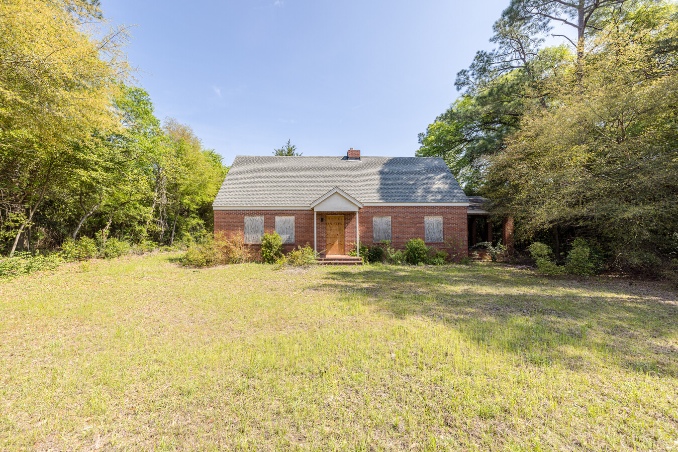
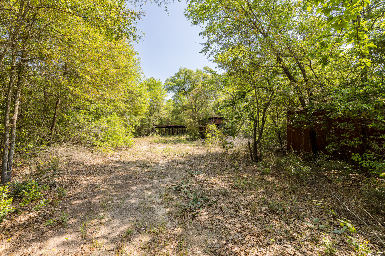
This Property Is For Sale
NEARBY LISTINGS FOR SALE OR LEASE
Property Detail
2555 Lumpkin Rd
0964061000
LUMPKIN RD
Residentialacreage
Richmond
X
Georgia
13245C0120G
1.34 AC
2024
South Richmond County
2024
Augusta/Richmond County
010506
Augusta-Richmond County, GA-SC
DEMOGRAPHICS near 2555 Lumpkin Rd
1 Mile
3 Mile
5 Mile
2024 Total Population
7,845
54,467
132,816
2029 Population
7,757
53,809
131,945
Pop Growth 2024-2029
(1.12%)
(1.21%)
(0.66%)
Average Age
39
38
38
2024 Total Households
3,166
21,232
51,986
HH Growth 2024-2029
(1.07%)
(1.12%)
(0.58%)
Median Household Inc
$34,298
$34,726
$46,083
Avg Household Size
2.40
2.50
2.40
2024 Avg HH Vehicles
2.00
2.00
2.00
Median Home Value
$82,663
$84,774
$131,366
Median Year Built
1965
1970
1976
Nearby Places
- Restaurants
- Banks
- Shops
- Fitness
- Groceries
PUBLIC TRANSPORTATION
AIRPORT
Augusta Regional at Bush Field
DRIVE
WALK
Distance
Augusta Regional at Bush Field
16 min
6.9 mi
Freight Ports
Georgia Ports - Savannah
DRIVE
WALK
Distance
Georgia Ports - Savannah
150 min
116.9 mi
Nearby Properties
Address
Land Use
TOTAL SIZE
Lot Size
Zoning
Address
Land Use
TOTAL SIZE
Lot Size
Zoning
1,428 SF
75.91 AC
R-1A
Address
Land Use
TOTAL SIZE
Lot Size
Zoning
1,620 SF
21.51 AC
R-3B
Address
Land Use
TOTAL SIZE
Lot Size
Zoning
99,046 SF
29.96 AC
R-1A
Address
Land Use
TOTAL SIZE
Lot Size
Zoning
38,080 SF
19.19 AC
R-3B
Address
Land Use
TOTAL SIZE
Lot Size
Zoning
241,284 SF
20.61 AC
R-1A
Address
Land Use
TOTAL SIZE
Lot Size
Zoning
56,631 SF
11.62 AC
R-1A, B-2
Address
Land Use
TOTAL SIZE
Lot Size
Zoning
16,120 SF
21.38 AC
R-3A
Address
Land Use
TOTAL SIZE
Lot Size
Zoning
4,947 SF
71.24 AC
R-3B
Address
Land Use
TOTAL SIZE
Lot Size
Zoning
158,192 SF
48.91 AC
R-1A
Address
Land Use
TOTAL SIZE
Lot Size
Zoning
14,850 SF
132.49 AC
A,R
Address
Land Use
TOTAL SIZE
Lot Size
Zoning
44,160 SF
12.46 AC
R-3B
Address
Land Use
TOTAL SIZE
Lot Size
Zoning
38,412 SF
22.51 AC
R-1A
Address
Land Use
TOTAL SIZE
Lot Size
Zoning
67,713 SF
5.24 AC
LI
Address
Land Use
TOTAL SIZE
Lot Size
Zoning
24,304 SF
11 AC
R-1A
Address
Land Use
TOTAL SIZE
Lot Size
Zoning
16,790 SF
22.07 AC
B-2
Address
Land Use
TOTAL SIZE
Lot Size
Zoning
40,824 SF
9.49 AC
R-3B
Address
Land Use
TOTAL SIZE
Lot Size
Zoning
70,251 SF
9.17 AC
R-1B
Address
Land Use
TOTAL SIZE
Lot Size
Zoning
22,080 SF
19.49 AC
R-3B
Address
Land Use
TOTAL SIZE
Lot Size
Zoning
38,911 SF
4.46 AC
LI_A
Address
Land Use
TOTAL SIZE
Lot Size
Zoning
86,184 SF
9.51 AC
R-3B
Address
Land Use
TOTAL SIZE
Lot Size
Zoning
136,260 SF
14.42 AC
LI_R-1
Address
Land Use
TOTAL SIZE
Lot Size
Zoning
48,103 SF
2.12 AC
LI
Address
Land Use
TOTAL SIZE
Lot Size
Zoning
6,323 SF
25.49 AC
R-3C
Address
Land Use
TOTAL SIZE
Lot Size
Zoning
57,408 SF
7.20 AC
R-3B
Address
Land Use
TOTAL SIZE
Lot Size
Zoning
432 SF
152.03 AC
B-2
Address
Land Use
TOTAL SIZE
Lot Size
Zoning
193,478 SF
24.91 AC
B-2
Address
Land Use
TOTAL SIZE
Lot Size
Zoning
66,528 SF
8.99 AC
R-3C
Address
Land Use
TOTAL SIZE
Lot Size
Zoning
128,882 SF
21.09 AC
B-2
Address
Land Use
TOTAL SIZE
Lot Size
Zoning
700 SF
7.12 AC
R-3C
Address
Land Use
TOTAL SIZE
Lot Size
Zoning
966 SF
8.45 AC
R-3B
The World's #1 Commercial Real Estate Marketplace
Connect with us
© 2025 CoStar Group
The information above has been obtained from sources believed reliable. While we do not doubt its accuracy we have not verified it and make no guarantee, warranty or representation about it. It is your responsibility to independently confirm its accuracy and completeness. Any projections, opinions, assumptions, or estimates used are for example only and do not represent the current or future performance of the property. The value of this transaction to you depends on tax and other factors which should be evaluated by your tax, financial, and legal advisors. You and your advisors should conduct a careful, independent investigation of the property to determine to your satisfaction the suitability of the property for your needs.