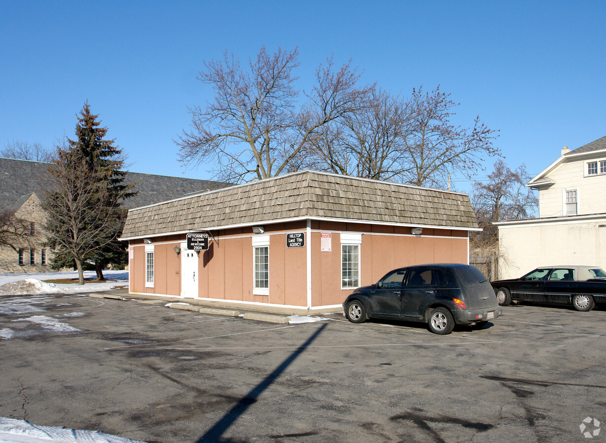
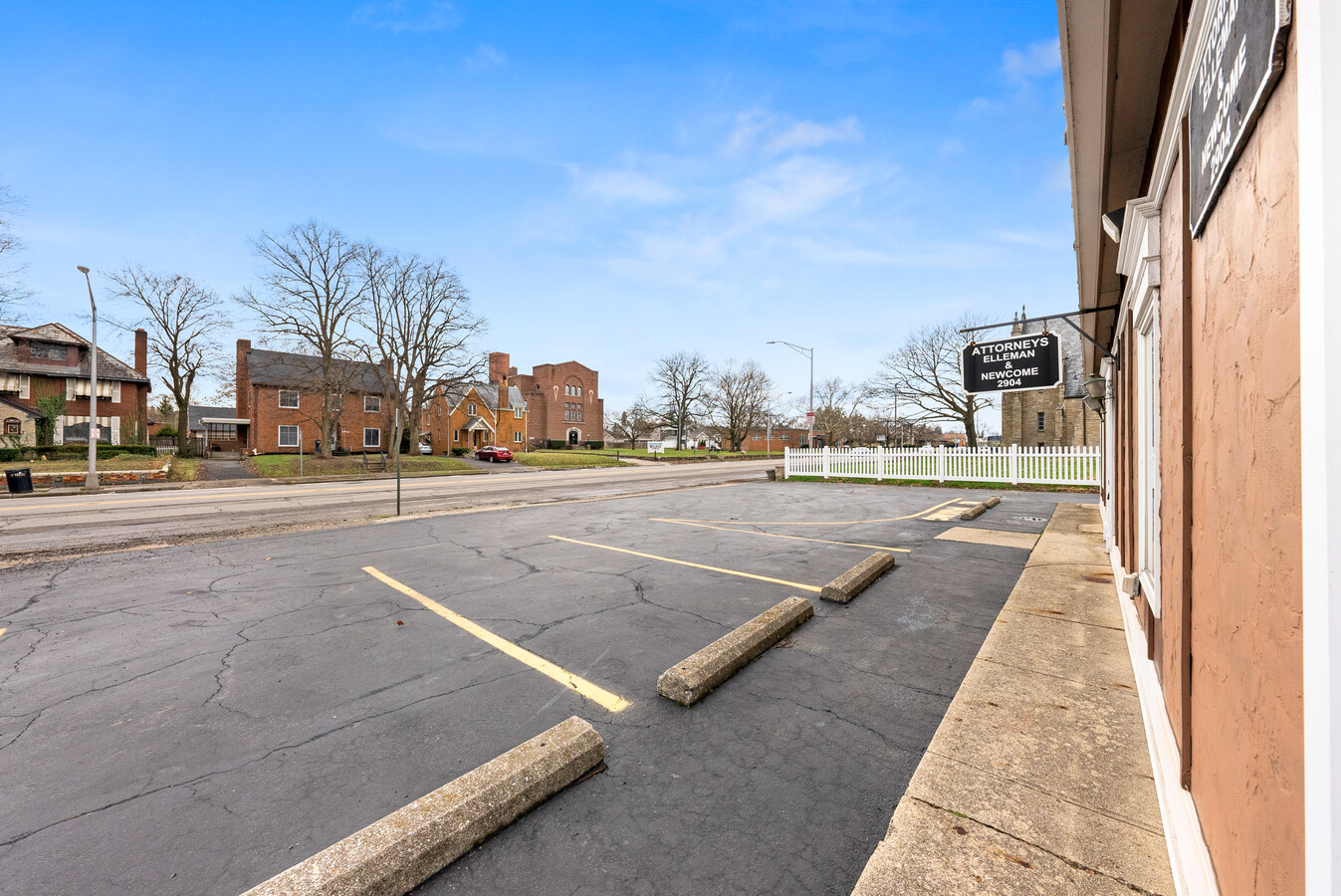
Property Record
2904 W Broad St, Columbus, OH 43204
NEARBY LISTINGS FOR SALE OR LEASE
Property Detail
2904 W Broad St
Columbus, OH
Hilltop Add
010-052416
W BROAD ST 79 82 FT S E HILLTOP LOT 24
Officebuilding
Franklin
X
Ohio
39049C0304K
24
2023
0.10 AC
2023
West
030500
Columbus
3,915 SF
DEMOGRAPHICS near 2904 W Broad St
1 Mile
3 Mile
5 Mile
2024 Total Population
22,334
117,040
306,317
2029 Population
22,821
118,325
307,996
Pop Growth 2024-2029
+ 2.18%
+ 1.10%
+ 0.55%
Average Age
36
37
36
2024 Total Households
8,147
45,834
129,328
HH Growth 2024-2029
+ 1.96%
+ 0.98%
+ 0.54%
Median Household Inc
$51,939
$56,191
$64,820
Avg Household Size
2.60
2.40
2.20
2024 Avg HH Vehicles
2.00
2.00
2.00
Median Home Value
$152,001
$176,074
$236,925
Median Year Built
1948
1964
1975
Nearby Places
- Restaurants
- Banks
- Shops
- Fitness
- Groceries
PUBLIC TRANSPORTATION
AIRPORT
John Glenn Columbus International
DRIVE
WALK
Distance
John Glenn Columbus International
19 min
11.9 mi
Rickenbacker International
DRIVE
WALK
Distance
Rickenbacker International
27 min
19.2 mi
Freight Ports
Port of Toledo
DRIVE
WALK
Distance
Port of Toledo
186 min
137.6 mi
SALE & LEASE HISTORY
LISTING DATE
SALE/LEASE

Mar 24, 2022
For Sale
Nearby Properties
Address
Land Use
TOTAL SIZE
Lot Size
Zoning
Address
Land Use
TOTAL SIZE
Lot Size
Zoning
907,446 SF
256.31 AC
Address
Land Use
TOTAL SIZE
Lot Size
Zoning
2,516,538 SF
3.73 AC
Address
Land Use
TOTAL SIZE
Lot Size
Zoning
1,367,463 SF
29.50 AC
Address
Land Use
TOTAL SIZE
Lot Size
Zoning
302,079 SF
77.95 AC
Address
Land Use
TOTAL SIZE
Lot Size
Zoning
1,439,937 SF
5.43 AC
Address
Land Use
TOTAL SIZE
Lot Size
Zoning
610,321 SF
21.84 AC
Address
Land Use
TOTAL SIZE
Lot Size
Zoning
563,812 SF
24.77 AC
Address
Land Use
TOTAL SIZE
Lot Size
Zoning
634,615 SF
10.10 AC
Address
Land Use
TOTAL SIZE
Lot Size
Zoning
961,397 SF
75.09 AC
Address
Land Use
TOTAL SIZE
Lot Size
Zoning
257,723 SF
38.06 AC
Address
Land Use
TOTAL SIZE
Lot Size
Zoning
87,654 SF
45.30 AC
Address
Land Use
TOTAL SIZE
Lot Size
Zoning
393,855 SF
27.85 AC
Address
Land Use
TOTAL SIZE
Lot Size
Zoning
329,215 SF
8.33 AC
Address
Land Use
TOTAL SIZE
Lot Size
Zoning
827,094 SF
2.85 AC
Address
Land Use
TOTAL SIZE
Lot Size
Zoning
351,712 SF
8.29 AC
Address
Land Use
TOTAL SIZE
Lot Size
Zoning
103,563 SF
29.23 AC
Address
Land Use
TOTAL SIZE
Lot Size
Zoning
257,116 SF
2.24 AC
Address
Land Use
TOTAL SIZE
Lot Size
Zoning
70,995 SF
38.78 AC
Address
Land Use
TOTAL SIZE
Lot Size
Zoning
470,517 SF
48.45 AC
Address
Land Use
TOTAL SIZE
Lot Size
Zoning
462,048 SF
3.07 AC
Address
Land Use
TOTAL SIZE
Lot Size
Zoning
286,320 SF
23.51 AC
Address
Land Use
TOTAL SIZE
Lot Size
Zoning
143.78 AC
Address
Land Use
TOTAL SIZE
Lot Size
Zoning
157,276 SF
1.83 AC
Address
Land Use
TOTAL SIZE
Lot Size
Zoning
374,896 SF
2.63 AC
Address
Land Use
TOTAL SIZE
Lot Size
Zoning
2,278,800 SF
23.74 AC
Address
Land Use
TOTAL SIZE
Lot Size
Zoning
138,003 SF
2.94 AC
Address
Land Use
TOTAL SIZE
Lot Size
Zoning
202,330 SF
18.89 AC
Address
Land Use
TOTAL SIZE
Lot Size
Zoning
898,740 SF
3.94 AC
Address
Land Use
TOTAL SIZE
Lot Size
Zoning
73,776 SF
76.12 AC
Address
Land Use
TOTAL SIZE
Lot Size
Zoning
208,950 SF
15.15 AC
The World's #1 Commercial Real Estate Marketplace
Connect with us
© 2025 CoStar Group
The information above has been obtained from sources believed reliable. While we do not doubt its accuracy we have not verified it and make no guarantee, warranty or representation about it. It is your responsibility to independently confirm its accuracy and completeness. Any projections, opinions, assumptions, or estimates used are for example only and do not represent the current or future performance of the property. The value of this transaction to you depends on tax and other factors which should be evaluated by your tax, financial, and legal advisors. You and your advisors should conduct a careful, independent investigation of the property to determine to your satisfaction the suitability of the property for your needs.