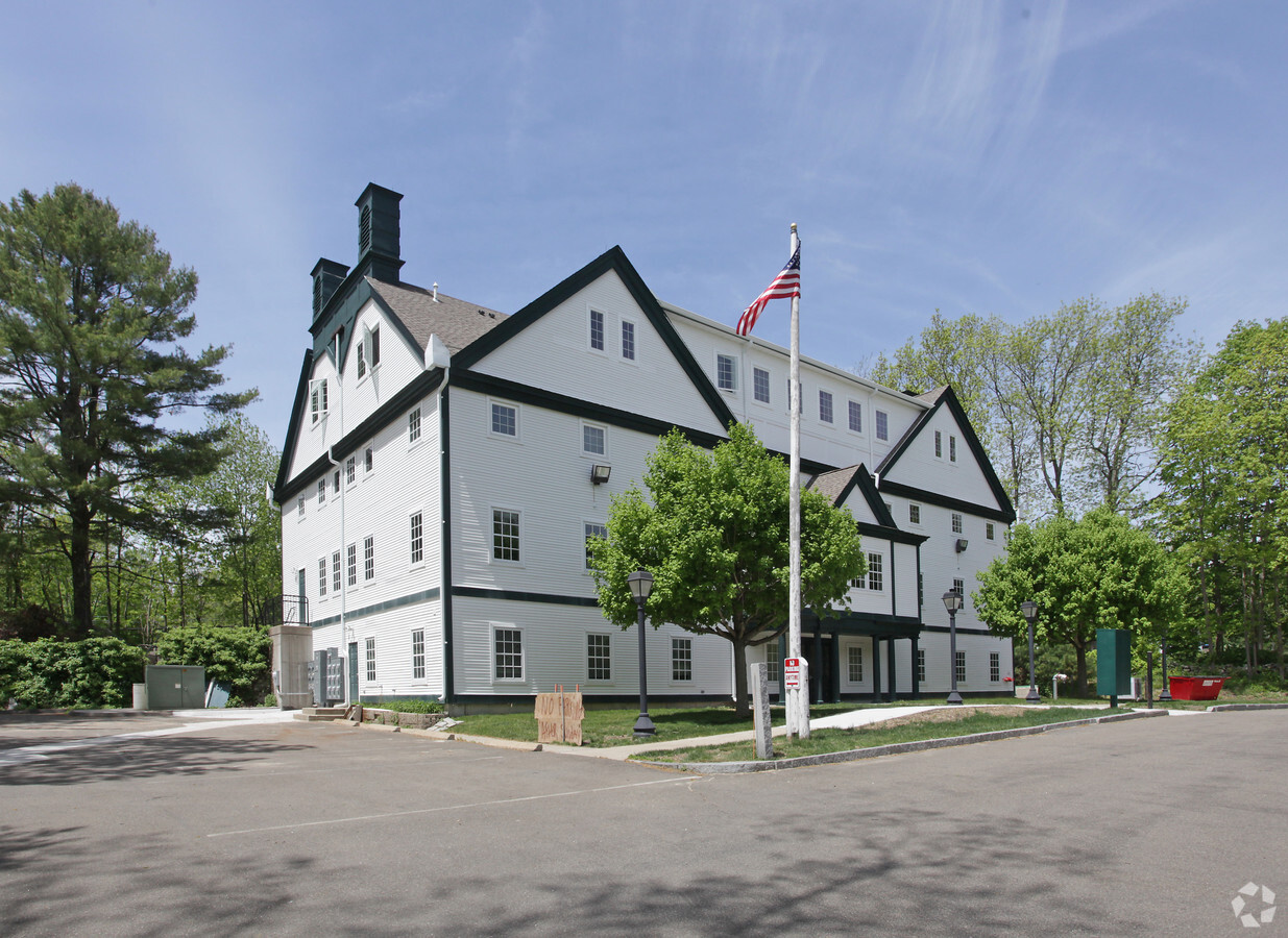
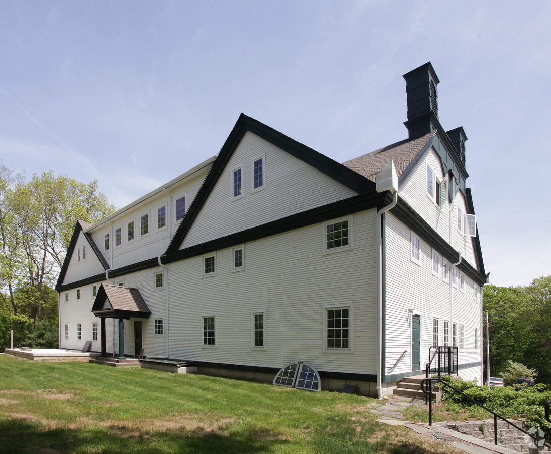
Property Record
257 Route 80, Killingworth, CT 06419
NEARBY LISTINGS FOR SALE OR LEASE
Property Detail
257 Route 80
Hartford-West Hartford-East Hartford, CT
Middlesex
KILL-000028-000000-000033A
Connecticut
Commercialnec
1.52 AC
X
SW Midlsx/Old Saybrk/Rt 9
09007C0302G
Hartford
19,219 SF
DEMOGRAPHICS near 257 Route 80
1 Mile
3 Mile
5 Mile
2024 Total Population
822
6,473
24,110
2029 Population
824
6,477
24,078
Pop Growth 2024-2029
+ 0.24%
+ 0.06%
(0.13%)
Average Age
47
46
45
2024 Total Households
327
2,565
9,186
HH Growth 2024-2029
0.00%
(0.19%)
(0.29%)
Median Household Inc
$116,666
$123,324
$132,043
Avg Household Size
2.50
2.50
2.60
2024 Avg HH Vehicles
2.00
2.00
2.00
Median Home Value
$347,619
$372,107
$388,789
Median Year Built
1978
1979
1978
Nearby Places
- Restaurants
- Banks
- Shops
- Fitness
- Groceries
PUBLIC TRANSPORTATION
COMMUTER RAIL
Clinton (Shore Line East - Shore Line East)
DRIVE
WALK
Distance
Clinton (Shore Line East - Shore Line East)
12 min
6.3 mi
Madison (Shore Line East - Shore Line East)
DRIVE
WALK
Distance
Madison (Shore Line East - Shore Line East)
16 min
6.7 mi
AIRPORT
Tweed/New Haven
DRIVE
WALK
Distance
Tweed/New Haven
36 min
21.2 mi
Freight Ports
Port of New Haven
DRIVE
WALK
Distance
Port of New Haven
36 min
20.9 mi
Nearby Properties
Address
Land Use
TOTAL SIZE
Lot Size
Zoning
Address
Land Use
TOTAL SIZE
Lot Size
Zoning
172,611 SF
39.08 AC
R-2
Address
Land Use
TOTAL SIZE
Lot Size
Zoning
26.29 AC
R-2
Address
Land Use
TOTAL SIZE
Lot Size
Zoning
384 AC
R-2
Address
Land Use
TOTAL SIZE
Lot Size
Zoning
345 AC
R-2
Address
Land Use
TOTAL SIZE
Lot Size
Zoning
60.97 AC
R-10
Address
Land Use
TOTAL SIZE
Lot Size
Zoning
3,479 SF
255.50 AC
R-2
Address
Land Use
TOTAL SIZE
Lot Size
Zoning
595.01 AC
R-2
Address
Land Use
TOTAL SIZE
Lot Size
Zoning
53,824 SF
10 AC
R-2
Address
Land Use
TOTAL SIZE
Lot Size
Zoning
3.84 AC
CD
Address
Land Use
TOTAL SIZE
Lot Size
Zoning
42.50 AC
R-2
Address
Land Use
TOTAL SIZE
Lot Size
Zoning
26,148 SF
12.22 AC
R-2
Address
Land Use
TOTAL SIZE
Lot Size
Zoning
5.60 AC
R-2
Address
Land Use
TOTAL SIZE
Lot Size
Zoning
9,030 SF
15.60 AC
R-2
Address
Land Use
TOTAL SIZE
Lot Size
Zoning
131 AC
R-2
Address
Land Use
TOTAL SIZE
Lot Size
Zoning
5.60 AC
CD
Address
Land Use
TOTAL SIZE
Lot Size
Zoning
7,144 SF
2 AC
R-2
Address
Land Use
TOTAL SIZE
Lot Size
Zoning
125.40 AC
R-2
Address
Land Use
TOTAL SIZE
Lot Size
Zoning
77.06 AC
RU-1
Address
Land Use
TOTAL SIZE
Lot Size
Zoning
130.80 AC
R-80
Address
Land Use
TOTAL SIZE
Lot Size
Zoning
5.03 AC
R-2
Address
Land Use
TOTAL SIZE
Lot Size
Zoning
379.10 AC
R-2
Address
Land Use
TOTAL SIZE
Lot Size
Zoning
7,508 SF
2 AC
ID
Address
Land Use
TOTAL SIZE
Lot Size
Zoning
15.90 AC
R-2
Address
Land Use
TOTAL SIZE
Lot Size
Zoning
1,596 SF
43.40 AC
R-2
Address
Land Use
TOTAL SIZE
Lot Size
Zoning
4,796 SF
32.19 AC
R-2
Address
Land Use
TOTAL SIZE
Lot Size
Zoning
3.20 AC
CD
Address
Land Use
TOTAL SIZE
Lot Size
Zoning
780 SF
6.60 AC
R-2
Address
Land Use
TOTAL SIZE
Lot Size
Zoning
4,429 SF
1.10 AC
CD
Address
Land Use
TOTAL SIZE
Lot Size
Zoning
17,450 SF
1.92 AC
ID
Address
Land Use
TOTAL SIZE
Lot Size
Zoning
1,034 SF
R-2
The World's #1 Commercial Real Estate Marketplace
Connect with us
© 2025 CoStar Group
The information above has been obtained from sources believed reliable. While we do not doubt its accuracy we have not verified it and make no guarantee, warranty or representation about it. It is your responsibility to independently confirm its accuracy and completeness. Any projections, opinions, assumptions, or estimates used are for example only and do not represent the current or future performance of the property. The value of this transaction to you depends on tax and other factors which should be evaluated by your tax, financial, and legal advisors. You and your advisors should conduct a careful, independent investigation of the property to determine to your satisfaction the suitability of the property for your needs.