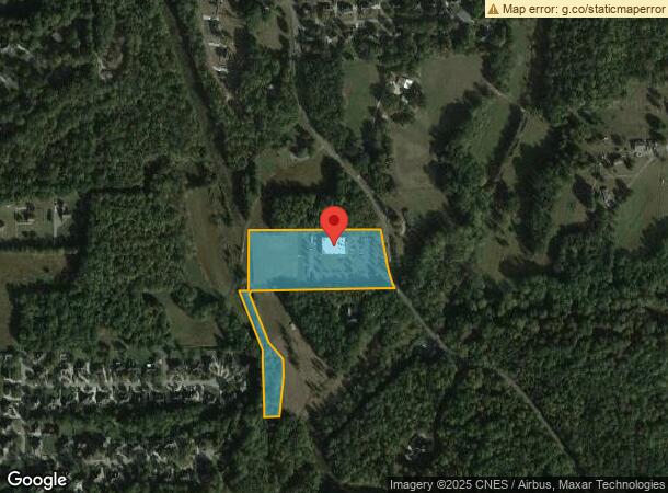
Property Record
2570 Harper Rd, Clemmons, NC 27012

NEARBY LISTINGS FOR SALE OR LEASE
Property Detail
2570 Harper Rd
Winston-Salem, NC
New Hope Presbyterian Church
5883-59-5606
NEW HOPE PRESBYTERIAN CHURCH LO039W BL4401 BU1
Religious
Forsyth
AE
North Carolina
3710588300J
39w
2023
7.59 AC
2023
Clemmons
004007
Greensboro/Winston-Salem
13,626 SF
DEMOGRAPHICS near 2570 Harper Rd
1 Mile
3 Mile
5 Mile
2024 Total Population
4,227
29,017
77,145
2029 Population
4,377
30,070
80,590
Pop Growth 2024-2029
+ 3.55%
+ 3.63%
+ 4.47%
Average Age
41
42
42
2024 Total Households
1,588
11,614
32,386
HH Growth 2024-2029
+ 3.53%
+ 3.62%
+ 4.45%
Median Household Inc
$112,289
$84,155
$79,268
Avg Household Size
2.60
2.40
2.30
2024 Avg HH Vehicles
3.00
2.00
2.00
Median Home Value
$329,211
$274,362
$279,855
Median Year Built
1991
1989
1989
Nearby Places
- Restaurants
- Banks
- Shops
- Fitness
- Groceries
PUBLIC TRANSPORTATION
AIRPORT
Piedmont Triad International
DRIVE
WALK
Distance
Piedmont Triad International
44 min
31.2 mi
Freight Ports
Port of Wilmington
DRIVE
WALK
Distance
Port of Wilmington
282 min
239.9 mi
SALE & LEASE HISTORY
LISTING DATE
SALE/LEASE

Oct 10, 2022
For Sale
Nearby Properties
Address
Land Use
TOTAL SIZE
Lot Size
Zoning
Address
Land Use
TOTAL SIZE
Lot Size
Zoning
211,009 SF
42.48 AC
PB-S
Address
Land Use
TOTAL SIZE
Lot Size
Zoning
100,233 SF
19.65 AC
PB-S
Address
Land Use
TOTAL SIZE
Lot Size
Zoning
121,563 SF
22.42 AC
PB-S
Address
Land Use
TOTAL SIZE
Lot Size
Zoning
198,651 SF
60 AC
IP
Address
Land Use
TOTAL SIZE
Lot Size
Zoning
59,930 SF
8.04 AC
PB-S
Address
Land Use
TOTAL SIZE
Lot Size
Zoning
98,507 SF
18.33 AC
RM12
Address
Land Use
TOTAL SIZE
Lot Size
Zoning
349,983 SF
19.63 AC
HB-S
Address
Land Use
TOTAL SIZE
Lot Size
Zoning
44,836 SF
14.01 AC
RM12
Address
Land Use
TOTAL SIZE
Lot Size
Zoning
67,021 SF
9.82 AC
GB-S
Address
Land Use
TOTAL SIZE
Lot Size
Zoning
77,980 SF
4.32 AC
PB-S
Address
Land Use
TOTAL SIZE
Lot Size
Zoning
126,760 SF
9.98 AC
HB-S
Address
Land Use
TOTAL SIZE
Lot Size
Zoning
79,386 SF
10.64 AC
HB
Address
Land Use
TOTAL SIZE
Lot Size
Zoning
71,306 SF
10.36 AC
IP-S
Address
Land Use
TOTAL SIZE
Lot Size
Zoning
51,434 SF
25.46 AC
RS9
Address
Land Use
TOTAL SIZE
Lot Size
Zoning
119,240 SF
22.72 AC
Address
Land Use
TOTAL SIZE
Lot Size
Zoning
95,816 SF
8.25 AC
HB-S
Address
Land Use
TOTAL SIZE
Lot Size
Zoning
68,028 SF
17.56 AC
IP
Address
Land Use
TOTAL SIZE
Lot Size
Zoning
32,696 SF
1.64 AC
PB-S
Address
Land Use
TOTAL SIZE
Lot Size
Zoning
69,062 SF
13.44 AC
RM18
Address
Land Use
TOTAL SIZE
Lot Size
Zoning
32,656 SF
3.14 AC
IP-S
Address
Land Use
TOTAL SIZE
Lot Size
Zoning
79,355 SF
14.91 AC
IP-S
Address
Land Use
TOTAL SIZE
Lot Size
Zoning
89,335 SF
44.77 AC
IP
Address
Land Use
TOTAL SIZE
Lot Size
Zoning
75,361 SF
15.20 AC
RM12
Address
Land Use
TOTAL SIZE
Lot Size
Zoning
152,991 SF
13.94 AC
HB-S
Address
Land Use
TOTAL SIZE
Lot Size
Zoning
63,600 SF
11.40 AC
NSB-S
Address
Land Use
TOTAL SIZE
Lot Size
Zoning
45,023 SF
14.02 AC
IP,RM8
Address
Land Use
TOTAL SIZE
Lot Size
Zoning
38,727 SF
6.84 AC
RM8-S
Address
Land Use
TOTAL SIZE
Lot Size
Zoning
54,297 SF
8.44 AC
HB-S
Address
Land Use
TOTAL SIZE
Lot Size
Zoning
53,105 SF
5.42 AC
IP-S
Address
Land Use
TOTAL SIZE
Lot Size
Zoning
34,813 SF
3.93 AC
RM12-S
The World's #1 Commercial Real Estate Marketplace
Connect with us
© 2025 CoStar Group
The information above has been obtained from sources believed reliable. While we do not doubt its accuracy we have not verified it and make no guarantee, warranty or representation about it. It is your responsibility to independently confirm its accuracy and completeness. Any projections, opinions, assumptions, or estimates used are for example only and do not represent the current or future performance of the property. The value of this transaction to you depends on tax and other factors which should be evaluated by your tax, financial, and legal advisors. You and your advisors should conduct a careful, independent investigation of the property to determine to your satisfaction the suitability of the property for your needs.