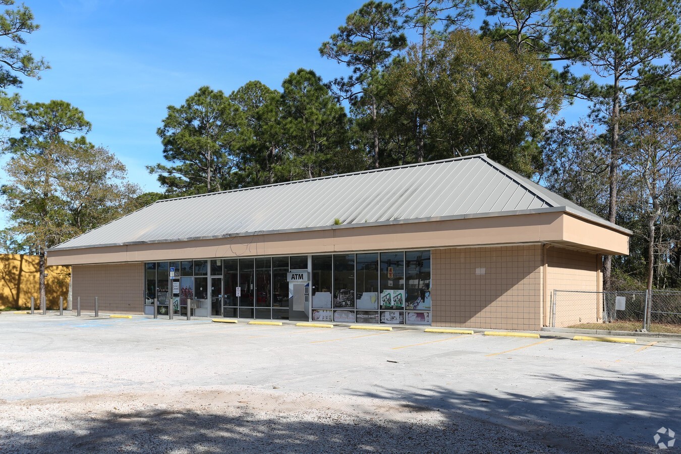
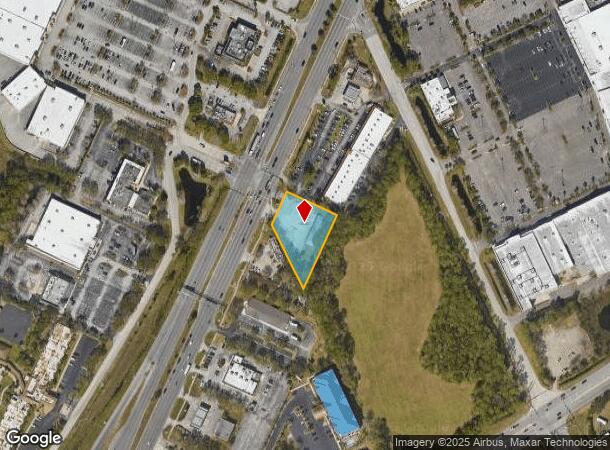
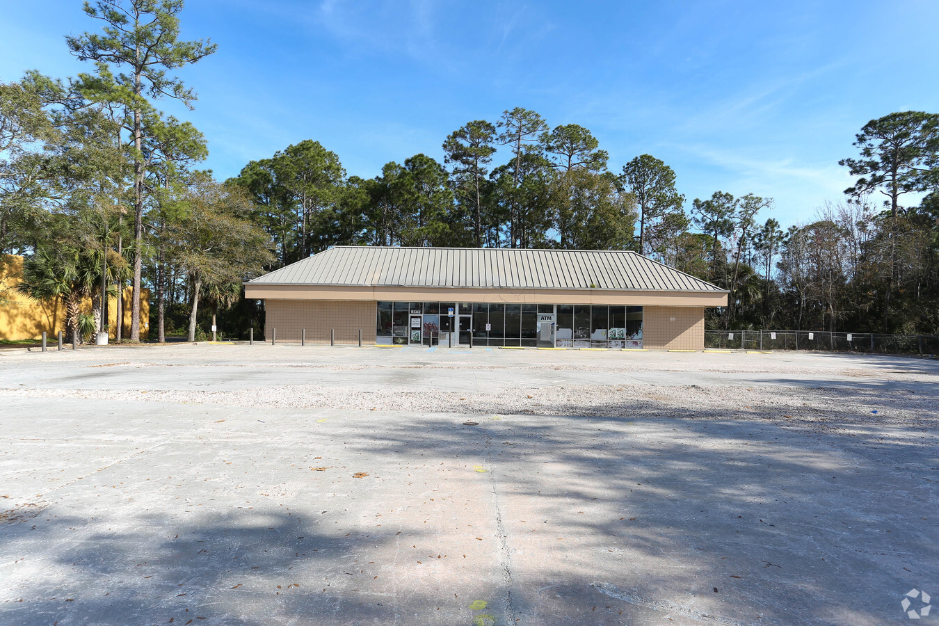
Property Record
2575 W International Speedway Blvd, Daytona Beach, FL 32114

NEARBY LISTINGS FOR SALE OR LEASE
Property Detail
2575 W International Speedway Blvd
5227-00-00-0162
Parcel
Storemultistory
27 15 32 IRREG PARCEL LYING 595.5 FT SW OF W/L OF THAMES AVE BEING 115 FT ON S/L OF US 92 & 247.24 FT ON W/L & 273.24 FT ON S/L PER OR 3658 PG 0989 & OR 4164 PG 1979-1989 PER OR 8200 PG 4475
X
Volusia
12127C0362H
Florida
2023
0.85 AC
2024
South Daytona Beach
092500
Deltona/Daytona Beach
3,100 SF
Deltona-Daytona Beach-Ormond Beach, FL
DEMOGRAPHICS near 2575 W International Speedway Blvd
1 Mile
3 Mile
5 Mile
2024 Total Population
496
29,019
114,640
2029 Population
564
32,225
127,992
Pop Growth 2024-2029
+ 13.71%
+ 11.05%
+ 11.65%
Average Age
38
39
42
2024 Total Households
241
12,037
48,819
HH Growth 2024-2029
+ 13.69%
+ 11.98%
+ 12.13%
Median Household Inc
$43,823
$49,526
$49,274
Avg Household Size
2.00
2.00
2.10
2024 Avg HH Vehicles
1.00
2.00
2.00
Median Home Value
$254,347
$218,263
$192,217
Median Year Built
1991
1986
1983
Nearby Places
- Restaurants
- Banks
- Shops
- Fitness
- Groceries
PUBLIC TRANSPORTATION
AIRPORT
Daytona Beach International
DRIVE
WALK
Distance
Daytona Beach International
6 min
2.5 mi
Orlando Sanford International
DRIVE
WALK
Distance
Orlando Sanford International
53 min
39.1 mi
Freight Ports
Port Canaveral
DRIVE
WALK
Distance
Port Canaveral
82 min
70.2 mi
Nearby Properties
Address
Land Use
TOTAL SIZE
Lot Size
Zoning
Address
Land Use
TOTAL SIZE
Lot Size
Zoning
863,820 SF
374 AC
AP
Address
Land Use
TOTAL SIZE
Lot Size
Zoning
1,365,998 SF
13 AC
Address
Land Use
TOTAL SIZE
Lot Size
Zoning
1,058,116 SF
54.22 AC
Address
Land Use
TOTAL SIZE
Lot Size
Zoning
831,398 SF
25.56 AC
Address
Land Use
TOTAL SIZE
Lot Size
Zoning
497,823 SF
73.48 AC
Address
Land Use
TOTAL SIZE
Lot Size
Zoning
442,125 SF
0.98 AC
A21
Address
Land Use
TOTAL SIZE
Lot Size
Zoning
353,548 SF
50.65 AC
Address
Land Use
TOTAL SIZE
Lot Size
Zoning
400,964 SF
38.93 AC
Address
Land Use
TOTAL SIZE
Lot Size
Zoning
356,386 SF
0.75 AC
Address
Land Use
TOTAL SIZE
Lot Size
Zoning
318,707 SF
12.16 AC
Address
Land Use
TOTAL SIZE
Lot Size
Zoning
275,814 SF
13 AC
Address
Land Use
TOTAL SIZE
Lot Size
Zoning
318,230 SF
21.28 AC
Address
Land Use
TOTAL SIZE
Lot Size
Zoning
286,461 SF
945.48 AC
B62
Address
Land Use
TOTAL SIZE
Lot Size
Zoning
303,151 SF
13.58 AC
Address
Land Use
TOTAL SIZE
Lot Size
Zoning
535,856 SF
46.85 AC
Address
Land Use
TOTAL SIZE
Lot Size
Zoning
259,175 SF
23.45 AC
Address
Land Use
TOTAL SIZE
Lot Size
Zoning
226,459 SF
0.57 AC
Address
Land Use
TOTAL SIZE
Lot Size
Zoning
417,015 SF
27.55 AC
Address
Land Use
TOTAL SIZE
Lot Size
Zoning
560,165 SF
37.79 AC
02BR2
Address
Land Use
TOTAL SIZE
Lot Size
Zoning
199,301 SF
21.54 AC
Address
Land Use
TOTAL SIZE
Lot Size
Zoning
208,825 SF
30.30 AC
02BA
Address
Land Use
TOTAL SIZE
Lot Size
Zoning
12,871 SF
0.20 AC
R4
Address
Land Use
TOTAL SIZE
Lot Size
Zoning
280,265 SF
11.95 AC
Address
Land Use
TOTAL SIZE
Lot Size
Zoning
324,364 SF
11.59 AC
02RPUD
Address
Land Use
TOTAL SIZE
Lot Size
Zoning
153,293 SF
10.95 AC
Address
Land Use
TOTAL SIZE
Lot Size
Zoning
169,917 SF
0.17 AC
02R2A
Address
Land Use
TOTAL SIZE
Lot Size
Zoning
207,607 SF
9.83 AC
Address
Land Use
TOTAL SIZE
Lot Size
Zoning
198,182 SF
7.43 AC
Address
Land Use
TOTAL SIZE
Lot Size
Zoning
92,927 SF
14.58 AC
Address
Land Use
TOTAL SIZE
Lot Size
Zoning
243,686 SF
0.17 AC
The World's #1 Commercial Real Estate Marketplace
Connect with us
© 2025 CoStar Group
The information above has been obtained from sources believed reliable. While we do not doubt its accuracy we have not verified it and make no guarantee, warranty or representation about it. It is your responsibility to independently confirm its accuracy and completeness. Any projections, opinions, assumptions, or estimates used are for example only and do not represent the current or future performance of the property. The value of this transaction to you depends on tax and other factors which should be evaluated by your tax, financial, and legal advisors. You and your advisors should conduct a careful, independent investigation of the property to determine to your satisfaction the suitability of the property for your needs.