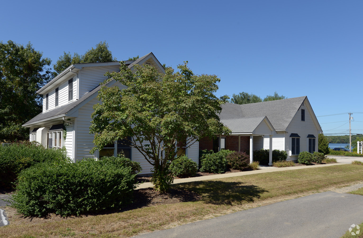
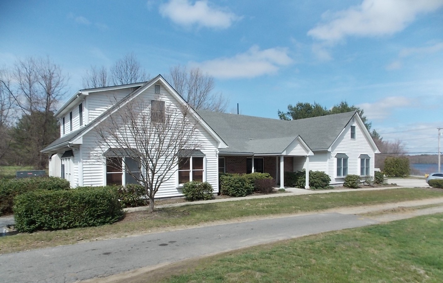
Property Record
26 Hartford Pike, North Scituate, RI 02857
NEARBY LISTINGS FOR SALE OR LEASE
-
-
View all North Scituate listings for lease on LoopNet.com
Property Detail
26 Hartford Pike
Commercialcondominium
Providence
X
Rhode Island
44007C0280G
50-3
2024
Foster/Scituate
2024
Providence
013201
Providence-Warwick, RI-MA
1,428 SF
SCIT-000016-000050-000003
DEMOGRAPHICS near 26 Hartford Pike
1 Mile
3 Mile
5 Mile
2024 Total Population
1,367
13,360
45,782
2029 Population
1,370
13,458
46,117
Pop Growth 2024-2029
+ 0.22%
+ 0.73%
+ 0.73%
Average Age
44
45
45
2024 Total Households
544
5,310
18,270
HH Growth 2024-2029
0.00%
+ 0.64%
+ 0.65%
Median Household Inc
$111,363
$105,072
$94,994
Avg Household Size
2.50
2.50
2.40
2024 Avg HH Vehicles
2.00
2.00
2.00
Median Home Value
$378,703
$383,607
$362,071
Median Year Built
1958
1971
1974
Nearby Places
- Restaurants
- Banks
- Shops
- Fitness
- Groceries
PUBLIC TRANSPORTATION
AIRPORT
Rhode Island Tf Green International
DRIVE
WALK
Distance
Rhode Island Tf Green International
23 min
14.7 mi
Freight Ports
Port of Davisville, RI
DRIVE
WALK
Distance
Port of Davisville, RI
34 min
24.0 mi
SALE & LEASE HISTORY
LISTING DATE
SALE/LEASE

Sep 25, 2016
For Lease
Sep 24, 2016
For Sale
May 18, 2017
For Sale
Aug 17, 2017
For Lease
Nearby Properties
Address
Land Use
TOTAL SIZE
Lot Size
Zoning
Address
Land Use
TOTAL SIZE
Lot Size
Zoning
135,831 SF
34.48 AC
RR-1
Address
Land Use
TOTAL SIZE
Lot Size
Zoning
9.59 AC
MU
Address
Land Use
TOTAL SIZE
Lot Size
Zoning
40.40 AC
RS-1
Address
Land Use
TOTAL SIZE
Lot Size
Zoning
40,586 SF
3.40 AC
RS-1
Address
Land Use
TOTAL SIZE
Lot Size
Zoning
30,275 SF
1.42 AC
MU
Address
Land Use
TOTAL SIZE
Lot Size
Zoning
1.81 AC
V
Address
Land Use
TOTAL SIZE
Lot Size
Zoning
50,886 SF
5.28 AC
BG
Address
Land Use
TOTAL SIZE
Lot Size
Zoning
36,973 SF
4.71 AC
R20
Address
Land Use
TOTAL SIZE
Lot Size
Zoning
2.37 AC
V
Address
Land Use
TOTAL SIZE
Lot Size
Zoning
19,244 SF
0.70 AC
RS-1
Address
Land Use
TOTAL SIZE
Lot Size
Zoning
18,400 SF
4.71 AC
B2
Address
Land Use
TOTAL SIZE
Lot Size
Zoning
18,351 SF
1.20 AC
R40
Address
Land Use
TOTAL SIZE
Lot Size
Zoning
53,824 SF
3.13 AC
V
Address
Land Use
TOTAL SIZE
Lot Size
Zoning
29,955 SF
2.99 AC
RS-1
Address
Land Use
TOTAL SIZE
Lot Size
Zoning
5.13 AC
V
Address
Land Use
TOTAL SIZE
Lot Size
Zoning
19,473 SF
52 AC
10
Address
Land Use
TOTAL SIZE
Lot Size
Zoning
21,870 SF
12.40 AC
RR-1
Address
Land Use
TOTAL SIZE
Lot Size
Zoning
238.68 AC
20
Address
Land Use
TOTAL SIZE
Lot Size
Zoning
34,800 SF
4.19 AC
I
Address
Land Use
TOTAL SIZE
Lot Size
Zoning
11,446 SF
0.69 AC
MU
Address
Land Use
TOTAL SIZE
Lot Size
Zoning
2,008 SF
6 AC
RS-1
Address
Land Use
TOTAL SIZE
Lot Size
Zoning
5,000 SF
3.70 AC
BG
Address
Land Use
TOTAL SIZE
Lot Size
Zoning
0.55 AC
V
Address
Land Use
TOTAL SIZE
Lot Size
Zoning
16,500 SF
3.93 AC
B2
Address
Land Use
TOTAL SIZE
Lot Size
Zoning
21,670 SF
1.64 AC
V
Address
Land Use
TOTAL SIZE
Lot Size
Zoning
11,688 SF
0.30 AC
RS-1
Address
Land Use
TOTAL SIZE
Lot Size
Zoning
2,144 SF
349.75 AC
R40
Address
Land Use
TOTAL SIZE
Lot Size
Zoning
9,111 SF
2.97 AC
MU
Address
Land Use
TOTAL SIZE
Lot Size
Zoning
Address
Land Use
TOTAL SIZE
Lot Size
Zoning
3.50 AC
BL
The World's #1 Commercial Real Estate Marketplace
Connect with us
© 2025 CoStar Group
The information above has been obtained from sources believed reliable. While we do not doubt its accuracy we have not verified it and make no guarantee, warranty or representation about it. It is your responsibility to independently confirm its accuracy and completeness. Any projections, opinions, assumptions, or estimates used are for example only and do not represent the current or future performance of the property. The value of this transaction to you depends on tax and other factors which should be evaluated by your tax, financial, and legal advisors. You and your advisors should conduct a careful, independent investigation of the property to determine to your satisfaction the suitability of the property for your needs.