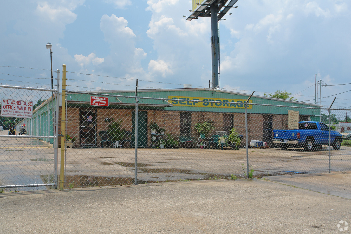
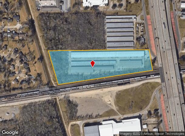
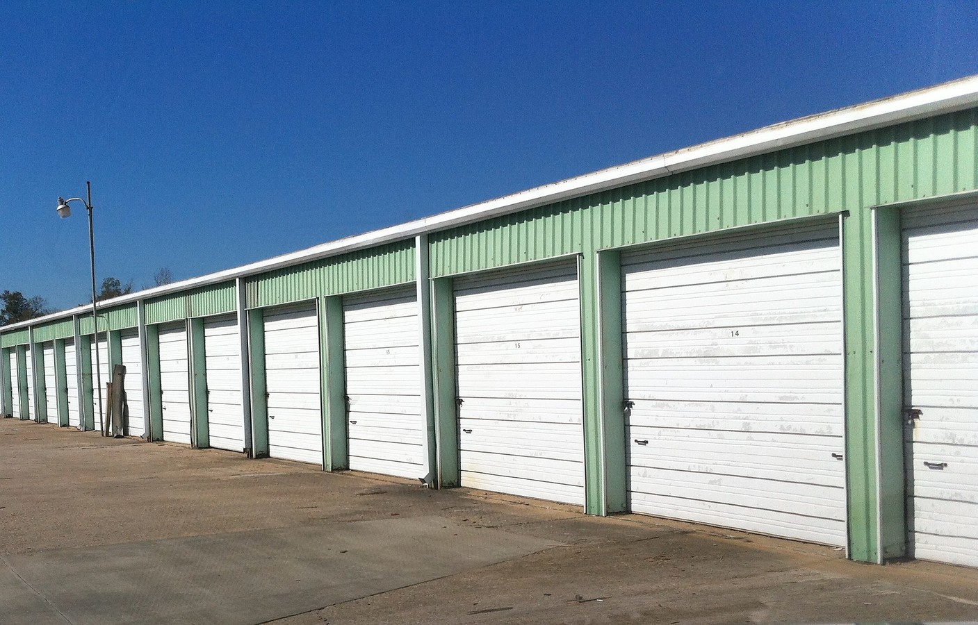
Property Record
260 Interstate 10 S, Beaumont, TX 77707
NEARBY LISTINGS FOR SALE OR LEASE
Property Detail
260 Interstate 10 S
Beaumont-Port Arthur, TX
C-6 52 N. Tevis
240306-000-000100-00000
PL C6 TR 2 & TR 2-A TR 2 B N TEVIS 7.6214 AC
Commercialnec
Jefferson
2024
Texas
2023
7.62 AC
001301
Beaumont
103,840 SF
Beaumont/Port Arthur
DEMOGRAPHICS near 260 Interstate 10 S
1 Mile
3 Mile
5 Mile
2024 Total Population
5,441
57,519
104,910
2029 Population
5,311
56,314
102,642
Pop Growth 2024-2029
(2.39%)
(2.09%)
(2.16%)
Average Age
37
39
38
2024 Total Households
2,037
22,541
41,860
HH Growth 2024-2029
(2.50%)
(2.20%)
(2.20%)
Median Household Inc
$53,992
$53,314
$52,341
Avg Household Size
2.50
2.40
2.40
2024 Avg HH Vehicles
2.00
2.00
2.00
Median Home Value
$132,885
$147,871
$148,750
Median Year Built
1965
1972
1976
Nearby Places
- Restaurants
- Banks
- Shops
- Fitness
- Groceries
PUBLIC TRANSPORTATION
COMMUTER RAIL
Beaumont Amtrak (Sunset Limited - Amtrak)
DRIVE
WALK
Distance
Beaumont Amtrak (Sunset Limited - Amtrak)
2 min
14 min
0.7 mi
Freight Ports
Port Beaumont
DRIVE
WALK
Distance
Port Beaumont
6 min
3.1 mi
SALE & LEASE HISTORY
LISTING DATE
SALE/LEASE

Jan 24, 2018
For Sale
Nearby Properties
Address
Land Use
TOTAL SIZE
Lot Size
Zoning
Address
Land Use
TOTAL SIZE
Lot Size
Zoning
163,287 SF
5.46 AC
Address
Land Use
TOTAL SIZE
Lot Size
Zoning
425,204 SF
6.99 AC
Address
Land Use
TOTAL SIZE
Lot Size
Zoning
130,658 SF
8.03 AC
Address
Land Use
TOTAL SIZE
Lot Size
Zoning
104,163 SF
12.76 AC
Address
Land Use
TOTAL SIZE
Lot Size
Zoning
2.07 AC
Address
Land Use
TOTAL SIZE
Lot Size
Zoning
241,242 SF
24.31 AC
Address
Land Use
TOTAL SIZE
Lot Size
Zoning
56,223 SF
1.93 AC
Address
Land Use
TOTAL SIZE
Lot Size
Zoning
213,450 SF
7.39 AC
Address
Land Use
TOTAL SIZE
Lot Size
Zoning
110,109 SF
6 AC
Address
Land Use
TOTAL SIZE
Lot Size
Zoning
165,276 SF
2.24 AC
Address
Land Use
TOTAL SIZE
Lot Size
Zoning
145,925 SF
23.56 AC
Address
Land Use
TOTAL SIZE
Lot Size
Zoning
124,434 SF
2.16 AC
Address
Land Use
TOTAL SIZE
Lot Size
Zoning
82,595 SF
29.48 AC
Address
Land Use
TOTAL SIZE
Lot Size
Zoning
266,107 SF
10.38 AC
Address
Land Use
TOTAL SIZE
Lot Size
Zoning
48,600 SF
4.87 AC
Address
Land Use
TOTAL SIZE
Lot Size
Zoning
31,914 SF
2.80 AC
Address
Land Use
TOTAL SIZE
Lot Size
Zoning
79,125 SF
8.09 AC
Address
Land Use
TOTAL SIZE
Lot Size
Zoning
48,913 SF
16.41 AC
Address
Land Use
TOTAL SIZE
Lot Size
Zoning
250,157 SF
17.65 AC
Address
Land Use
TOTAL SIZE
Lot Size
Zoning
57,326 SF
2.32 AC
Address
Land Use
TOTAL SIZE
Lot Size
Zoning
124,800 SF
9.34 AC
Address
Land Use
TOTAL SIZE
Lot Size
Zoning
112,290 SF
4.22 AC
Address
Land Use
TOTAL SIZE
Lot Size
Zoning
14,691 SF
2.50 AC
Address
Land Use
TOTAL SIZE
Lot Size
Zoning
122,954 SF
8.63 AC
Address
Land Use
TOTAL SIZE
Lot Size
Zoning
132,319 SF
13.92 AC
Address
Land Use
TOTAL SIZE
Lot Size
Zoning
101,083 SF
3.16 AC
Address
Land Use
TOTAL SIZE
Lot Size
Zoning
65,335 SF
11.51 AC
Address
Land Use
TOTAL SIZE
Lot Size
Zoning
81,868 SF
8.05 AC
Address
Land Use
TOTAL SIZE
Lot Size
Zoning
75,210 SF
3.10 AC
Address
Land Use
TOTAL SIZE
Lot Size
Zoning
172,974 SF
16.02 AC
The World's #1 Commercial Real Estate Marketplace
Connect with us
© 2025 CoStar Group
The information above has been obtained from sources believed reliable. While we do not doubt its accuracy we have not verified it and make no guarantee, warranty or representation about it. It is your responsibility to independently confirm its accuracy and completeness. Any projections, opinions, assumptions, or estimates used are for example only and do not represent the current or future performance of the property. The value of this transaction to you depends on tax and other factors which should be evaluated by your tax, financial, and legal advisors. You and your advisors should conduct a careful, independent investigation of the property to determine to your satisfaction the suitability of the property for your needs.