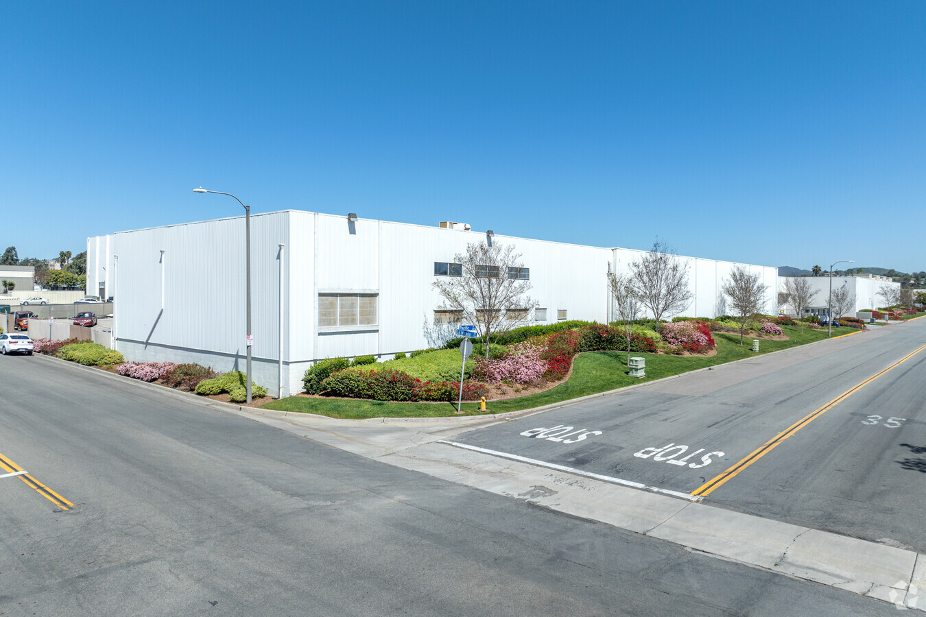
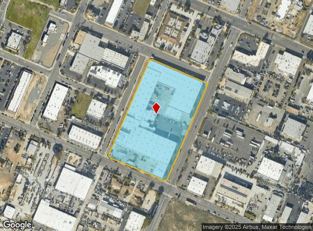
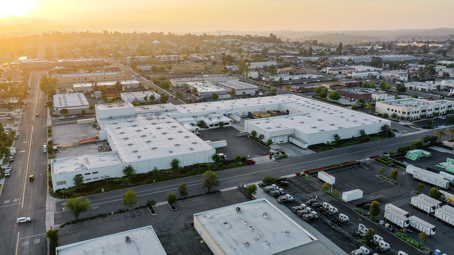
Property Record
260 S Pacific St, San Marcos, CA 92078
Current Lease Availabilities
NEARBY LISTINGS FOR SALE OR LEASE
Property Detail
260 S Pacific St
San Diego-Carlsbad, CA
Rancho Los Vallecitos De San M
219-089-02
BLK 175 (EX ST WID)STS&ALLEYS CLSD ADJ&BLK 174& TR 000806
Industrialgeneral
San Diego
X
California
06073C0789H
1-32
2024
6.41 AC
2024
San Marcos
020029
San Diego
99,999 SF
DEMOGRAPHICS near 260 S Pacific St
1 Mile
3 Mile
5 Mile
2024 Total Population
14,616
98,014
208,512
2029 Population
14,535
97,213
207,056
Pop Growth 2024-2029
(0.55%)
(0.82%)
(0.70%)
Average Age
41
38
40
2024 Total Households
4,991
32,786
71,813
HH Growth 2024-2029
(0.42%)
(0.91%)
(0.85%)
Median Household Inc
$61,030
$94,371
$105,056
Avg Household Size
2.70
2.90
2.80
2024 Avg HH Vehicles
2.00
2.00
2.00
Median Home Value
$453,061
$745,520
$780,328
Median Year Built
1981
1991
1988
Nearby Places
- Restaurants
- Banks
- Shops
- Fitness
- Groceries
PUBLIC TRANSPORTATION
COMMUTER RAIL
Carlsbad Poinsettia (Coaster - San Diego North County Transit District (Coaster/Sprinter/Breeze))
DRIVE
WALK
Distance
Carlsbad Poinsettia (Coaster - San Diego North County Transit District (Coaster/Sprinter/Breeze))
17 min
9.5 mi
AIRPORT
San Diego International
DRIVE
WALK
Distance
San Diego International
47 min
36.5 mi
Freight Ports
Port of San Diego
DRIVE
WALK
Distance
Port of San Diego
50 min
38.7 mi
Nearby Properties
Address
Land Use
TOTAL SIZE
Lot Size
Zoning
Address
Land Use
TOTAL SIZE
Lot Size
Zoning
27.98 AC
SPA
Address
Land Use
TOTAL SIZE
Lot Size
Zoning
18.90 AC
R-M
Address
Land Use
TOTAL SIZE
Lot Size
Zoning
15.37 AC
SPA
Address
Land Use
TOTAL SIZE
Lot Size
Zoning
5.25 AC
SPA
Address
Land Use
TOTAL SIZE
Lot Size
Zoning
5.37 AC
SPA
Address
Land Use
TOTAL SIZE
Lot Size
Zoning
10.82 AC
SPA
Address
Land Use
TOTAL SIZE
Lot Size
Zoning
11.87 AC
R-M
Address
Land Use
TOTAL SIZE
Lot Size
Zoning
9.41 AC
SPI
Address
Land Use
TOTAL SIZE
Lot Size
Zoning
16.91 AC
C
Address
Land Use
TOTAL SIZE
Lot Size
Zoning
11.08 AC
SPI
Address
Land Use
TOTAL SIZE
Lot Size
Zoning
9.88 AC
R-3-10
Address
Land Use
TOTAL SIZE
Lot Size
Zoning
Address
Land Use
TOTAL SIZE
Lot Size
Zoning
14.91 AC
SPI
Address
Land Use
TOTAL SIZE
Lot Size
Zoning
4.76 AC
C34
Address
Land Use
TOTAL SIZE
Lot Size
Zoning
13.20 AC
P-M
Address
Land Use
TOTAL SIZE
Lot Size
Zoning
19.35 AC
I-7
Address
Land Use
TOTAL SIZE
Lot Size
Zoning
9.80 AC
I
Address
Land Use
TOTAL SIZE
Lot Size
Zoning
27.30 AC
SPI
Address
Land Use
TOTAL SIZE
Lot Size
Zoning
7.91 AC
SPI
Address
Land Use
TOTAL SIZE
Lot Size
Zoning
19.68 AC
SPI
Address
Land Use
TOTAL SIZE
Lot Size
Zoning
10.80 AC
SPA
Address
Land Use
TOTAL SIZE
Lot Size
Zoning
1.94 AC
C
Address
Land Use
TOTAL SIZE
Lot Size
Zoning
9.99 AC
MU-1
Address
Land Use
TOTAL SIZE
Lot Size
Zoning
7.33 AC
R-M
Address
Land Use
TOTAL SIZE
Lot Size
Zoning
4.65 AC
SPI
Address
Land Use
TOTAL SIZE
Lot Size
Zoning
8.07 AC
SPI
Address
Land Use
TOTAL SIZE
Lot Size
Zoning
1.49 AC
SPA
Address
Land Use
TOTAL SIZE
Lot Size
Zoning
Address
Land Use
TOTAL SIZE
Lot Size
Zoning
9.75 AC
RU
Address
Land Use
TOTAL SIZE
Lot Size
Zoning
5.85 AC
SPA
The World's #1 Commercial Real Estate Marketplace
Connect with us
© 2025 CoStar Group
The information above has been obtained from sources believed reliable. While we do not doubt its accuracy we have not verified it and make no guarantee, warranty or representation about it. It is your responsibility to independently confirm its accuracy and completeness. Any projections, opinions, assumptions, or estimates used are for example only and do not represent the current or future performance of the property. The value of this transaction to you depends on tax and other factors which should be evaluated by your tax, financial, and legal advisors. You and your advisors should conduct a careful, independent investigation of the property to determine to your satisfaction the suitability of the property for your needs.