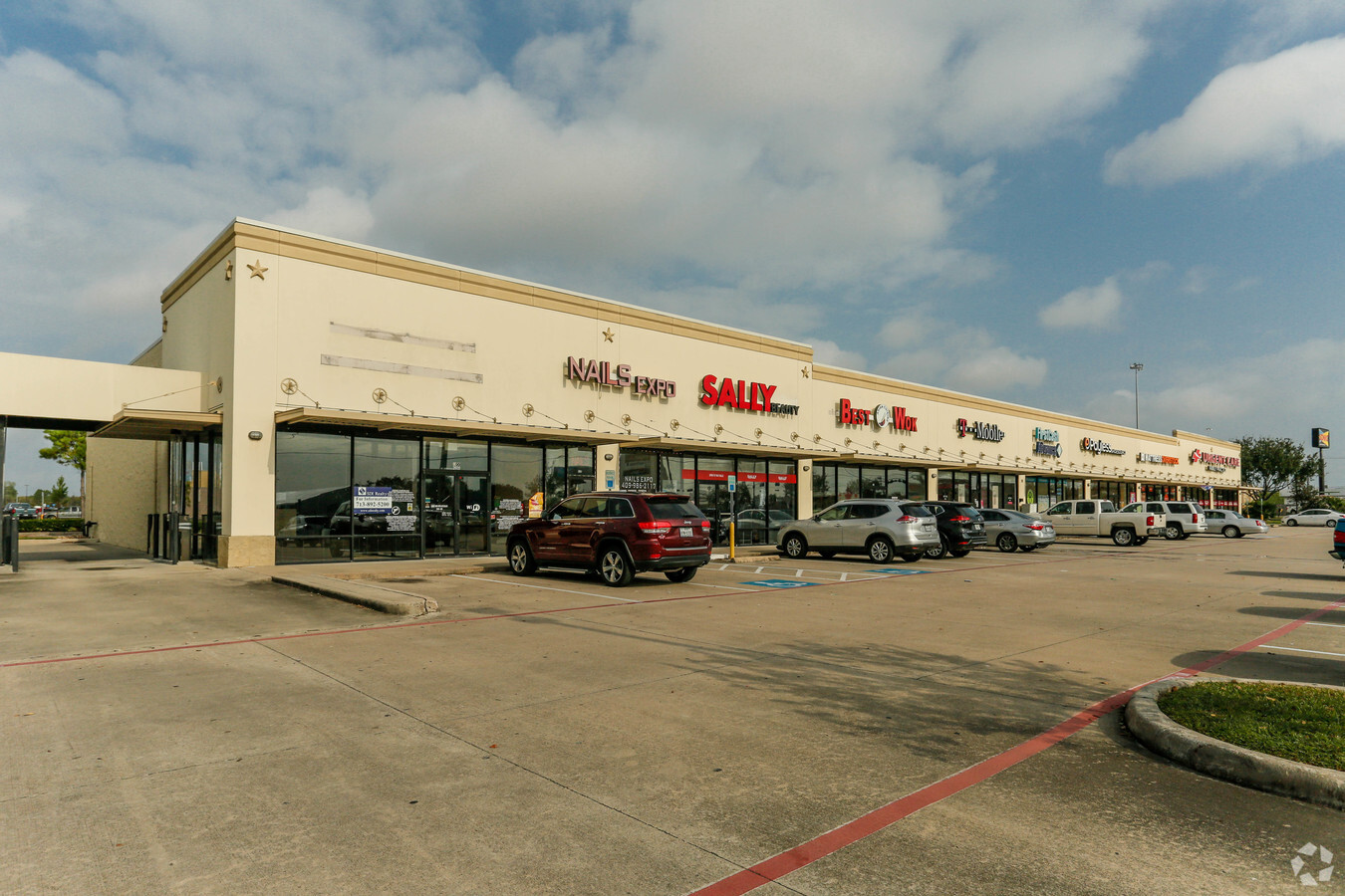
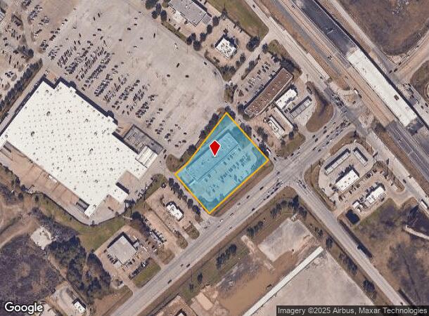
Property Record
2600 Fm 1764 Rd, La Marque, TX 77568

NEARBY LISTINGS FOR SALE OR LEASE
Property Detail
2600 Fm 1764 Rd
Houston-The Woodlands-Sugar Land, TX
Elektra Outlots At Fm 1764 (2003) Abst 2
3177-0001-0001-000
ELEKTRA OUTLOTS AT FM 1764 (2003) ABST 208, BLOCK 1, RES A, ACRES 2.416
Commercialnec
Galveston
X
Texas
48167C0245G
a
2023
2.42 AC
2023
Southeast Outlier
723300
Houston
22,080 SF
DEMOGRAPHICS near 2600 Fm 1764 Rd
1 Mile
3 Mile
5 Mile
2024 Total Population
5,825
29,017
84,621
2029 Population
6,454
31,112
89,710
Pop Growth 2024-2029
+ 10.80%
+ 7.22%
+ 6.01%
Average Age
35
37
38
2024 Total Households
2,111
10,476
30,974
HH Growth 2024-2029
+ 11.13%
+ 7.36%
+ 6.22%
Median Household Inc
$86,607
$79,744
$72,996
Avg Household Size
2.80
2.70
2.70
2024 Avg HH Vehicles
2.00
2.00
2.00
Median Home Value
$249,778
$231,977
$223,570
Median Year Built
2010
2004
1992
Nearby Places
- Restaurants
- Banks
- Shops
- Fitness
- Groceries
PUBLIC TRANSPORTATION
AIRPORT
William P Hobby
DRIVE
WALK
Distance
William P Hobby
37 min
23.8 mi
Freight Ports
Port of Galveston
DRIVE
WALK
Distance
Port of Galveston
21 min
16.4 mi
SALE & LEASE HISTORY
LISTING DATE
SALE/LEASE

Dec 18, 2017
For Lease
Nearby Properties
Address
Land Use
TOTAL SIZE
Lot Size
Zoning
Address
Land Use
TOTAL SIZE
Lot Size
Zoning
355,987 SF
46.99 AC
Address
Land Use
TOTAL SIZE
Lot Size
Zoning
383,204 SF
81.22 AC
Address
Land Use
TOTAL SIZE
Lot Size
Zoning
466,692 SF
27.67 AC
E
Address
Land Use
TOTAL SIZE
Lot Size
Zoning
200,000 SF
19.31 AC
A
Address
Land Use
TOTAL SIZE
Lot Size
Zoning
259,782 SF
9.40 AC
Address
Land Use
TOTAL SIZE
Lot Size
Zoning
197,584 SF
11.85 AC
Address
Land Use
TOTAL SIZE
Lot Size
Zoning
4,967 SF
19.74 AC
Address
Land Use
TOTAL SIZE
Lot Size
Zoning
219,355 SF
10.24 AC
Address
Land Use
TOTAL SIZE
Lot Size
Zoning
107,300 SF
25.86 AC
Address
Land Use
TOTAL SIZE
Lot Size
Zoning
60,400 SF
17.89 AC
Address
Land Use
TOTAL SIZE
Lot Size
Zoning
1,216 SF
939.08 AC
Address
Land Use
TOTAL SIZE
Lot Size
Zoning
Address
Land Use
TOTAL SIZE
Lot Size
Zoning
267,588 SF
15.68 AC
Address
Land Use
TOTAL SIZE
Lot Size
Zoning
149,850 SF
26.15 AC
Address
Land Use
TOTAL SIZE
Lot Size
Zoning
225,844 SF
22.56 AC
Address
Land Use
TOTAL SIZE
Lot Size
Zoning
243,492 SF
10.27 AC
Address
Land Use
TOTAL SIZE
Lot Size
Zoning
367,464 SF
81.30 AC
Address
Land Use
TOTAL SIZE
Lot Size
Zoning
146,724 SF
13.63 AC
E
Address
Land Use
TOTAL SIZE
Lot Size
Zoning
303,433 SF
24.37 AC
Address
Land Use
TOTAL SIZE
Lot Size
Zoning
74,800 SF
44.61 AC
Address
Land Use
TOTAL SIZE
Lot Size
Zoning
60,288 SF
4.96 AC
Address
Land Use
TOTAL SIZE
Lot Size
Zoning
164,130 SF
36.79 AC
Address
Land Use
TOTAL SIZE
Lot Size
Zoning
133,888 SF
15.74 AC
Address
Land Use
TOTAL SIZE
Lot Size
Zoning
158,388 SF
16.52 AC
Address
Land Use
TOTAL SIZE
Lot Size
Zoning
29.08 AC
Address
Land Use
TOTAL SIZE
Lot Size
Zoning
37,323 SF
4.50 AC
Address
Land Use
TOTAL SIZE
Lot Size
Zoning
142,300 SF
10.33 AC
Address
Land Use
TOTAL SIZE
Lot Size
Zoning
105,810 SF
9.07 AC
Address
Land Use
TOTAL SIZE
Lot Size
Zoning
180,212 SF
19.20 AC
Address
Land Use
TOTAL SIZE
Lot Size
Zoning
124,867 SF
12.04 AC
The World's #1 Commercial Real Estate Marketplace
Connect with us
© 2025 CoStar Group
The information above has been obtained from sources believed reliable. While we do not doubt its accuracy we have not verified it and make no guarantee, warranty or representation about it. It is your responsibility to independently confirm its accuracy and completeness. Any projections, opinions, assumptions, or estimates used are for example only and do not represent the current or future performance of the property. The value of this transaction to you depends on tax and other factors which should be evaluated by your tax, financial, and legal advisors. You and your advisors should conduct a careful, independent investigation of the property to determine to your satisfaction the suitability of the property for your needs.