Property Record
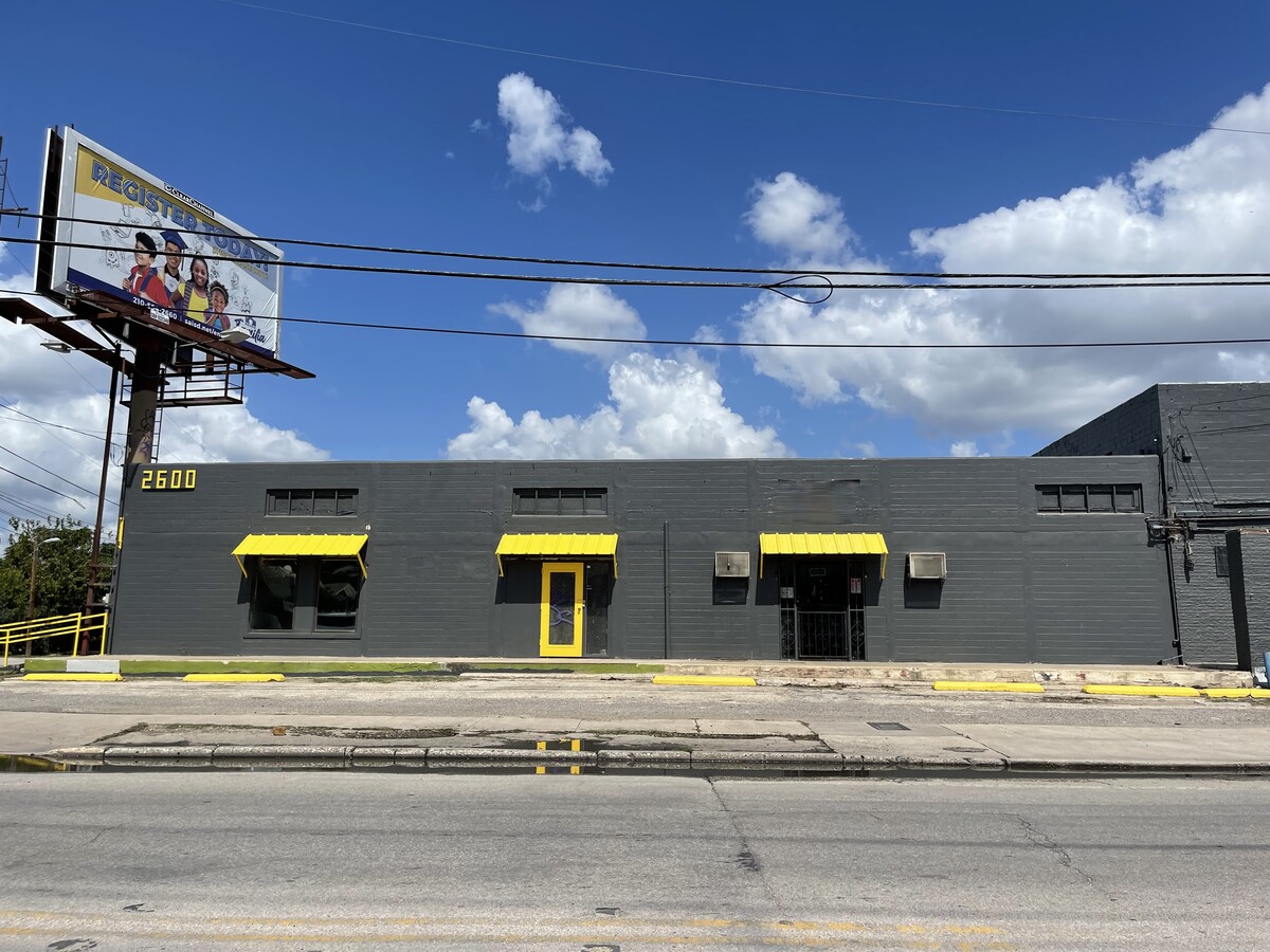
2600 S Flores St, San Antonio, TX 78204

Current Lease Availabilities
NEARBY LISTINGS FOR SALE OR LEASE
Property Detail
2600 S Flores St
San Antonio-New Braunfels, TX
Conv A/S Code
02597-000-0210
NCB 2597 BLK LOT 21 (GARDEA-1) 2018-NEW PER PLAT 9710/99-101 FILED 1-13-2017. JLF/GIS/4-12-2017
Warehouse
Bexar
X
Texas
48029C0395G
19
2023
1.62 AC
2023
CBD
150100
San Antonio
34,088 SF
DEMOGRAPHICS near 2600 S Flores St
1 Mile
3 Mile
5 Mile
2024 Total Population
15,845
148,977
351,645
2029 Population
17,209
158,934
374,960
Pop Growth 2024-2029
+ 8.61%
+ 6.68%
+ 6.63%
Average Age
39
38
38
2024 Total Households
6,184
53,292
125,754
HH Growth 2024-2029
+ 9.07%
+ 7.23%
+ 7.03%
Median Household Inc
$48,883
$38,232
$39,217
Avg Household Size
2.50
2.60
2.60
2024 Avg HH Vehicles
2.00
2.00
2.00
Median Home Value
$142,375
$117,768
$125,203
Median Year Built
1951
1954
1958
Nearby Places
- Restaurants
- Banks
- Shops
- Fitness
- Groceries
PUBLIC TRANSPORTATION
COMMUTER RAIL
San Antonio Amtrak Station (Sunset Limited - Amtrak, Texas Eagle - Amtrak)
DRIVE
WALK
Distance
San Antonio Amtrak Station (Sunset Limited - Amtrak, Texas Eagle - Amtrak)
7 min
3.2 mi
AIRPORT
San Antonio International
DRIVE
WALK
Distance
San Antonio International
16 min
10.2 mi
Freight Ports
Calhoun Port
DRIVE
WALK
Distance
Calhoun Port
180 min
146.8 mi
Nearby Properties
Address
Land Use
TOTAL SIZE
Lot Size
Zoning
Address
Land Use
TOTAL SIZE
Lot Size
Zoning
26.51 AC
Address
Land Use
TOTAL SIZE
Lot Size
Zoning
443,000 SF
4.16 AC
Address
Land Use
TOTAL SIZE
Lot Size
Zoning
738,650 SF
2.93 AC
Address
Land Use
TOTAL SIZE
Lot Size
Zoning
1,049,861 SF
1.50 AC
Address
Land Use
TOTAL SIZE
Lot Size
Zoning
922,468 SF
10.78 AC
Address
Land Use
TOTAL SIZE
Lot Size
Zoning
443,560 SF
2.77 AC
Address
Land Use
TOTAL SIZE
Lot Size
Zoning
481,589 SF
5.29 AC
Address
Land Use
TOTAL SIZE
Lot Size
Zoning
400,228 SF
0.78 AC
Address
Land Use
TOTAL SIZE
Lot Size
Zoning
521,935 SF
2.17 AC
Address
Land Use
TOTAL SIZE
Lot Size
Zoning
290,794 SF
0.62 AC
Address
Land Use
TOTAL SIZE
Lot Size
Zoning
15,468 SF
4.18 AC
Address
Land Use
TOTAL SIZE
Lot Size
Zoning
387,443 SF
0.89 AC
Address
Land Use
TOTAL SIZE
Lot Size
Zoning
8.10 AC
Address
Land Use
TOTAL SIZE
Lot Size
Zoning
542,922 SF
1.83 AC
Address
Land Use
TOTAL SIZE
Lot Size
Zoning
7,018 SF
3.24 AC
Address
Land Use
TOTAL SIZE
Lot Size
Zoning
14,492 SF
6.62 AC
Address
Land Use
TOTAL SIZE
Lot Size
Zoning
262,082 SF
1.60 AC
Address
Land Use
TOTAL SIZE
Lot Size
Zoning
495,840 SF
1.20 AC
Address
Land Use
TOTAL SIZE
Lot Size
Zoning
103,425 SF
4.76 AC
Address
Land Use
TOTAL SIZE
Lot Size
Zoning
13,153 SF
2.62 AC
Address
Land Use
TOTAL SIZE
Lot Size
Zoning
252,105 SF
0.47 AC
Address
Land Use
TOTAL SIZE
Lot Size
Zoning
31,334 SF
14.11 AC
Address
Land Use
TOTAL SIZE
Lot Size
Zoning
349,678 SF
0.83 AC
Address
Land Use
TOTAL SIZE
Lot Size
Zoning
9,390 SF
3.71 AC
Address
Land Use
TOTAL SIZE
Lot Size
Zoning
291,374 SF
13.49 AC
Address
Land Use
TOTAL SIZE
Lot Size
Zoning
156,480 SF
3.46 AC
Address
Land Use
TOTAL SIZE
Lot Size
Zoning
360,853 SF
1.18 AC
Address
Land Use
TOTAL SIZE
Lot Size
Zoning
240,394 SF
0.64 AC
Address
Land Use
TOTAL SIZE
Lot Size
Zoning
163,858 SF
0.62 AC
Address
Land Use
TOTAL SIZE
Lot Size
Zoning
399,007 SF
22.03 AC
The World's #1 Commercial Real Estate Marketplace
Connect with us
© 2025 CoStar Group
The information above has been obtained from sources believed reliable. While we do not doubt its accuracy we have not verified it and make no guarantee, warranty or representation about it. It is your responsibility to independently confirm its accuracy and completeness. Any projections, opinions, assumptions, or estimates used are for example only and do not represent the current or future performance of the property. The value of this transaction to you depends on tax and other factors which should be evaluated by your tax, financial, and legal advisors. You and your advisors should conduct a careful, independent investigation of the property to determine to your satisfaction the suitability of the property for your needs.