Property Record
2601 W Storage Parkway Rd, Rogers, AR 72756
NEARBY LISTINGS FOR SALE OR LEASE
Property Detail
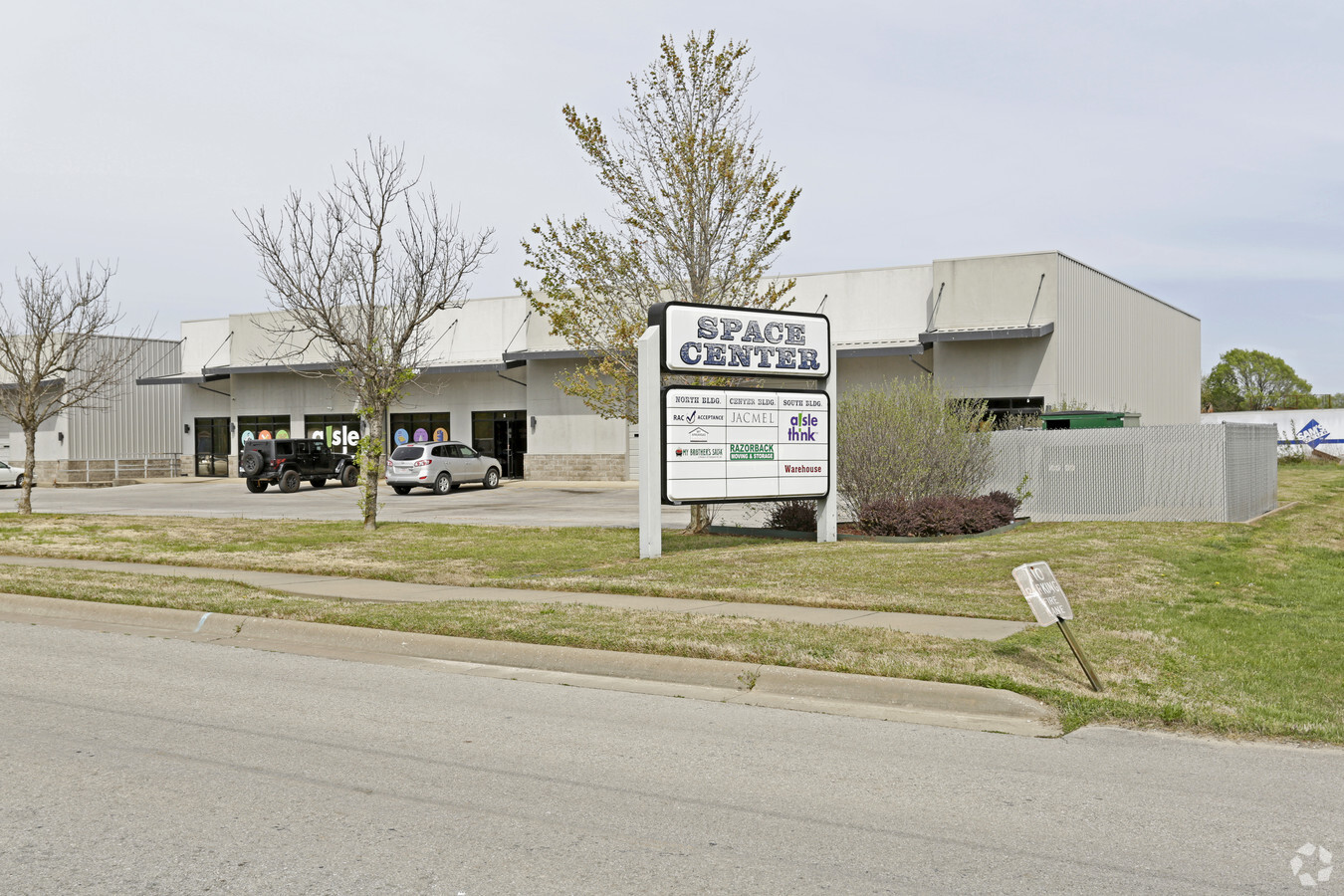
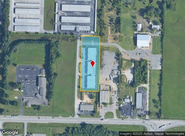
2601 W Storage Parkway Rd
02-02124-000
Rogers
Industrialgeneral
PART OF THE SE OF THE SW OF SECTION 36, TOWNSHIP 20 NORTH, RANGE 30 WEST, BENTON COUNTY, ARKANSAS, DESCRIBED AS FOLLOWS: BEGINNING AT A POINT NORTH 89 0236 EAST 745.50 FEET AND NORTH 00 5724 WEST 307.03 FEET FROM THE SOUTHWEST CORNER OF SAID SE O
AE
Benton
05007C0260K
Arkansas
2024
2.57 AC
2024
East Rogers
020201
Fayetteville/Springdale/Rogers
30,664 SF
Fayetteville-Springdale-Rogers, AR-MO
DEMOGRAPHICS near 2601 W Storage Parkway Rd
1 Mile
3 Mile
5 Mile
2024 Total Population
4,724
40,109
89,855
2029 Population
5,477
46,729
105,460
Pop Growth 2024-2029
+ 15.94%
+ 16.51%
+ 17.37%
Average Age
36
37
37
2024 Total Households
1,585
14,516
33,531
HH Growth 2024-2029
+ 15.96%
+ 16.56%
+ 17.58%
Median Household Inc
$60,094
$61,921
$67,251
Avg Household Size
2.70
2.60
2.60
2024 Avg HH Vehicles
2.00
2.00
2.00
Median Home Value
$199,227
$198,588
$218,642
Median Year Built
1987
1987
1993
Nearby Places
- Restaurants
- Banks
- Shops
- Fitness
- Groceries
PUBLIC TRANSPORTATION
AIRPORT
Northwest Arkansas Ntl
DRIVE
WALK
Distance
Northwest Arkansas Ntl
31 min
15.7 mi
Freight Ports
Tulsa Port of Inola
DRIVE
WALK
Distance
Tulsa Port of Inola
118 min
101.0 mi
Nearby Properties
Address
Land Use
TOTAL SIZE
Lot Size
Zoning
Address
Land Use
TOTAL SIZE
Lot Size
Zoning
117,522 SF
0.12 AC
Address
Land Use
TOTAL SIZE
Lot Size
Zoning
746,783 SF
77.03 AC
Address
Land Use
TOTAL SIZE
Lot Size
Zoning
542,873 SF
16.52 AC
Address
Land Use
TOTAL SIZE
Lot Size
Zoning
573,476 SF
57.80 AC
Address
Land Use
TOTAL SIZE
Lot Size
Zoning
249,843 SF
19.21 AC
Address
Land Use
TOTAL SIZE
Lot Size
Zoning
214,791 SF
9.13 AC
Address
Land Use
TOTAL SIZE
Lot Size
Zoning
156,100 SF
7.89 AC
Address
Land Use
TOTAL SIZE
Lot Size
Zoning
274,312 SF
12.24 AC
Address
Land Use
TOTAL SIZE
Lot Size
Zoning
152,759 SF
12.01 AC
Address
Land Use
TOTAL SIZE
Lot Size
Zoning
114,250 SF
7.54 AC
Address
Land Use
TOTAL SIZE
Lot Size
Zoning
117,522 SF
13.66 AC
Address
Land Use
TOTAL SIZE
Lot Size
Zoning
231,576 SF
15.18 AC
Address
Land Use
TOTAL SIZE
Lot Size
Zoning
102,477 SF
7.15 AC
Address
Land Use
TOTAL SIZE
Lot Size
Zoning
46,851 SF
4.28 AC
Address
Land Use
TOTAL SIZE
Lot Size
Zoning
74,243 SF
14.03 AC
Address
Land Use
TOTAL SIZE
Lot Size
Zoning
205,851 SF
20.13 AC
Address
Land Use
TOTAL SIZE
Lot Size
Zoning
263,095 SF
13.17 AC
Address
Land Use
TOTAL SIZE
Lot Size
Zoning
402,500 SF
19.54 AC
Address
Land Use
TOTAL SIZE
Lot Size
Zoning
191,610 SF
43 AC
Address
Land Use
TOTAL SIZE
Lot Size
Zoning
112,935 SF
6.75 AC
Address
Land Use
TOTAL SIZE
Lot Size
Zoning
197,916 SF
15.49 AC
Address
Land Use
TOTAL SIZE
Lot Size
Zoning
141,332 SF
18.26 AC
Address
Land Use
TOTAL SIZE
Lot Size
Zoning
4,329 SF
2.55 AC
Address
Land Use
TOTAL SIZE
Lot Size
Zoning
101,690 SF
8.76 AC
Address
Land Use
TOTAL SIZE
Lot Size
Zoning
123,791 SF
5.64 AC
Address
Land Use
TOTAL SIZE
Lot Size
Zoning
123,879 SF
5.31 AC
Address
Land Use
TOTAL SIZE
Lot Size
Zoning
143,368 SF
11.72 AC
Address
Land Use
TOTAL SIZE
Lot Size
Zoning
160,798 SF
14.84 AC
Address
Land Use
TOTAL SIZE
Lot Size
Zoning
57,609 SF
8.53 AC
Address
Land Use
TOTAL SIZE
Lot Size
Zoning
123,568 SF
12.12 AC
The World's #1 Commercial Real Estate Marketplace
Connect with us
© 2025 CoStar Group
The information above has been obtained from sources believed reliable. While we do not doubt its accuracy we have not verified it and make no guarantee, warranty or representation about it. It is your responsibility to independently confirm its accuracy and completeness. Any projections, opinions, assumptions, or estimates used are for example only and do not represent the current or future performance of the property. The value of this transaction to you depends on tax and other factors which should be evaluated by your tax, financial, and legal advisors. You and your advisors should conduct a careful, independent investigation of the property to determine to your satisfaction the suitability of the property for your needs.