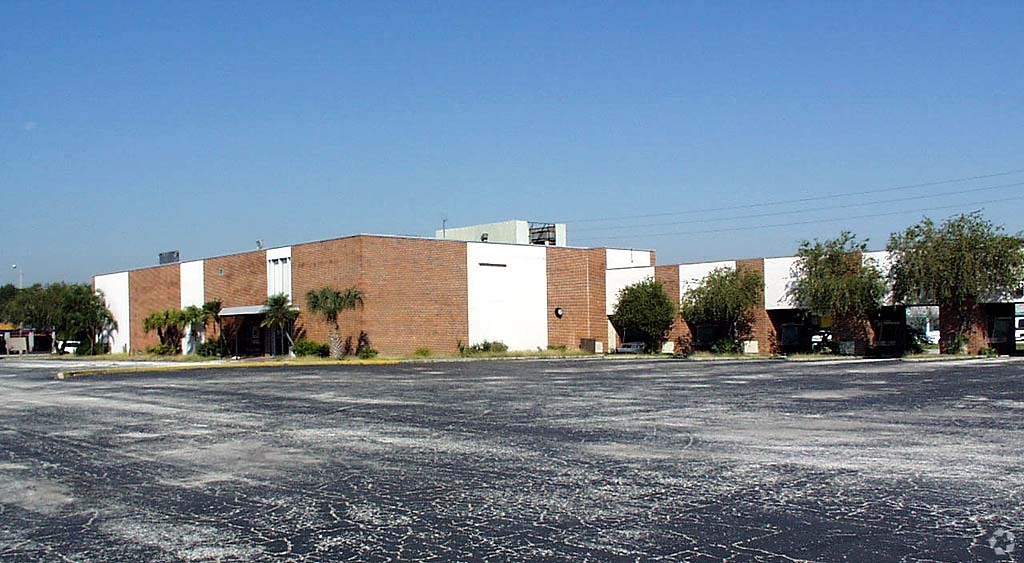
Property Record
289 34Th St N, Saint Petersburg, FL 33713


NEARBY LISTINGS FOR SALE OR LEASE
Property Detail
289 34Th St N
23-31-16-00000-220-0800
Part Of Nw 1/4 Of Sec 23-
Publicstorage
PART OF NW 1/4 OF SEC 23- 31-16 DESC AS FROM NW SEC COR TH S00D0836W 1267.11FT FOR POB TH N89D 4817E 380.01FT TH N00D 0836E 270FT TH S89D48 17W 380.01FT TH S00D08 36W 270FT TO POB LESS W 50FT FOR 34TH ST R/W & LESS ANY PARTS LYING WITHIN R/WS OF 3RD
X
Pinellas
12103C0218G
Florida
2023
2.02 AC
2024
South Pinellas
021900
Tampa/St Petersburg
97,746 SF
Tampa-St. Petersburg-Clearwater, FL
DEMOGRAPHICS near 289 34Th St N
1 Mile
3 Mile
5 Mile
2024 Total Population
13,630
132,130
282,381
2029 Population
13,622
132,482
283,913
Pop Growth 2024-2029
(0.06%)
+ 0.27%
+ 0.54%
Average Age
41
42
45
2024 Total Households
6,244
60,154
129,506
HH Growth 2024-2029
(0.34%)
+ 0.08%
+ 0.46%
Median Household Inc
$68,412
$60,182
$61,849
Avg Household Size
2.10
2.10
2.10
2024 Avg HH Vehicles
1.00
2.00
2.00
Median Home Value
$288,711
$269,486
$281,660
Median Year Built
1954
1958
1965
Nearby Places
- Restaurants
- Banks
- Shops
- Fitness
- Groceries
PUBLIC TRANSPORTATION
AIRPORT
St Pete-Clearwater International
DRIVE
WALK
Distance
St Pete-Clearwater International
24 min
12.9 mi
Tampa International
DRIVE
WALK
Distance
Tampa International
31 min
21.6 mi
Sarasota/Bradenton International
DRIVE
WALK
Distance
Sarasota/Bradenton International
47 min
31.5 mi
Freight Ports
Port Manatee
DRIVE
WALK
Distance
Port Manatee
34 min
24.0 mi
Nearby Properties
Address
Land Use
TOTAL SIZE
Lot Size
Zoning
Address
Land Use
TOTAL SIZE
Lot Size
Zoning
725,000 SF
6.05 AC
Address
Land Use
TOTAL SIZE
Lot Size
Zoning
1,100,000 SF
57.70 AC
Address
Land Use
TOTAL SIZE
Lot Size
Zoning
655,966 SF
1.25 AC
Address
Land Use
TOTAL SIZE
Lot Size
Zoning
662,311 SF
2.89 AC
Address
Land Use
TOTAL SIZE
Lot Size
Zoning
221,003 SF
1.39 AC
Address
Land Use
TOTAL SIZE
Lot Size
Zoning
690,001 SF
2.28 AC
Address
Land Use
TOTAL SIZE
Lot Size
Zoning
478,217 SF
9.84 AC
Address
Land Use
TOTAL SIZE
Lot Size
Zoning
593,859 SF
2.04 AC
Address
Land Use
TOTAL SIZE
Lot Size
Zoning
807,604 SF
9.61 AC
Address
Land Use
TOTAL SIZE
Lot Size
Zoning
402,572 SF
10.02 AC
Address
Land Use
TOTAL SIZE
Lot Size
Zoning
593,733 SF
4.35 AC
Address
Land Use
TOTAL SIZE
Lot Size
Zoning
287,275 SF
6.29 AC
Address
Land Use
TOTAL SIZE
Lot Size
Zoning
596,429 SF
8.07 AC
Address
Land Use
TOTAL SIZE
Lot Size
Zoning
474,605 SF
1.84 AC
Address
Land Use
TOTAL SIZE
Lot Size
Zoning
547,258 SF
3.24 AC
Address
Land Use
TOTAL SIZE
Lot Size
Zoning
443,983 SF
0.88 AC
Address
Land Use
TOTAL SIZE
Lot Size
Zoning
242,915 SF
2.20 AC
Address
Land Use
TOTAL SIZE
Lot Size
Zoning
193,444 SF
2,339.19 AC
Address
Land Use
TOTAL SIZE
Lot Size
Zoning
393,952 SF
Address
Land Use
TOTAL SIZE
Lot Size
Zoning
231,140 SF
5.10 AC
Address
Land Use
TOTAL SIZE
Lot Size
Zoning
366,959 SF
2.02 AC
Address
Land Use
TOTAL SIZE
Lot Size
Zoning
457,983 SF
3.86 AC
Address
Land Use
TOTAL SIZE
Lot Size
Zoning
512,449 SF
6 AC
Address
Land Use
TOTAL SIZE
Lot Size
Zoning
348,400 SF
1.89 AC
Address
Land Use
TOTAL SIZE
Lot Size
Zoning
330,467 SF
1.88 AC
Address
Land Use
TOTAL SIZE
Lot Size
Zoning
339,332 SF
1.37 AC
Address
Land Use
TOTAL SIZE
Lot Size
Zoning
21,232 SF
332.98 AC
Address
Land Use
TOTAL SIZE
Lot Size
Zoning
341,472 SF
29.42 AC
Address
Land Use
TOTAL SIZE
Lot Size
Zoning
94,875 SF
1.26 AC
Address
Land Use
TOTAL SIZE
Lot Size
Zoning
7,227 SF
10.78 AC
The World's #1 Commercial Real Estate Marketplace
Connect with us
© 2025 CoStar Group
The information above has been obtained from sources believed reliable. While we do not doubt its accuracy we have not verified it and make no guarantee, warranty or representation about it. It is your responsibility to independently confirm its accuracy and completeness. Any projections, opinions, assumptions, or estimates used are for example only and do not represent the current or future performance of the property. The value of this transaction to you depends on tax and other factors which should be evaluated by your tax, financial, and legal advisors. You and your advisors should conduct a careful, independent investigation of the property to determine to your satisfaction the suitability of the property for your needs.