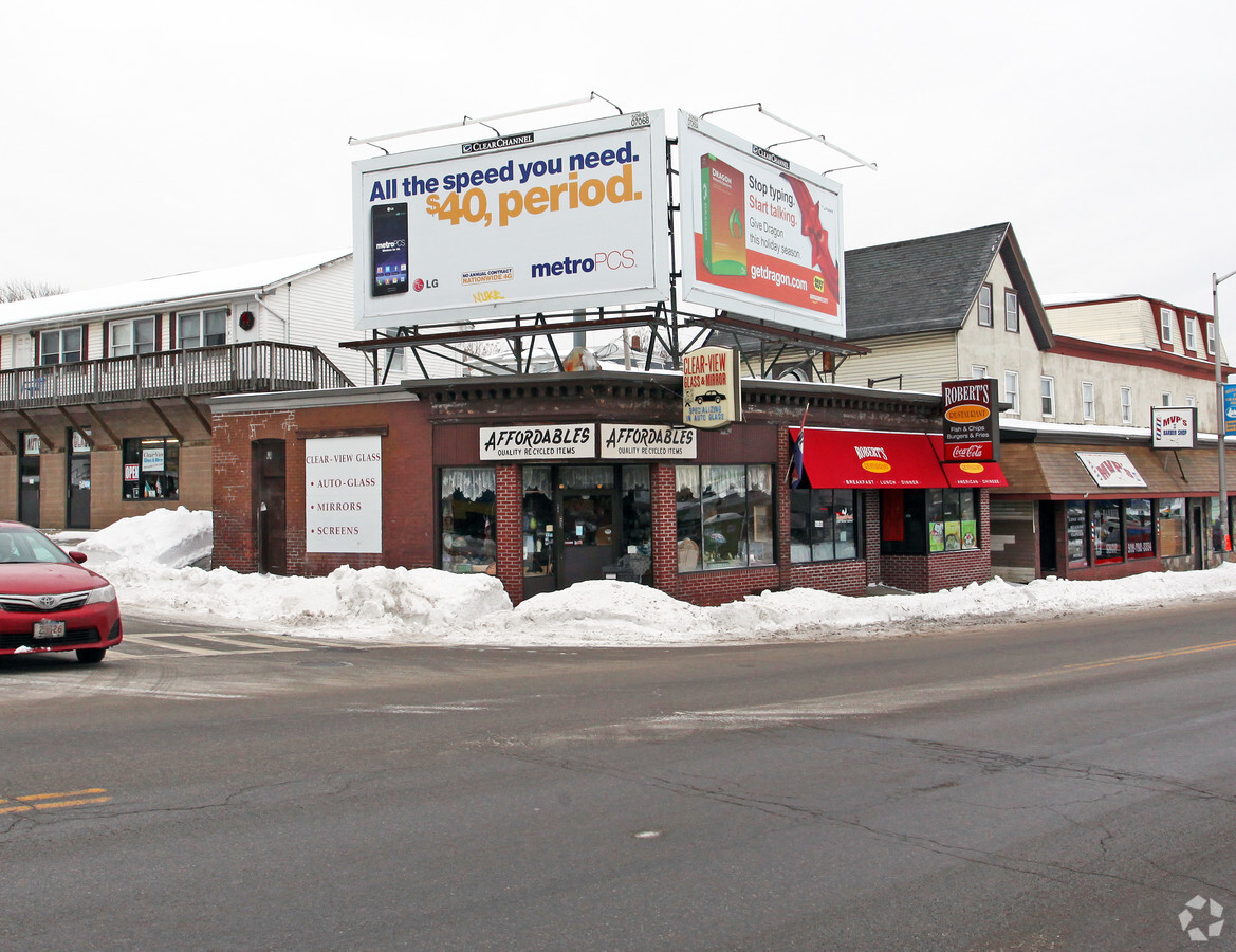
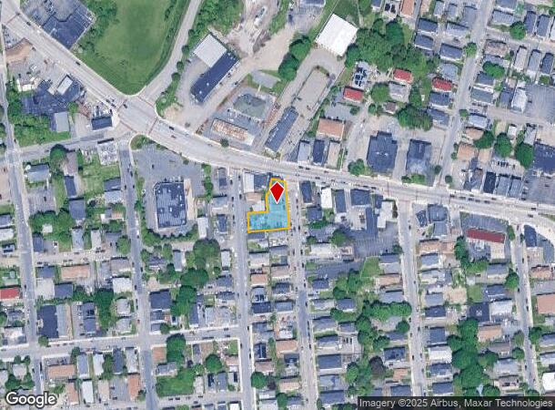
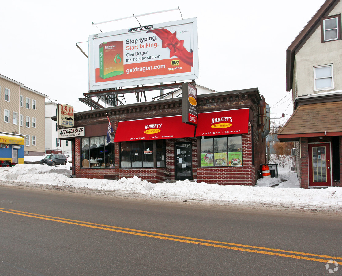
Property Record
264 Grafton St, Worcester, MA 01604
NEARBY LISTINGS FOR SALE OR LEASE
Property Detail
264 Grafton St
WORC-000004-000028-000002-000028
Worcester
Commercialofficeresidentialmixeduse
Massachusetts
X
2+28
25027C0618E
0.32 AC
0
Worcester Metro
2024
Boston
732302
Worcester, MA-CT
DEMOGRAPHICS near 264 Grafton St
1 Mile
3 Mile
5 Mile
2024 Total Population
33,417
153,352
249,467
2029 Population
32,725
151,173
246,851
Pop Growth 2024-2029
(2.07%)
(1.42%)
(1.05%)
Average Age
36
37
39
2024 Total Households
13,316
59,562
97,059
HH Growth 2024-2029
(1.98%)
(1.38%)
(1.03%)
Median Household Inc
$47,629
$56,446
$68,075
Avg Household Size
2.30
2.30
2.40
2024 Avg HH Vehicles
1.00
1.00
2.00
Median Home Value
$274,754
$314,293
$336,521
Median Year Built
1948
1949
1954
Nearby Places
- Restaurants
- Banks
- Shops
- Fitness
- Groceries
PUBLIC TRANSPORTATION
COMMUTER RAIL
Worcester Union Station (Lake Shore Limited - Amtrak)
DRIVE
WALK
Distance
Worcester Union Station (Lake Shore Limited - Amtrak)
1 min
11 min
0.6 mi
Worcester (Framingham/Worcester Line - Massachusetts Bay Transportation Authority Commuter Rail (Purple Line))
DRIVE
WALK
Distance
Worcester (Framingham/Worcester Line - Massachusetts Bay Transportation Authority Commuter Rail (Purple Line))
1 min
15 min
0.7 mi
AIRPORT
Worcester Regional
DRIVE
WALK
Distance
Worcester Regional
13 min
6.5 mi
Freight Ports
Port of Boston
DRIVE
WALK
Distance
Port of Boston
59 min
44.4 mi
SALE & LEASE HISTORY
LISTING DATE
SALE/LEASE

Jan 18, 2021
For Lease
Jan 18, 2021
For Sale
Nearby Properties
Address
Land Use
TOTAL SIZE
Lot Size
Zoning
Address
Land Use
TOTAL SIZE
Lot Size
Zoning
669,637 SF
17.46 AC
BG-6
Address
Land Use
TOTAL SIZE
Lot Size
Zoning
49.51 AC
IN-S
Address
Land Use
TOTAL SIZE
Lot Size
Zoning
381,440 SF
2.74 AC
BG-6
Address
Land Use
TOTAL SIZE
Lot Size
Zoning
457,170 SF
29.92 AC
ML-.5
Address
Land Use
TOTAL SIZE
Lot Size
Zoning
612,538 SF
3.98 AC
BG-6
Address
Land Use
TOTAL SIZE
Lot Size
Zoning
20.01 AC
BG-2
Address
Land Use
TOTAL SIZE
Lot Size
Zoning
26,152 SF
7.97 AC
COM BU
Address
Land Use
TOTAL SIZE
Lot Size
Zoning
142.98 AC
Address
Land Use
TOTAL SIZE
Lot Size
Zoning
51.05 AC
BO-1
Address
Land Use
TOTAL SIZE
Lot Size
Zoning
524,527 SF
45.16 AC
BL-1
Address
Land Use
TOTAL SIZE
Lot Size
Zoning
Address
Land Use
TOTAL SIZE
Lot Size
Zoning
16.01 AC
COM BU
Address
Land Use
TOTAL SIZE
Lot Size
Zoning
3.85 AC
RG-5
Address
Land Use
TOTAL SIZE
Lot Size
Zoning
25,000 SF
99.10 AC
MG-.5
Address
Land Use
TOTAL SIZE
Lot Size
Zoning
117,645 SF
3.11 AC
BO-1
Address
Land Use
TOTAL SIZE
Lot Size
Zoning
1,760 SF
105.54 AC
ML10
Address
Land Use
TOTAL SIZE
Lot Size
Zoning
272,824 SF
14.95 AC
BL-1
Address
Land Use
TOTAL SIZE
Lot Size
Zoning
157,385 SF
3.45 AC
BG-6
Address
Land Use
TOTAL SIZE
Lot Size
Zoning
Address
Land Use
TOTAL SIZE
Lot Size
Zoning
19,319 SF
10.67 AC
RG-5
Address
Land Use
TOTAL SIZE
Lot Size
Zoning
176,316 SF
19.57 AC
RL-7
Address
Land Use
TOTAL SIZE
Lot Size
Zoning
177.12 AC
RL-7
Address
Land Use
TOTAL SIZE
Lot Size
Zoning
70,514 SF
31.64 AC
RL-7
Address
Land Use
TOTAL SIZE
Lot Size
Zoning
3.55 AC
RG-5
Address
Land Use
TOTAL SIZE
Lot Size
Zoning
15.42 AC
RG-5
Address
Land Use
TOTAL SIZE
Lot Size
Zoning
194,264 SF
4.32 AC
BL-1
Address
Land Use
TOTAL SIZE
Lot Size
Zoning
69.46 AC
RS-7
Address
Land Use
TOTAL SIZE
Lot Size
Zoning
159,355 SF
207.62 AC
RL-7
Address
Land Use
TOTAL SIZE
Lot Size
Zoning
68.34 AC
ML10
Address
Land Use
TOTAL SIZE
Lot Size
Zoning
3.43 AC
ML10
The World's #1 Commercial Real Estate Marketplace
Connect with us
© 2025 CoStar Group
The information above has been obtained from sources believed reliable. While we do not doubt its accuracy we have not verified it and make no guarantee, warranty or representation about it. It is your responsibility to independently confirm its accuracy and completeness. Any projections, opinions, assumptions, or estimates used are for example only and do not represent the current or future performance of the property. The value of this transaction to you depends on tax and other factors which should be evaluated by your tax, financial, and legal advisors. You and your advisors should conduct a careful, independent investigation of the property to determine to your satisfaction the suitability of the property for your needs.