Property Record
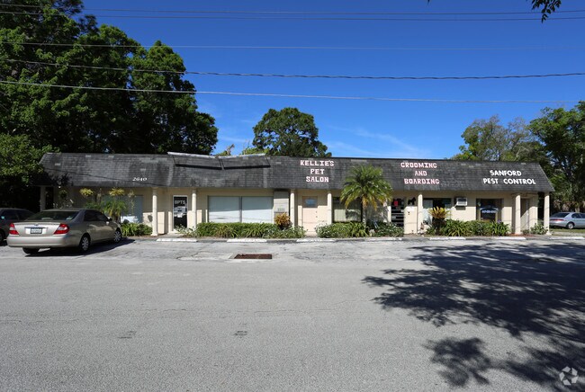
2640 Hiawatha Ave, Sanford, FL 32773


NEARBY LISTINGS FOR SALE OR LEASE
-
-
-
-
-
No Photo
-
-
-
-
-
-
-
-
View all Sanford listings for sale on LoopNet.com
Property Detail
2640 Hiawatha Ave
Orlando-Kissimmee-Sanford, FL
Dreamwold
01-20-30-504-1800-0090
LOTS 9 + 10 BLK 18 DREAMWOLD PB 3 PG 90 + PB 4 PG 99
Officebuilding
Seminole
X
Florida
12069C0450E
9,10
2025
0.36 AC
2025
Sanford
020901
Orlando
4,242 SF
DEMOGRAPHICS near 2640 Hiawatha Ave
1 Mile
3 Mile
5 Mile
2024 Total Population
12,390
66,438
109,401
2029 Population
13,109
69,577
114,722
Pop Growth 2024-2029
+ 5.80%
+ 4.72%
+ 4.86%
Average Age
37
39
39
2024 Total Households
4,620
24,594
41,397
HH Growth 2024-2029
+ 5.78%
+ 4.78%
+ 5.00%
Median Household Inc
$46,626
$55,359
$62,783
Avg Household Size
2.50
2.60
2.50
2024 Avg HH Vehicles
2.00
2.00
2.00
Median Home Value
$183,302
$234,677
$275,863
Median Year Built
1978
1986
1993
Nearby Places
Map Layers
Map Styles
 Street
 Aerial
- Restaurants
- Banks
- Shops
- Fitness
- Groceries
PUBLIC TRANSPORTATION
COMMUTER RAIL
DRIVE
WALK
Distance
8 min
3.0 mi
DRIVE
WALK
Distance
9 min
3.9 mi
AIRPORT
Orlando Sanford International
DRIVE
WALK
Distance
Orlando Sanford International
8 min
3.0 mi
Orlando International
DRIVE
WALK
Distance
Orlando International
39 min
32.1 mi
Daytona Beach International
DRIVE
WALK
Distance
Daytona Beach International
49 min
37.5 mi
Freight Ports
Port Canaveral
DRIVE
WALK
Distance
Port Canaveral
76 min
65.1 mi
Nearby Properties
Address
Land Use
TOTAL SIZE
Lot Size
Zoning
Address
Land Use
TOTAL SIZE
Lot Size
Zoning
36.94 AC
A1
Address
Land Use
TOTAL SIZE
Lot Size
Zoning
312 SF
10.47 AC
Address
Land Use
TOTAL SIZE
Lot Size
Zoning
413,982 SF
0.05 AC
RI1
Address
Land Use
TOTAL SIZE
Lot Size
Zoning
314,822 SF
10.96 AC
GC2
Address
Land Use
TOTAL SIZE
Lot Size
Zoning
250 SF
14.29 AC
RMOI
Address
Land Use
TOTAL SIZE
Lot Size
Zoning
615.80 AC
RI1
Address
Land Use
TOTAL SIZE
Lot Size
Zoning
504,437 SF
20.84 AC
A1
Address
Land Use
TOTAL SIZE
Lot Size
Zoning
1,001 SF
12.02 AC
MR3
Address
Land Use
TOTAL SIZE
Lot Size
Zoning
10,757 SF
70.59 AC
C2
Address
Land Use
TOTAL SIZE
Lot Size
Zoning
938 SF
9.46 AC
SC3
Address
Land Use
TOTAL SIZE
Lot Size
Zoning
245,806 SF
24.93 AC
RMOI
Address
Land Use
TOTAL SIZE
Lot Size
Zoning
864 SF
9.99 AC
A1
Address
Land Use
TOTAL SIZE
Lot Size
Zoning
209,424 SF
12.93 AC
MR2
Address
Land Use
TOTAL SIZE
Lot Size
Zoning
209,950 SF
16.28 AC
RMOI
Address
Land Use
TOTAL SIZE
Lot Size
Zoning
376.01 AC
C2
Address
Land Use
TOTAL SIZE
Lot Size
Zoning
216,071 SF
77 AC
A1
Address
Land Use
TOTAL SIZE
Lot Size
Zoning
362,876 SF
22.06 AC
MR3
Address
Land Use
TOTAL SIZE
Lot Size
Zoning
138,513 SF
14.95 AC
GC2
Address
Land Use
TOTAL SIZE
Lot Size
Zoning
110,310 SF
19.33 AC
PD
Address
Land Use
TOTAL SIZE
Lot Size
Zoning
9.54 AC
M1
Address
Land Use
TOTAL SIZE
Lot Size
Zoning
365,961 SF
18.41 AC
MR3
Address
Land Use
TOTAL SIZE
Lot Size
Zoning
428,525 SF
20.81 AC
A1
Address
Land Use
TOTAL SIZE
Lot Size
Zoning
204,151 SF
12 AC
MR2
Address
Land Use
TOTAL SIZE
Lot Size
Zoning
115,946 SF
47.65 AC
PD
Address
Land Use
TOTAL SIZE
Lot Size
Zoning
121,720 SF
7.20 AC
GC2
Address
Land Use
TOTAL SIZE
Lot Size
Zoning
101.53 AC
PUD
Address
Land Use
TOTAL SIZE
Lot Size
Zoning
2,100 SF
10.98 AC
Address
Land Use
TOTAL SIZE
Lot Size
Zoning
158,656 SF
17.80 AC
GC2
Address
Land Use
TOTAL SIZE
Lot Size
Zoning
184,276 SF
20.70 AC
SR1
Address
Land Use
TOTAL SIZE
Lot Size
Zoning
1,124 SF
11.01 AC
MR2
The World's #1 Commercial Real Estate Marketplace
Connect with us
© 2026 CoStar Group
The information above has been obtained from sources believed reliable. While we do not doubt its accuracy we have not verified it and make no guarantee, warranty or representation about it. It is your responsibility to independently confirm its accuracy and completeness. Any projections, opinions, assumptions, or estimates used are for example only and do not represent the current or future performance of the property. The value of this transaction to you depends on tax and other factors which should be evaluated by your tax, financial, and legal advisors. You and your advisors should conduct a careful, independent investigation of the property to determine to your satisfaction the suitability of the property for your needs.