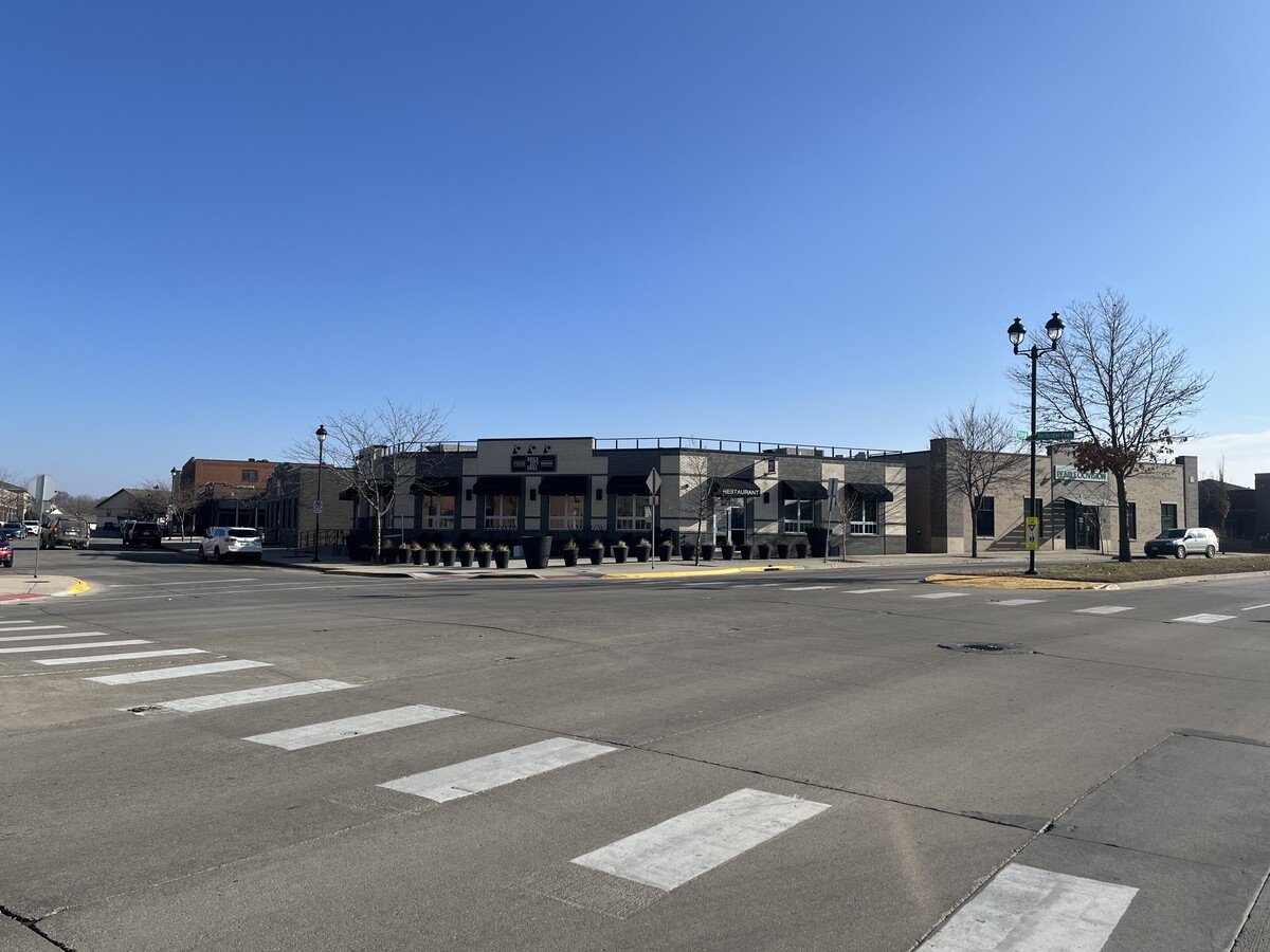
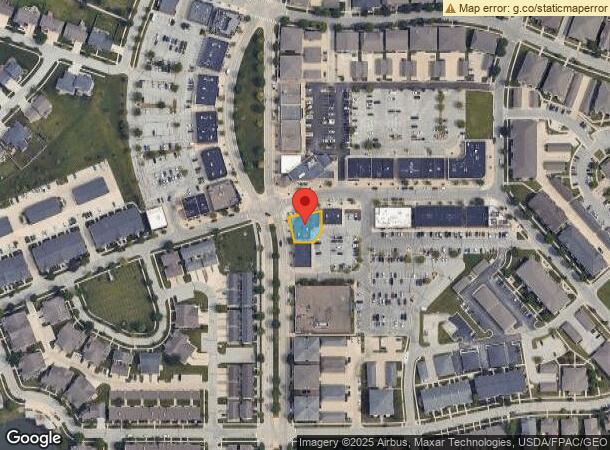
Property Record
2640 Stange Rd, Ames, IA 50010

NEARBY LISTINGS FOR SALE OR LEASE
Property Detail
2640 Stange Rd
Ames, IA
Somerset Sd 2Nd Add
05-33-227-091
SOMERSET SD 24TH ADD LOT:2 AMES
Restaurantbuilding
Story
X
Iowa
19015C0250D
2
2024
0.16 AC
2024
Somerset
000105
Other Market Areas
4,272 SF
DEMOGRAPHICS near 2640 Stange Rd
1 Mile
3 Mile
5 Mile
2024 Total Population
11,526
52,625
69,876
2029 Population
11,939
54,240
71,969
Pop Growth 2024-2029
+ 3.58%
+ 3.07%
+ 3.00%
Average Age
39
34
34
2024 Total Households
4,694
20,825
28,084
HH Growth 2024-2029
+ 4.22%
+ 3.41%
+ 3.38%
Median Household Inc
$74,067
$61,297
$58,437
Avg Household Size
2.20
2.10
2.10
2024 Avg HH Vehicles
2.00
2.00
2.00
Median Home Value
$278,560
$250,589
$252,453
Median Year Built
1995
1985
1990
Nearby Places
- Restaurants
- Banks
- Shops
- Fitness
- Groceries
Nearby Properties
Address
Land Use
TOTAL SIZE
Lot Size
Zoning
Address
Land Use
TOTAL SIZE
Lot Size
Zoning
54,112 SF
12.70 AC
Address
Land Use
TOTAL SIZE
Lot Size
Zoning
289,606 SF
1.77 AC
CSC
Address
Land Use
TOTAL SIZE
Lot Size
Zoning
215,689 SF
22.56 AC
HOC
Address
Land Use
TOTAL SIZE
Lot Size
Zoning
75,302 SF
16.66 AC
HOC
Address
Land Use
TOTAL SIZE
Lot Size
Zoning
82,734 SF
1.42 AC
CSC
Address
Land Use
TOTAL SIZE
Lot Size
Zoning
78,379 SF
7.92 AC
SHM
Address
Land Use
TOTAL SIZE
Lot Size
Zoning
156,833 SF
14.54 AC
PRC
Address
Land Use
TOTAL SIZE
Lot Size
Zoning
16,222 SF
10.44 AC
Address
Land Use
TOTAL SIZE
Lot Size
Zoning
117,797 SF
7.88 AC
Address
Land Use
TOTAL SIZE
Lot Size
Zoning
78,507 SF
3 AC
FS-RM
Address
Land Use
TOTAL SIZE
Lot Size
Zoning
7,314 SF
8.91 AC
RH
Address
Land Use
TOTAL SIZE
Lot Size
Zoning
122,502 SF
10.96 AC
HOC
Address
Land Use
TOTAL SIZE
Lot Size
Zoning
133,668 SF
3.71 AC
RH
Address
Land Use
TOTAL SIZE
Lot Size
Zoning
7,181 SF
20.11 AC
PRC
Address
Land Use
TOTAL SIZE
Lot Size
Zoning
20,619 SF
2.44 AC
RH
Address
Land Use
TOTAL SIZE
Lot Size
Zoning
920 SF
20.72 AC
F-PRD
Address
Land Use
TOTAL SIZE
Lot Size
Zoning
97,767 SF
0.05 AC
CSC
Address
Land Use
TOTAL SIZE
Lot Size
Zoning
100,588 SF
7.65 AC
HOC
Address
Land Use
TOTAL SIZE
Lot Size
Zoning
63,021 SF
3.43 AC
Address
Land Use
TOTAL SIZE
Lot Size
Zoning
52,904 SF
2.13 AC
RH
Address
Land Use
TOTAL SIZE
Lot Size
Zoning
26.37 AC
SGA
Address
Land Use
TOTAL SIZE
Lot Size
Zoning
8,820 SF
7.37 AC
PRC
Address
Land Use
TOTAL SIZE
Lot Size
Zoning
105,550 SF
0.62 AC
CSC
Address
Land Use
TOTAL SIZE
Lot Size
Zoning
29,212 SF
1.01 AC
SHM
Address
Land Use
TOTAL SIZE
Lot Size
Zoning
19,656 SF
4.86 AC
RH
Address
Land Use
TOTAL SIZE
Lot Size
Zoning
41,000 SF
1.73 AC
Address
Land Use
TOTAL SIZE
Lot Size
Zoning
7,200 SF
4.32 AC
HOC
Address
Land Use
TOTAL SIZE
Lot Size
Zoning
990 SF
5.66 AC
RH
Address
Land Use
TOTAL SIZE
Lot Size
Zoning
43,805 SF
4.65 AC
HOC
Address
Land Use
TOTAL SIZE
Lot Size
Zoning
23,954 SF
3.77 AC
CCN
The World's #1 Commercial Real Estate Marketplace
Connect with us
© 2025 CoStar Group
The information above has been obtained from sources believed reliable. While we do not doubt its accuracy we have not verified it and make no guarantee, warranty or representation about it. It is your responsibility to independently confirm its accuracy and completeness. Any projections, opinions, assumptions, or estimates used are for example only and do not represent the current or future performance of the property. The value of this transaction to you depends on tax and other factors which should be evaluated by your tax, financial, and legal advisors. You and your advisors should conduct a careful, independent investigation of the property to determine to your satisfaction the suitability of the property for your needs.