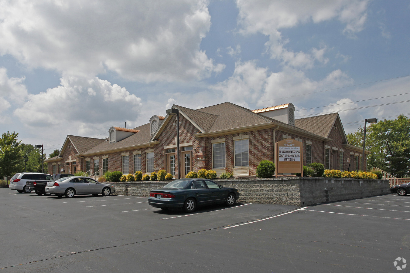
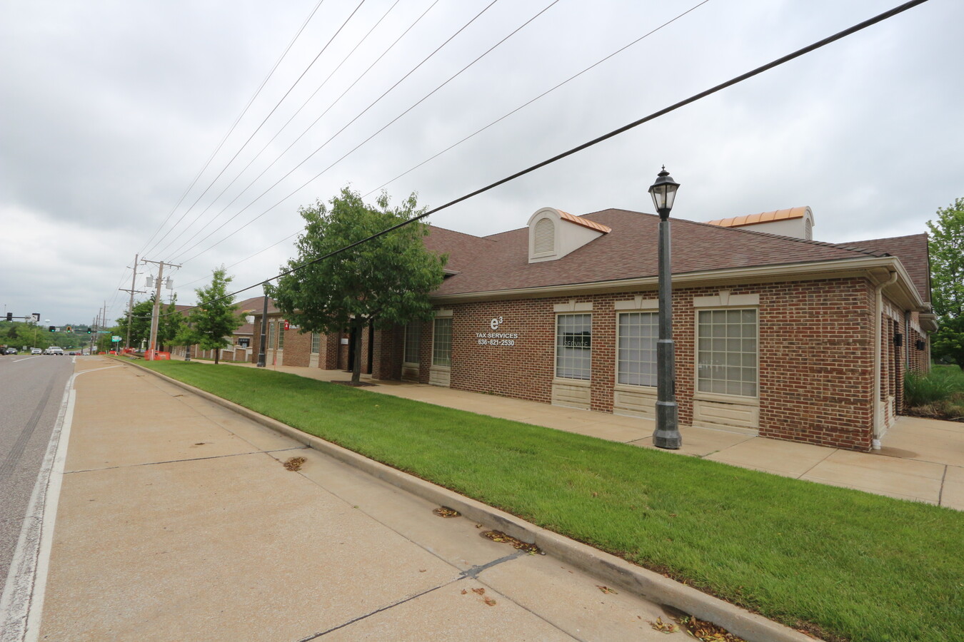
Property Record
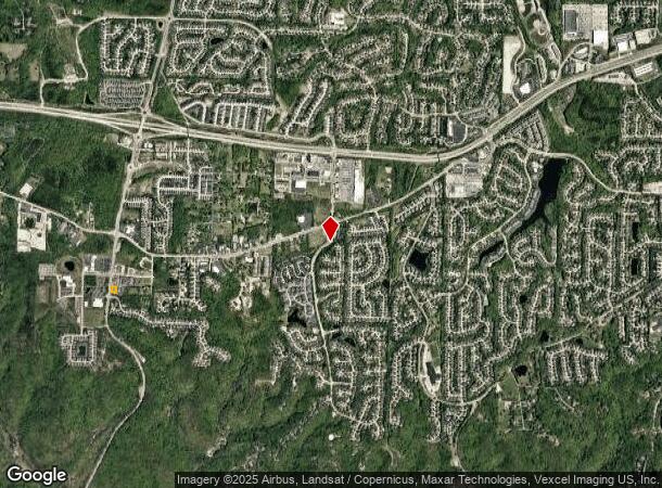
2642 Highway 109 Grover St, Grover, MO 63040

Current Lease Availabilities
NEARBY LISTINGS FOR SALE OR LEASE
Property Detail
2642 Highway 109 Grover St
St. Louis, MO-IL
Westridge Office Center Resubdivision
24V-4-1-026-4
WESTRIDGE OFFICE CENTER RESUBDIVISION LOT 5
Officebuilding
St. Louis
X
Missouri
29071C0225E
5
2023
0.27 AC
2023
West County
222100
St. Louis
8,176 SF
DEMOGRAPHICS near 2642 Highway 109 Grover St
1 Mile
3 Mile
5 Mile
2024 Total Population
3,808
25,737
64,785
2029 Population
3,778
25,137
63,466
Pop Growth 2024-2029
(0.79%)
(2.33%)
(2.04%)
Average Age
42
42
42
2024 Total Households
1,553
9,485
23,712
HH Growth 2024-2029
(0.84%)
(2.36%)
(2.07%)
Median Household Inc
$97,007
$132,185
$130,482
Avg Household Size
2.40
2.70
2.70
2024 Avg HH Vehicles
2.00
2.00
2.00
Median Home Value
$340,944
$386,238
$391,897
Median Year Built
1993
1991
1990
Nearby Places
- Restaurants
- Banks
- Shops
- Fitness
- Groceries
PUBLIC TRANSPORTATION
AIRPORT
St Louis Lambert International
DRIVE
WALK
Distance
St Louis Lambert International
43 min
27.9 mi
Freight Ports
Tulsa Port of Inola
DRIVE
WALK
Distance
Tulsa Port of Inola
399 min
361.2 mi
Nearby Properties
Address
Land Use
TOTAL SIZE
Lot Size
Zoning
Address
Land Use
TOTAL SIZE
Lot Size
Zoning
156,253 SF
10.64 AC
87PC
Address
Land Use
TOTAL SIZE
Lot Size
Zoning
51.20 AC
NU
Address
Land Use
TOTAL SIZE
Lot Size
Zoning
5,675 SF
1,382.01 AC
PS
Address
Land Use
TOTAL SIZE
Lot Size
Zoning
85,946 SF
60.44 AC
NU
Address
Land Use
TOTAL SIZE
Lot Size
Zoning
313,104 SF
14.66 AC
MXD
Address
Land Use
TOTAL SIZE
Lot Size
Zoning
138,056 SF
17.42 AC
NU
Address
Land Use
TOTAL SIZE
Lot Size
Zoning
175,448 SF
6.95 AC
Address
Land Use
TOTAL SIZE
Lot Size
Zoning
27.86 AC
107NU
Address
Land Use
TOTAL SIZE
Lot Size
Zoning
7,900 SF
31.95 AC
87A
Address
Land Use
TOTAL SIZE
Lot Size
Zoning
2,154 SF
13.19 AC
S
Address
Land Use
TOTAL SIZE
Lot Size
Zoning
97,285 SF
13.66 AC
19R-1
Address
Land Use
TOTAL SIZE
Lot Size
Zoning
128,358 SF
12.01 AC
19C-3
Address
Land Use
TOTAL SIZE
Lot Size
Zoning
30 AC
107NU
Address
Land Use
TOTAL SIZE
Lot Size
Zoning
16.80 AC
NU
Address
Land Use
TOTAL SIZE
Lot Size
Zoning
164,430 SF
9.85 AC
19C-4
Address
Land Use
TOTAL SIZE
Lot Size
Zoning
247,511 SF
31.03 AC
19M-1
Address
Land Use
TOTAL SIZE
Lot Size
Zoning
120,760 SF
11.10 AC
19C-3
Address
Land Use
TOTAL SIZE
Lot Size
Zoning
3,750 SF
169.58 AC
107NU
Address
Land Use
TOTAL SIZE
Lot Size
Zoning
3,464 SF
12.30 AC
107NU
Address
Land Use
TOTAL SIZE
Lot Size
Zoning
7,250 SF
80.06 AC
R
Address
Land Use
TOTAL SIZE
Lot Size
Zoning
222,707 SF
13.82 AC
19C-1
Address
Land Use
TOTAL SIZE
Lot Size
Zoning
109,550 SF
14.21 AC
107R6A
Address
Land Use
TOTAL SIZE
Lot Size
Zoning
118,097 SF
14.32 AC
19C-4
Address
Land Use
TOTAL SIZE
Lot Size
Zoning
185,087 SF
8 AC
19C-4
Address
Land Use
TOTAL SIZE
Lot Size
Zoning
70,267 SF
11.61 AC
19C-3
Address
Land Use
TOTAL SIZE
Lot Size
Zoning
99,100 SF
3.74 AC
19R-1
Address
Land Use
TOTAL SIZE
Lot Size
Zoning
84,616 SF
7.96 AC
A
Address
Land Use
TOTAL SIZE
Lot Size
Zoning
11.91 AC
107R3
Address
Land Use
TOTAL SIZE
Lot Size
Zoning
9.89 AC
19R-1
Address
Land Use
TOTAL SIZE
Lot Size
Zoning
17.18 AC
R1A
The World's #1 Commercial Real Estate Marketplace
Connect with us
© 2025 CoStar Group
The information above has been obtained from sources believed reliable. While we do not doubt its accuracy we have not verified it and make no guarantee, warranty or representation about it. It is your responsibility to independently confirm its accuracy and completeness. Any projections, opinions, assumptions, or estimates used are for example only and do not represent the current or future performance of the property. The value of this transaction to you depends on tax and other factors which should be evaluated by your tax, financial, and legal advisors. You and your advisors should conduct a careful, independent investigation of the property to determine to your satisfaction the suitability of the property for your needs.