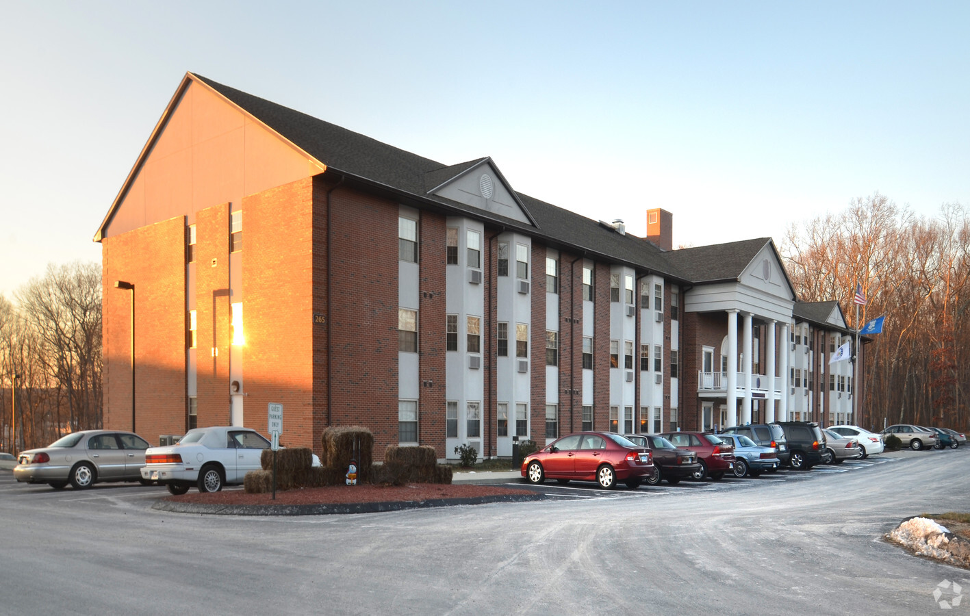
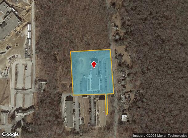
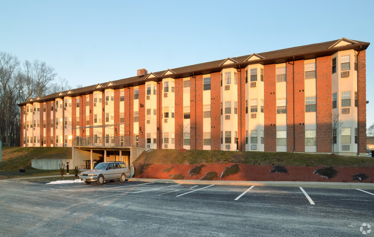
Property Record
265 Roxbury Rd, Niantic, CT 06357
NEARBY LISTINGS FOR SALE OR LEASE
-
-
View all Niantic listings for sale on LoopNet.com
Property Detail
265 Roxbury Rd
Apartmenthouse5plusunits
New London
X
Connecticut
09011C0478J
3.83 AC
2024
Southwest New London/Lyme
2024
Hartford
716101
Norwich-New London, CT
43,175 SF
ELYM-001000-003001
DEMOGRAPHICS near 265 Roxbury Rd
1 Mile
3 Mile
5 Mile
2024 Total Population
3,513
17,334
34,158
2029 Population
3,562
17,594
34,556
Pop Growth 2024-2029
+ 1.39%
+ 1.50%
+ 1.17%
Average Age
46
47
47
2024 Total Households
1,226
7,364
14,457
HH Growth 2024-2029
+ 0.49%
+ 1.52%
+ 1.20%
Median Household Inc
$71,513
$104,634
$103,959
Avg Household Size
2.00
2.20
2.20
2024 Avg HH Vehicles
2.00
2.00
2.00
Median Home Value
$295,854
$366,446
$370,602
Median Year Built
1978
1968
1967
Nearby Places
- Restaurants
- Banks
- Shops
- Fitness
- Groceries
PUBLIC TRANSPORTATION
COMMUTER RAIL
New London (Shore Line East - Shore Line East)
DRIVE
WALK
Distance
New London (Shore Line East - Shore Line East)
18 min
8.3 mi
Old Saybrook (Shore Line East - Shore Line East)
DRIVE
WALK
Distance
Old Saybrook (Shore Line East - Shore Line East)
15 min
9.6 mi
Freight Ports
Port of New Haven
DRIVE
WALK
Distance
Port of New Haven
49 min
37.5 mi
Nearby Properties
Address
Land Use
TOTAL SIZE
Lot Size
Zoning
Address
Land Use
TOTAL SIZE
Lot Size
Zoning
66.17 AC
LI
Address
Land Use
TOTAL SIZE
Lot Size
Zoning
617.95 AC
Address
Land Use
TOTAL SIZE
Lot Size
Zoning
511.78 AC
R40
Address
Land Use
TOTAL SIZE
Lot Size
Zoning
14.76 AC
CA
Address
Land Use
TOTAL SIZE
Lot Size
Zoning
106 AC
R40
Address
Land Use
TOTAL SIZE
Lot Size
Zoning
62,878 SF
6.01 AC
CA
Address
Land Use
TOTAL SIZE
Lot Size
Zoning
55,906 SF
2.16 AC
CB
Address
Land Use
TOTAL SIZE
Lot Size
Zoning
122,580 SF
15.18 AC
Address
Land Use
TOTAL SIZE
Lot Size
Zoning
48,697 SF
3.83 AC
TC-80
Address
Land Use
TOTAL SIZE
Lot Size
Zoning
67,784 SF
5.53 AC
CA
Address
Land Use
TOTAL SIZE
Lot Size
Zoning
10.79 AC
R40
Address
Land Use
TOTAL SIZE
Lot Size
Zoning
23.41 AC
LI
Address
Land Use
TOTAL SIZE
Lot Size
Zoning
18.40 AC
R80
Address
Land Use
TOTAL SIZE
Lot Size
Zoning
3.29 AC
CB
Address
Land Use
TOTAL SIZE
Lot Size
Zoning
56,568 SF
3.65 AC
LI
Address
Land Use
TOTAL SIZE
Lot Size
Zoning
29,830 SF
4.85 AC
LI
Address
Land Use
TOTAL SIZE
Lot Size
Zoning
57,298 SF
2.13 AC
CA
Address
Land Use
TOTAL SIZE
Lot Size
Zoning
25,088 SF
8.10 AC
Address
Land Use
TOTAL SIZE
Lot Size
Zoning
11.62 AC
Address
Land Use
TOTAL SIZE
Lot Size
Zoning
2 AC
R40
Address
Land Use
TOTAL SIZE
Lot Size
Zoning
5.13 AC
CM
Address
Land Use
TOTAL SIZE
Lot Size
Zoning
38,837 SF
2.15 AC
R40
Address
Land Use
TOTAL SIZE
Lot Size
Zoning
27,356 SF
0.95 AC
CB
Address
Land Use
TOTAL SIZE
Lot Size
Zoning
1.97 AC
CM
Address
Land Use
TOTAL SIZE
Lot Size
Zoning
41,563 SF
4.20 AC
Address
Land Use
TOTAL SIZE
Lot Size
Zoning
5,098 SF
2.66 AC
R40
Address
Land Use
TOTAL SIZE
Lot Size
Zoning
5.73 AC
LI
Address
Land Use
TOTAL SIZE
Lot Size
Zoning
5,088 SF
2.84 AC
R40
Address
Land Use
TOTAL SIZE
Lot Size
Zoning
3.89 AC
R40
The World's #1 Commercial Real Estate Marketplace
Connect with us
© 2025 CoStar Group
The information above has been obtained from sources believed reliable. While we do not doubt its accuracy we have not verified it and make no guarantee, warranty or representation about it. It is your responsibility to independently confirm its accuracy and completeness. Any projections, opinions, assumptions, or estimates used are for example only and do not represent the current or future performance of the property. The value of this transaction to you depends on tax and other factors which should be evaluated by your tax, financial, and legal advisors. You and your advisors should conduct a careful, independent investigation of the property to determine to your satisfaction the suitability of the property for your needs.