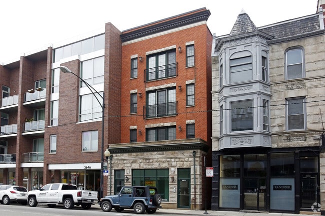
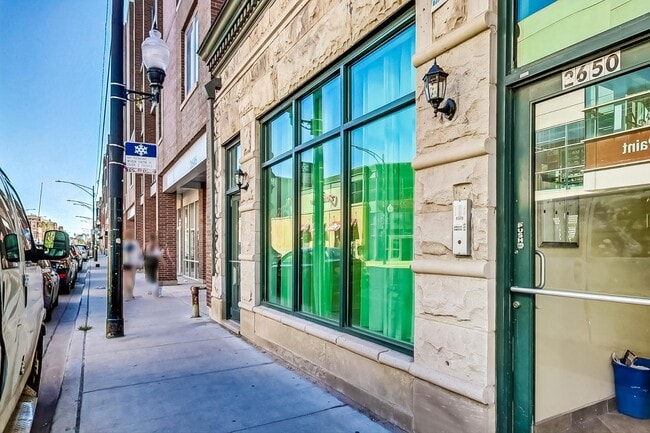
Property Record
2650 N Halsted St, Chicago, IL 60614


NEARBY LISTINGS FOR SALE OR LEASE
Property Detail
2650 N Halsted St
14-29-407-112-0000
John Reynolds
Miscresidentialimprovement
Cook
X
Illinois
17031C0417K
6
2023
0.07 AC
2025
Lincoln Park
070300
Chicago
6,625 SF
Chicago-Naperville-Elgin, IL-IN-WI
DEMOGRAPHICS near 2650 N Halsted St
1 Mile
3 Mile
5 Mile
2024 Total Population
101,927
478,645
995,848
2029 Population
99,652
466,659
964,095
Pop Growth 2024-2029
(2.23%)
(2.50%)
(3.19%)
Average Age
35
37
37
2024 Total Households
54,930
254,764
490,953
HH Growth 2024-2029
(2.47%)
(2.60%)
(3.09%)
Median Household Inc
$104,096
$106,433
$93,286
Avg Household Size
1.80
1.80
1.90
2024 Avg HH Vehicles
1.00
1.00
1.00
Median Home Value
$622,194
$543,474
$460,883
Median Year Built
1964
1966
1962
Nearby Places
Map Layers
Map Styles
 Street
 Aerial
- Restaurants
- Banks
- Shops
- Fitness
- Groceries
PUBLIC TRANSPORTATION
TRANSIT/SUBWAY
Diversey Station (Brown Line - Chicago Transit Authority "L" Trains (The "L"), Purple Line - Chicago Transit Authority "L" Trains (The "L"))
DRIVE
WALK
Distance
Diversey Station (Brown Line - Chicago Transit Authority "L" Trains (The "L"), Purple Line - Chicago Transit Authority "L" Trains (The "L"))
1 min
7 min
0.3 mi
Fullerton Station (Brown Line - Chicago Transit Authority "L" Trains (The "L"), Purple Line - Chicago Transit Authority "L" Trains (The "L"), Red Line - Chicago Transit Authority "L" Trains (The "L"))
DRIVE
WALK
Distance
Fullerton Station (Brown Line - Chicago Transit Authority "L" Trains (The "L"), Purple Line - Chicago Transit Authority "L" Trains (The "L"), Red Line - Chicago Transit Authority "L" Trains (The "L"))
1 min
11 min
0.6 mi
Wellington Station (Brown Line - Chicago Transit Authority "L" Trains (The "L"), Purple Line - Chicago Transit Authority "L" Trains (The "L"))
DRIVE
WALK
Distance
Wellington Station (Brown Line - Chicago Transit Authority "L" Trains (The "L"), Purple Line - Chicago Transit Authority "L" Trains (The "L"))
2 min
12 min
0.6 mi
Belmont Station (Brown, Purple, Red Lines) (Brown Line - Chicago Transit Authority "L" Trains (The "L"), Purple Line - Chicago Transit Authority "L" Trains (The "L"), Red Line - Chicago Transit Authority "L" Trains (The "L"))
DRIVE
WALK
Distance
Belmont Station (Brown, Purple, Red Lines) (Brown Line - Chicago Transit Authority "L" Trains (The "L"), Purple Line - Chicago Transit Authority "L" Trains (The "L"), Red Line - Chicago Transit Authority "L" Trains (The "L"))
2 min
15 min
0.8 mi
COMMUTER RAIL
Clybourn Station (Union Pacific North Line - Northeast Illinois Regional Commuter Railroad (Metra), Union Pacific Northwest Line - Northeast Illinois Regional Commuter Railroad (Metra))
DRIVE
WALK
Distance
Clybourn Station (Union Pacific North Line - Northeast Illinois Regional Commuter Railroad (Metra), Union Pacific Northwest Line - Northeast Illinois Regional Commuter Railroad (Metra))
4 min
2.0 mi
Ravenswood Station (Union Pacific North Line - Northeast Illinois Regional Commuter Railroad (Metra))
DRIVE
WALK
Distance
Ravenswood Station (Union Pacific North Line - Northeast Illinois Regional Commuter Railroad (Metra))
7 min
3.4 mi
AIRPORT
Chicago Midway International
DRIVE
WALK
Distance
Chicago Midway International
24 min
13.7 mi
Chicago O'Hare International
DRIVE
WALK
Distance
Chicago O'Hare International
24 min
15.3 mi
SALE & LEASE HISTORY
LISTING DATE
SALE/LEASE

Sep 04, 2024
For Lease
Jun 13, 2018
For Lease
Dec 18, 2019
For Lease
Nearby Properties
Address
Land Use
TOTAL SIZE
Lot Size
Zoning
Address
Land Use
TOTAL SIZE
Lot Size
Zoning
4,296,046 SF
6.15 AC
DC-16
Address
Land Use
TOTAL SIZE
Lot Size
Zoning
831,084 SF
2.05 AC
PD 316
Address
Land Use
TOTAL SIZE
Lot Size
Zoning
1,502,279 SF
3.79 AC
PD 98
Address
Land Use
TOTAL SIZE
Lot Size
Zoning
1,578,363 SF
2.62 AC
DX-12
Address
Land Use
TOTAL SIZE
Lot Size
Zoning
1,857,394 SF
3.13 AC
PD 447
Address
Land Use
TOTAL SIZE
Lot Size
Zoning
1.09 AC
B1-3
Address
Land Use
TOTAL SIZE
Lot Size
Zoning
491,382 SF
2.05 AC
PD 316
Address
Land Use
TOTAL SIZE
Lot Size
Zoning
433,026 SF
0.47 AC
DX-12
Address
Land Use
TOTAL SIZE
Lot Size
Zoning
717,243 SF
1.01 AC
PD 790
Address
Land Use
TOTAL SIZE
Lot Size
Zoning
559,589 SF
1.72 AC
C3-5
Address
Land Use
TOTAL SIZE
Lot Size
Zoning
0.72 AC
PD 1403
Address
Land Use
TOTAL SIZE
Lot Size
Zoning
229,725 SF
1.21 AC
DX-12,DX-1
Address
Land Use
TOTAL SIZE
Lot Size
Zoning
1,284,706 SF
4.40 AC
Address
Land Use
TOTAL SIZE
Lot Size
Zoning
403,219 SF
1.42 AC
DX-12,DX-1
Address
Land Use
TOTAL SIZE
Lot Size
Zoning
549,130 SF
1.45 AC
DX-12
Address
Land Use
TOTAL SIZE
Lot Size
Zoning
594,987 SF
1.11 AC
PD 1407
Address
Land Use
TOTAL SIZE
Lot Size
Zoning
2.33 AC
PD 124
Address
Land Use
TOTAL SIZE
Lot Size
Zoning
276,408 SF
0.40 AC
PD 428
Address
Land Use
TOTAL SIZE
Lot Size
Zoning
1.36 AC
DX-12
Address
Land Use
TOTAL SIZE
Lot Size
Zoning
1,412,950 SF
1.03 AC
DX-12
Address
Land Use
TOTAL SIZE
Lot Size
Zoning
1.12 AC
PD 563
Address
Land Use
TOTAL SIZE
Lot Size
Zoning
314,000 SF
PD 124
Address
Land Use
TOTAL SIZE
Lot Size
Zoning
2,087,700 SF
0.96 AC
PD 98
Address
Land Use
TOTAL SIZE
Lot Size
Zoning
2.33 AC
PD 124
Address
Land Use
TOTAL SIZE
Lot Size
Zoning
380,668 SF
0.48 AC
PD 218
Address
Land Use
TOTAL SIZE
Lot Size
Zoning
391,168 SF
1.13 AC
PD 380
Address
Land Use
TOTAL SIZE
Lot Size
Zoning
0.34 AC
PD 967
Address
Land Use
TOTAL SIZE
Lot Size
Zoning
266,248 SF
Address
Land Use
TOTAL SIZE
Lot Size
Zoning
228,018 SF
8.72 AC
PD 958
Address
Land Use
TOTAL SIZE
Lot Size
Zoning
309,985 SF
0.78 AC
PD 1418
The World's #1 Commercial Real Estate Marketplace
Connect with us
© 2025 CoStar Group
The information above has been obtained from sources believed reliable. While we do not doubt its accuracy we have not verified it and make no guarantee, warranty or representation about it. It is your responsibility to independently confirm its accuracy and completeness. Any projections, opinions, assumptions, or estimates used are for example only and do not represent the current or future performance of the property. The value of this transaction to you depends on tax and other factors which should be evaluated by your tax, financial, and legal advisors. You and your advisors should conduct a careful, independent investigation of the property to determine to your satisfaction the suitability of the property for your needs.