Property Record
2651 Strang Blvd, Yorktown Heights, NY 10598
Current Lease Availabilities
Office LEASE
Negotiable
1,770 - 2,836 SF
NEARBY LISTINGS FOR SALE OR LEASE
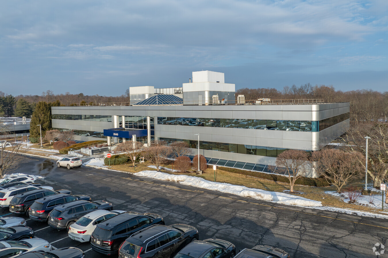
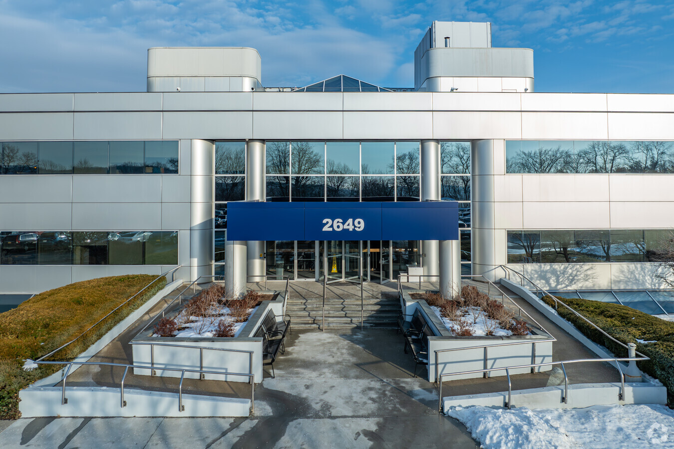
Property Detail
2651 Strang Blvd
New York-Jersey City-White Plains, NY-NJ
Map Of Building Lots At Turkahoe Westche
5400-026-019-00001-000-0002
Westchester
Officebuilding
New York
X
24.13 AC
36119C0037F
North
879 SF
Westchester/So Connecticut
DEMOGRAPHICS near 2651 Strang Blvd
1 Mile
3 Mile
5 Mile
2024 Total Population
3,371
34,269
80,807
2029 Population
3,296
33,380
78,955
Pop Growth 2024-2029
(2.22%)
(2.59%)
(2.29%)
Average Age
42
44
43
2024 Total Households
1,071
12,257
28,590
HH Growth 2024-2029
(2.52%)
(2.85%)
(2.53%)
Median Household Inc
$190,024
$144,685
$134,552
Avg Household Size
3.00
2.70
2.70
2024 Avg HH Vehicles
2.00
2.00
2.00
Median Home Value
$570,454
$495,874
$476,033
Median Year Built
1961
1966
1966
Nearby Places
- Restaurants
- Banks
- Shops
- Fitness
- Groceries
PUBLIC TRANSPORTATION
COMMUTER RAIL
Peekskill Station (Hudson Line - Metro-North Commuter Railroad Company (Metro-North))
DRIVE
WALK
Distance
Peekskill Station (Hudson Line - Metro-North Commuter Railroad Company (Metro-North))
12 min
6.8 mi
Cortlandt Station (Hudson Line - Metro-North Commuter Railroad Company (Metro-North))
DRIVE
WALK
Distance
Cortlandt Station (Hudson Line - Metro-North Commuter Railroad Company (Metro-North))
19 min
9.9 mi
AIRPORT
Westchester County
DRIVE
WALK
Distance
Westchester County
32 min
23.9 mi
New York Stewart International
DRIVE
WALK
Distance
New York Stewart International
51 min
30.0 mi
Freight Ports
NY - Red Hook Container Terminal
DRIVE
WALK
Distance
NY - Red Hook Container Terminal
75 min
51.7 mi
Nearby Properties
Address
Land Use
TOTAL SIZE
Lot Size
Zoning
Address
Land Use
TOTAL SIZE
Lot Size
Zoning
53.74 AC
Address
Land Use
TOTAL SIZE
Lot Size
Zoning
878 SF
62.50 AC
R1-20
Address
Land Use
TOTAL SIZE
Lot Size
Zoning
13 AC
R1-40
Address
Land Use
TOTAL SIZE
Lot Size
Zoning
38.76 AC
CRC
Address
Land Use
TOTAL SIZE
Lot Size
Zoning
Address
Land Use
TOTAL SIZE
Lot Size
Zoning
1,124 SF
8 AC
R1-80
Address
Land Use
TOTAL SIZE
Lot Size
Zoning
2,241 SF
595 AC
R1-16
Address
Land Use
TOTAL SIZE
Lot Size
Zoning
82.53 AC
Address
Land Use
TOTAL SIZE
Lot Size
Zoning
1,504 SF
45.28 AC
R1-80
Address
Land Use
TOTAL SIZE
Lot Size
Zoning
38.05 AC
Address
Land Use
TOTAL SIZE
Lot Size
Zoning
12 AC
R1-40
Address
Land Use
TOTAL SIZE
Lot Size
Zoning
1,449 SF
580 AC
R1-16
Address
Land Use
TOTAL SIZE
Lot Size
Zoning
35.97 AC
Address
Land Use
TOTAL SIZE
Lot Size
Zoning
1,642 SF
11.50 AC
R1-20
Address
Land Use
TOTAL SIZE
Lot Size
Zoning
64.38 AC
Address
Land Use
TOTAL SIZE
Lot Size
Zoning
12.38 AC
R1-40
Address
Land Use
TOTAL SIZE
Lot Size
Zoning
10.19 AC
R1-40
Address
Land Use
TOTAL SIZE
Lot Size
Zoning
1,809 SF
4.33 AC
C-2R
Address
Land Use
TOTAL SIZE
Lot Size
Zoning
Address
Land Use
TOTAL SIZE
Lot Size
Zoning
9.77 AC
IN
Address
Land Use
TOTAL SIZE
Lot Size
Zoning
Address
Land Use
TOTAL SIZE
Lot Size
Zoning
14.94 AC
C-1
Address
Land Use
TOTAL SIZE
Lot Size
Zoning
39.17 AC
R1-40
Address
Land Use
TOTAL SIZE
Lot Size
Zoning
846 SF
1.16 AC
R1-40
Address
Land Use
TOTAL SIZE
Lot Size
Zoning
20.81 AC
R1-80
Address
Land Use
TOTAL SIZE
Lot Size
Zoning
3,170 SF
25.01 AC
R1-80
Address
Land Use
TOTAL SIZE
Lot Size
Zoning
1,620 SF
127.19 AC
R1-16
Address
Land Use
TOTAL SIZE
Lot Size
Zoning
Address
Land Use
TOTAL SIZE
Lot Size
Zoning
32.20 AC
Address
Land Use
TOTAL SIZE
Lot Size
Zoning
The World's #1 Commercial Real Estate Marketplace
Connect with us
© 2025 CoStar Group
The information above has been obtained from sources believed reliable. While we do not doubt its accuracy we have not verified it and make no guarantee, warranty or representation about it. It is your responsibility to independently confirm its accuracy and completeness. Any projections, opinions, assumptions, or estimates used are for example only and do not represent the current or future performance of the property. The value of this transaction to you depends on tax and other factors which should be evaluated by your tax, financial, and legal advisors. You and your advisors should conduct a careful, independent investigation of the property to determine to your satisfaction the suitability of the property for your needs.