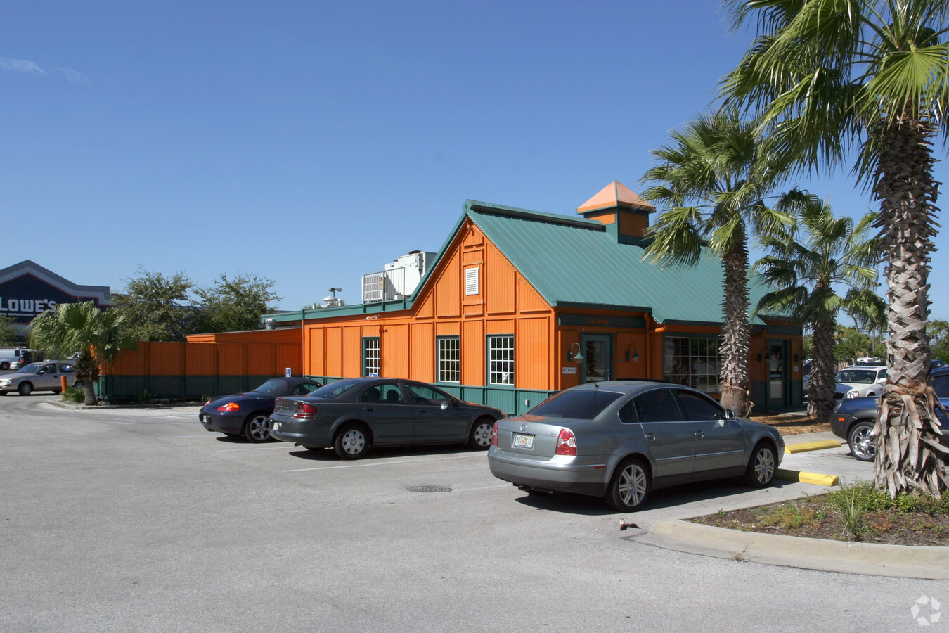
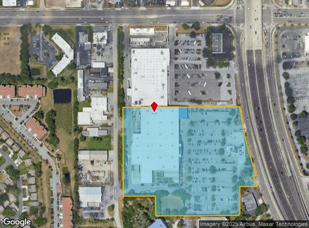
Property Record
26900 Us Highway 19 N, Clearwater, FL 33761
NEARBY LISTINGS FOR SALE OR LEASE
Property Detail
26900 Us Highway 19 N
Tampa-St. Petersburg-Clearwater, FL
Lowes Sub
30-28-16-53001-000-0010
LOWES SUB LOT 1
Supermarket
Pinellas
X
Florida
12103C0088G
1
2023
13.55 AC
2024
North Pinellas
026811
Tampa/St Petersburg
148,043 SF
DEMOGRAPHICS near 26900 Us Highway 19 N
1 Mile
3 Mile
5 Mile
2024 Total Population
14,610
103,914
225,184
2029 Population
14,754
103,880
225,192
Pop Growth 2024-2029
+ 0.99%
(0.03%)
0.00%
Average Age
51
49
47
2024 Total Households
7,731
48,855
102,027
HH Growth 2024-2029
+ 0.74%
(0.18%)
(0.10%)
Median Household Inc
$51,117
$60,903
$59,761
Avg Household Size
1.80
2.00
2.10
2024 Avg HH Vehicles
1.00
2.00
2.00
Median Home Value
$188,680
$272,049
$283,993
Median Year Built
1980
1979
1979
Nearby Places
- Restaurants
- Banks
- Shops
- Fitness
- Groceries
PUBLIC TRANSPORTATION
AIRPORT
St Pete-Clearwater International
DRIVE
WALK
Distance
St Pete-Clearwater International
26 min
13.9 mi
Tampa International
DRIVE
WALK
Distance
Tampa International
30 min
18.1 mi
Freight Ports
Port of Tampa Bay
DRIVE
WALK
Distance
Port of Tampa Bay
43 min
26.5 mi
Nearby Properties
Address
Land Use
TOTAL SIZE
Lot Size
Zoning
Address
Land Use
TOTAL SIZE
Lot Size
Zoning
491,546 SF
19.26 AC
Address
Land Use
TOTAL SIZE
Lot Size
Zoning
675,202 SF
43.24 AC
Address
Land Use
TOTAL SIZE
Lot Size
Zoning
724,220 SF
22.95 AC
Address
Land Use
TOTAL SIZE
Lot Size
Zoning
460,041 SF
44.28 AC
Address
Land Use
TOTAL SIZE
Lot Size
Zoning
385,080 SF
22.84 AC
Address
Land Use
TOTAL SIZE
Lot Size
Zoning
356,262 SF
15.48 AC
Address
Land Use
TOTAL SIZE
Lot Size
Zoning
406,729 SF
29.79 AC
CP1
Address
Land Use
TOTAL SIZE
Lot Size
Zoning
412,099 SF
49.21 AC
Address
Land Use
TOTAL SIZE
Lot Size
Zoning
167,201 SF
63.11 AC
AE
Address
Land Use
TOTAL SIZE
Lot Size
Zoning
326,008 SF
53.12 AC
Address
Land Use
TOTAL SIZE
Lot Size
Zoning
225,992 SF
19.07 AC
Address
Land Use
TOTAL SIZE
Lot Size
Zoning
278,505 SF
38.67 AC
Address
Land Use
TOTAL SIZE
Lot Size
Zoning
171,150 SF
17.58 AC
Address
Land Use
TOTAL SIZE
Lot Size
Zoning
662,010 SF
33.76 AC
Address
Land Use
TOTAL SIZE
Lot Size
Zoning
321,395 SF
25.22 AC
Address
Land Use
TOTAL SIZE
Lot Size
Zoning
362,238 SF
13.80 AC
Address
Land Use
TOTAL SIZE
Lot Size
Zoning
239,340 SF
17.27 AC
Address
Land Use
TOTAL SIZE
Lot Size
Zoning
239,480 SF
18.89 AC
RPD5
Address
Land Use
TOTAL SIZE
Lot Size
Zoning
258,472 SF
18.23 AC
Address
Land Use
TOTAL SIZE
Lot Size
Zoning
215,081 SF
16.60 AC
Address
Land Use
TOTAL SIZE
Lot Size
Zoning
208,637 SF
16.83 AC
M1
Address
Land Use
TOTAL SIZE
Lot Size
Zoning
367,503 SF
20.34 AC
M2
Address
Land Use
TOTAL SIZE
Lot Size
Zoning
241,170 SF
17.23 AC
Address
Land Use
TOTAL SIZE
Lot Size
Zoning
117,024 SF
56.52 AC
Address
Land Use
TOTAL SIZE
Lot Size
Zoning
161,404 SF
18.48 AC
CP2
Address
Land Use
TOTAL SIZE
Lot Size
Zoning
191,375 SF
13.58 AC
AE
Address
Land Use
TOTAL SIZE
Lot Size
Zoning
194,532 SF
16.86 AC
Address
Land Use
TOTAL SIZE
Lot Size
Zoning
196,808 SF
12.70 AC
Address
Land Use
TOTAL SIZE
Lot Size
Zoning
145,000 SF
1.26 AC
Address
Land Use
TOTAL SIZE
Lot Size
Zoning
250,113 SF
39.50 AC
The World's #1 Commercial Real Estate Marketplace
Connect with us
© 2025 CoStar Group
The information above has been obtained from sources believed reliable. While we do not doubt its accuracy we have not verified it and make no guarantee, warranty or representation about it. It is your responsibility to independently confirm its accuracy and completeness. Any projections, opinions, assumptions, or estimates used are for example only and do not represent the current or future performance of the property. The value of this transaction to you depends on tax and other factors which should be evaluated by your tax, financial, and legal advisors. You and your advisors should conduct a careful, independent investigation of the property to determine to your satisfaction the suitability of the property for your needs.