Property Record
27 Van Buren Blvd, Altamont, NY 12009
NEARBY LISTINGS FOR SALE OR LEASE
-
-
View all Altamont listings for lease on LoopNet.com
Property Detail
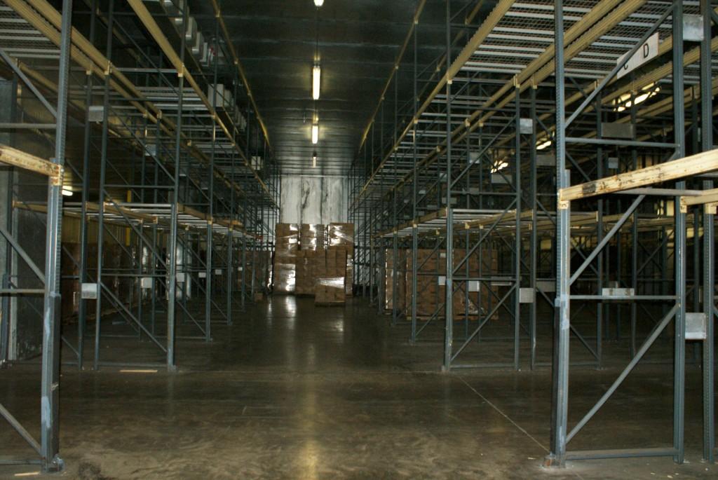
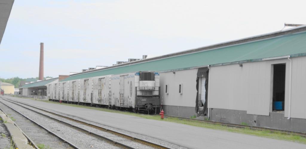
27 Van Buren Blvd
013089-050-000-0001-014-016-0000
BLDGS 1,2,5,6,9,10,18,51, 52,60,77,88,89 6054 DEPOT RD
Warehouse
Albany
X
New York
36001C0154D
14.011
2024
3.40 AC
2023
W Outer Albany County
014613
Albany/Schenectady/Troy
150,880 SF
Albany-Schenectady-Troy, NY
DEMOGRAPHICS near 27 Van Buren Blvd
1 Mile
3 Mile
5 Mile
2024 Total Population
854
11,100
40,408
2029 Population
840
11,063
40,258
Pop Growth 2024-2029
(1.64%)
(0.33%)
(0.37%)
Average Age
44
43
43
2024 Total Households
347
4,458
16,737
HH Growth 2024-2029
(1.44%)
(0.27%)
(0.29%)
Median Household Inc
$75,694
$105,531
$95,269
Avg Household Size
2.30
2.40
2.30
2024 Avg HH Vehicles
2.00
2.00
2.00
Median Home Value
$323,846
$363,137
$307,641
Median Year Built
1966
1978
1977
Nearby Places
- Restaurants
- Banks
- Shops
- Fitness
- Groceries
PUBLIC TRANSPORTATION
AIRPORT
Albany International
DRIVE
WALK
Distance
Albany International
28 min
14.1 mi
Freight Ports
Albany, NY Port
DRIVE
WALK
Distance
Albany, NY Port
31 min
16.8 mi
SALE & LEASE HISTORY
LISTING DATE
SALE/LEASE

Sep 25, 2016
For Lease
Nearby Properties
Address
Land Use
TOTAL SIZE
Lot Size
Zoning
Address
Land Use
TOTAL SIZE
Lot Size
Zoning
353,075 SF
69.50 AC
R15
Address
Land Use
TOTAL SIZE
Lot Size
Zoning
172,800 SF
209.63 AC
IN
Address
Land Use
TOTAL SIZE
Lot Size
Zoning
172,800 SF
289.06 AC
IN
Address
Land Use
TOTAL SIZE
Lot Size
Zoning
9,000 SF
10.32 AC
GB
Address
Land Use
TOTAL SIZE
Lot Size
Zoning
19,968 SF
12 AC
MR
Address
Land Use
TOTAL SIZE
Lot Size
Zoning
14,436 SF
13.20 AC
MR
Address
Land Use
TOTAL SIZE
Lot Size
Zoning
16,232 SF
285.90 AC
RO40
Address
Land Use
TOTAL SIZE
Lot Size
Zoning
89,640 SF
6 AC
MR
Address
Land Use
TOTAL SIZE
Lot Size
Zoning
7,856 SF
14.30 AC
MR
Address
Land Use
TOTAL SIZE
Lot Size
Zoning
75,000 SF
8 AC
R15
Address
Land Use
TOTAL SIZE
Lot Size
Zoning
20,630 SF
12.99 AC
MR*
Address
Land Use
TOTAL SIZE
Lot Size
Zoning
68,000 SF
11.20 AC
TH
Address
Land Use
TOTAL SIZE
Lot Size
Zoning
7,148 SF
7.20 AC
PUD
Address
Land Use
TOTAL SIZE
Lot Size
Zoning
61,006 SF
8.10 AC
R15
Address
Land Use
TOTAL SIZE
Lot Size
Zoning
3,200 SF
231.30 AC
RA3
Address
Land Use
TOTAL SIZE
Lot Size
Zoning
51,779 SF
17.50 AC
R-1
Address
Land Use
TOTAL SIZE
Lot Size
Zoning
33,176 SF
3.29 AC
R15
Address
Land Use
TOTAL SIZE
Lot Size
Zoning
56,592 SF
29.50 AC
R20
Address
Land Use
TOTAL SIZE
Lot Size
Zoning
189,116 SF
7.60 AC
IN
Address
Land Use
TOTAL SIZE
Lot Size
Zoning
28,332 SF
844.23 AC
F
Address
Land Use
TOTAL SIZE
Lot Size
Zoning
104,000 SF
6.40 AC
IN
Address
Land Use
TOTAL SIZE
Lot Size
Zoning
572 SF
688.20 AC
RA3
Address
Land Use
TOTAL SIZE
Lot Size
Zoning
20,391 SF
2.20 AC
LB
Address
Land Use
TOTAL SIZE
Lot Size
Zoning
78,295 SF
44.50 AC
V7
Address
Land Use
TOTAL SIZE
Lot Size
Zoning
100,000 SF
5.80 AC
IN
Address
Land Use
TOTAL SIZE
Lot Size
Zoning
30,612 SF
15.70 AC
R15
Address
Land Use
TOTAL SIZE
Lot Size
Zoning
30,184 SF
4.60 AC
R15
Address
Land Use
TOTAL SIZE
Lot Size
Zoning
34,460 SF
6.11 AC
LB
Address
Land Use
TOTAL SIZE
Lot Size
Zoning
4,394 SF
5.60 AC
LB
Address
Land Use
TOTAL SIZE
Lot Size
Zoning
19,126 SF
5.90 AC
F*
The World's #1 Commercial Real Estate Marketplace
Connect with us
© 2025 CoStar Group
The information above has been obtained from sources believed reliable. While we do not doubt its accuracy we have not verified it and make no guarantee, warranty or representation about it. It is your responsibility to independently confirm its accuracy and completeness. Any projections, opinions, assumptions, or estimates used are for example only and do not represent the current or future performance of the property. The value of this transaction to you depends on tax and other factors which should be evaluated by your tax, financial, and legal advisors. You and your advisors should conduct a careful, independent investigation of the property to determine to your satisfaction the suitability of the property for your needs.