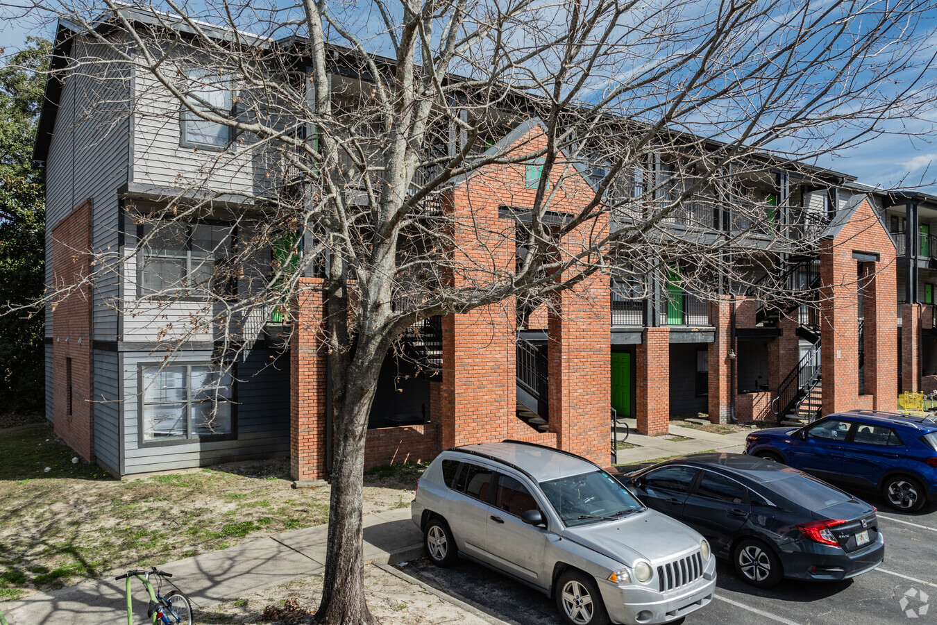
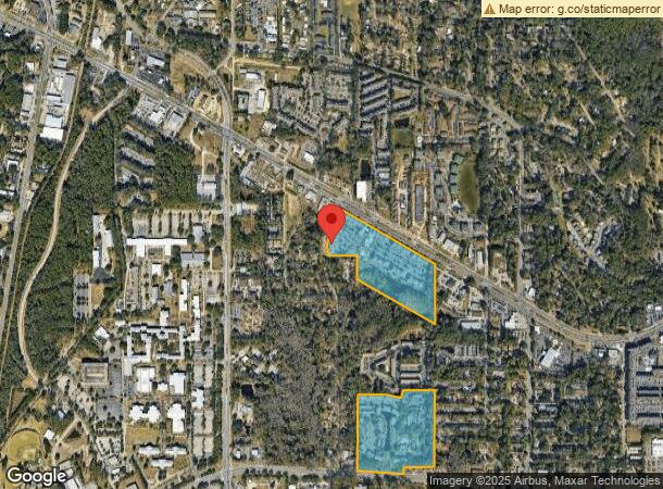
Property Record
2700 W Pensacola St, Tallahassee, FL 32304
NEARBY LISTINGS FOR SALE OR LEASE
Property Detail
2700 W Pensacola St
Tallahassee, FL
Gathering Apartments
21-33-37-000-000.1
THE GATHERING APARTMENTS 33 1N 1W IN NE 1/4 OR 1494/2009 1920/1421 2142/794 189 UNITS
Multifamilydwelling
Leon
A
Florida
12073C0279F
000-1
2024
20.82 AC
2024
University
002008
Tallahassee
322,635 SF
DEMOGRAPHICS near 2700 W Pensacola St
1 Mile
3 Mile
5 Mile
2024 Total Population
10,885
82,684
137,016
2029 Population
10,970
85,952
143,605
Pop Growth 2024-2029
+ 0.78%
+ 3.95%
+ 4.81%
Average Age
27
30
33
2024 Total Households
4,457
33,552
57,686
HH Growth 2024-2029
+ 0.04%
+ 4.02%
+ 4.96%
Median Household Inc
$27,923
$32,684
$41,319
Avg Household Size
2.20
2.10
2.10
2024 Avg HH Vehicles
2.00
2.00
2.00
Median Home Value
$101,361
$147,726
$181,059
Median Year Built
1987
1984
1982
Nearby Places
- Restaurants
- Banks
- Shops
- Fitness
- Groceries
PUBLIC TRANSPORTATION
AIRPORT
Tallahassee International
DRIVE
WALK
Distance
Tallahassee International
9 min
4.6 mi
Freight Ports
Port of Panama City
DRIVE
WALK
Distance
Port of Panama City
138 min
97.6 mi
Nearby Properties
Address
Land Use
TOTAL SIZE
Lot Size
Zoning
Address
Land Use
TOTAL SIZE
Lot Size
Zoning
1,635,322 SF
29.76 AC
UT
Address
Land Use
TOTAL SIZE
Lot Size
Zoning
6,686,582 SF
86.50 AC
UT
Address
Land Use
TOTAL SIZE
Lot Size
Zoning
4,577,528 SF
108.47 AC
UT
Address
Land Use
TOTAL SIZE
Lot Size
Zoning
3,647,358 SF
49.17 AC
UT
Address
Land Use
TOTAL SIZE
Lot Size
Zoning
1,603,013 SF
175.71 AC
MR1
Address
Land Use
TOTAL SIZE
Lot Size
Zoning
479,864 SF
19.01 AC
DI
Address
Land Use
TOTAL SIZE
Lot Size
Zoning
859,455 SF
3.79 AC
CU45
Address
Land Use
TOTAL SIZE
Lot Size
Zoning
959,505 SF
32.03 AC
M1
Address
Land Use
TOTAL SIZE
Lot Size
Zoning
369,383 SF
4.50 AC
UT
Address
Land Use
TOTAL SIZE
Lot Size
Zoning
758,762 SF
20.82 AC
UT
Address
Land Use
TOTAL SIZE
Lot Size
Zoning
445,676 SF
23.50 AC
PUD
Address
Land Use
TOTAL SIZE
Lot Size
Zoning
719,149 SF
40.73 AC
MR1
Address
Land Use
TOTAL SIZE
Lot Size
Zoning
452,530 SF
10.30 AC
UV
Address
Land Use
TOTAL SIZE
Lot Size
Zoning
721,205 SF
6.19 AC
UT
Address
Land Use
TOTAL SIZE
Lot Size
Zoning
652,729 SF
1.71 AC
UT
Address
Land Use
TOTAL SIZE
Lot Size
Zoning
859,666 SF
20.17 AC
MR1
Address
Land Use
TOTAL SIZE
Lot Size
Zoning
531,932 SF
2.58 AC
DI
Address
Land Use
TOTAL SIZE
Lot Size
Zoning
556,751 SF
20.60 AC
CP
Address
Land Use
TOTAL SIZE
Lot Size
Zoning
851,869 SF
5.15 AC
DI
Address
Land Use
TOTAL SIZE
Lot Size
Zoning
254,414 SF
9.24 AC
UT
Address
Land Use
TOTAL SIZE
Lot Size
Zoning
309,750 SF
11.04 AC
Address
Land Use
TOTAL SIZE
Lot Size
Zoning
392,437 SF
10 AC
UT
Address
Land Use
TOTAL SIZE
Lot Size
Zoning
351,885 SF
2.82 AC
UV
Address
Land Use
TOTAL SIZE
Lot Size
Zoning
326,800 SF
2.52 AC
UV
Address
Land Use
TOTAL SIZE
Lot Size
Zoning
424,591 SF
2.77 AC
UT
Address
Land Use
TOTAL SIZE
Lot Size
Zoning
225,370 SF
3.76 AC
CU45
Address
Land Use
TOTAL SIZE
Lot Size
Zoning
303,616 SF
1.78 AC
UV
Address
Land Use
TOTAL SIZE
Lot Size
Zoning
604,638 SF
2.26 AC
Address
Land Use
TOTAL SIZE
Lot Size
Zoning
459,568 SF
10.10 AC
CU45
Address
Land Use
TOTAL SIZE
Lot Size
Zoning
883,293 SF
35.97 AC
R4
The World's #1 Commercial Real Estate Marketplace
Connect with us
© 2025 CoStar Group
The information above has been obtained from sources believed reliable. While we do not doubt its accuracy we have not verified it and make no guarantee, warranty or representation about it. It is your responsibility to independently confirm its accuracy and completeness. Any projections, opinions, assumptions, or estimates used are for example only and do not represent the current or future performance of the property. The value of this transaction to you depends on tax and other factors which should be evaluated by your tax, financial, and legal advisors. You and your advisors should conduct a careful, independent investigation of the property to determine to your satisfaction the suitability of the property for your needs.