Property Record
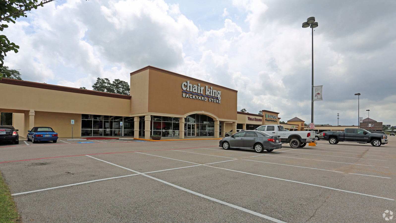
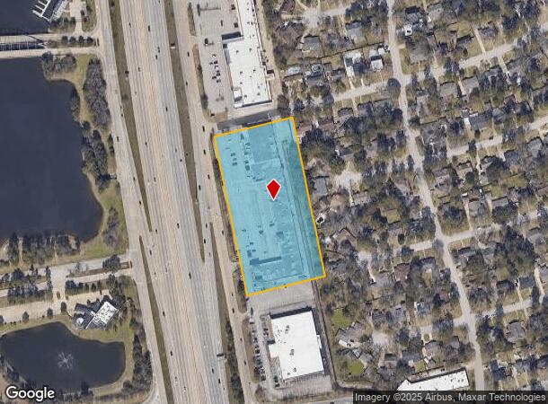
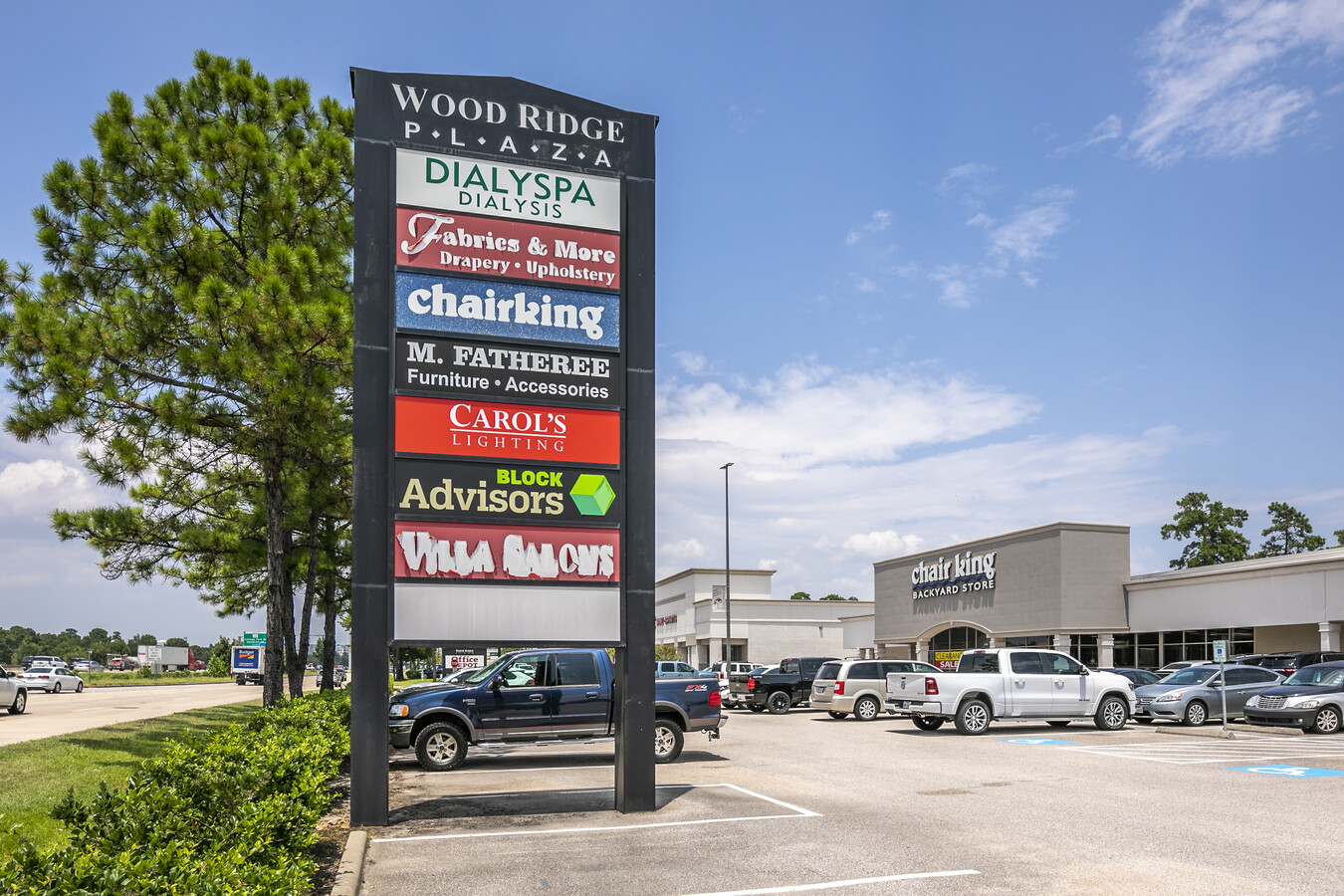
27100 Interstate 45 N, Conroe, TX 77385

NEARBY LISTINGS FOR SALE OR LEASE
Property Detail
27100 Interstate 45 N
7640-07-25210
Oak Ridge North 07
Commercialnec
S764007 - OAK RIDGE NORTH 07, RES C (4.1196 AC), PORTION OF PAULA LANE (0.3884 AC), ACRES 4.508
AE
Montgomery
48339C0540H
Texas
2023
4.51 AC
2024
Montgomery County
691802
Houston
52,630 SF
Houston-The Woodlands-Sugar Land, TX
DEMOGRAPHICS near 27100 Interstate 45 N
1 Mile
3 Mile
5 Mile
2024 Total Population
7,241
68,957
170,130
2029 Population
8,915
84,762
204,246
Pop Growth 2024-2029
+ 23.12%
+ 22.92%
+ 20.05%
Average Age
44
39
38
2024 Total Households
3,212
28,303
63,914
HH Growth 2024-2029
+ 23.82%
+ 23.33%
+ 20.55%
Median Household Inc
$95,342
$85,699
$97,514
Avg Household Size
2.20
2.40
2.60
2024 Avg HH Vehicles
2.00
2.00
2.00
Median Home Value
$294,924
$301,012
$304,460
Median Year Built
1987
1999
2001
Nearby Places
- Restaurants
- Banks
- Shops
- Fitness
- Groceries
PUBLIC TRANSPORTATION
AIRPORT
George Bush Intcntl/Houston
DRIVE
WALK
Distance
George Bush Intcntl/Houston
29 min
21.9 mi
Freight Ports
Port of Houston
DRIVE
WALK
Distance
Port of Houston
52 min
37.6 mi
SALE & LEASE HISTORY
LISTING DATE
SALE/LEASE

Oct 20, 2021
For Sale
May 04, 2017
For Lease
Nearby Properties
Address
Land Use
TOTAL SIZE
Lot Size
Zoning
Address
Land Use
TOTAL SIZE
Lot Size
Zoning
1,416,950 SF
21.80 AC
Address
Land Use
TOTAL SIZE
Lot Size
Zoning
1,673,574 SF
5.10 AC
Address
Land Use
TOTAL SIZE
Lot Size
Zoning
855,268 SF
31.65 AC
6
Address
Land Use
TOTAL SIZE
Lot Size
Zoning
718,313 SF
33.62 AC
Address
Land Use
TOTAL SIZE
Lot Size
Zoning
1,053,284 SF
2.25 AC
Address
Land Use
TOTAL SIZE
Lot Size
Zoning
813,318 SF
20.95 AC
Address
Land Use
TOTAL SIZE
Lot Size
Zoning
709,789 SF
3.04 AC
Address
Land Use
TOTAL SIZE
Lot Size
Zoning
339,320 SF
3.48 AC
Address
Land Use
TOTAL SIZE
Lot Size
Zoning
370,039 SF
40.66 AC
Address
Land Use
TOTAL SIZE
Lot Size
Zoning
670,440 SF
6.70 AC
Address
Land Use
TOTAL SIZE
Lot Size
Zoning
426,270 SF
4.52 AC
Address
Land Use
TOTAL SIZE
Lot Size
Zoning
558,353 SF
4.82 AC
Address
Land Use
TOTAL SIZE
Lot Size
Zoning
1,132,062 SF
3.31 AC
Address
Land Use
TOTAL SIZE
Lot Size
Zoning
410,156 SF
18.68 AC
Address
Land Use
TOTAL SIZE
Lot Size
Zoning
325,294 SF
21.81 AC
6
Address
Land Use
TOTAL SIZE
Lot Size
Zoning
327,377 SF
24.02 AC
6
Address
Land Use
TOTAL SIZE
Lot Size
Zoning
438,062 SF
4.54 AC
Address
Land Use
TOTAL SIZE
Lot Size
Zoning
473,060 SF
10.07 AC
Address
Land Use
TOTAL SIZE
Lot Size
Zoning
579,596 SF
1.32 AC
Address
Land Use
TOTAL SIZE
Lot Size
Zoning
475,014 SF
6 AC
Address
Land Use
TOTAL SIZE
Lot Size
Zoning
514,121 SF
2.01 AC
Address
Land Use
TOTAL SIZE
Lot Size
Zoning
92,000 SF
8.65 AC
Address
Land Use
TOTAL SIZE
Lot Size
Zoning
296,094 SF
10.19 AC
Address
Land Use
TOTAL SIZE
Lot Size
Zoning
336,730 SF
2.41 AC
Address
Land Use
TOTAL SIZE
Lot Size
Zoning
246,719 SF
1.25 AC
Address
Land Use
TOTAL SIZE
Lot Size
Zoning
388,855 SF
19.86 AC
6
Address
Land Use
TOTAL SIZE
Lot Size
Zoning
280,912 SF
12.45 AC
6
Address
Land Use
TOTAL SIZE
Lot Size
Zoning
469,813 SF
3.16 AC
Address
Land Use
TOTAL SIZE
Lot Size
Zoning
383,484 SF
4.67 AC
Address
Land Use
TOTAL SIZE
Lot Size
Zoning
225,149 SF
1.07 AC
The World's #1 Commercial Real Estate Marketplace
Connect with us
© 2025 CoStar Group
The information above has been obtained from sources believed reliable. While we do not doubt its accuracy we have not verified it and make no guarantee, warranty or representation about it. It is your responsibility to independently confirm its accuracy and completeness. Any projections, opinions, assumptions, or estimates used are for example only and do not represent the current or future performance of the property. The value of this transaction to you depends on tax and other factors which should be evaluated by your tax, financial, and legal advisors. You and your advisors should conduct a careful, independent investigation of the property to determine to your satisfaction the suitability of the property for your needs.