Property Record
2720 Paintball Way, Bismarck, ND 58504
NEARBY LISTINGS FOR SALE OR LEASE
-
-
View all Bismarck listings for sale on LoopNet.com
Property Detail
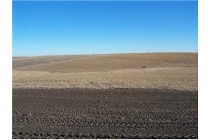
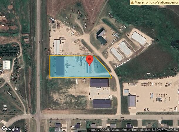
2720 Paintball Way
Bismarck, ND
Mauch Subdivision
39-138-79-61-01-080
TWN: 138 RNG: 79 SUB: 391387961 BLK: 01 MAUCH BLOCK 01 LOT 8 802661
Recyclingfacility
Burleigh
X
North Dakota
38015C0820E
8-80266
2023
2.29 AC
2023
South Bismarck
011300
Other Market Areas
13,600 SF
DEMOGRAPHICS near 2720 Paintball Way
1 Mile
3 Mile
5 Mile
2024 Total Population
174
6,089
9,599
2029 Population
178
6,190
9,762
Pop Growth 2024-2029
+ 2.30%
+ 1.66%
+ 1.70%
Average Age
31
33
34
2024 Total Households
56
2,050
2,984
HH Growth 2024-2029
+ 1.79%
+ 1.56%
+ 1.64%
Median Household Inc
$103,846
$95,166
$95,198
Avg Household Size
3.10
2.90
2.90
2024 Avg HH Vehicles
2.00
3.00
3.00
Median Home Value
$261,999
$261,648
$276,176
Median Year Built
2010
2004
2001
Nearby Places
- Restaurants
- Banks
- Shops
- Fitness
- Groceries
PUBLIC TRANSPORTATION
AIRPORT
Bismarck Municipal
DRIVE
WALK
Distance
Bismarck Municipal
22 min
8.2 mi
Freight Ports
Port Milwaukee
DRIVE
WALK
Distance
Port Milwaukee
830 min
767.6 mi
Nearby Properties
Address
Land Use
TOTAL SIZE
Lot Size
Zoning
Address
Land Use
TOTAL SIZE
Lot Size
Zoning
26.42 AC
MA
Address
Land Use
TOTAL SIZE
Lot Size
Zoning
35.42 AC
MA
Address
Land Use
TOTAL SIZE
Lot Size
Zoning
42,908 SF
12.44 AC
MA
Address
Land Use
TOTAL SIZE
Lot Size
Zoning
64,008 SF
12.61 AC
MA
Address
Land Use
TOTAL SIZE
Lot Size
Zoning
79,200 SF
6.01 AC
MA
Address
Land Use
TOTAL SIZE
Lot Size
Zoning
8.16 AC
MA
Address
Land Use
TOTAL SIZE
Lot Size
Zoning
56,846 SF
10.33 AC
MA
Address
Land Use
TOTAL SIZE
Lot Size
Zoning
22,848 SF
8.70 AC
MA
Address
Land Use
TOTAL SIZE
Lot Size
Zoning
23,622 SF
5.07 AC
MA
Address
Land Use
TOTAL SIZE
Lot Size
Zoning
17,080 SF
11.55 AC
MA
Address
Land Use
TOTAL SIZE
Lot Size
Zoning
23,637 SF
4.76 AC
MA
Address
Land Use
TOTAL SIZE
Lot Size
Zoning
45,507 SF
2.76 AC
Address
Land Use
TOTAL SIZE
Lot Size
Zoning
45,507 SF
2.25 AC
Address
Land Use
TOTAL SIZE
Lot Size
Zoning
30,170 SF
22.94 AC
MA
Address
Land Use
TOTAL SIZE
Lot Size
Zoning
49,920 SF
4.55 AC
MA
Address
Land Use
TOTAL SIZE
Lot Size
Zoning
25,000 SF
4 AC
MA
Address
Land Use
TOTAL SIZE
Lot Size
Zoning
2,400 SF
19.70 AC
Address
Land Use
TOTAL SIZE
Lot Size
Zoning
23,980 SF
4.69 AC
MA
Address
Land Use
TOTAL SIZE
Lot Size
Zoning
12,000 SF
8.36 AC
MA
Address
Land Use
TOTAL SIZE
Lot Size
Zoning
6,434 SF
2.72 AC
MA
Address
Land Use
TOTAL SIZE
Lot Size
Zoning
32,460 SF
3.41 AC
MA
Address
Land Use
TOTAL SIZE
Lot Size
Zoning
21,875 SF
5.79 AC
MA
Address
Land Use
TOTAL SIZE
Lot Size
Zoning
10,000 SF
4 AC
MA
Address
Land Use
TOTAL SIZE
Lot Size
Zoning
41,086 SF
11.29 AC
MA
Address
Land Use
TOTAL SIZE
Lot Size
Zoning
3,232 SF
29.26 AC
N/A
Address
Land Use
TOTAL SIZE
Lot Size
Zoning
17,342 SF
2.30 AC
MA
Address
Land Use
TOTAL SIZE
Lot Size
Zoning
18,042 SF
4.59 AC
MA
Address
Land Use
TOTAL SIZE
Lot Size
Zoning
4,500 SF
11.37 AC
MA
Address
Land Use
TOTAL SIZE
Lot Size
Zoning
15,075 SF
2.23 AC
MA
Address
Land Use
TOTAL SIZE
Lot Size
Zoning
18,000 SF
3.26 AC
MA
The World's #1 Commercial Real Estate Marketplace
Connect with us
© 2025 CoStar Group
The information above has been obtained from sources believed reliable. While we do not doubt its accuracy we have not verified it and make no guarantee, warranty or representation about it. It is your responsibility to independently confirm its accuracy and completeness. Any projections, opinions, assumptions, or estimates used are for example only and do not represent the current or future performance of the property. The value of this transaction to you depends on tax and other factors which should be evaluated by your tax, financial, and legal advisors. You and your advisors should conduct a careful, independent investigation of the property to determine to your satisfaction the suitability of the property for your needs.