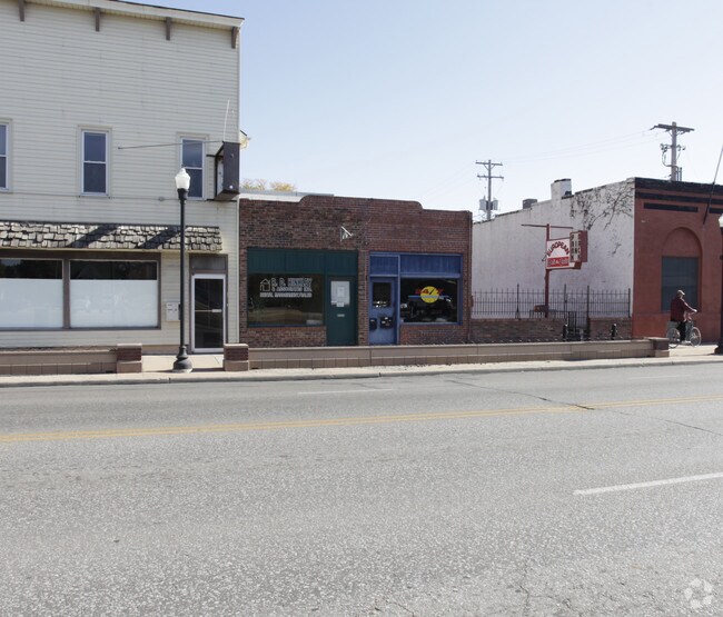
Property Record
2732 N 48Th St, Lincoln, NE 68504


NEARBY LISTINGS FOR SALE OR LEASE
Property Detail
2732 N 48Th St
Lincoln, NE
Baldwins Subdivision
17-17-214-007-000
BALDWINS SUBDIVISION, LOT 4 & N4.3 LOT 5
Storemultistory
Lancaster
X
Nebraska
31109C0310F
4,5
2024
0.05 AC
2025
Northeast
000202
Lincoln
3,048 SF
DEMOGRAPHICS near 2732 N 48Th St
1 Mile
3 Mile
5 Mile
2024 Total Population
15,495
101,180
200,193
2029 Population
16,109
104,968
207,874
Pop Growth 2024-2029
+ 3.96%
+ 3.74%
+ 3.84%
Average Age
36
37
37
2024 Total Households
6,713
42,195
84,616
HH Growth 2024-2029
+ 4.29%
+ 3.95%
+ 4.00%
Median Household Inc
$44,423
$54,142
$56,166
Avg Household Size
2.10
2.20
2.20
2024 Avg HH Vehicles
2.00
2.00
2.00
Median Home Value
$147,849
$175,614
$199,608
Median Year Built
1964
1972
1973
Nearby Places
Map Layers
Map Styles
 Street
 Aerial
- Restaurants
- Banks
- Shops
- Fitness
- Groceries
PUBLIC TRANSPORTATION
COMMUTER RAIL
DRIVE
WALK
Distance
9 min
4.3 mi
AIRPORT
Lincoln
DRIVE
WALK
Distance
Lincoln
13 min
6.4 mi
Nearby Properties
Address
Land Use
TOTAL SIZE
Lot Size
Zoning
Address
Land Use
TOTAL SIZE
Lot Size
Zoning
604,749 SF
20.55 AC
R2
Address
Land Use
TOTAL SIZE
Lot Size
Zoning
364,797 SF
25.06 AC
R1
Address
Land Use
TOTAL SIZE
Lot Size
Zoning
382,244 SF
44.25 AC
R6
Address
Land Use
TOTAL SIZE
Lot Size
Zoning
531,687 SF
32.18 AC
B5
Address
Land Use
TOTAL SIZE
Lot Size
Zoning
48,088 SF
28.06 AC
R5
Address
Land Use
TOTAL SIZE
Lot Size
Zoning
32,110 SF
14.60 AC
R5
Address
Land Use
TOTAL SIZE
Lot Size
Zoning
71,046 SF
23.72 AC
R5
Address
Land Use
TOTAL SIZE
Lot Size
Zoning
217,115 SF
2.03 AC
B4
Address
Land Use
TOTAL SIZE
Lot Size
Zoning
37,240 SF
17.06 AC
NULL
Address
Land Use
TOTAL SIZE
Lot Size
Zoning
287,193 SF
6.62 AC
B4
Address
Land Use
TOTAL SIZE
Lot Size
Zoning
27,171 SF
14.68 AC
NULL
Address
Land Use
TOTAL SIZE
Lot Size
Zoning
174,576 SF
2.07 AC
R6
Address
Land Use
TOTAL SIZE
Lot Size
Zoning
36,751 SF
1.80 AC
B5
Address
Land Use
TOTAL SIZE
Lot Size
Zoning
430,949 SF
41.47 AC
P
Address
Land Use
TOTAL SIZE
Lot Size
Zoning
65,064 SF
1.39 AC
R6
Address
Land Use
TOTAL SIZE
Lot Size
Zoning
179,447 SF
7.85 AC
R6
Address
Land Use
TOTAL SIZE
Lot Size
Zoning
102,739 SF
4.24 AC
B2
Address
Land Use
TOTAL SIZE
Lot Size
Zoning
119,335 SF
26.11 AC
R1
Address
Land Use
TOTAL SIZE
Lot Size
Zoning
8,824 SF
12.33 AC
R5
Address
Land Use
TOTAL SIZE
Lot Size
Zoning
65,967 SF
11.65 AC
NULL
Address
Land Use
TOTAL SIZE
Lot Size
Zoning
10,688 SF
237.77 AC
P
Address
Land Use
TOTAL SIZE
Lot Size
Zoning
63,914 SF
12.22 AC
R5
Address
Land Use
TOTAL SIZE
Lot Size
Zoning
192,751 SF
18.49 AC
B5
Address
Land Use
TOTAL SIZE
Lot Size
Zoning
92,505 SF
2.96 AC
B4
Address
Land Use
TOTAL SIZE
Lot Size
Zoning
63,003 SF
1.22 AC
O3
Address
Land Use
TOTAL SIZE
Lot Size
Zoning
46,906 SF
2.88 AC
Address
Land Use
TOTAL SIZE
Lot Size
Zoning
214,823 SF
19.37 AC
B5
Address
Land Use
TOTAL SIZE
Lot Size
Zoning
51,080 SF
12.42 AC
Address
Land Use
TOTAL SIZE
Lot Size
Zoning
23,881 SF
0.80 AC
B4
Address
Land Use
TOTAL SIZE
Lot Size
Zoning
73,737 SF
5.98 AC
B2
The World's #1 Commercial Real Estate Marketplace
Connect with us
© 2025 CoStar Group
The information above has been obtained from sources believed reliable. While we do not doubt its accuracy we have not verified it and make no guarantee, warranty or representation about it. It is your responsibility to independently confirm its accuracy and completeness. Any projections, opinions, assumptions, or estimates used are for example only and do not represent the current or future performance of the property. The value of this transaction to you depends on tax and other factors which should be evaluated by your tax, financial, and legal advisors. You and your advisors should conduct a careful, independent investigation of the property to determine to your satisfaction the suitability of the property for your needs.