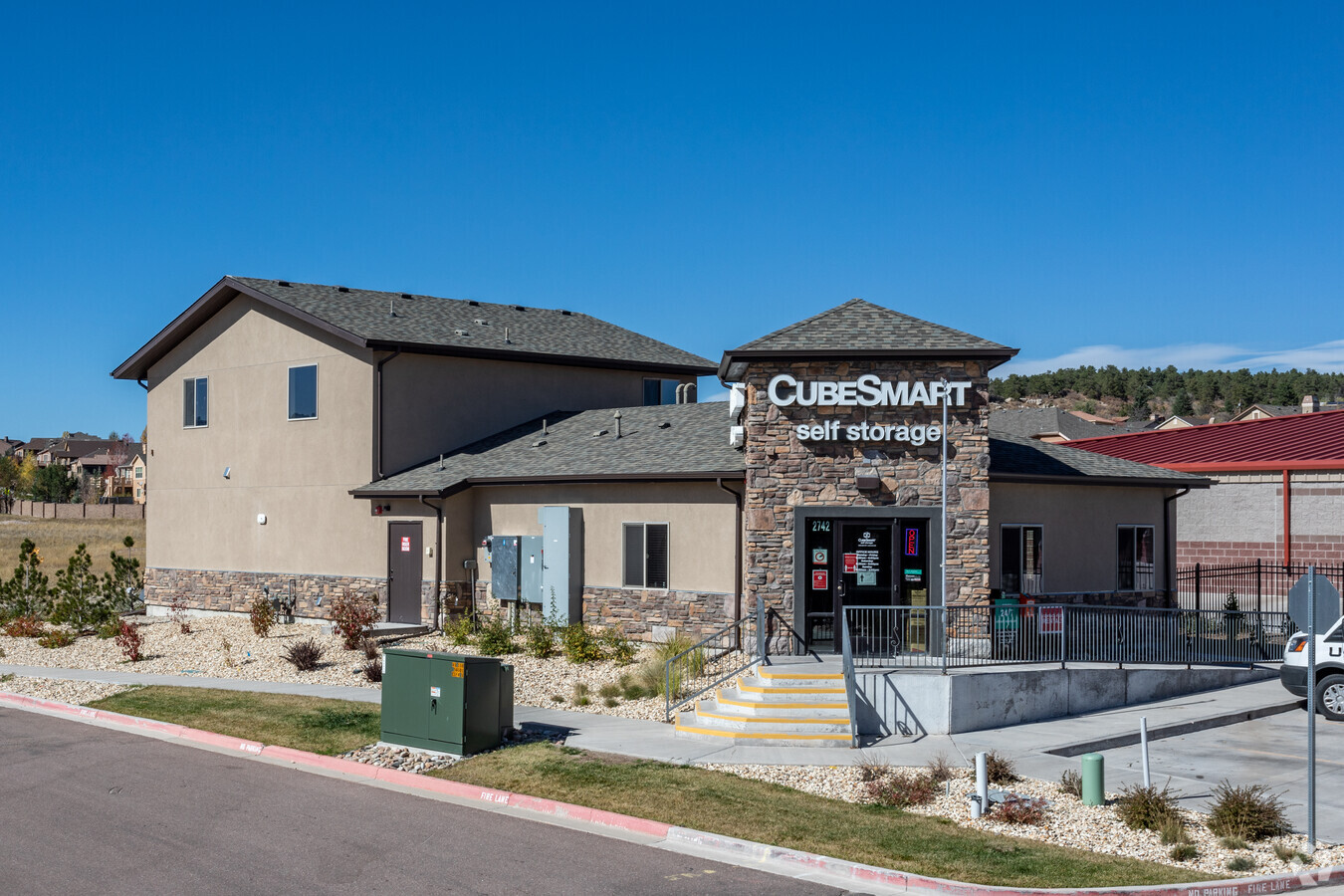
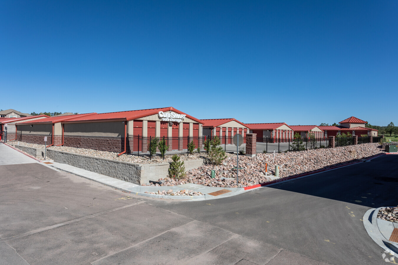
Property Record
2742 N Gate Blvd, Colorado Springs, CO 80921
NEARBY LISTINGS FOR SALE OR LEASE
-
-
View all Colorado Springs listings for sale on LoopNet.com
Property Detail
2742 N Gate Blvd
Colorado Springs, CO
Flying Horse No 21 Fil No 3
62044-04-103
LOT 1 BLK 1 FLYING HORSE NO 21 FIL NO 3
Warehouse
El Paso
X
Colorado
08041C0295G
1
2023
3.44 AC
2024
Northeast
007206
Colorado Springs
60,348 SF
DEMOGRAPHICS near 2742 N Gate Blvd
1 Mile
3 Mile
5 Mile
2024 Total Population
2,769
28,316
65,582
2029 Population
2,910
29,909
69,609
Pop Growth 2024-2029
+ 5.09%
+ 5.63%
+ 6.14%
Average Age
41
40
39
2024 Total Households
900
10,161
23,207
HH Growth 2024-2029
+ 5.33%
+ 5.84%
+ 6.39%
Median Household Inc
$180,882
$136,947
$137,553
Avg Household Size
3.00
2.80
2.80
2024 Avg HH Vehicles
2.00
2.00
2.00
Median Home Value
$740,455
$640,774
$632,717
Median Year Built
2010
2007
2006
Nearby Places
- Restaurants
- Banks
- Shops
- Fitness
- Groceries
PUBLIC TRANSPORTATION
AIRPORT
City of Colorado Springs Municipal
DRIVE
WALK
Distance
City of Colorado Springs Municipal
29 min
18.4 mi
Freight Ports
Tulsa Port Of Catoosa
DRIVE
WALK
Distance
Tulsa Port Of Catoosa
738 min
693.4 mi
Nearby Properties
Address
Land Use
TOTAL SIZE
Lot Size
Zoning
Address
Land Use
TOTAL SIZE
Lot Size
Zoning
562,942 SF
27.13 AC
PUD
Address
Land Use
TOTAL SIZE
Lot Size
Zoning
278,951 SF
32.43 AC
PIP1/CR HR
Address
Land Use
TOTAL SIZE
Lot Size
Zoning
257,140 SF
30.17 AC
PBC OC/CR
Address
Land Use
TOTAL SIZE
Lot Size
Zoning
316,105 SF
19.73 AC
PUD
Address
Land Use
TOTAL SIZE
Lot Size
Zoning
323,646 SF
31.30 AC
PIP1 A PIP
Address
Land Use
TOTAL SIZE
Lot Size
Zoning
261,339 SF
10.42 AC
PBC CU
Address
Land Use
TOTAL SIZE
Lot Size
Zoning
188,626 SF
22.34 AC
PIP1/CR HR
Address
Land Use
TOTAL SIZE
Lot Size
Zoning
132,854 SF
10 AC
PIP1/CR HR
Address
Land Use
TOTAL SIZE
Lot Size
Zoning
411,465 SF
22.54 AC
PUD
Address
Land Use
TOTAL SIZE
Lot Size
Zoning
95,337 SF
49.29 AC
PIP1
Address
Land Use
TOTAL SIZE
Lot Size
Zoning
154,703 SF
14.29 AC
PIP1 HR
Address
Land Use
TOTAL SIZE
Lot Size
Zoning
82,671 SF
21.90 AC
PUD
Address
Land Use
TOTAL SIZE
Lot Size
Zoning
266,793 SF
15.68 AC
PUD
Address
Land Use
TOTAL SIZE
Lot Size
Zoning
346,674 SF
17.96 AC
PUD
Address
Land Use
TOTAL SIZE
Lot Size
Zoning
347,470 SF
15.42 AC
PUD HR
Address
Land Use
TOTAL SIZE
Lot Size
Zoning
349,673 SF
12.25 AC
PUD
Address
Land Use
TOTAL SIZE
Lot Size
Zoning
154,641 SF
15.05 AC
OC/CR PIP1
Address
Land Use
TOTAL SIZE
Lot Size
Zoning
222,866 SF
14.40 AC
RM-30
Address
Land Use
TOTAL SIZE
Lot Size
Zoning
206,674 SF
3.86 AC
PUD
Address
Land Use
TOTAL SIZE
Lot Size
Zoning
355,799 SF
10.51 AC
PUD HR
Address
Land Use
TOTAL SIZE
Lot Size
Zoning
119,596 SF
19.25 AC
PUD HR
Address
Land Use
TOTAL SIZE
Lot Size
Zoning
238,843 SF
9.46 AC
PUD
Address
Land Use
TOTAL SIZE
Lot Size
Zoning
40,730 SF
13.26 AC
PBC CU
Address
Land Use
TOTAL SIZE
Lot Size
Zoning
75,787 SF
2.84 AC
A PUD
Address
Land Use
TOTAL SIZE
Lot Size
Zoning
51,034 SF
11.01 AC
PUD HR
Address
Land Use
TOTAL SIZE
Lot Size
Zoning
65,044 SF
4.26 AC
PUD
Address
Land Use
TOTAL SIZE
Lot Size
Zoning
49,248 SF
5 AC
PUD
Address
Land Use
TOTAL SIZE
Lot Size
Zoning
83,922 SF
16.29 AC
A
Address
Land Use
TOTAL SIZE
Lot Size
Zoning
49,927 SF
9.72 AC
PIP1
Address
Land Use
TOTAL SIZE
Lot Size
Zoning
112,266 SF
0.24 AC
RR3
The World's #1 Commercial Real Estate Marketplace
Connect with us
© 2025 CoStar Group
The information above has been obtained from sources believed reliable. While we do not doubt its accuracy we have not verified it and make no guarantee, warranty or representation about it. It is your responsibility to independently confirm its accuracy and completeness. Any projections, opinions, assumptions, or estimates used are for example only and do not represent the current or future performance of the property. The value of this transaction to you depends on tax and other factors which should be evaluated by your tax, financial, and legal advisors. You and your advisors should conduct a careful, independent investigation of the property to determine to your satisfaction the suitability of the property for your needs.