Property Record
275 Eastpark Dr, Roanoke, VA 24019
NEARBY LISTINGS FOR SALE OR LEASE
-
-
View all Roanoke listings for sale on LoopNet.com
Property Detail
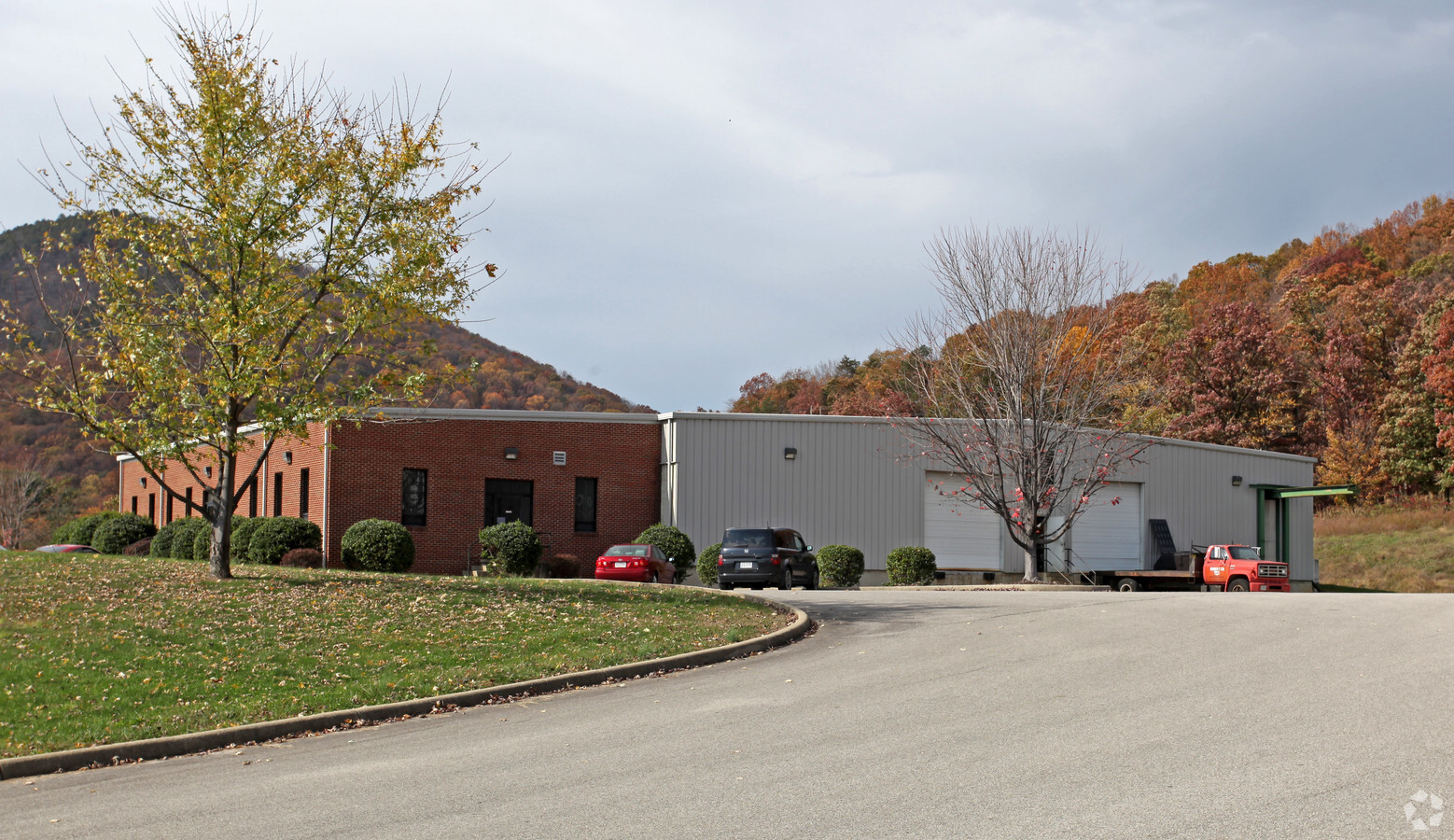
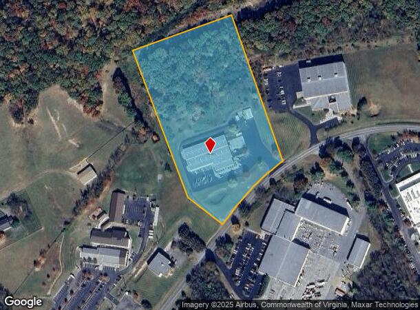
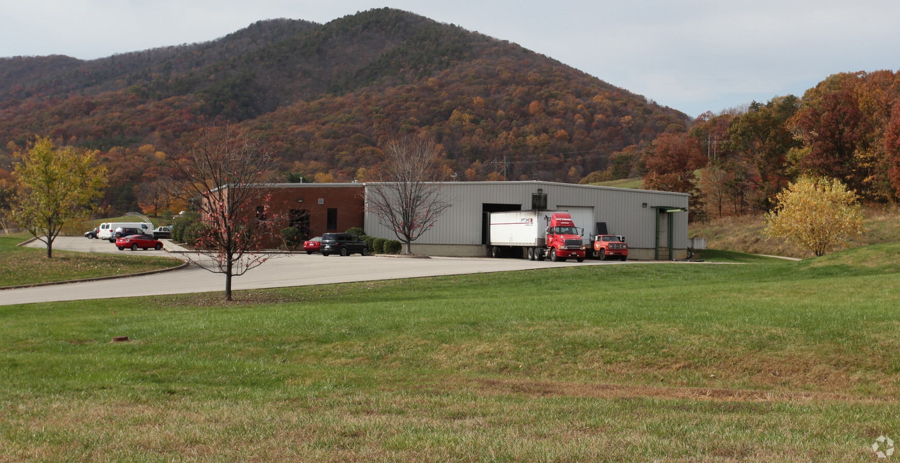
275 Eastpark Dr
Roanoke, VA
Eastpark Commerce
108(13)3
EASTPARK COMMERCLOT 3
Commercialnec
Botetourt
X
Virginia
51023C0460C
3
2023
8.31 AC
2024
Botetourt County
040501
Roanoke
DEMOGRAPHICS near 275 Eastpark Dr
1 Mile
3 Mile
5 Mile
2024 Total Population
2,328
16,832
60,443
2029 Population
2,376
17,079
60,612
Pop Growth 2024-2029
+ 2.06%
+ 1.47%
+ 0.28%
Average Age
44
44
42
2024 Total Households
944
6,741
25,007
HH Growth 2024-2029
+ 1.91%
+ 1.38%
+ 0.18%
Median Household Inc
$84,114
$79,121
$64,191
Avg Household Size
2.50
2.50
2.30
2024 Avg HH Vehicles
2.00
2.00
2.00
Median Home Value
$282,938
$280,332
$211,012
Median Year Built
1992
1988
1975
Nearby Places
- Restaurants
- Banks
- Shops
- Fitness
- Groceries
PUBLIC TRANSPORTATION
COMMUTER RAIL
Roanoke (Northeast Regional - Amtrak)
DRIVE
WALK
Distance
Roanoke (Northeast Regional - Amtrak)
15 min
7.6 mi
AIRPORT
Roanoke/Blacksburg Regional (Woodrum Field)
DRIVE
WALK
Distance
Roanoke/Blacksburg Regional (Woodrum Field)
19 min
9.2 mi
Freight Ports
Virginia Port Authority - Richmond
DRIVE
WALK
Distance
Virginia Port Authority - Richmond
209 min
157.4 mi
SALE & LEASE HISTORY
LISTING DATE
SALE/LEASE

Jan 31, 2018
For Sale
Nearby Properties
Address
Land Use
TOTAL SIZE
Lot Size
Zoning
Address
Land Use
TOTAL SIZE
Lot Size
Zoning
1,991 SF
26.77 AC
R-1
Address
Land Use
TOTAL SIZE
Lot Size
Zoning
24,126 SF
20.11 AC
R3
Address
Land Use
TOTAL SIZE
Lot Size
Zoning
402,320 SF
42.13 AC
I1C
Address
Land Use
TOTAL SIZE
Lot Size
Zoning
387,684 SF
27.44 AC
I-1
Address
Land Use
TOTAL SIZE
Lot Size
Zoning
40.12 AC
M-1
Address
Land Use
TOTAL SIZE
Lot Size
Zoning
40.04 AC
M-2
Address
Land Use
TOTAL SIZE
Lot Size
Zoning
22.52 AC
R-1
Address
Land Use
TOTAL SIZE
Lot Size
Zoning
57,985 SF
12.66 AC
R1
Address
Land Use
TOTAL SIZE
Lot Size
Zoning
446,526 SF
28.10 AC
I-1
Address
Land Use
TOTAL SIZE
Lot Size
Zoning
391,945 SF
25 AC
I1C
Address
Land Use
TOTAL SIZE
Lot Size
Zoning
36.98 AC
M-1
Address
Land Use
TOTAL SIZE
Lot Size
Zoning
333,572 SF
20 AC
I-1
Address
Land Use
TOTAL SIZE
Lot Size
Zoning
183,960 SF
27.63 AC
C2
Address
Land Use
TOTAL SIZE
Lot Size
Zoning
48.26 AC
I-1
Address
Land Use
TOTAL SIZE
Lot Size
Zoning
69,212 SF
19.65 AC
R3S
Address
Land Use
TOTAL SIZE
Lot Size
Zoning
63,648 SF
11.50 AC
INPUD
Address
Land Use
TOTAL SIZE
Lot Size
Zoning
123,019 SF
21.84 AC
I-1
Address
Land Use
TOTAL SIZE
Lot Size
Zoning
134,019 SF
14.84 AC
C2
Address
Land Use
TOTAL SIZE
Lot Size
Zoning
83,159 SF
15.49 AC
C2S
Address
Land Use
TOTAL SIZE
Lot Size
Zoning
35,582 SF
16.36 AC
I2S
Address
Land Use
TOTAL SIZE
Lot Size
Zoning
9.98 AC
A1
Address
Land Use
TOTAL SIZE
Lot Size
Zoning
9.14 AC
M-2
Address
Land Use
TOTAL SIZE
Lot Size
Zoning
110,347 SF
17.46 AC
I-1
Address
Land Use
TOTAL SIZE
Lot Size
Zoning
117,202 SF
17 AC
I1C
Address
Land Use
TOTAL SIZE
Lot Size
Zoning
4 AC
B-2
Address
Land Use
TOTAL SIZE
Lot Size
Zoning
275,553 SF
23.30 AC
I1
Address
Land Use
TOTAL SIZE
Lot Size
Zoning
16.94 AC
M-1
Address
Land Use
TOTAL SIZE
Lot Size
Zoning
28,326 SF
13.05 AC
C1
Address
Land Use
TOTAL SIZE
Lot Size
Zoning
10 AC
R-1
Address
Land Use
TOTAL SIZE
Lot Size
Zoning
18.97 AC
M-2
The World's #1 Commercial Real Estate Marketplace
Connect with us
© 2025 CoStar Group
The information above has been obtained from sources believed reliable. While we do not doubt its accuracy we have not verified it and make no guarantee, warranty or representation about it. It is your responsibility to independently confirm its accuracy and completeness. Any projections, opinions, assumptions, or estimates used are for example only and do not represent the current or future performance of the property. The value of this transaction to you depends on tax and other factors which should be evaluated by your tax, financial, and legal advisors. You and your advisors should conduct a careful, independent investigation of the property to determine to your satisfaction the suitability of the property for your needs.