Property Record
275 Northpointe Pkwy, Buffalo, NY 14228
NEARBY LISTINGS FOR SALE OR LEASE
Property Detail
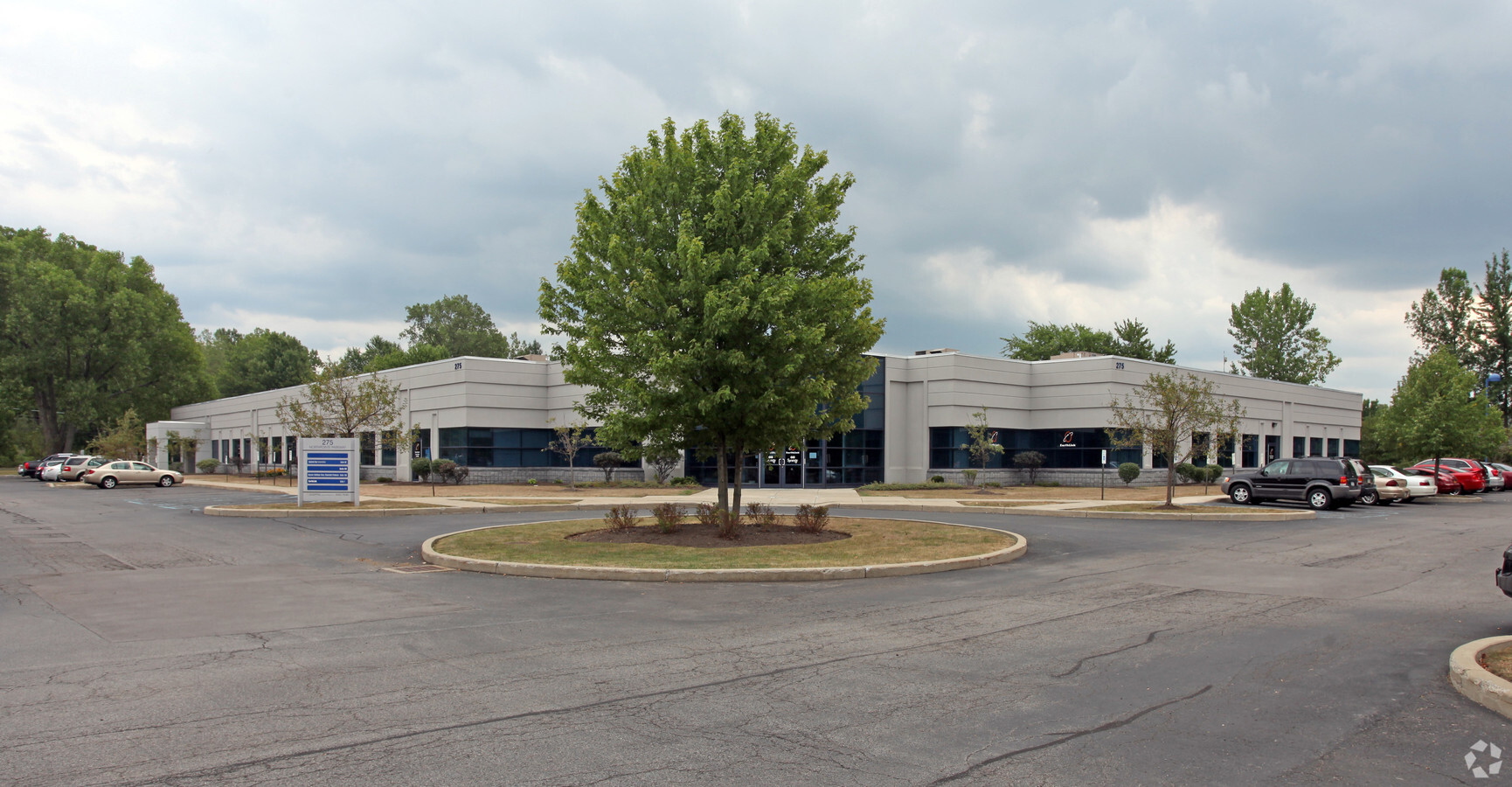
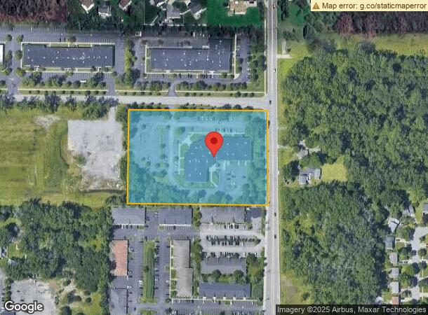
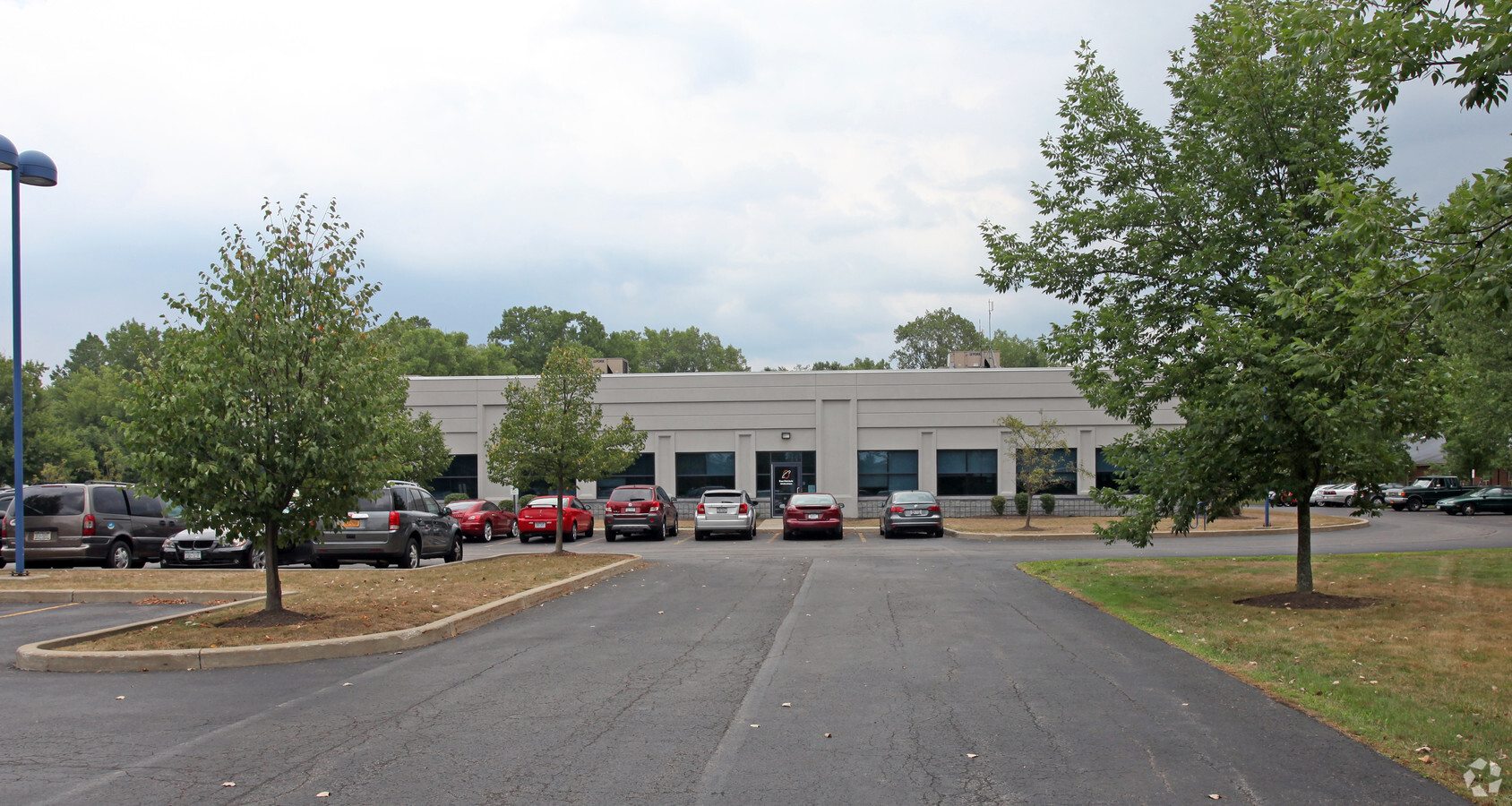
275 Northpointe Pkwy
142289-026-040-0001-032-131
Holland Land Companys Survey
Officebuilding
Erie
X
New York
36029C0066H
32.131
2024
5.04 AC
2023
North
009107
Buffalo/Niagara Falls
31,714 SF
Buffalo-Cheektowaga-Niagara Falls, NY
DEMOGRAPHICS near 275 Northpointe Pkwy
1 Mile
3 Mile
5 Mile
2024 Total Population
6,490
55,638
177,574
2029 Population
6,337
55,158
176,623
Pop Growth 2024-2029
(2.36%)
(0.86%)
(0.54%)
Average Age
37
39
42
2024 Total Households
2,525
21,619
73,502
HH Growth 2024-2029
(2.14%)
(0.75%)
(0.56%)
Median Household Inc
$71,351
$66,588
$72,883
Avg Household Size
2.50
2.20
2.20
2024 Avg HH Vehicles
2.00
2.00
2.00
Median Home Value
$237,681
$223,747
$202,238
Median Year Built
1973
1974
1964
Nearby Places
- Restaurants
- Banks
- Shops
- Fitness
- Groceries
PUBLIC TRANSPORTATION
AIRPORT
Niagara Falls International
DRIVE
WALK
Distance
Niagara Falls International
18 min
9.8 mi
Buffalo Niagara International
DRIVE
WALK
Distance
Buffalo Niagara International
18 min
9.9 mi
Freight Ports
Port of Toledo
DRIVE
WALK
Distance
Port of Toledo
373 min
314.5 mi
SALE & LEASE HISTORY
LISTING DATE
SALE/LEASE

Sep 25, 2016
For Lease
Nearby Properties
Address
Land Use
TOTAL SIZE
Lot Size
Zoning
Address
Land Use
TOTAL SIZE
Lot Size
Zoning
2,592,064 SF
1,057.90 AC
Address
Land Use
TOTAL SIZE
Lot Size
Zoning
5,472 SF
70.10 AC
Address
Land Use
TOTAL SIZE
Lot Size
Zoning
283,706 SF
68.90 AC
Address
Land Use
TOTAL SIZE
Lot Size
Zoning
397,620 SF
36.41 AC
CTR-5
Address
Land Use
TOTAL SIZE
Lot Size
Zoning
29,774 SF
12.77 AC
GB
Address
Land Use
TOTAL SIZE
Lot Size
Zoning
121,808 SF
19.75 AC
Address
Land Use
TOTAL SIZE
Lot Size
Zoning
41,104 SF
27.52 AC
Address
Land Use
TOTAL SIZE
Lot Size
Zoning
33,465 SF
22.65 AC
Address
Land Use
TOTAL SIZE
Lot Size
Zoning
8,842 SF
29.30 AC
Address
Land Use
TOTAL SIZE
Lot Size
Zoning
84,697 SF
29 AC
MFR-5
Address
Land Use
TOTAL SIZE
Lot Size
Zoning
173,881 SF
13.12 AC
GC
Address
Land Use
TOTAL SIZE
Lot Size
Zoning
70,261 SF
14.63 AC
CTR-5
Address
Land Use
TOTAL SIZE
Lot Size
Zoning
319,982 SF
50.62 AC
Address
Land Use
TOTAL SIZE
Lot Size
Zoning
131,890 SF
12.25 AC
CTR-5
Address
Land Use
TOTAL SIZE
Lot Size
Zoning
134,136 SF
30.20 AC
NCD
Address
Land Use
TOTAL SIZE
Lot Size
Zoning
154,296 SF
7.90 AC
RD
Address
Land Use
TOTAL SIZE
Lot Size
Zoning
110,243 SF
19.06 AC
Address
Land Use
TOTAL SIZE
Lot Size
Zoning
47,400 SF
10.03 AC
MS
Address
Land Use
TOTAL SIZE
Lot Size
Zoning
14,140 SF
12.30 AC
Address
Land Use
TOTAL SIZE
Lot Size
Zoning
6,384 SF
13.40 AC
Address
Land Use
TOTAL SIZE
Lot Size
Zoning
68,045 SF
21.70 AC
MFR-5
Address
Land Use
TOTAL SIZE
Lot Size
Zoning
131,128 SF
15.48 AC
RD
Address
Land Use
TOTAL SIZE
Lot Size
Zoning
175,793 SF
27.30 AC
M-1
Address
Land Use
TOTAL SIZE
Lot Size
Zoning
2,135 SF
11.96 AC
Address
Land Use
TOTAL SIZE
Lot Size
Zoning
67,475 SF
5 AC
Address
Land Use
TOTAL SIZE
Lot Size
Zoning
197,074 SF
29.46 AC
Address
Land Use
TOTAL SIZE
Lot Size
Zoning
253,920 SF
22.83 AC
RD
Address
Land Use
TOTAL SIZE
Lot Size
Zoning
112,256 SF
38.33 AC
00000
Address
Land Use
TOTAL SIZE
Lot Size
Zoning
106,676 SF
8.90 AC
RD
Address
Land Use
TOTAL SIZE
Lot Size
Zoning
131,200 SF
16.90 AC
The World's #1 Commercial Real Estate Marketplace
Connect with us
© 2025 CoStar Group
The information above has been obtained from sources believed reliable. While we do not doubt its accuracy we have not verified it and make no guarantee, warranty or representation about it. It is your responsibility to independently confirm its accuracy and completeness. Any projections, opinions, assumptions, or estimates used are for example only and do not represent the current or future performance of the property. The value of this transaction to you depends on tax and other factors which should be evaluated by your tax, financial, and legal advisors. You and your advisors should conduct a careful, independent investigation of the property to determine to your satisfaction the suitability of the property for your needs.