Property Record
2765 Statesville Blvd, Salisbury, NC 28147
NEARBY LISTINGS FOR SALE OR LEASE
Property Detail
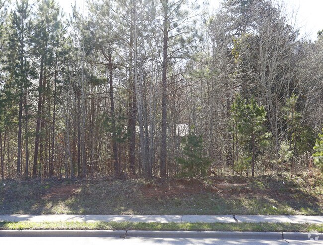
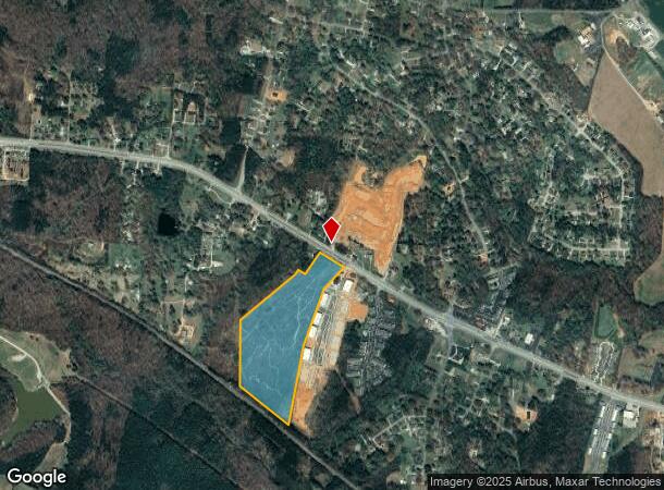
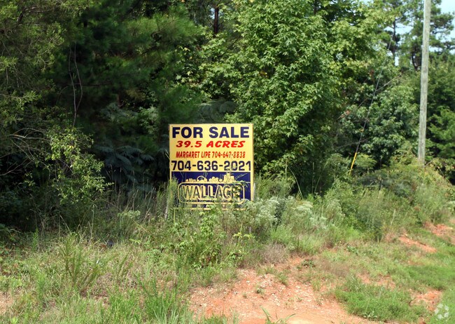
2765 Statesville Blvd
330-021
L1 25.79AC
Commercialacreage
Rowan
X
North Carolina
3710574100J
25.79 AC
2024
Rowan County
2024
Charlotte
051301
Charlotte-Concord-Gastonia, NC-SC
1,110 SF
DEMOGRAPHICS near 2765 Statesville Blvd
1 Mile
3 Mile
5 Mile
2024 Total Population
2,514
13,281
43,243
2029 Population
2,634
13,909
45,652
Pop Growth 2024-2029
+ 4.77%
+ 4.73%
+ 5.57%
Average Age
40
42
40
2024 Total Households
1,049
5,432
16,981
HH Growth 2024-2029
+ 4.77%
+ 4.71%
+ 5.67%
Median Household Inc
$42,686
$55,480
$51,465
Avg Household Size
2.20
2.30
2.30
2024 Avg HH Vehicles
2.00
2.00
2.00
Median Home Value
$178,830
$214,491
$207,568
Median Year Built
1980
1986
1978
Nearby Places
- Restaurants
- Banks
- Shops
- Fitness
- Groceries
PUBLIC TRANSPORTATION
COMMUTER RAIL
Salisbury Station (Piedmont - North Carolina by Train (NC Train))
DRIVE
WALK
Distance
Salisbury Station (Piedmont - North Carolina by Train (NC Train))
12 min
5.5 mi
AIRPORT
Concord-Padgett Regional
DRIVE
WALK
Distance
Concord-Padgett Regional
44 min
32.3 mi
Freight Ports
Port of Wilmington
DRIVE
WALK
Distance
Port of Wilmington
277 min
213.3 mi
Nearby Properties
Address
Land Use
TOTAL SIZE
Lot Size
Zoning
Address
Land Use
TOTAL SIZE
Lot Size
Zoning
193,040 SF
73.85 AC
Address
Land Use
TOTAL SIZE
Lot Size
Zoning
165,360 SF
76.51 AC
Address
Land Use
TOTAL SIZE
Lot Size
Zoning
360,312 SF
106.52 AC
Address
Land Use
TOTAL SIZE
Lot Size
Zoning
12,864 SF
17.69 AC
Address
Land Use
TOTAL SIZE
Lot Size
Zoning
7,680 SF
18 AC
Address
Land Use
TOTAL SIZE
Lot Size
Zoning
27,456 SF
22.41 AC
Address
Land Use
TOTAL SIZE
Lot Size
Zoning
151.25 AC
Address
Land Use
TOTAL SIZE
Lot Size
Zoning
34,391 SF
57.23 AC
Address
Land Use
TOTAL SIZE
Lot Size
Zoning
96,281 SF
32.14 AC
Address
Land Use
TOTAL SIZE
Lot Size
Zoning
81,412 SF
9.83 AC
HB:HIGHWAY
Address
Land Use
TOTAL SIZE
Lot Size
Zoning
141,593 SF
25.55 AC
HB:HIGHWAY
Address
Land Use
TOTAL SIZE
Lot Size
Zoning
15,705 SF
5.98 AC
Address
Land Use
TOTAL SIZE
Lot Size
Zoning
7,020 SF
7.61 AC
Address
Land Use
TOTAL SIZE
Lot Size
Zoning
11,339 SF
4.07 AC
Address
Land Use
TOTAL SIZE
Lot Size
Zoning
6,935 SF
10.55 AC
Address
Land Use
TOTAL SIZE
Lot Size
Zoning
25,024 SF
14 AC
Address
Land Use
TOTAL SIZE
Lot Size
Zoning
14,976 SF
2.38 AC
Address
Land Use
TOTAL SIZE
Lot Size
Zoning
38,207 SF
40 AC
Address
Land Use
TOTAL SIZE
Lot Size
Zoning
71,040 SF
12.69 AC
Address
Land Use
TOTAL SIZE
Lot Size
Zoning
27,999 SF
9.12 AC
Address
Land Use
TOTAL SIZE
Lot Size
Zoning
74.60 AC
Address
Land Use
TOTAL SIZE
Lot Size
Zoning
52,206 SF
12.86 AC
Address
Land Use
TOTAL SIZE
Lot Size
Zoning
64,500 SF
6.65 AC
HB:HIGHWAY
Address
Land Use
TOTAL SIZE
Lot Size
Zoning
12,600 SF
12.36 AC
Address
Land Use
TOTAL SIZE
Lot Size
Zoning
31,801 SF
7.50 AC
Address
Land Use
TOTAL SIZE
Lot Size
Zoning
9,184 SF
6.95 AC
Address
Land Use
TOTAL SIZE
Lot Size
Zoning
19,992 SF
9.10 AC
Address
Land Use
TOTAL SIZE
Lot Size
Zoning
2,525 SF
295.42 AC
Address
Land Use
TOTAL SIZE
Lot Size
Zoning
38,970 SF
8.66 AC
Address
Land Use
TOTAL SIZE
Lot Size
Zoning
134,552 SF
M1:LIGHT I
The World's #1 Commercial Real Estate Marketplace
Connect with us
© 2025 CoStar Group
The information above has been obtained from sources believed reliable. While we do not doubt its accuracy we have not verified it and make no guarantee, warranty or representation about it. It is your responsibility to independently confirm its accuracy and completeness. Any projections, opinions, assumptions, or estimates used are for example only and do not represent the current or future performance of the property. The value of this transaction to you depends on tax and other factors which should be evaluated by your tax, financial, and legal advisors. You and your advisors should conduct a careful, independent investigation of the property to determine to your satisfaction the suitability of the property for your needs.