Property Record
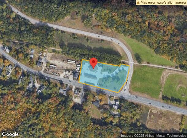
277 Mast Rd, Goffstown, NH 03045
NEARBY LISTINGS FOR SALE OR LEASE
-
-
View all Goffstown listings for sale on LoopNet.com
Property Detail
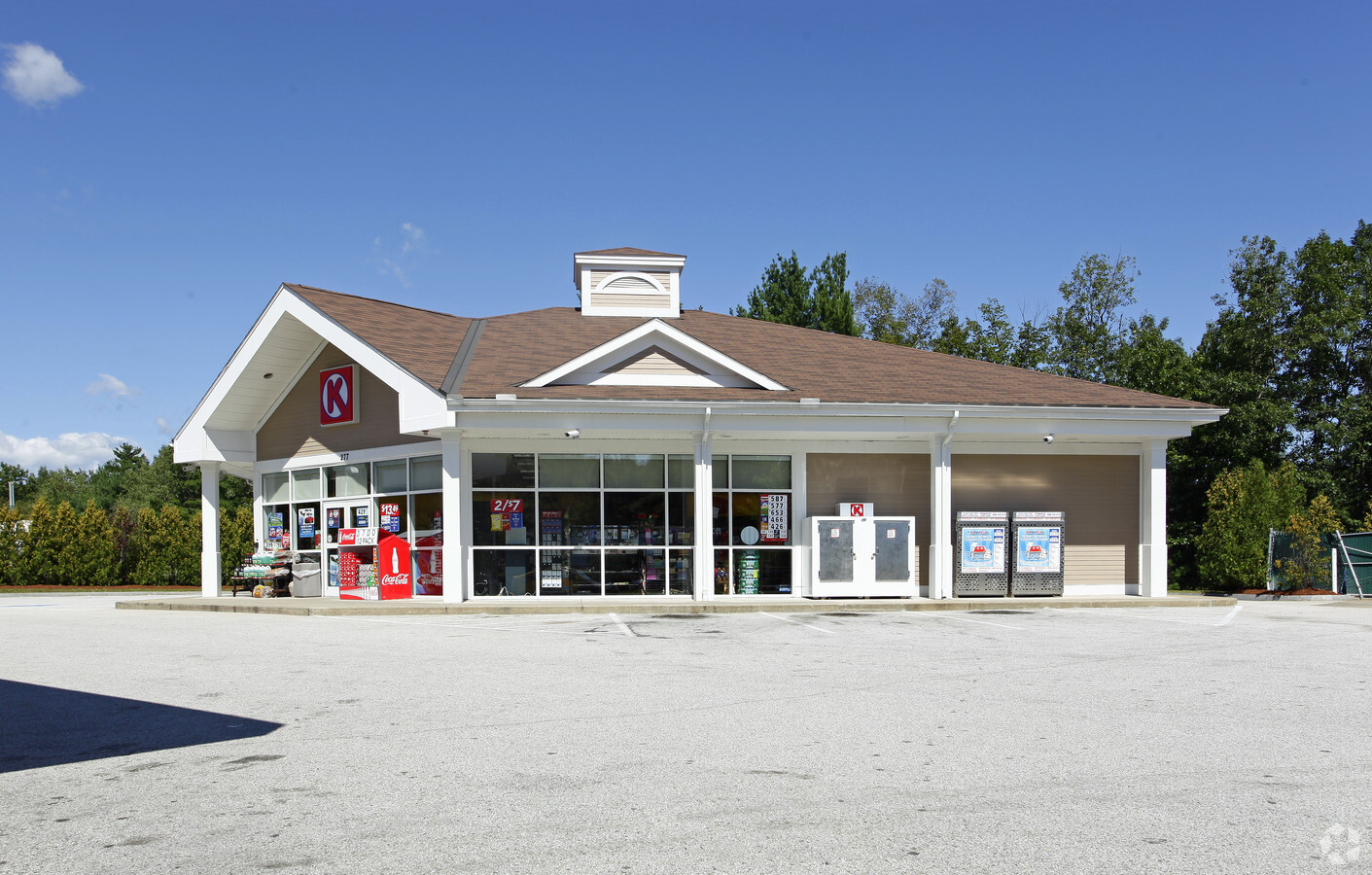
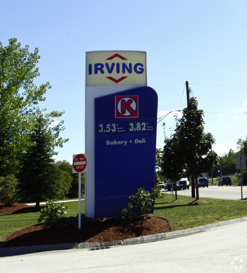
277 Mast Rd
Servicestation
Hillsborough
X
New Hampshire
33013C0670E
2.28 AC
2024
Hillsborough
2024
Boston
002801
Manchester-Nashua, NH
3,328 SF
GOFF-000026-000024
DEMOGRAPHICS near 277 Mast Rd
1 Mile
3 Mile
5 Mile
2024 Total Population
1,651
20,332
94,007
2029 Population
1,698
20,719
95,655
Pop Growth 2024-2029
+ 2.85%
+ 1.90%
+ 1.75%
Average Age
48
40
40
2024 Total Households
656
7,479
38,306
HH Growth 2024-2029
+ 3.05%
+ 2.13%
+ 1.85%
Median Household Inc
$86,328
$91,735
$76,244
Avg Household Size
2.30
2.40
2.30
2024 Avg HH Vehicles
2.00
2.00
2.00
Median Home Value
$324,400
$327,159
$349,415
Median Year Built
1982
1978
1969
Nearby Places
- Restaurants
- Banks
- Shops
- Fitness
- Groceries
PUBLIC TRANSPORTATION
AIRPORT
Manchester Boston Regional
DRIVE
WALK
Distance
Manchester Boston Regional
21 min
10.0 mi
Freight Ports
Port of Boston
DRIVE
WALK
Distance
Port of Boston
93 min
62.4 mi
Nearby Properties
Address
Land Use
TOTAL SIZE
Lot Size
Zoning
Address
Land Use
TOTAL SIZE
Lot Size
Zoning
60,000 SF
144.50 AC
R2
Address
Land Use
TOTAL SIZE
Lot Size
Zoning
43,576 SF
R2
Address
Land Use
TOTAL SIZE
Lot Size
Zoning
177,600 SF
30 AC
R1
Address
Land Use
TOTAL SIZE
Lot Size
Zoning
50,954 SF
14.95 AC
R2
Address
Land Use
TOTAL SIZE
Lot Size
Zoning
138,175 SF
9 AC
CIFZ
Address
Land Use
TOTAL SIZE
Lot Size
Zoning
8,530 SF
26.33 AC
Address
Land Use
TOTAL SIZE
Lot Size
Zoning
27,450 SF
9.10 AC
Address
Land Use
TOTAL SIZE
Lot Size
Zoning
121,464 SF
60.30 AC
A
Address
Land Use
TOTAL SIZE
Lot Size
Zoning
1,710 SF
9.65 AC
R2
Address
Land Use
TOTAL SIZE
Lot Size
Zoning
41,252 SF
6.87 AC
Address
Land Use
TOTAL SIZE
Lot Size
Zoning
30,552 SF
22.24 AC
Address
Land Use
TOTAL SIZE
Lot Size
Zoning
26,200 SF
25.48 AC
R2
Address
Land Use
TOTAL SIZE
Lot Size
Zoning
41,240 SF
4.41 AC
Address
Land Use
TOTAL SIZE
Lot Size
Zoning
96,742 SF
15.54 AC
A
Address
Land Use
TOTAL SIZE
Lot Size
Zoning
261.40 AC
Address
Land Use
TOTAL SIZE
Lot Size
Zoning
61,250 SF
11.24 AC
CIFZ
Address
Land Use
TOTAL SIZE
Lot Size
Zoning
111,511 SF
16.70 AC
C
Address
Land Use
TOTAL SIZE
Lot Size
Zoning
9,630 SF
72.90 AC
Address
Land Use
TOTAL SIZE
Lot Size
Zoning
64,992 SF
9.70 AC
C
Address
Land Use
TOTAL SIZE
Lot Size
Zoning
27,450 SF
2.98 AC
Address
Land Use
TOTAL SIZE
Lot Size
Zoning
27,612 SF
8.76 AC
C
Address
Land Use
TOTAL SIZE
Lot Size
Zoning
14,400 SF
11.22 AC
I
Address
Land Use
TOTAL SIZE
Lot Size
Zoning
45,770 SF
2.50 AC
C
Address
Land Use
TOTAL SIZE
Lot Size
Zoning
14,682 SF
1.85 AC
C
Address
Land Use
TOTAL SIZE
Lot Size
Zoning
4.20 AC
A
Address
Land Use
TOTAL SIZE
Lot Size
Zoning
41,252 SF
3.32 AC
Address
Land Use
TOTAL SIZE
Lot Size
Zoning
39,724 SF
12.37 AC
CIFZ
Address
Land Use
TOTAL SIZE
Lot Size
Zoning
38,440 SF
4 AC
R1
Address
Land Use
TOTAL SIZE
Lot Size
Zoning
4,212 SF
15.50 AC
R2
Address
Land Use
TOTAL SIZE
Lot Size
Zoning
80,500 SF
8.76 AC
I
The World's #1 Commercial Real Estate Marketplace
Connect with us
© 2025 CoStar Group
The information above has been obtained from sources believed reliable. While we do not doubt its accuracy we have not verified it and make no guarantee, warranty or representation about it. It is your responsibility to independently confirm its accuracy and completeness. Any projections, opinions, assumptions, or estimates used are for example only and do not represent the current or future performance of the property. The value of this transaction to you depends on tax and other factors which should be evaluated by your tax, financial, and legal advisors. You and your advisors should conduct a careful, independent investigation of the property to determine to your satisfaction the suitability of the property for your needs.