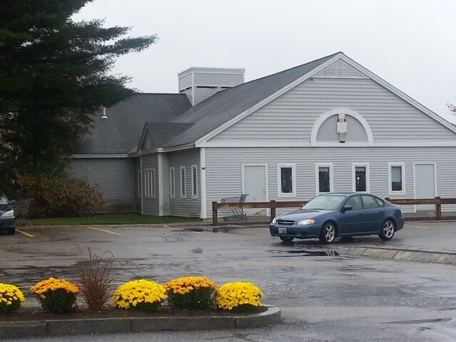
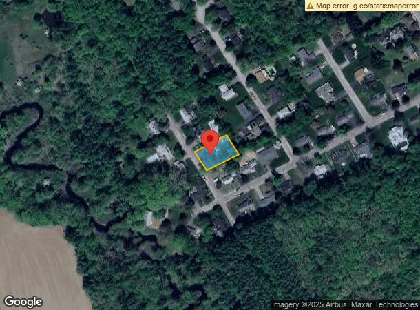
Property Record
257 Newport Rd, New London, NH 03257

NEARBY LISTINGS FOR SALE OR LEASE
Property Detail
257 Newport Rd
NLDN-000059-000008
Merrimack
Commercialnec
New Hampshire
X
5
33013C0095E
9.54 AC
2024
Concord/New Hampshire North Area
2024
Other Market Areas
041001
Concord, NH
21,248 SF
DEMOGRAPHICS near 257 Newport Rd
1 Mile
3 Mile
5 Mile
2024 Total Population
1,154
3,646
6,845
2029 Population
1,173
3,704
7,013
Pop Growth 2024-2029
+ 1.65%
+ 1.59%
+ 2.45%
Average Age
50
48
47
2024 Total Households
507
1,461
2,834
HH Growth 2024-2029
+ 1.78%
+ 1.44%
+ 2.36%
Median Household Inc
$78,472
$93,789
$96,127
Avg Household Size
2.00
2.10
2.20
2024 Avg HH Vehicles
2.00
2.00
2.00
Median Home Value
$450,793
$468,468
$453,460
Median Year Built
1979
1977
1978
Nearby Places
- Restaurants
- Banks
- Shops
- Fitness
- Groceries
PUBLIC TRANSPORTATION
AIRPORT
Manchester Boston Regional
DRIVE
WALK
Distance
Manchester Boston Regional
36 min
22.3 mi
Freight Ports
Port of Boston
DRIVE
WALK
Distance
Port of Boston
101 min
70.8 mi
SALE & LEASE HISTORY
LISTING DATE
SALE/LEASE

Sep 25, 2016
For Lease
May 07, 2018
For Lease
Jun 12, 2017
For Lease
Nearby Properties
Address
Land Use
TOTAL SIZE
Lot Size
Zoning
Address
Land Use
TOTAL SIZE
Lot Size
Zoning
181,592 SF
5.53 AC
IS
Address
Land Use
TOTAL SIZE
Lot Size
Zoning
7.22 AC
IS
Address
Land Use
TOTAL SIZE
Lot Size
Zoning
230,929 SF
127 AC
IS
Address
Land Use
TOTAL SIZE
Lot Size
Zoning
1,500 SF
RO
Address
Land Use
TOTAL SIZE
Lot Size
Zoning
161,715 SF
70 AC
CV
Address
Land Use
TOTAL SIZE
Lot Size
Zoning
156 AC
IS
Address
Land Use
TOTAL SIZE
Lot Size
Zoning
65.25 AC
IN
Address
Land Use
TOTAL SIZE
Lot Size
Zoning
128.74 AC
IS
Address
Land Use
TOTAL SIZE
Lot Size
Zoning
15.59 AC
GWP
Address
Land Use
TOTAL SIZE
Lot Size
Zoning
4,400 SF
76.15 AC
MUD4
Address
Land Use
TOTAL SIZE
Lot Size
Zoning
1.92 AC
IS
Address
Land Use
TOTAL SIZE
Lot Size
Zoning
79,703 SF
2.16 AC
CVP
Address
Land Use
TOTAL SIZE
Lot Size
Zoning
110 AC
IN
Address
Land Use
TOTAL SIZE
Lot Size
Zoning
88,452 SF
1.12 AC
IS
Address
Land Use
TOTAL SIZE
Lot Size
Zoning
136,536 SF
17.69 AC
GWP
Address
Land Use
TOTAL SIZE
Lot Size
Zoning
75,917 SF
0.30 AC
CBP
Address
Land Use
TOTAL SIZE
Lot Size
Zoning
5 AC
C
Address
Land Use
TOTAL SIZE
Lot Size
Zoning
21.45 AC
RH
Address
Land Use
TOTAL SIZE
Lot Size
Zoning
15.22 AC
OCP
Address
Land Use
TOTAL SIZE
Lot Size
Zoning
1.34 AC
CVP
Address
Land Use
TOTAL SIZE
Lot Size
Zoning
81,493 SF
33 AC
CV
Address
Land Use
TOTAL SIZE
Lot Size
Zoning
11,574 SF
6.57 AC
CV
Address
Land Use
TOTAL SIZE
Lot Size
Zoning
41.95 AC
IN
Address
Land Use
TOTAL SIZE
Lot Size
Zoning
13 AC
IS
Address
Land Use
TOTAL SIZE
Lot Size
Zoning
109,643 SF
128.35 AC
IS
Address
Land Use
TOTAL SIZE
Lot Size
Zoning
52,750 SF
3.26 AC
OCP
Address
Land Use
TOTAL SIZE
Lot Size
Zoning
76,966 SF
11.15 AC
RS
Address
Land Use
TOTAL SIZE
Lot Size
Zoning
132,828 SF
1.31 AC
CBP
Address
Land Use
TOTAL SIZE
Lot Size
Zoning
64,843 SF
6.60 AC
C
Address
Land Use
TOTAL SIZE
Lot Size
Zoning
73,281 SF
2.80 AC
RD
The World's #1 Commercial Real Estate Marketplace
Connect with us
© 2025 CoStar Group
The information above has been obtained from sources believed reliable. While we do not doubt its accuracy we have not verified it and make no guarantee, warranty or representation about it. It is your responsibility to independently confirm its accuracy and completeness. Any projections, opinions, assumptions, or estimates used are for example only and do not represent the current or future performance of the property. The value of this transaction to you depends on tax and other factors which should be evaluated by your tax, financial, and legal advisors. You and your advisors should conduct a careful, independent investigation of the property to determine to your satisfaction the suitability of the property for your needs.