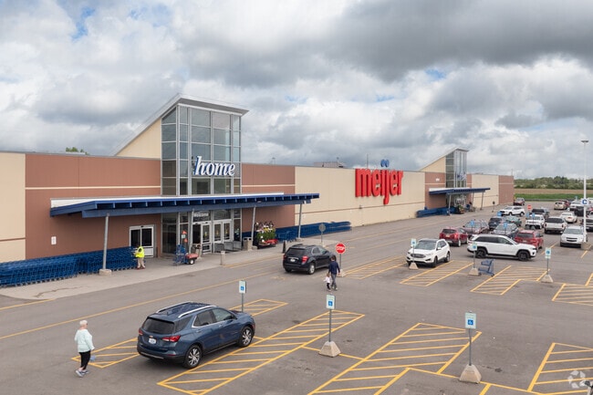
Property Record
2770 S State Rd, Ionia, MI 48846


Current Lease Availabilities
Property Detail
2770 S State Rd
010-036-000-160-61
PT SE 1/4 SEC 36 COM E 1/4 PO TH S 940.69FT TO POB, TH S 312.31FT, TH W 30FT, TH NWLY 58.54FT ALG 48.35FT CURVE LEFT ANGLE
Commercialnec
Ionia
B and X Area of moderate flood hazard, usually the area between the limits of the 100-year and 500-year floods.
Michigan
2024
23.37 AC
2025
Ionia County
031900
West Michigan
209,286 SF
Grand Rapids-Wyoming-Kentwood, MI
NEARBY LISTINGS FOR SALE OR LEASE
DEMOGRAPHICS near 2770 S State Rd
1 mile
3 mile
5 mile
2025 Total Population
2,118
12,765
20,142
2030 Population
2,152
12,827
20,221
Pop Growth 2025-2030
+ 1.61%
+ 0.49%
+ 0.39%
Average Age
39
40
40
2025 Total Households
796
3,195
5,590
HH Growth 2025-2030
+ 1.51%
+ 1.19%
+ 0.77%
Median Household Inc
$60,606
$61,936
$61,616
Avg Household Size
2.60
2.50
2.50
2025 Avg HH Vehicles
2.00
2.00
2.00
Median Home Value
$237,812
$206,250
$209,992
Median Year Built
1982
1959
1967
Nearby Places
Map Layers
Map Styles
 Street
 Aerial
Transit
 Traffic
 Biking
Places
Listings with unknown addresses are not visible on the map
- Restaurants
- Banks
- Shops
- Fitness
- Groceries
PUBLIC TRANSPORTATION
AIRPORT
Capital Region International
Drive
Walk
Distance
Capital Region International
42 min
32.7 mi
Gerald R Ford International
Drive
Walk
Distance
Gerald R Ford International
43 min
32.7 mi
Nearby Properties
Address
Land Use
TOTAL SIZE
Lot Size
Zoning
Address
Land Use
TOTAL SIZE
Lot Size
Zoning
178,310 SF
21.07 AC
Address
Land Use
TOTAL SIZE
Lot Size
Zoning
Address
Land Use
TOTAL SIZE
Lot Size
Zoning
8,960 SF
6.11 AC
Address
Land Use
TOTAL SIZE
Lot Size
Zoning
96,695 SF
11.92 AC
I-1
Address
Land Use
TOTAL SIZE
Lot Size
Zoning
111,316 SF
14.62 AC
Address
Land Use
TOTAL SIZE
Lot Size
Zoning
131,333 SF
14.07 AC
Address
Land Use
TOTAL SIZE
Lot Size
Zoning
127,496 SF
10.70 AC
I-1
Address
Land Use
TOTAL SIZE
Lot Size
Zoning
94,800 SF
13.63 AC
Address
Land Use
TOTAL SIZE
Lot Size
Zoning
1,920 SF
68.57 AC
Address
Land Use
TOTAL SIZE
Lot Size
Zoning
31,242 SF
0.25 AC
B-2
Address
Land Use
TOTAL SIZE
Lot Size
Zoning
23,904 SF
0.31 AC
B-2
Address
Land Use
TOTAL SIZE
Lot Size
Zoning
628.74 AC
Address
Land Use
TOTAL SIZE
Lot Size
Zoning
4.31 AC
RM-1
Address
Land Use
TOTAL SIZE
Lot Size
Zoning
2,396 SF
72.30 AC
Address
Land Use
TOTAL SIZE
Lot Size
Zoning
24,672 SF
4.46 AC
Address
Land Use
TOTAL SIZE
Lot Size
Zoning
5,247 SF
1.74 AC
Address
Land Use
TOTAL SIZE
Lot Size
Zoning
7,200 SF
2.72 AC
Address
Land Use
TOTAL SIZE
Lot Size
Zoning
1.45 AC
Address
Land Use
TOTAL SIZE
Lot Size
Zoning
32,565 SF
5.61 AC
Address
Land Use
TOTAL SIZE
Lot Size
Zoning
11,701 SF
2.13 AC
B-3
Address
Land Use
TOTAL SIZE
Lot Size
Zoning
33,556 SF
2 AC
Address
Land Use
TOTAL SIZE
Lot Size
Zoning
14,224 SF
5.12 AC
Address
Land Use
TOTAL SIZE
Lot Size
Zoning
6,148 SF
3.43 AC
B-3
Address
Land Use
TOTAL SIZE
Lot Size
Zoning
2.17 AC
Address
Land Use
TOTAL SIZE
Lot Size
Zoning
13,000 SF
82.44 AC
Address
Land Use
TOTAL SIZE
Lot Size
Zoning
4,208 SF
1.45 AC
Address
Land Use
TOTAL SIZE
Lot Size
Zoning
7,524 SF
1.23 AC
B-3
Address
Land Use
TOTAL SIZE
Lot Size
Zoning
15,804 SF
0.25 AC
B-2
Address
Land Use
TOTAL SIZE
Lot Size
Zoning
190 AC
The World's #1 Commercial Real Estate Marketplace
Connect with us
© 2026 CoStar Group
The information above has been obtained from sources believed reliable. While we do not doubt its accuracy we have not verified it and make no guarantee, warranty or representation about it. It is your responsibility to independently confirm its accuracy and completeness. Any projections, opinions, assumptions, or estimates used are for example only and do not represent the current or future performance of the property. The value of this transaction to you depends on tax and other factors which should be evaluated by your tax, financial, and legal advisors. You and your advisors should conduct a careful, independent investigation of the property to determine to your satisfaction the suitability of the property for your needs.