Property Record
27701 S Tamiami Trl, Bonita Springs, FL 34134
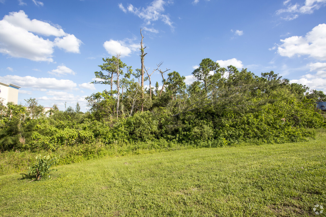
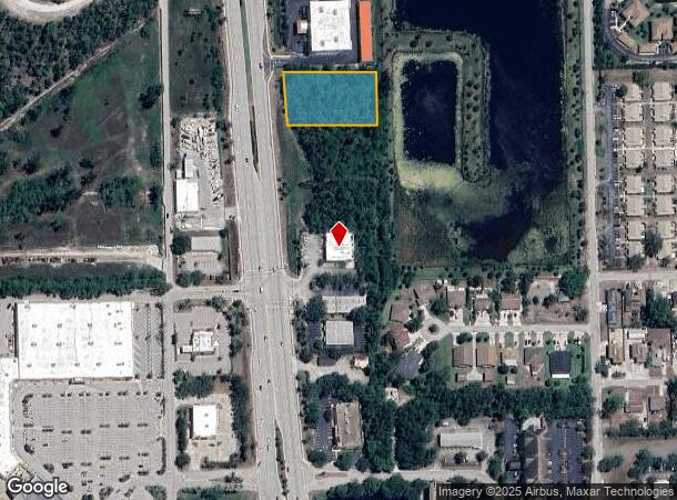
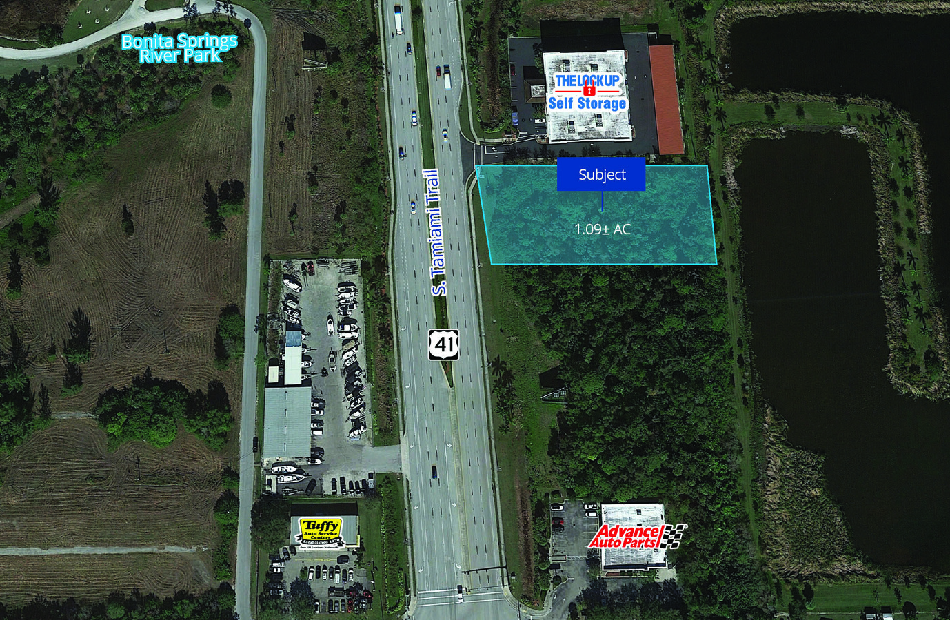
This Property Is For Sale
NEARBY LISTINGS FOR SALE OR LEASE
Property Detail
27701 S Tamiami Trl
Cape Coral-Fort Myers, FL
Arroyal
33-47-25-B3-00257.0030
ARROYAL PB 3 PG 80 PT LOT 57 N 1/2 LYING E OF US 41
Commercialacreage
Lee
AE
Florida
12021C0183J
57
2023
1.09 AC
2024
Bonita Springs
050603
Southwest Florida
DEMOGRAPHICS near 27701 S Tamiami Trl
1 Mile
3 Mile
5 Mile
2024 Total Population
6,838
52,961
98,394
2029 Population
8,177
63,135
116,930
Pop Growth 2024-2029
+ 19.58%
+ 19.21%
+ 18.84%
Average Age
52
54
55
2024 Total Households
3,247
24,573
46,377
HH Growth 2024-2029
+ 19.25%
+ 18.85%
+ 18.64%
Median Household Inc
$74,644
$77,111
$84,321
Avg Household Size
2.00
2.10
2.00
2024 Avg HH Vehicles
2.00
2.00
2.00
Median Home Value
$422,034
$395,418
$433,036
Median Year Built
1993
1994
1996
Nearby Places
- Restaurants
- Banks
- Shops
- Fitness
- Groceries
PUBLIC TRANSPORTATION
AIRPORT
Southwest Florida International
DRIVE
WALK
Distance
Southwest Florida International
27 min
20.1 mi
Freight Ports
Port Manatee
DRIVE
WALK
Distance
Port Manatee
1 min
101.1 mi
Nearby Properties
Address
Land Use
TOTAL SIZE
Lot Size
Zoning
Address
Land Use
TOTAL SIZE
Lot Size
Zoning
761,828 SF
86.10 AC
PUD
Address
Land Use
TOTAL SIZE
Lot Size
Zoning
406,601 SF
19.88 AC
RPD
Address
Land Use
TOTAL SIZE
Lot Size
Zoning
331,056 SF
8 AC
CPD
Address
Land Use
TOTAL SIZE
Lot Size
Zoning
311,416 SF
17.06 AC
Address
Land Use
TOTAL SIZE
Lot Size
Zoning
252,506 SF
36.27 AC
PUD
Address
Land Use
TOTAL SIZE
Lot Size
Zoning
221,244 SF
65.55 AC
MPD
Address
Land Use
TOTAL SIZE
Lot Size
Zoning
227,264 SF
8.72 AC
A
Address
Land Use
TOTAL SIZE
Lot Size
Zoning
435,724 SF
64.61 AC
PUD
Address
Land Use
TOTAL SIZE
Lot Size
Zoning
230,920 SF
7.80 AC
C-4
Address
Land Use
TOTAL SIZE
Lot Size
Zoning
366,884 SF
30.64 AC
RM-2
Address
Land Use
TOTAL SIZE
Lot Size
Zoning
244,984 SF
32.47 AC
PUD
Address
Land Use
TOTAL SIZE
Lot Size
Zoning
286,416 SF
28.78 AC
CG
Address
Land Use
TOTAL SIZE
Lot Size
Zoning
214,836 SF
24.50 AC
CPD
Address
Land Use
TOTAL SIZE
Lot Size
Zoning
464,234 SF
22.53 AC
CPD
Address
Land Use
TOTAL SIZE
Lot Size
Zoning
182,802 SF
18.08 AC
CC
Address
Land Use
TOTAL SIZE
Lot Size
Zoning
63,235 SF
22.36 AC
PUD
Address
Land Use
TOTAL SIZE
Lot Size
Zoning
8.87 AC
CT
Address
Land Use
TOTAL SIZE
Lot Size
Zoning
97,916 SF
19.72 AC
CF-2
Address
Land Use
TOTAL SIZE
Lot Size
Zoning
43,432 SF
60.86 AC
PUD
Address
Land Use
TOTAL SIZE
Lot Size
Zoning
144,993 SF
8.73 AC
PUD
Address
Land Use
TOTAL SIZE
Lot Size
Zoning
63,768 SF
8.73 AC
Address
Land Use
TOTAL SIZE
Lot Size
Zoning
4,772 SF
3.31 AC
CF-3
Address
Land Use
TOTAL SIZE
Lot Size
Zoning
117,766 SF
4.48 AC
RPD
Address
Land Use
TOTAL SIZE
Lot Size
Zoning
52,150 SF
136.13 AC
PUD
Address
Land Use
TOTAL SIZE
Lot Size
Zoning
133,571 SF
18.86 AC
C-4
Address
Land Use
TOTAL SIZE
Lot Size
Zoning
111,478 SF
15.76 AC
AG-2
Address
Land Use
TOTAL SIZE
Lot Size
Zoning
126,947 SF
15.86 AC
CF-2
Address
Land Use
TOTAL SIZE
Lot Size
Zoning
87,430 SF
7.30 AC
IPD
Address
Land Use
TOTAL SIZE
Lot Size
Zoning
Address
Land Use
TOTAL SIZE
Lot Size
Zoning
64,806 SF
9.82 AC
CFPD
The World's #1 Commercial Real Estate Marketplace
Connect with us
© 2025 CoStar Group
The information above has been obtained from sources believed reliable. While we do not doubt its accuracy we have not verified it and make no guarantee, warranty or representation about it. It is your responsibility to independently confirm its accuracy and completeness. Any projections, opinions, assumptions, or estimates used are for example only and do not represent the current or future performance of the property. The value of this transaction to you depends on tax and other factors which should be evaluated by your tax, financial, and legal advisors. You and your advisors should conduct a careful, independent investigation of the property to determine to your satisfaction the suitability of the property for your needs.