Property Record
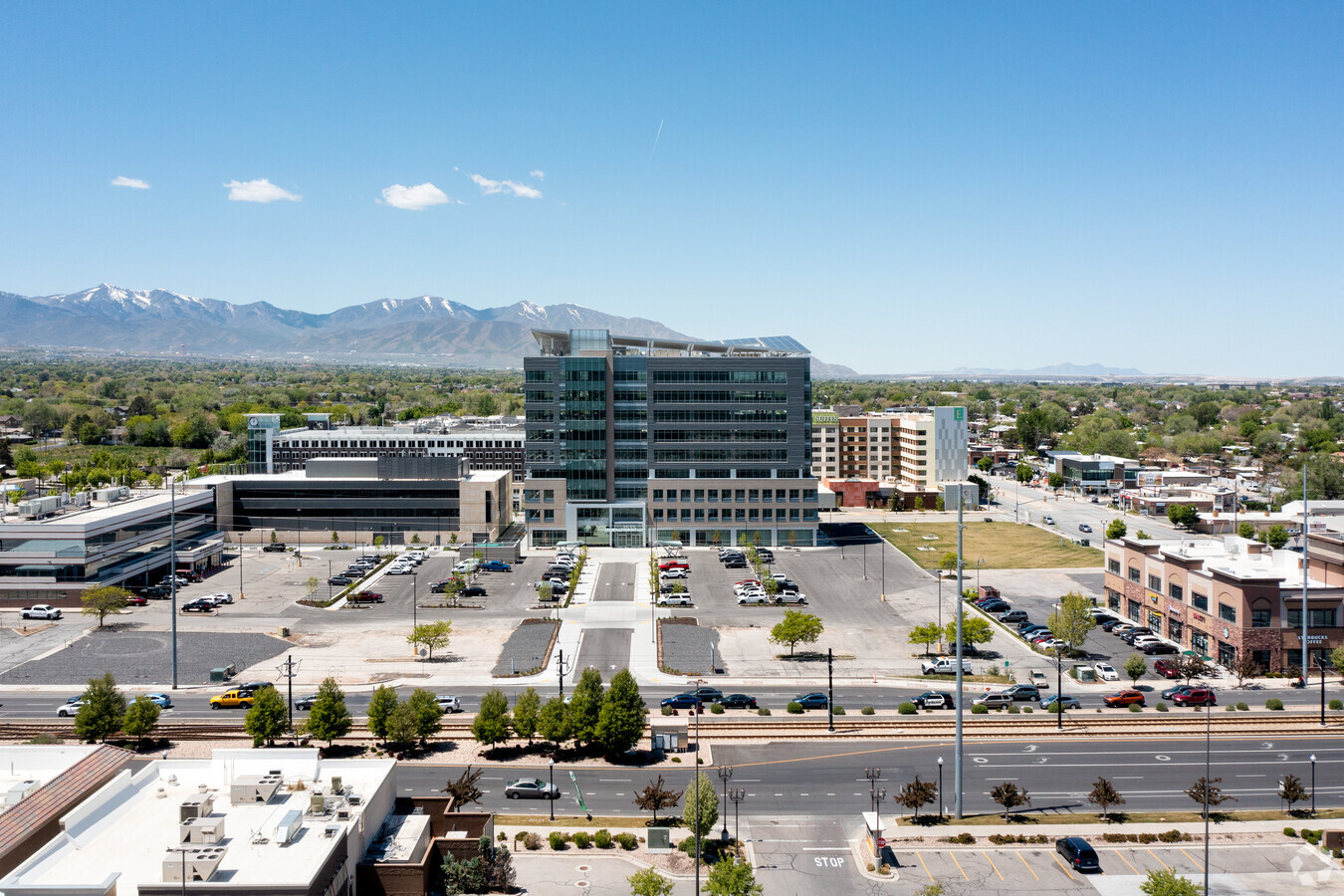
2787 W 3500 Blvd S, West Valley City, UT 84119

Current Lease Availabilities
NEARBY LISTINGS FOR SALE OR LEASE
Property Detail
2787 W 3500 Blvd S
15-33-129-069-4001
BEG S 89^5320 W 591.98 FT & S 00^0020 W 182.99 FT FR THEN 1/4 COR OF SEC 33, T1S, R1W, SLM; N 89^5320 E 119.96 FT;S 00^0041 W 15.96 FT; N 89^5320 E 142.00 FT; S 00^0041W 277.00 FT; S 89^5320 W 248.93 FT; N 00^0020 E 34.42 FT; NLY ALG A 466.66 FT RADI
Officebuilding
Salt Lake
X
Utah
49035C0280E
1.69 AC
2023
West Valley/Lake Park
2023
Salt Lake City
113310
Salt Lake City, UT
353,107 SF
DEMOGRAPHICS near 2787 W 3500 Blvd S
1 Mile
3 Mile
5 Mile
2024 Total Population
22,585
130,455
332,437
2029 Population
22,736
131,696
336,068
Pop Growth 2024-2029
+ 0.67%
+ 0.95%
+ 1.09%
Average Age
35
36
36
2024 Total Households
7,211
40,994
109,573
HH Growth 2024-2029
+ 0.75%
+ 0.97%
+ 1.13%
Median Household Inc
$58,927
$65,908
$67,999
Avg Household Size
3.00
3.00
2.90
2024 Avg HH Vehicles
2.00
2.00
2.00
Median Home Value
$305,375
$326,834
$351,546
Median Year Built
1981
1979
1980
Nearby Places
- Restaurants
- Banks
- Shops
- Fitness
- Groceries
PUBLIC TRANSPORTATION
TRANSIT/SUBWAY
West Valley Central Station (Green Line - Utah Transit Authority (UTA))
DRIVE
WALK
Distance
West Valley Central Station (Green Line - Utah Transit Authority (UTA))
0 min
2 min
0.1 mi
COMMUTER RAIL
North Temple Station (FrontRunner - Utah Transit Authority (UTA))
DRIVE
WALK
Distance
North Temple Station (FrontRunner - Utah Transit Authority (UTA))
16 min
8.4 mi
Warm Springs Relief Point (FrontRunner - Utah Transit Authority (UTA))
DRIVE
WALK
Distance
Warm Springs Relief Point (FrontRunner - Utah Transit Authority (UTA))
16 min
9.7 mi
AIRPORT
Salt Lake City International
DRIVE
WALK
Distance
Salt Lake City International
13 min
7.4 mi
Freight Ports
Port of Stockton
DRIVE
WALK
Distance
Port of Stockton
713 min
694.0 mi
Nearby Properties
Address
Land Use
TOTAL SIZE
Lot Size
Zoning
Address
Land Use
TOTAL SIZE
Lot Size
Zoning
488,509 SF
36.03 AC
FLEX
Address
Land Use
TOTAL SIZE
Lot Size
Zoning
488,509 SF
36.15 AC
LT-IND
Address
Land Use
TOTAL SIZE
Lot Size
Zoning
35,897 SF
28.61 AC
RM-12
Address
Land Use
TOTAL SIZE
Lot Size
Zoning
185,436 SF
25.23 AC
RM
Address
Land Use
TOTAL SIZE
Lot Size
Zoning
828,265 SF
9.06 AC
RM
Address
Land Use
TOTAL SIZE
Lot Size
Zoning
382,335 SF
63.87 AC
R-1-8
Address
Land Use
TOTAL SIZE
Lot Size
Zoning
322,076 SF
16.32 AC
PL
Address
Land Use
TOTAL SIZE
Lot Size
Zoning
62,939 SF
14.32 AC
RM
Address
Land Use
TOTAL SIZE
Lot Size
Zoning
76,096 SF
17.30 AC
RM
Address
Land Use
TOTAL SIZE
Lot Size
Zoning
178,102 SF
15.95 AC
C-3
Address
Land Use
TOTAL SIZE
Lot Size
Zoning
84,870 SF
9.76 AC
MPMU
Address
Land Use
TOTAL SIZE
Lot Size
Zoning
545,061 SF
38.41 AC
M
Address
Land Use
TOTAL SIZE
Lot Size
Zoning
289,725 SF
8.42 AC
1108
Address
Land Use
TOTAL SIZE
Lot Size
Zoning
63,758 SF
13.93 AC
RM
Address
Land Use
TOTAL SIZE
Lot Size
Zoning
82,485 SF
19.18 AC
RM
Address
Land Use
TOTAL SIZE
Lot Size
Zoning
217,700 SF
52.59 AC
FLEX
Address
Land Use
TOTAL SIZE
Lot Size
Zoning
116,268 SF
8.07 AC
RMF-45
Address
Land Use
TOTAL SIZE
Lot Size
Zoning
29.13 AC
C-2
Address
Land Use
TOTAL SIZE
Lot Size
Zoning
89,239 SF
14.78 AC
RM
Address
Land Use
TOTAL SIZE
Lot Size
Zoning
603,730 SF
31.77 AC
PO
Address
Land Use
TOTAL SIZE
Lot Size
Zoning
57,772 SF
8.09 AC
4144
Address
Land Use
TOTAL SIZE
Lot Size
Zoning
180,383 SF
4.77 AC
MXD
Address
Land Use
TOTAL SIZE
Lot Size
Zoning
46,874 SF
16.35 AC
RM
Address
Land Use
TOTAL SIZE
Lot Size
Zoning
398,192 SF
2.88 AC
CC
Address
Land Use
TOTAL SIZE
Lot Size
Zoning
393,809 SF
2.86 AC
CC
Address
Land Use
TOTAL SIZE
Lot Size
Zoning
436,875 SF
26.95 AC
M-1
Address
Land Use
TOTAL SIZE
Lot Size
Zoning
74,439 SF
27.33 AC
M
Address
Land Use
TOTAL SIZE
Lot Size
Zoning
750,887 SF
28 AC
M1
Address
Land Use
TOTAL SIZE
Lot Size
Zoning
330,834 SF
7.60 AC
R-1-8
Address
Land Use
TOTAL SIZE
Lot Size
Zoning
81,524 SF
12.81 AC
RM
The World's #1 Commercial Real Estate Marketplace
Connect with us
© 2025 CoStar Group
The information above has been obtained from sources believed reliable. While we do not doubt its accuracy we have not verified it and make no guarantee, warranty or representation about it. It is your responsibility to independently confirm its accuracy and completeness. Any projections, opinions, assumptions, or estimates used are for example only and do not represent the current or future performance of the property. The value of this transaction to you depends on tax and other factors which should be evaluated by your tax, financial, and legal advisors. You and your advisors should conduct a careful, independent investigation of the property to determine to your satisfaction the suitability of the property for your needs.