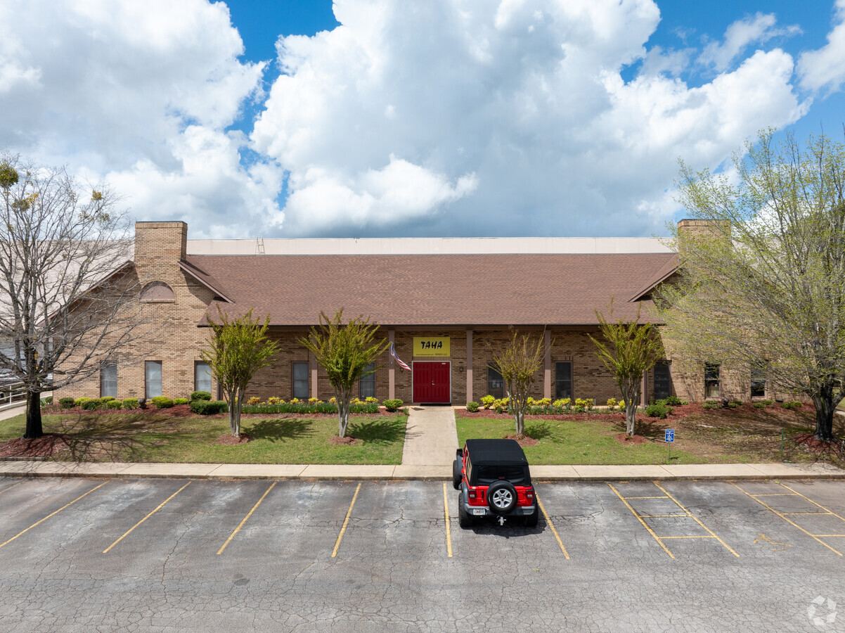
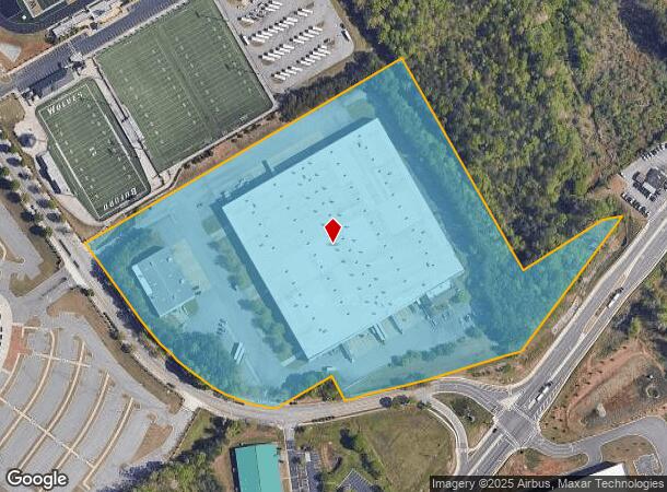
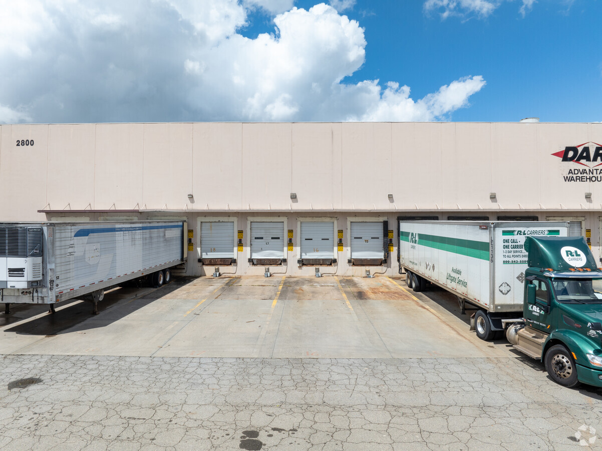
Property Record
2800 Sawnee Ave, Buford, GA 30518

Current Lease Availabilities
NEARBY LISTINGS FOR SALE OR LEASE
Property Detail
2800 Sawnee Ave
7-297-049
HWY 13
Warehouse
Gwinnett
X
Georgia
13139C0288G
297
2023
19.77 AC
2023
Duluth/Suwanee/Buford
050105
Atlanta
303,526 SF
Atlanta-Sandy Springs-Roswell, GA
DEMOGRAPHICS near 2800 Sawnee Ave
1 Mile
3 Mile
5 Mile
2024 Total Population
2,182
36,051
105,066
2029 Population
2,324
38,400
112,605
Pop Growth 2024-2029
+ 6.51%
+ 6.52%
+ 7.18%
Average Age
36
38
38
2024 Total Households
694
11,871
34,867
HH Growth 2024-2029
+ 6.63%
+ 6.71%
+ 7.35%
Median Household Inc
$70,908
$74,115
$83,674
Avg Household Size
3.10
3.00
3.00
2024 Avg HH Vehicles
2.00
2.00
2.00
Median Home Value
$372,618
$331,766
$332,205
Median Year Built
1988
1999
2002
Nearby Places
- Restaurants
- Banks
- Shops
- Fitness
- Groceries
Nearby Properties
Address
Land Use
TOTAL SIZE
Lot Size
Zoning
Address
Land Use
TOTAL SIZE
Lot Size
Zoning
285,000 SF
97.06 AC
M-I
Address
Land Use
TOTAL SIZE
Lot Size
Zoning
815,563 SF
58.80 AC
M-I
Address
Land Use
TOTAL SIZE
Lot Size
Zoning
101,632 SF
78.33 AC
M-I
Address
Land Use
TOTAL SIZE
Lot Size
Zoning
213,532 SF
44.32 AC
M-I
Address
Land Use
TOTAL SIZE
Lot Size
Zoning
286,520 SF
21.60 AC
P
Address
Land Use
TOTAL SIZE
Lot Size
Zoning
573,750 SF
43.94 AC
C1
Address
Land Use
TOTAL SIZE
Lot Size
Zoning
261,368 SF
5.80 AC
M-I
Address
Land Use
TOTAL SIZE
Lot Size
Zoning
875,180 SF
58.69 AC
C1
Address
Land Use
TOTAL SIZE
Lot Size
Zoning
652,710 SF
40.90 AC
M1
Address
Land Use
TOTAL SIZE
Lot Size
Zoning
427,000 SF
37.90 AC
M1
Address
Land Use
TOTAL SIZE
Lot Size
Zoning
488,890 SF
59.62 AC
M1
Address
Land Use
TOTAL SIZE
Lot Size
Zoning
143,000 SF
41.30 AC
M-I
Address
Land Use
TOTAL SIZE
Lot Size
Zoning
641,180 SF
57.04 AC
M1
Address
Land Use
TOTAL SIZE
Lot Size
Zoning
422,933 SF
42.35 AC
M1
Address
Land Use
TOTAL SIZE
Lot Size
Zoning
150,591 SF
24.39 AC
P
Address
Land Use
TOTAL SIZE
Lot Size
Zoning
458,256 SF
26.39 AC
M-I
Address
Land Use
TOTAL SIZE
Lot Size
Zoning
461,700 SF
43.77 AC
C2
Address
Land Use
TOTAL SIZE
Lot Size
Zoning
300,000 SF
23.03 AC
M-II
Address
Land Use
TOTAL SIZE
Lot Size
Zoning
72,304 SF
83.10 AC
R100
Address
Land Use
TOTAL SIZE
Lot Size
Zoning
224,093 SF
33.94 AC
M-I
Address
Land Use
TOTAL SIZE
Lot Size
Zoning
88,704 SF
66.08 AC
M1
Address
Land Use
TOTAL SIZE
Lot Size
Zoning
92,789 SF
8.93 AC
C2
Address
Land Use
TOTAL SIZE
Lot Size
Zoning
445,214 SF
54.83 AC
C2
Address
Land Use
TOTAL SIZE
Lot Size
Zoning
274,018 SF
25.57 AC
M1
Address
Land Use
TOTAL SIZE
Lot Size
Zoning
250,444 SF
32.04 AC
M1
Address
Land Use
TOTAL SIZE
Lot Size
Zoning
302,477 SF
15.01 AC
C1-NBHD BU
Address
Land Use
TOTAL SIZE
Lot Size
Zoning
151,330 SF
19.30 AC
RM
Address
Land Use
TOTAL SIZE
Lot Size
Zoning
110,557 SF
93.99 AC
P
Address
Land Use
TOTAL SIZE
Lot Size
Zoning
236,184 SF
26.58 AC
M1
The World's #1 Commercial Real Estate Marketplace
Connect with us
© 2025 CoStar Group
The information above has been obtained from sources believed reliable. While we do not doubt its accuracy we have not verified it and make no guarantee, warranty or representation about it. It is your responsibility to independently confirm its accuracy and completeness. Any projections, opinions, assumptions, or estimates used are for example only and do not represent the current or future performance of the property. The value of this transaction to you depends on tax and other factors which should be evaluated by your tax, financial, and legal advisors. You and your advisors should conduct a careful, independent investigation of the property to determine to your satisfaction the suitability of the property for your needs.