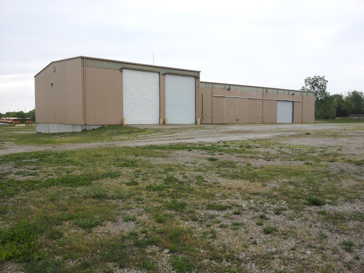
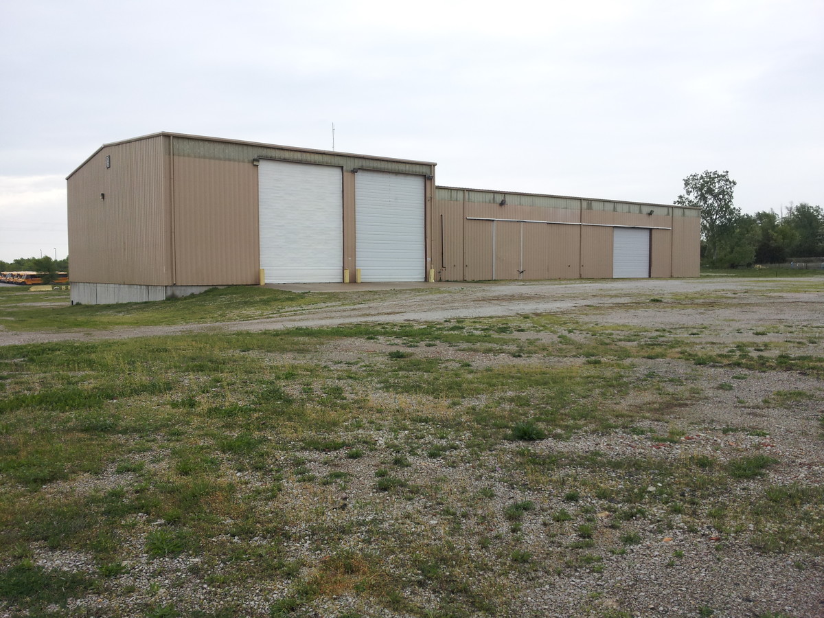
Property Record
2801 S Brickplant Rd, Harrisonville, MO 64701
NEARBY LISTINGS FOR SALE OR LEASE
Property Detail
2801 S Brickplant Rd
Kansas City, MO-KS
Brickyard Ind Pk
0946001
Cass
Officebuilding
Missouri
X
4 AC
29037C0188F
Cass County
44,700 SF
Kansas City
DEMOGRAPHICS near 2801 S Brickplant Rd
1 Mile
3 Mile
5 Mile
2024 Total Population
1,116
11,104
13,752
2029 Population
1,184
11,756
14,556
Pop Growth 2024-2029
+ 6.09%
+ 5.87%
+ 5.85%
Average Age
37
40
41
2024 Total Households
409
4,289
5,281
HH Growth 2024-2029
+ 6.11%
+ 5.99%
+ 5.96%
Median Household Inc
$57,307
$61,865
$65,513
Avg Household Size
2.40
2.40
2.50
2024 Avg HH Vehicles
2.00
2.00
2.00
Median Home Value
$133,064
$206,483
$230,260
Median Year Built
1974
1975
1977
Nearby Places
- Restaurants
- Banks
- Shops
- Fitness
- Groceries
Nearby Properties
Address
Land Use
TOTAL SIZE
Lot Size
Zoning
Address
Land Use
TOTAL SIZE
Lot Size
Zoning
197,883 SF
30 AC
Address
Land Use
TOTAL SIZE
Lot Size
Zoning
367,575 SF
53.34 AC
Address
Land Use
TOTAL SIZE
Lot Size
Zoning
996,962 SF
75.28 AC
Address
Land Use
TOTAL SIZE
Lot Size
Zoning
219,735 SF
33.54 AC
Address
Land Use
TOTAL SIZE
Lot Size
Zoning
1,030,621 SF
43.38 AC
Address
Land Use
TOTAL SIZE
Lot Size
Zoning
411,232 SF
26.77 AC
Address
Land Use
TOTAL SIZE
Lot Size
Zoning
157,628 SF
5.06 AC
Address
Land Use
TOTAL SIZE
Lot Size
Zoning
1,126,810 SF
17.17 AC
Address
Land Use
TOTAL SIZE
Lot Size
Zoning
42,378 SF
14.20 AC
Address
Land Use
TOTAL SIZE
Lot Size
Zoning
Address
Land Use
TOTAL SIZE
Lot Size
Zoning
53,673 SF
12.16 AC
Address
Land Use
TOTAL SIZE
Lot Size
Zoning
19,600 SF
6.30 AC
Address
Land Use
TOTAL SIZE
Lot Size
Zoning
103,920 SF
12.29 AC
Address
Land Use
TOTAL SIZE
Lot Size
Zoning
40,784 SF
0.45 AC
Address
Land Use
TOTAL SIZE
Lot Size
Zoning
45,480 SF
6.46 AC
Address
Land Use
TOTAL SIZE
Lot Size
Zoning
435,678 SF
20 AC
Address
Land Use
TOTAL SIZE
Lot Size
Zoning
74,086 SF
5.39 AC
Address
Land Use
TOTAL SIZE
Lot Size
Zoning
88,957 SF
9.93 AC
Address
Land Use
TOTAL SIZE
Lot Size
Zoning
20,600 SF
3.90 AC
Address
Land Use
TOTAL SIZE
Lot Size
Zoning
107,500 SF
7.10 AC
Address
Land Use
TOTAL SIZE
Lot Size
Zoning
48.57 AC
Address
Land Use
TOTAL SIZE
Lot Size
Zoning
55,428 SF
10 AC
Address
Land Use
TOTAL SIZE
Lot Size
Zoning
11,070 SF
10.15 AC
Address
Land Use
TOTAL SIZE
Lot Size
Zoning
7,540 SF
0.82 AC
Address
Land Use
TOTAL SIZE
Lot Size
Zoning
90,300 SF
34.03 AC
Address
Land Use
TOTAL SIZE
Lot Size
Zoning
45,944 SF
7 AC
Address
Land Use
TOTAL SIZE
Lot Size
Zoning
Address
Land Use
TOTAL SIZE
Lot Size
Zoning
4,800 SF
0.40 AC
Address
Land Use
TOTAL SIZE
Lot Size
Zoning
84,525 SF
4.84 AC
Address
Land Use
TOTAL SIZE
Lot Size
Zoning
5,812 SF
19.87 AC
The World's #1 Commercial Real Estate Marketplace
Connect with us
© 2025 CoStar Group
The information above has been obtained from sources believed reliable. While we do not doubt its accuracy we have not verified it and make no guarantee, warranty or representation about it. It is your responsibility to independently confirm its accuracy and completeness. Any projections, opinions, assumptions, or estimates used are for example only and do not represent the current or future performance of the property. The value of this transaction to you depends on tax and other factors which should be evaluated by your tax, financial, and legal advisors. You and your advisors should conduct a careful, independent investigation of the property to determine to your satisfaction the suitability of the property for your needs.