Property Record
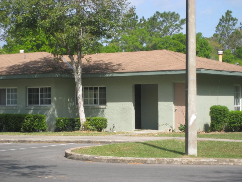
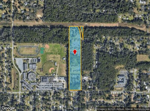
2802 Ne 4Th Ct, Ocala, FL 34470
NEARBY LISTINGS FOR SALE OR LEASE
-
-
View all Ocala listings for sale on LoopNet.com
Property Detail
2802 Ne 4Th Ct
24868-003-02
SEC 05 TWP 15 RGE 22 S 1780.87 FT OF E 357.67 FT OF W 1/2 OF NW 1/4 EX S 15 FT SUBJECT TO AN EASEMENT FOR THE 230KV TRANSMISSION SYSTEM DESC AS COM NW COR S 00-23-40 W 41.02 FT TO S ROW NW 35TH ST N 89-35-00 W 584.82 FT S 00-10- 40 W 965.50 FT S 89-2
Apartment
Marion
AE
Florida
12083C0509E
14.46 AC
2023
Eastern Marion County
2023
Ocala
001401
Ocala, FL
79,249 SF
DEMOGRAPHICS near 2802 Ne 4Th Ct
1 Mile
3 Mile
5 Mile
2024 Total Population
4,872
39,291
85,081
2029 Population
5,511
44,348
95,843
Pop Growth 2024-2029
+ 13.12%
+ 12.87%
+ 12.65%
Average Age
36
39
42
2024 Total Households
1,780
16,057
35,204
HH Growth 2024-2029
+ 13.15%
+ 12.82%
+ 12.71%
Median Household Inc
$35,367
$40,869
$50,856
Avg Household Size
2.70
2.40
2.30
2024 Avg HH Vehicles
1.00
2.00
2.00
Median Home Value
$135,097
$156,511
$187,426
Median Year Built
1978
1977
1982
Nearby Places
- Restaurants
- Banks
- Shops
- Fitness
- Groceries
Nearby Properties
Address
Land Use
TOTAL SIZE
Lot Size
Zoning
Address
Land Use
TOTAL SIZE
Lot Size
Zoning
207,950 SF
14.08 AC
INST
Address
Land Use
TOTAL SIZE
Lot Size
Zoning
326,425 SF
11.66 AC
INST
Address
Land Use
TOTAL SIZE
Lot Size
Zoning
195,992 SF
5.72 AC
FBC
Address
Land Use
TOTAL SIZE
Lot Size
Zoning
441,040 SF
150.01 AC
M1
Address
Land Use
TOTAL SIZE
Lot Size
Zoning
350,895 SF
27.85 AC
M1
Address
Land Use
TOTAL SIZE
Lot Size
Zoning
180,334 SF
24.29 AC
INST
Address
Land Use
TOTAL SIZE
Lot Size
Zoning
111,395 SF
13 AC
B2
Address
Land Use
TOTAL SIZE
Lot Size
Zoning
116,035 SF
38.20 AC
GU
Address
Land Use
TOTAL SIZE
Lot Size
Zoning
30,334 SF
29.72 AC
GU
Address
Land Use
TOTAL SIZE
Lot Size
Zoning
78,280 SF
12.54 AC
R3
Address
Land Use
TOTAL SIZE
Lot Size
Zoning
19,117 SF
0.98 AC
FBC
Address
Land Use
TOTAL SIZE
Lot Size
Zoning
112,663 SF
32.72 AC
INST
Address
Land Use
TOTAL SIZE
Lot Size
Zoning
26,801 SF
5.66 AC
FBC
Address
Land Use
TOTAL SIZE
Lot Size
Zoning
384,930 SF
17.76 AC
M1
Address
Land Use
TOTAL SIZE
Lot Size
Zoning
80,571 SF
13.72 AC
INST
Address
Land Use
TOTAL SIZE
Lot Size
Zoning
104,732 SF
6.38 AC
M1
Address
Land Use
TOTAL SIZE
Lot Size
Zoning
81,689 SF
11.05 AC
B2
Address
Land Use
TOTAL SIZE
Lot Size
Zoning
50,199 SF
4.74 AC
FBC
Address
Land Use
TOTAL SIZE
Lot Size
Zoning
50,369 SF
6.99 AC
B2
Address
Land Use
TOTAL SIZE
Lot Size
Zoning
94,360 SF
17.51 AC
B5
Address
Land Use
TOTAL SIZE
Lot Size
Zoning
116,876 SF
23.78 AC
M2
Address
Land Use
TOTAL SIZE
Lot Size
Zoning
73,361 SF
23.20 AC
GU
Address
Land Use
TOTAL SIZE
Lot Size
Zoning
47,567 SF
12 AC
INST
Address
Land Use
TOTAL SIZE
Lot Size
Zoning
55,809 SF
6.30 AC
M2
Address
Land Use
TOTAL SIZE
Lot Size
Zoning
64,438 SF
12.27 AC
B4
Address
Land Use
TOTAL SIZE
Lot Size
Zoning
79,311 SF
10.12 AC
INST
Address
Land Use
TOTAL SIZE
Lot Size
Zoning
15,800 SF
1.15 AC
FBC
Address
Land Use
TOTAL SIZE
Lot Size
Zoning
39,552 SF
5.97 AC
R3
Address
Land Use
TOTAL SIZE
Lot Size
Zoning
121,462 SF
10.92 AC
B2
Address
Land Use
TOTAL SIZE
Lot Size
Zoning
81,174 SF
18.50 AC
B2
The World's #1 Commercial Real Estate Marketplace
Connect with us
© 2025 CoStar Group
The information above has been obtained from sources believed reliable. While we do not doubt its accuracy we have not verified it and make no guarantee, warranty or representation about it. It is your responsibility to independently confirm its accuracy and completeness. Any projections, opinions, assumptions, or estimates used are for example only and do not represent the current or future performance of the property. The value of this transaction to you depends on tax and other factors which should be evaluated by your tax, financial, and legal advisors. You and your advisors should conduct a careful, independent investigation of the property to determine to your satisfaction the suitability of the property for your needs.