Property Record
2808 Menards Dr, Evansville, IN 47715

NEARBY LISTINGS FOR SALE OR LEASE
-
-
1510 Tutor Lane Evansville In 47715
Evansville, IN 47715
$329,000 - $2,354,000
0.78 - 1.22 AC Lot
Land
-
-
-
-
-
-
View all Evansville listings for sale on LoopNet.com
Property Detail
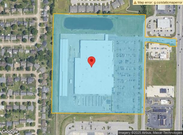
2808 Menards Dr
82-06-14-015-170.007-027
Stonefield Crossing Sub
Wholesaleoutletdiscountstore
STONEFIELD CROSSING SUB (SECOND CORRECTED PLAT) L 8 & L 9 SEC 14-6-10
AE
Vanderburgh
18173C0115D
Indiana
2023
22.71 AC
2023
Eastside
000204
Evansville
162,726 SF
Evansville, IN-KY
DEMOGRAPHICS near 2808 Menards Dr
1 Mile
3 Mile
5 Mile
2024 Total Population
7,444
37,662
131,966
2029 Population
7,375
37,449
132,943
Pop Growth 2024-2029
(0.93%)
(0.57%)
+ 0.74%
Average Age
44
42
40
2024 Total Households
3,827
17,185
56,830
HH Growth 2024-2029
(0.94%)
(0.57%)
+ 0.71%
Median Household Inc
$47,465
$55,428
$52,209
Avg Household Size
1.90
2.10
2.20
2024 Avg HH Vehicles
1.00
2.00
2.00
Median Home Value
$154,781
$151,638
$144,051
Median Year Built
1986
1973
1970
Nearby Places
- Restaurants
- Banks
- Shops
- Fitness
- Groceries
PUBLIC TRANSPORTATION
AIRPORT
Evansville Regional
DRIVE
WALK
Distance
Evansville Regional
10 min
5.2 mi
Freight Ports
Port of Toledo
DRIVE
WALK
Distance
Port of Toledo
451 min
389.3 mi
SALE & LEASE HISTORY
LISTING DATE
SALE/LEASE

Sep 24, 2016
For Sale
Nearby Properties
Address
Land Use
TOTAL SIZE
Lot Size
Zoning
Address
Land Use
TOTAL SIZE
Lot Size
Zoning
169,860 SF
20.33 AC
Address
Land Use
TOTAL SIZE
Lot Size
Zoning
451,370 SF
23.93 AC
Address
Land Use
TOTAL SIZE
Lot Size
Zoning
132,150 SF
11.36 AC
Address
Land Use
TOTAL SIZE
Lot Size
Zoning
75,282 SF
7.56 AC
Address
Land Use
TOTAL SIZE
Lot Size
Zoning
37,199 SF
27.28 AC
Address
Land Use
TOTAL SIZE
Lot Size
Zoning
38,566 SF
10.50 AC
Address
Land Use
TOTAL SIZE
Lot Size
Zoning
176,128 SF
18.91 AC
Address
Land Use
TOTAL SIZE
Lot Size
Zoning
5,000 SF
21.20 AC
Address
Land Use
TOTAL SIZE
Lot Size
Zoning
27,984 SF
10.28 AC
Address
Land Use
TOTAL SIZE
Lot Size
Zoning
992,266 SF
116.92 AC
Address
Land Use
TOTAL SIZE
Lot Size
Zoning
194,564 SF
24.47 AC
Address
Land Use
TOTAL SIZE
Lot Size
Zoning
153,640 SF
20.09 AC
Address
Land Use
TOTAL SIZE
Lot Size
Zoning
210,137 SF
18 AC
Address
Land Use
TOTAL SIZE
Lot Size
Zoning
3,405 SF
24.60 AC
Address
Land Use
TOTAL SIZE
Lot Size
Zoning
4,165 SF
17.92 AC
Address
Land Use
TOTAL SIZE
Lot Size
Zoning
4,831 SF
22.16 AC
Address
Land Use
TOTAL SIZE
Lot Size
Zoning
103,226 SF
10.64 AC
Address
Land Use
TOTAL SIZE
Lot Size
Zoning
143,846 SF
11.09 AC
Address
Land Use
TOTAL SIZE
Lot Size
Zoning
5,005 SF
20.13 AC
Address
Land Use
TOTAL SIZE
Lot Size
Zoning
10,619 SF
29.18 AC
Address
Land Use
TOTAL SIZE
Lot Size
Zoning
8,700 SF
22.09 AC
Address
Land Use
TOTAL SIZE
Lot Size
Zoning
132,574 SF
17.09 AC
Address
Land Use
TOTAL SIZE
Lot Size
Zoning
4,234 SF
17.46 AC
Address
Land Use
TOTAL SIZE
Lot Size
Zoning
311,804 SF
31.94 AC
Address
Land Use
TOTAL SIZE
Lot Size
Zoning
60,642 SF
8.66 AC
Address
Land Use
TOTAL SIZE
Lot Size
Zoning
66,456 SF
39.47 AC
Address
Land Use
TOTAL SIZE
Lot Size
Zoning
3,950 SF
16.77 AC
Address
Land Use
TOTAL SIZE
Lot Size
Zoning
59,642 SF
12.11 AC
Address
Land Use
TOTAL SIZE
Lot Size
Zoning
184,046 SF
10.05 AC
The World's #1 Commercial Real Estate Marketplace
Connect with us
© 2025 CoStar Group
The information above has been obtained from sources believed reliable. While we do not doubt its accuracy we have not verified it and make no guarantee, warranty or representation about it. It is your responsibility to independently confirm its accuracy and completeness. Any projections, opinions, assumptions, or estimates used are for example only and do not represent the current or future performance of the property. The value of this transaction to you depends on tax and other factors which should be evaluated by your tax, financial, and legal advisors. You and your advisors should conduct a careful, independent investigation of the property to determine to your satisfaction the suitability of the property for your needs.