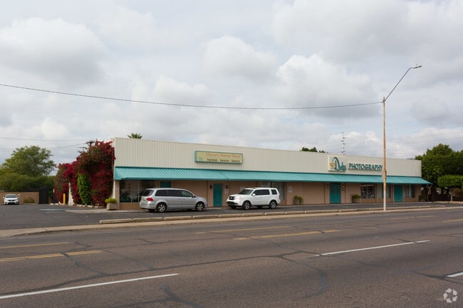
Property Record
701 W Thomas Rd, Phoenix, AZ 85013

NEARBY LISTINGS FOR SALE OR LEASE
Property Detail
701 W Thomas Rd
111-13-012
Encanto Manor
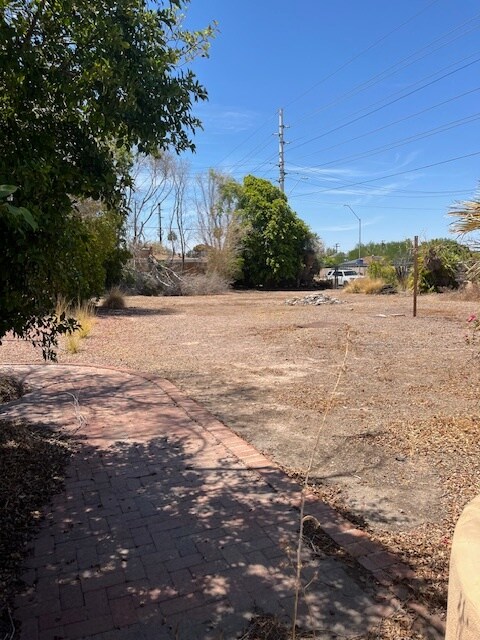
Commercialacreage
TH PT NE4 NE4 USING AS A BASE TH N LI OF NE4 WITH AN ASUMD BRG OF EAST-BEG AT INTERSEC OF C/L OF 7TH AVE & N LI NE4 FR WH NE COR BEARS E 121.75 TH W 133 TH S 2D 19 30 E 133 TH E 133 TO C/L 7TH AVE TH N 2D1930 W ALG C/L 7TH AVE 133 TO POB EX N 42 & EX
X
Maricopa
04013C2205L
Arizona
2025
0.19 AC
2025
Downtown Phoenix
108802
Phoenix
1,798 SF
Phoenix-Mesa-Scottsdale, AZ
DEMOGRAPHICS near 701 W Thomas Rd
1 Mile
3 Mile
5 Mile
2024 Total Population
16,708
172,010
426,270
2029 Population
18,281
187,653
461,985
Pop Growth 2024-2029
+ 9.41%
+ 9.09%
+ 8.38%
Average Age
40
36
36
2024 Total Households
8,750
74,124
163,222
HH Growth 2024-2029
+ 9.65%
+ 9.52%
+ 8.89%
Median Household Inc
$69,119
$53,717
$55,158
Avg Household Size
1.90
2.20
2.40
2024 Avg HH Vehicles
1.00
1.00
2.00
Median Home Value
$458,537
$375,899
$359,983
Median Year Built
1965
1969
1969
Nearby Places
Map Layers
Map Styles
 Street
 Aerial
- Restaurants
- Banks
- Shops
- Fitness
- Groceries
PUBLIC TRANSPORTATION
TRANSIT/SUBWAY
Thomas/Central Ave (METRO Light Rail - Valley Metro (Phoenix Light Rail))
DRIVE
WALK
Distance
Thomas/Central Ave (METRO Light Rail - Valley Metro (Phoenix Light Rail))
1 min
12 min
0.6 mi
Osborn/Central Ave (METRO Light Rail - Valley Metro (Phoenix Light Rail))
DRIVE
WALK
Distance
Osborn/Central Ave (METRO Light Rail - Valley Metro (Phoenix Light Rail))
3 min
18 min
1.0 mi
Encanto/Central Ave (METRO Light Rail - Valley Metro (Phoenix Light Rail))
DRIVE
WALK
Distance
Encanto/Central Ave (METRO Light Rail - Valley Metro (Phoenix Light Rail))
2 min
19 min
1.0 mi
AIRPORT
Phoenix Sky Harbor International
DRIVE
WALK
Distance
Phoenix Sky Harbor International
14 min
8.0 mi
Phoenix-Mesa Gateway
DRIVE
WALK
Distance
Phoenix-Mesa Gateway
46 min
34.8 mi
Freight Ports
Port of San Diego
DRIVE
WALK
Distance
Port of San Diego
395 min
355.4 mi
SALE & LEASE HISTORY
LISTING DATE
SALE/LEASE

Aug 25, 2024
For Sale
Aug 14, 2023
For Lease
Aug 14, 2023
For Sale
Nearby Properties
Address
Land Use
TOTAL SIZE
Lot Size
Zoning
Address
Land Use
TOTAL SIZE
Lot Size
Zoning
582,073 SF
1.45 AC
C-C
Address
Land Use
TOTAL SIZE
Lot Size
Zoning
1.85 AC
Address
Land Use
TOTAL SIZE
Lot Size
Zoning
455,443 SF
3.21 AC
C-C
Address
Land Use
TOTAL SIZE
Lot Size
Zoning
997,436 SF
24.84 AC
DC
Address
Land Use
TOTAL SIZE
Lot Size
Zoning
339,909 SF
3 AC
C-C
Address
Land Use
TOTAL SIZE
Lot Size
Zoning
2,568,761 SF
48.36 AC
C-C
Address
Land Use
TOTAL SIZE
Lot Size
Zoning
437,102 SF
1.02 AC
C-2
Address
Land Use
TOTAL SIZE
Lot Size
Zoning
2,006,402 SF
18.66 AC
C-C
Address
Land Use
TOTAL SIZE
Lot Size
Zoning
2,334,671 SF
32.63 AC
C-2
Address
Land Use
TOTAL SIZE
Lot Size
Zoning
191,120 SF
1.43 AC
C-C
Address
Land Use
TOTAL SIZE
Lot Size
Zoning
1,636,025 SF
16.50 AC
C-DT
Address
Land Use
TOTAL SIZE
Lot Size
Zoning
577,883 SF
2.05 AC
C-DT
Address
Land Use
TOTAL SIZE
Lot Size
Zoning
568,512 SF
6.99 AC
C-DT
Address
Land Use
TOTAL SIZE
Lot Size
Zoning
671,803 SF
2.99 AC
C-DT
Address
Land Use
TOTAL SIZE
Lot Size
Zoning
833,326 SF
1.31 AC
C-DT
Address
Land Use
TOTAL SIZE
Lot Size
Zoning
940,067 SF
12.22 AC
DTCBIO
Address
Land Use
TOTAL SIZE
Lot Size
Zoning
96,183 SF
11.04 AC
R-6
Address
Land Use
TOTAL SIZE
Lot Size
Zoning
536,452 SF
0.58 AC
C-DT
Address
Land Use
TOTAL SIZE
Lot Size
Zoning
981,015 SF
2.83 AC
C-DT
Address
Land Use
TOTAL SIZE
Lot Size
Zoning
429,457 SF
9.41 AC
C-DT
Address
Land Use
TOTAL SIZE
Lot Size
Zoning
384,291 SF
2.68 AC
C-DT
Address
Land Use
TOTAL SIZE
Lot Size
Zoning
782,912 SF
1.12 AC
C-DT
Address
Land Use
TOTAL SIZE
Lot Size
Zoning
550,269 SF
2.05 AC
DTCBCORE
Address
Land Use
TOTAL SIZE
Lot Size
Zoning
727,848 SF
0.06 AC
C-DT
Address
Land Use
TOTAL SIZE
Lot Size
Zoning
913,637 SF
35.53 AC
M-H
Address
Land Use
TOTAL SIZE
Lot Size
Zoning
569,100 SF
0.95 AC
C-DT
Address
Land Use
TOTAL SIZE
Lot Size
Zoning
222,983 SF
1.61 AC
C-DT
Address
Land Use
TOTAL SIZE
Lot Size
Zoning
686,094 SF
5.09 AC
C-C
Address
Land Use
TOTAL SIZE
Lot Size
Zoning
610,451 SF
4.21 AC
C-C
Address
Land Use
TOTAL SIZE
Lot Size
Zoning
631,780 SF
2.07 AC
C-DT
The World's #1 Commercial Real Estate Marketplace
Connect with us
© 2025 CoStar Group
The information above has been obtained from sources believed reliable. While we do not doubt its accuracy we have not verified it and make no guarantee, warranty or representation about it. It is your responsibility to independently confirm its accuracy and completeness. Any projections, opinions, assumptions, or estimates used are for example only and do not represent the current or future performance of the property. The value of this transaction to you depends on tax and other factors which should be evaluated by your tax, financial, and legal advisors. You and your advisors should conduct a careful, independent investigation of the property to determine to your satisfaction the suitability of the property for your needs.