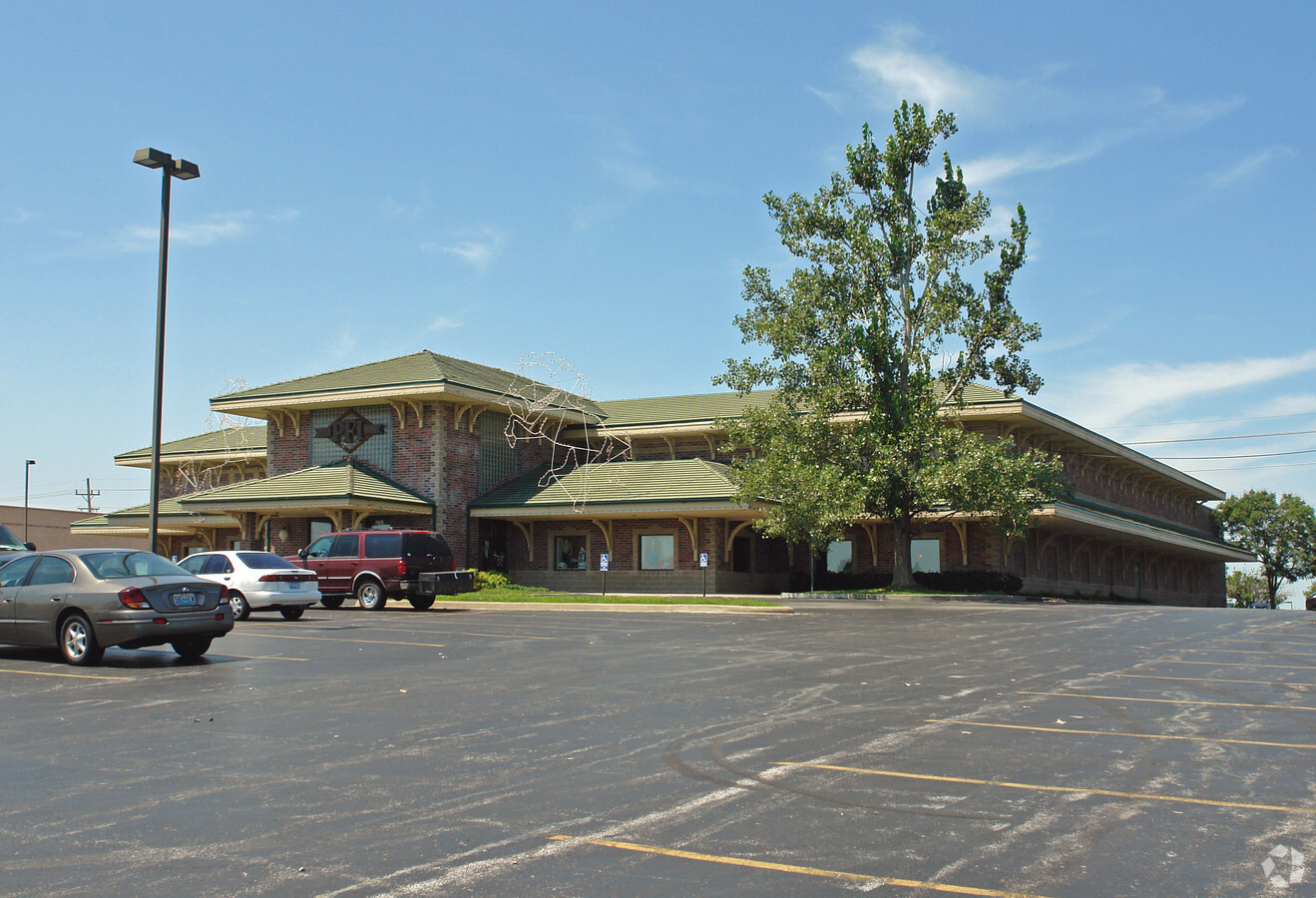
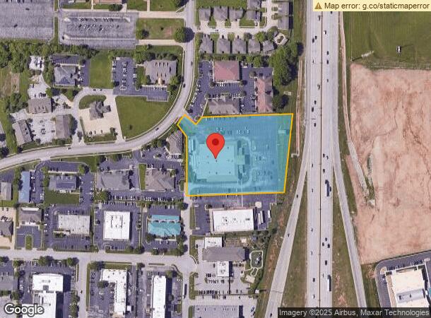
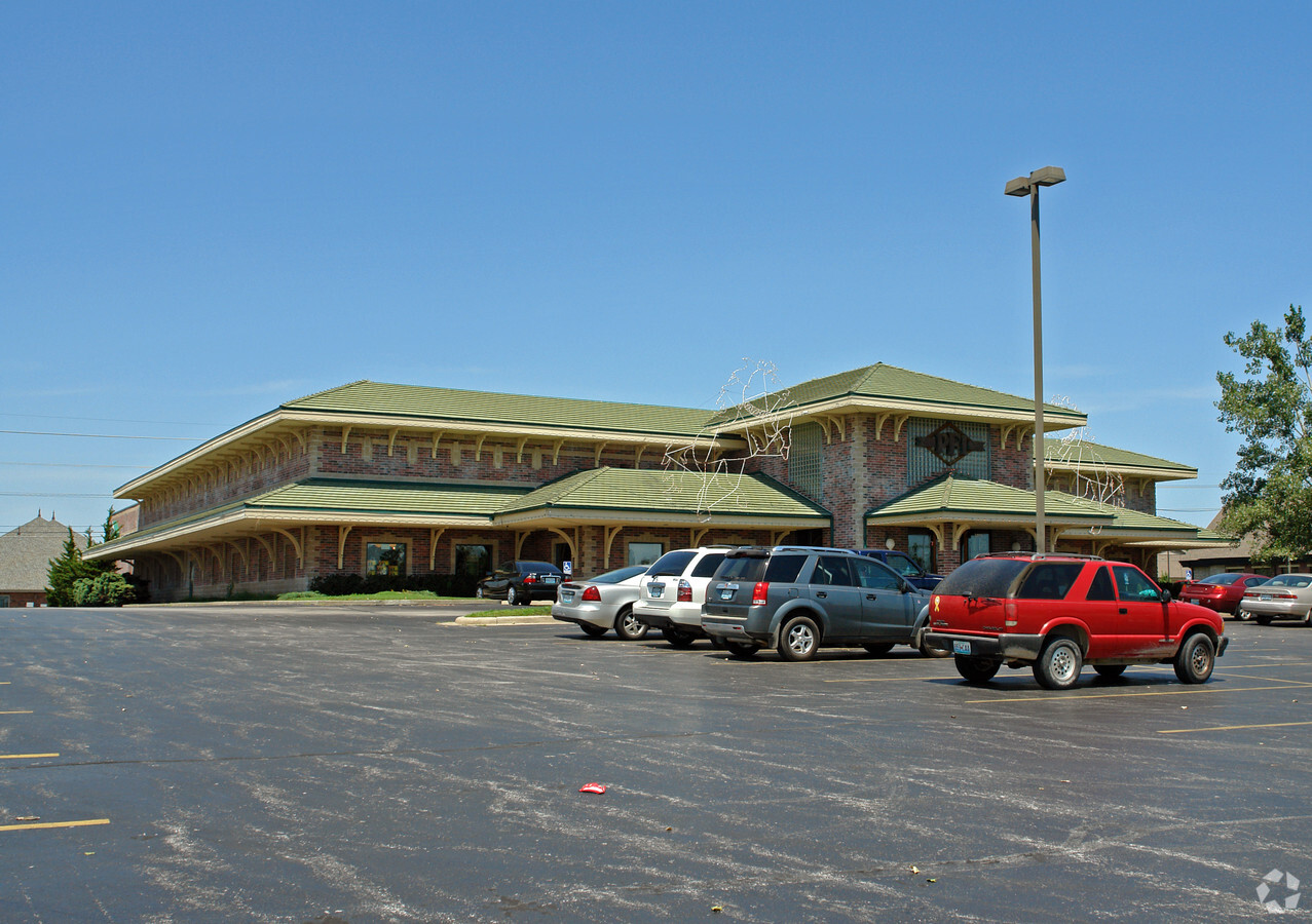
Property Record
2816 S Ingram Mill Rd, Springfield, MO 65804
NEARBY LISTINGS FOR SALE OR LEASE
Property Detail
2816 S Ingram Mill Rd
Springfield, MO
Deerfield Office
19-03-202-098
DEERFIELD OFFICE PARK BEG 23.13 FT N SE COR LOT 8 WLY 400.95 FT SWLY 41.26 FTNWLY 70 FT M/L SWLY 58.39 FT SELY 73.60 FT SLY
Commercialnec
Greene
X
Missouri
29077C0361E
8
2024
3.80 AC
2024
Southeast
002502
Springfield
33,190 SF
DEMOGRAPHICS near 2816 S Ingram Mill Rd
1 Mile
3 Mile
5 Mile
2024 Total Population
7,007
44,729
118,420
2029 Population
7,207
46,280
122,599
Pop Growth 2024-2029
+ 2.85%
+ 3.47%
+ 3.53%
Average Age
42
42
40
2024 Total Households
3,250
20,385
53,932
HH Growth 2024-2029
+ 3.05%
+ 3.67%
+ 3.77%
Median Household Inc
$56,696
$58,820
$51,222
Avg Household Size
2.10
2.10
2.00
2024 Avg HH Vehicles
2.00
2.00
2.00
Median Home Value
$263,552
$217,306
$196,145
Median Year Built
1984
1978
1978
Nearby Places
- Restaurants
- Banks
- Shops
- Fitness
- Groceries
PUBLIC TRANSPORTATION
AIRPORT
Springfield-Branson Ntl
DRIVE
WALK
Distance
Springfield-Branson Ntl
31 min
19.4 mi
Freight Ports
Tulsa Port of Inola
DRIVE
WALK
Distance
Tulsa Port of Inola
200 min
178.7 mi
Nearby Properties
Address
Land Use
TOTAL SIZE
Lot Size
Zoning
Address
Land Use
TOTAL SIZE
Lot Size
Zoning
162,468 SF
35.77 AC
INC
Address
Land Use
TOTAL SIZE
Lot Size
Zoning
299,725 SF
18.80 AC
INC
Address
Land Use
TOTAL SIZE
Lot Size
Zoning
376,072 SF
17.67 AC
INC
Address
Land Use
TOTAL SIZE
Lot Size
Zoning
210,374 SF
24.37 AC
INC
Address
Land Use
TOTAL SIZE
Lot Size
Zoning
224,730 SF
19.99 AC
INC
Address
Land Use
TOTAL SIZE
Lot Size
Zoning
10.29 AC
INC.
Address
Land Use
TOTAL SIZE
Lot Size
Zoning
15.46 AC
Address
Land Use
TOTAL SIZE
Lot Size
Zoning
211,041 SF
19.13 AC
INC
Address
Land Use
TOTAL SIZE
Lot Size
Zoning
51.65 AC
INC
Address
Land Use
TOTAL SIZE
Lot Size
Zoning
4.63 AC
O-2
Address
Land Use
TOTAL SIZE
Lot Size
Zoning
779,221 SF
45.03 AC
INC
Address
Land Use
TOTAL SIZE
Lot Size
Zoning
3.43 AC
INC
Address
Land Use
TOTAL SIZE
Lot Size
Zoning
12.74 AC
Address
Land Use
TOTAL SIZE
Lot Size
Zoning
8.24 AC
INC
Address
Land Use
TOTAL SIZE
Lot Size
Zoning
17.07 AC
INC.
Address
Land Use
TOTAL SIZE
Lot Size
Zoning
25.51 AC
INC
Address
Land Use
TOTAL SIZE
Lot Size
Zoning
324,341 SF
43 AC
INC
Address
Land Use
TOTAL SIZE
Lot Size
Zoning
12.90 AC
INC
Address
Land Use
TOTAL SIZE
Lot Size
Zoning
2 AC
INC.
Address
Land Use
TOTAL SIZE
Lot Size
Zoning
6.50 AC
INC.
Address
Land Use
TOTAL SIZE
Lot Size
Zoning
26,240 SF
2.39 AC
INC.
Address
Land Use
TOTAL SIZE
Lot Size
Zoning
11.50 AC
INC
Address
Land Use
TOTAL SIZE
Lot Size
Zoning
2.69 AC
INC
Address
Land Use
TOTAL SIZE
Lot Size
Zoning
89,310 SF
10.89 AC
INC
Address
Land Use
TOTAL SIZE
Lot Size
Zoning
66,686 SF
1.91 AC
INC
Address
Land Use
TOTAL SIZE
Lot Size
Zoning
70,500 SF
7.20 AC
INC
Address
Land Use
TOTAL SIZE
Lot Size
Zoning
130,098 SF
12.54 AC
INC
Address
Land Use
TOTAL SIZE
Lot Size
Zoning
117,322 SF
12.67 AC
INC
Address
Land Use
TOTAL SIZE
Lot Size
Zoning
114,021 SF
12.83 AC
INC
Address
Land Use
TOTAL SIZE
Lot Size
Zoning
The World's #1 Commercial Real Estate Marketplace
Connect with us
© 2025 CoStar Group
The information above has been obtained from sources believed reliable. While we do not doubt its accuracy we have not verified it and make no guarantee, warranty or representation about it. It is your responsibility to independently confirm its accuracy and completeness. Any projections, opinions, assumptions, or estimates used are for example only and do not represent the current or future performance of the property. The value of this transaction to you depends on tax and other factors which should be evaluated by your tax, financial, and legal advisors. You and your advisors should conduct a careful, independent investigation of the property to determine to your satisfaction the suitability of the property for your needs.