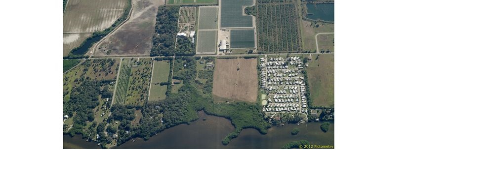
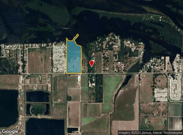
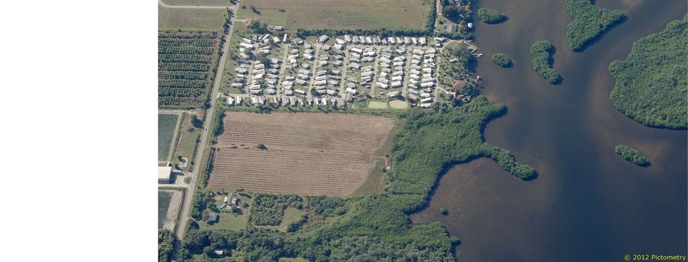
Property Record
2817 Gulf City Rd, Ruskin, FL 33570
NEARBY LISTINGS FOR SALE OR LEASE
Property Detail
2817 Gulf City Rd
Tampa-St. Petersburg-Clearwater, FL
Unplatted
U-11-32-18-ZZZ-000001-08580.0
GOV LOT 5 LESS W 670.18 FT
Vacantlandnec
Hillsborough
AE
Florida
12057C0653J
5
2023
23.13 AC
2023
Southeast Hillsborough
014104
Tampa/St Petersburg
DEMOGRAPHICS near 2817 Gulf City Rd
1 Mile
3 Mile
5 Mile
2024 Total Population
1,180
18,150
43,976
2029 Population
1,279
20,421
49,433
Pop Growth 2024-2029
+ 8.39%
+ 12.51%
+ 12.41%
Average Age
56
43
39
2024 Total Households
614
6,950
15,528
HH Growth 2024-2029
+ 8.31%
+ 12.33%
+ 12.48%
Median Household Inc
$40,682
$71,291
$74,474
Avg Household Size
1.90
2.60
2.80
2024 Avg HH Vehicles
2.00
2.00
2.00
Median Home Value
$202,174
$250,134
$258,907
Median Year Built
1979
2000
2006
Nearby Places
- Restaurants
- Banks
- Shops
- Fitness
- Groceries
PUBLIC TRANSPORTATION
AIRPORT
Sarasota/Bradenton International
DRIVE
WALK
Distance
Sarasota/Bradenton International
42 min
26.7 mi
Tampa International
DRIVE
WALK
Distance
Tampa International
53 min
33.5 mi
St Pete-Clearwater International
DRIVE
WALK
Distance
St Pete-Clearwater International
60 min
43.3 mi
Freight Ports
Port Manatee
DRIVE
WALK
Distance
Port Manatee
17 min
9.9 mi
SALE & LEASE HISTORY
LISTING DATE
SALE/LEASE

Nov 15, 2022
For Sale
May 07, 2022
For Sale
Mar 22, 2018
For Sale
Jul 17, 2017
For Sale
Apr 14, 2019
For Sale
Nearby Properties
Address
Land Use
TOTAL SIZE
Lot Size
Zoning
Address
Land Use
TOTAL SIZE
Lot Size
Zoning
132,036 SF
3.30 AC
PD
Address
Land Use
TOTAL SIZE
Lot Size
Zoning
233,300 SF
49.10 AC
PD
Address
Land Use
TOTAL SIZE
Lot Size
Zoning
106,623 SF
225.30 AC
AR
Address
Land Use
TOTAL SIZE
Lot Size
Zoning
13,003 SF
116.48 AC
PD
Address
Land Use
TOTAL SIZE
Lot Size
Zoning
182.35 AC
AR
Address
Land Use
TOTAL SIZE
Lot Size
Zoning
367.33 AC
AR
Address
Land Use
TOTAL SIZE
Lot Size
Zoning
628.36 AC
AR
Address
Land Use
TOTAL SIZE
Lot Size
Zoning
119,624 SF
13.03 AC
M
Address
Land Use
TOTAL SIZE
Lot Size
Zoning
97,398 SF
12.45 AC
RDC-12
Address
Land Use
TOTAL SIZE
Lot Size
Zoning
6,768 SF
47.53 AC
PD
Address
Land Use
TOTAL SIZE
Lot Size
Zoning
236.45 AC
AR
Address
Land Use
TOTAL SIZE
Lot Size
Zoning
459 SF
149.45 AC
AR
Address
Land Use
TOTAL SIZE
Lot Size
Zoning
58,695 SF
19.42 AC
PD
Address
Land Use
TOTAL SIZE
Lot Size
Zoning
1,701 SF
3.74 AC
PD
Address
Land Use
TOTAL SIZE
Lot Size
Zoning
118.68 AC
AR
Address
Land Use
TOTAL SIZE
Lot Size
Zoning
53,071 SF
6.71 AC
RSC-6
Address
Land Use
TOTAL SIZE
Lot Size
Zoning
7,886 SF
344.76 AC
AR
Address
Land Use
TOTAL SIZE
Lot Size
Zoning
21,979 SF
4.70 AC
PD
Address
Land Use
TOTAL SIZE
Lot Size
Zoning
34,129 SF
15.85 AC
AR
Address
Land Use
TOTAL SIZE
Lot Size
Zoning
42,729 SF
8.70 AC
PD
Address
Land Use
TOTAL SIZE
Lot Size
Zoning
5,263 SF
10.52 AC
PD
Address
Land Use
TOTAL SIZE
Lot Size
Zoning
5,985 SF
53.98 AC
AR
Address
Land Use
TOTAL SIZE
Lot Size
Zoning
19,126 SF
9.22 AC
ASC-1
Address
Land Use
TOTAL SIZE
Lot Size
Zoning
74.84 AC
PD
Address
Land Use
TOTAL SIZE
Lot Size
Zoning
36,426 SF
2.45 AC
CG
Address
Land Use
TOTAL SIZE
Lot Size
Zoning
32,400 SF
8.66 AC
RMC-9
Address
Land Use
TOTAL SIZE
Lot Size
Zoning
148.58 AC
AR
Address
Land Use
TOTAL SIZE
Lot Size
Zoning
9.38 AC
PD
Address
Land Use
TOTAL SIZE
Lot Size
Zoning
12,701 SF
1.61 AC
RTC-1
The World's #1 Commercial Real Estate Marketplace
Connect with us
© 2025 CoStar Group
The information above has been obtained from sources believed reliable. While we do not doubt its accuracy we have not verified it and make no guarantee, warranty or representation about it. It is your responsibility to independently confirm its accuracy and completeness. Any projections, opinions, assumptions, or estimates used are for example only and do not represent the current or future performance of the property. The value of this transaction to you depends on tax and other factors which should be evaluated by your tax, financial, and legal advisors. You and your advisors should conduct a careful, independent investigation of the property to determine to your satisfaction the suitability of the property for your needs.