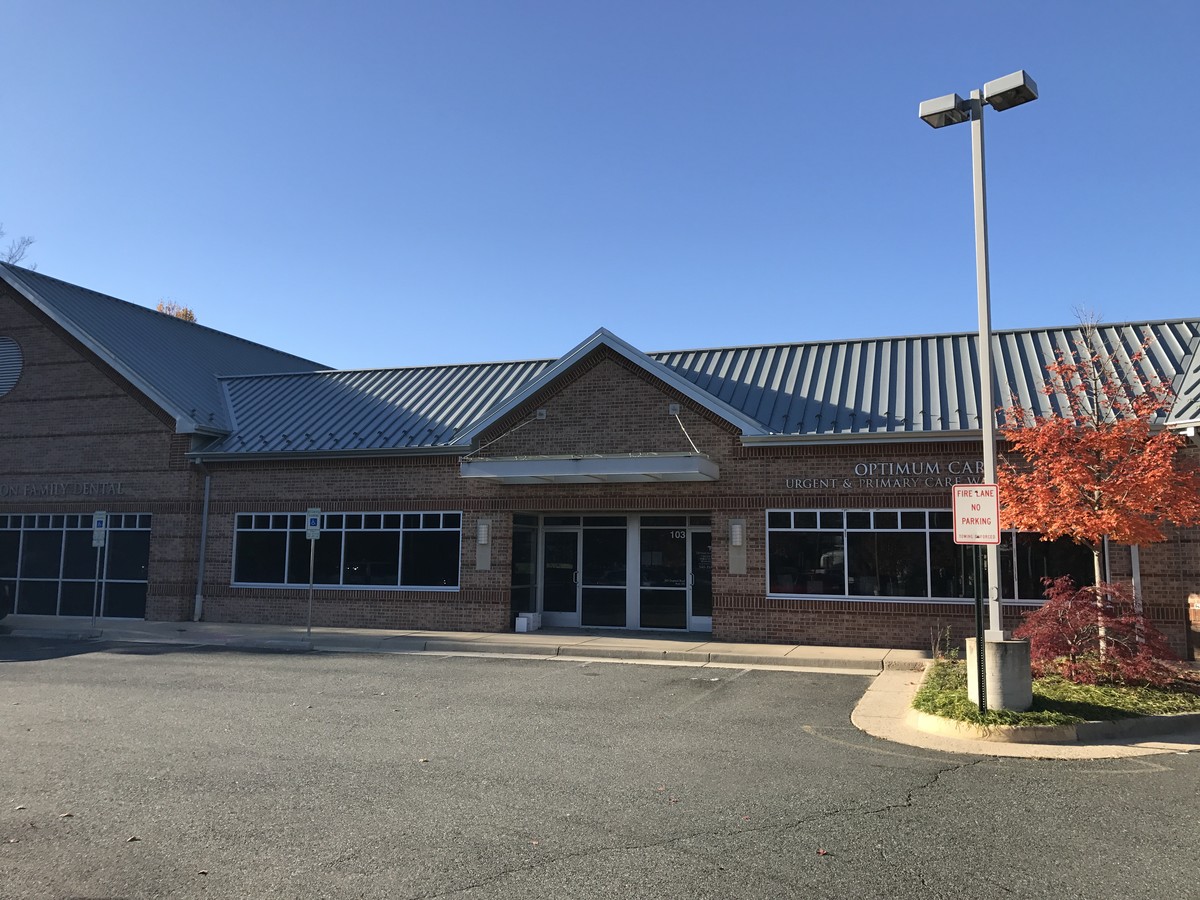
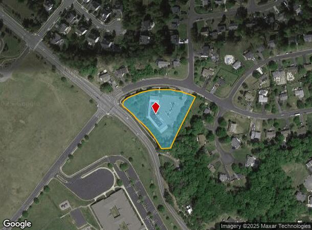
Property Record
282 Choptank Rd, Stafford, VA 22556

NEARBY LISTINGS FOR SALE OR LEASE
Property Detail
282 Choptank Rd
Washington-Arlington-Alexandria, DC-VA-MD-WV
Sec 10 Phase 3 Vista Woods Subdivision
19D310-684
LOT 684 89322 SQFT SEC 10 PHASE 3 VISTA WOODS SUBDIVISION
Officebuilding
Stafford
X
Virginia
51179C0128F
684
2024
2.05 AC
2024
Stafford County
010205
Washington, DC
11,631 SF
DEMOGRAPHICS near 282 Choptank Rd
1 Mile
3 Mile
5 Mile
2024 Total Population
5,321
28,260
64,898
2029 Population
5,880
31,360
72,098
Pop Growth 2024-2029
+ 10.51%
+ 10.97%
+ 11.09%
Average Age
38
38
36
2024 Total Households
1,609
8,518
20,083
HH Growth 2024-2029
+ 10.57%
+ 10.99%
+ 11.14%
Median Household Inc
$142,715
$149,223
$130,285
Avg Household Size
3.30
3.30
3.20
2024 Avg HH Vehicles
3.00
3.00
2.00
Median Home Value
$397,806
$436,864
$424,682
Median Year Built
1990
1995
1996
Nearby Places
- Restaurants
- Banks
- Shops
- Fitness
- Groceries
SALE & LEASE HISTORY
LISTING DATE
SALE/LEASE

Sep 25, 2023
For Lease
Oct 24, 2019
For Lease
Nov 21, 2016
For Lease
Nearby Properties
Address
Land Use
TOTAL SIZE
Lot Size
Zoning
Address
Land Use
TOTAL SIZE
Lot Size
Zoning
175,700 SF
128.43 AC
R3
Address
Land Use
TOTAL SIZE
Lot Size
Zoning
Address
Land Use
TOTAL SIZE
Lot Size
Zoning
295,187 SF
88.50 AC
A1
Address
Land Use
TOTAL SIZE
Lot Size
Zoning
244,617 SF
61.73 AC
R3
Address
Land Use
TOTAL SIZE
Lot Size
Zoning
175,990 SF
50.21 AC
A1
Address
Land Use
TOTAL SIZE
Lot Size
Zoning
103,560 SF
21.68 AC
B3
Address
Land Use
TOTAL SIZE
Lot Size
Zoning
168,780 SF
7.23 AC
R3
Address
Land Use
TOTAL SIZE
Lot Size
Zoning
97,516 SF
26.25 AC
A1
Address
Land Use
TOTAL SIZE
Lot Size
Zoning
146,710 SF
43.68 AC
R1
Address
Land Use
TOTAL SIZE
Lot Size
Zoning
125,365 SF
7.01 AC
B2
Address
Land Use
TOTAL SIZE
Lot Size
Zoning
95,535 SF
7.08 AC
B3
Address
Land Use
TOTAL SIZE
Lot Size
Zoning
76,187 SF
23.38 AC
A1
Address
Land Use
TOTAL SIZE
Lot Size
Zoning
82,543 SF
20.89 AC
A1
Address
Land Use
TOTAL SIZE
Lot Size
Zoning
75,936 SF
20 AC
PD1
Address
Land Use
TOTAL SIZE
Lot Size
Zoning
127,035 SF
2.90 AC
B2
Address
Land Use
TOTAL SIZE
Lot Size
Zoning
39,078 SF
21.15 AC
B2
Address
Land Use
TOTAL SIZE
Lot Size
Zoning
50,770 SF
3.66 AC
B3
Address
Land Use
TOTAL SIZE
Lot Size
Zoning
106,035 SF
5.35 AC
B2
Address
Land Use
TOTAL SIZE
Lot Size
Zoning
17,638 SF
4.45 AC
A1
Address
Land Use
TOTAL SIZE
Lot Size
Zoning
40,792 SF
15.16 AC
SC
Address
Land Use
TOTAL SIZE
Lot Size
Zoning
42,090 SF
4.44 AC
B2
Address
Land Use
TOTAL SIZE
Lot Size
Zoning
29,070 SF
3.88 AC
B2
Address
Land Use
TOTAL SIZE
Lot Size
Zoning
34,320 SF
10.60 AC
A1
Address
Land Use
TOTAL SIZE
Lot Size
Zoning
44,606 SF
4.13 AC
B3
Address
Land Use
TOTAL SIZE
Lot Size
Zoning
16,000 SF
2.05 AC
B2
Address
Land Use
TOTAL SIZE
Lot Size
Zoning
26,870 SF
2.35 AC
B2
Address
Land Use
TOTAL SIZE
Lot Size
Zoning
5,995 SF
3.11 AC
B2
Address
Land Use
TOTAL SIZE
Lot Size
Zoning
56,040 SF
6.18 AC
B2
Address
Land Use
TOTAL SIZE
Lot Size
Zoning
16,321 SF
16.72 AC
A1
Address
Land Use
TOTAL SIZE
Lot Size
Zoning
6,659 SF
2.30 AC
B2
The World's #1 Commercial Real Estate Marketplace
Connect with us
© 2025 CoStar Group
The information above has been obtained from sources believed reliable. While we do not doubt its accuracy we have not verified it and make no guarantee, warranty or representation about it. It is your responsibility to independently confirm its accuracy and completeness. Any projections, opinions, assumptions, or estimates used are for example only and do not represent the current or future performance of the property. The value of this transaction to you depends on tax and other factors which should be evaluated by your tax, financial, and legal advisors. You and your advisors should conduct a careful, independent investigation of the property to determine to your satisfaction the suitability of the property for your needs.