Property Record
28281 Paseo Dr, Wesley Chapel, FL 33543
NEARBY LISTINGS FOR SALE OR LEASE
Property Detail
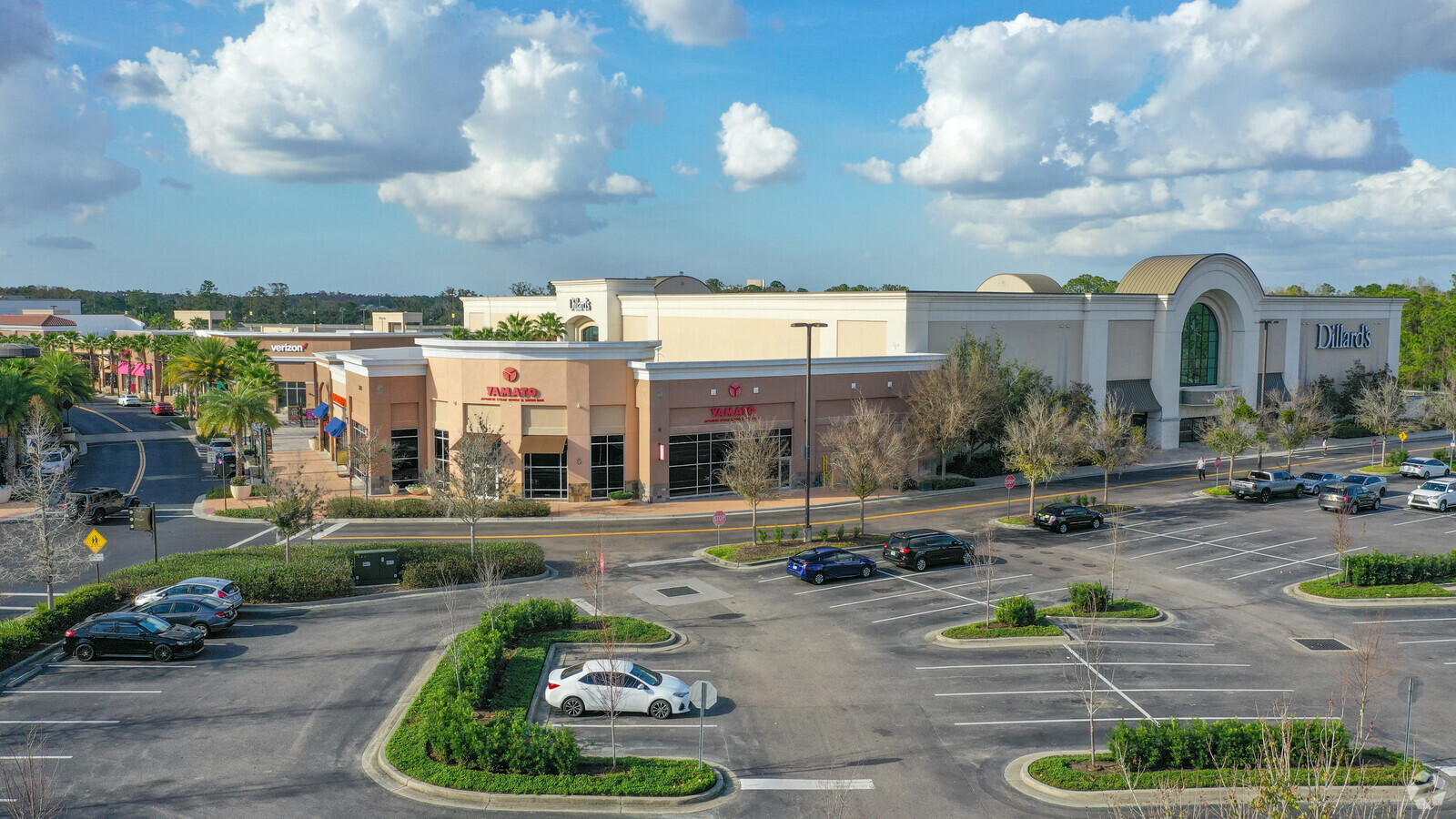
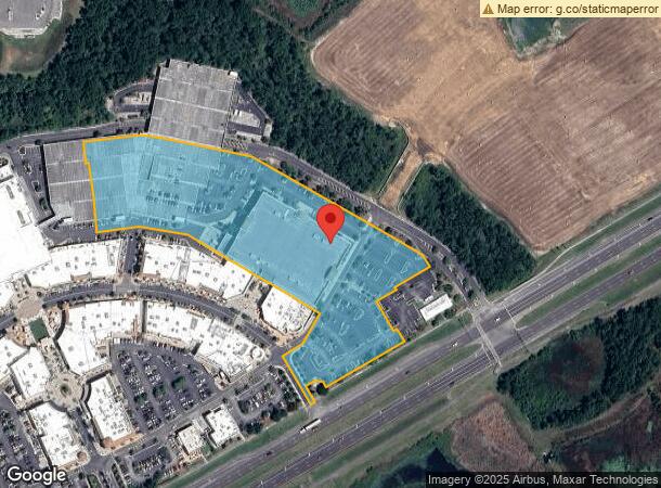
28281 Paseo Dr
Tampa-St. Petersburg-Clearwater, FL
Shops At Wiregrass
30-26-20-0010-00000-0130
SHOPS AT WIREGRASS PB 67 PG 042 LOT 13 OR 7786 PG 1052
Departmentstore
Pasco
X
Florida
12101C0428F
13
2024
8.58 AC
2024
Pasco County
032107
Tampa/St Petersburg
145,285 SF
DEMOGRAPHICS near 28281 Paseo Dr
1 Mile
3 Mile
5 Mile
2024 Total Population
6,165
55,607
145,903
2029 Population
7,377
64,899
169,971
Pop Growth 2024-2029
+ 19.66%
+ 16.71%
+ 16.50%
Average Age
38
38
38
2024 Total Households
2,271
19,475
51,691
HH Growth 2024-2029
+ 19.59%
+ 16.74%
+ 16.51%
Median Household Inc
$110,516
$110,185
$102,746
Avg Household Size
2.70
2.80
2.80
2024 Avg HH Vehicles
2.00
2.00
2.00
Median Home Value
$341,911
$350,741
$335,562
Median Year Built
2002
2005
2004
Nearby Places
- Restaurants
- Banks
- Shops
- Fitness
- Groceries
PUBLIC TRANSPORTATION
AIRPORT
Tampa International
DRIVE
WALK
Distance
Tampa International
40 min
28.7 mi
St Pete-Clearwater International
DRIVE
WALK
Distance
St Pete-Clearwater International
57 min
37.9 mi
Freight Ports
Port of Tampa Bay
DRIVE
WALK
Distance
Port of Tampa Bay
36 min
24.4 mi
Nearby Properties
Address
Land Use
TOTAL SIZE
Lot Size
Zoning
Address
Land Use
TOTAL SIZE
Lot Size
Zoning
548,616 SF
138.97 AC
PD-A
Address
Land Use
TOTAL SIZE
Lot Size
Zoning
455,090 SF
52.24 AC
MPUD
Address
Land Use
TOTAL SIZE
Lot Size
Zoning
425,346 SF
19.60 AC
MPUD
Address
Land Use
TOTAL SIZE
Lot Size
Zoning
306,559 SF
34.59 AC
MPUD
Address
Land Use
TOTAL SIZE
Lot Size
Zoning
293,253 SF
51.11 AC
MPUD
Address
Land Use
TOTAL SIZE
Lot Size
Zoning
347,708 SF
43.40 AC
MPUD
Address
Land Use
TOTAL SIZE
Lot Size
Zoning
346,880 SF
20.01 AC
MPUD
Address
Land Use
TOTAL SIZE
Lot Size
Zoning
324,184 SF
19.12 AC
MPUD
Address
Land Use
TOTAL SIZE
Lot Size
Zoning
263,289 SF
26.30 AC
MPUD
Address
Land Use
TOTAL SIZE
Lot Size
Zoning
425,489 SF
12.72 AC
MPUD
Address
Land Use
TOTAL SIZE
Lot Size
Zoning
299,792 SF
73.98 AC
AS-1
Address
Land Use
TOTAL SIZE
Lot Size
Zoning
279,167 SF
14.75 AC
MPUD
Address
Land Use
TOTAL SIZE
Lot Size
Zoning
175,877 SF
7.64 AC
PD
Address
Land Use
TOTAL SIZE
Lot Size
Zoning
192,698 SF
19.31 AC
MPUD
Address
Land Use
TOTAL SIZE
Lot Size
Zoning
138,613 SF
10.71 AC
PD
Address
Land Use
TOTAL SIZE
Lot Size
Zoning
198,276 SF
60.64 AC
AC
Address
Land Use
TOTAL SIZE
Lot Size
Zoning
175,978 SF
29.19 AC
AC
Address
Land Use
TOTAL SIZE
Lot Size
Zoning
153,412 SF
9.77 AC
MPUD
Address
Land Use
TOTAL SIZE
Lot Size
Zoning
113,513 SF
42.35 AC
PD-A
Address
Land Use
TOTAL SIZE
Lot Size
Zoning
153,330 SF
16.99 AC
PUD
Address
Land Use
TOTAL SIZE
Lot Size
Zoning
121,727 SF
48.75 AC
MPUD
Address
Land Use
TOTAL SIZE
Lot Size
Zoning
147,238 SF
13.89 AC
MPUD
Address
Land Use
TOTAL SIZE
Lot Size
Zoning
59,481 SF
43.31 AC
PD
Address
Land Use
TOTAL SIZE
Lot Size
Zoning
104,418 SF
89.04 AC
MPUD
Address
Land Use
TOTAL SIZE
Lot Size
Zoning
136,319 SF
26.11 AC
MPUD
Address
Land Use
TOTAL SIZE
Lot Size
Zoning
94,524 SF
6.44 AC
PD
Address
Land Use
TOTAL SIZE
Lot Size
Zoning
206,368 SF
27.78 AC
PD-A
Address
Land Use
TOTAL SIZE
Lot Size
Zoning
83,294 SF
7.68 AC
MPUD
Address
Land Use
TOTAL SIZE
Lot Size
Zoning
97,416 SF
0.94 AC
MPUD
Address
Land Use
TOTAL SIZE
Lot Size
Zoning
91,866 SF
2.70 AC
MPUD
The World's #1 Commercial Real Estate Marketplace
Connect with us
© 2025 CoStar Group
The information above has been obtained from sources believed reliable. While we do not doubt its accuracy we have not verified it and make no guarantee, warranty or representation about it. It is your responsibility to independently confirm its accuracy and completeness. Any projections, opinions, assumptions, or estimates used are for example only and do not represent the current or future performance of the property. The value of this transaction to you depends on tax and other factors which should be evaluated by your tax, financial, and legal advisors. You and your advisors should conduct a careful, independent investigation of the property to determine to your satisfaction the suitability of the property for your needs.