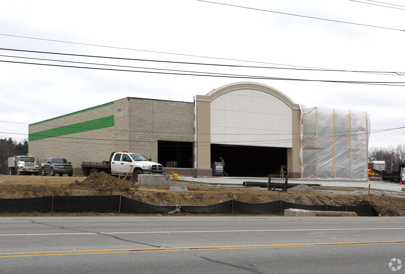
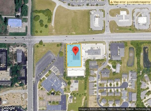
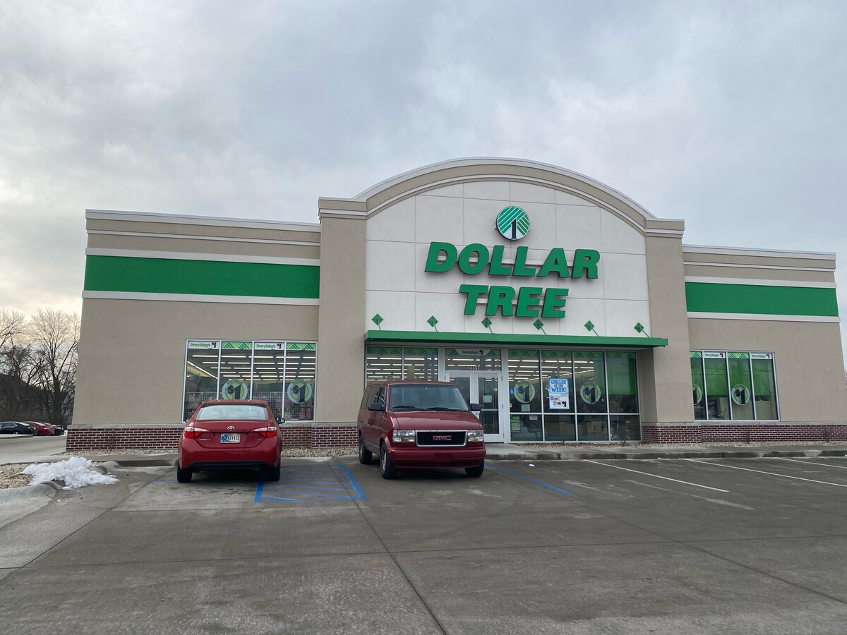
Property Record
2831 Us Highway 52 W, West Lafayette, IN 47906
NEARBY LISTINGS FOR SALE OR LEASE
Property Detail
2831 Us Highway 52 W
Lafayette-West Lafayette, IN
Commercial Sd
79-06-02-302-003.000-023
2827 COMMERCIAL SD LOT 2
Storebuilding
Tippecanoe
X
Indiana
18157C0129D
2
2023
1.11 AC
2024
Lafayette/Kokomo
010208
Other Market Areas
10,000 SF
DEMOGRAPHICS near 2831 Us Highway 52 W
1 Mile
3 Mile
5 Mile
2024 Total Population
8,742
33,370
77,156
2029 Population
9,094
34,439
80,095
Pop Growth 2024-2029
+ 4.03%
+ 3.20%
+ 3.81%
Average Age
32
34
32
2024 Total Households
3,752
13,486
29,615
HH Growth 2024-2029
+ 3.97%
+ 3.26%
+ 4.30%
Median Household Inc
$34,222
$58,105
$40,527
Avg Household Size
2.30
2.30
2.20
2024 Avg HH Vehicles
2.00
2.00
2.00
Median Home Value
$188,915
$243,737
$253,966
Median Year Built
2001
1997
1993
Nearby Places
- Restaurants
- Banks
- Shops
- Fitness
- Groceries
PUBLIC TRANSPORTATION
COMMUTER RAIL
Lafayette Amtrak Station (Cardinal - Amtrak)
DRIVE
WALK
Distance
Lafayette Amtrak Station (Cardinal - Amtrak)
11 min
5.9 mi
Freight Ports
Port Milwaukee
DRIVE
WALK
Distance
Port Milwaukee
248 min
202.8 mi
SALE & LEASE HISTORY
LISTING DATE
SALE/LEASE

Jan 19, 2021
For Sale
Nearby Properties
Address
Land Use
TOTAL SIZE
Lot Size
Zoning
Address
Land Use
TOTAL SIZE
Lot Size
Zoning
13,773 SF
87 SF
Address
Land Use
TOTAL SIZE
Lot Size
Zoning
191,872 SF
87 SF
Address
Land Use
TOTAL SIZE
Lot Size
Zoning
265,805 SF
44 SF
Address
Land Use
TOTAL SIZE
Lot Size
Zoning
159,946 SF
87 SF
Address
Land Use
TOTAL SIZE
Lot Size
Zoning
267,566 SF
87 SF
Address
Land Use
TOTAL SIZE
Lot Size
Zoning
402,757 SF
87 SF
Address
Land Use
TOTAL SIZE
Lot Size
Zoning
335,332 SF
87 SF
Address
Land Use
TOTAL SIZE
Lot Size
Zoning
0.01 AC
Address
Land Use
TOTAL SIZE
Lot Size
Zoning
336,185 SF
87 SF
Address
Land Use
TOTAL SIZE
Lot Size
Zoning
257,996 SF
87 SF
Address
Land Use
TOTAL SIZE
Lot Size
Zoning
Address
Land Use
TOTAL SIZE
Lot Size
Zoning
42,800 SF
131 SF
Address
Land Use
TOTAL SIZE
Lot Size
Zoning
273,240 SF
44 SF
Address
Land Use
TOTAL SIZE
Lot Size
Zoning
213,048 SF
44 SF
Address
Land Use
TOTAL SIZE
Lot Size
Zoning
277,589 SF
44 SF
Address
Land Use
TOTAL SIZE
Lot Size
Zoning
165,842 SF
44 SF
Address
Land Use
TOTAL SIZE
Lot Size
Zoning
133,379 SF
44 SF
Address
Land Use
TOTAL SIZE
Lot Size
Zoning
111,600 SF
87 SF
Address
Land Use
TOTAL SIZE
Lot Size
Zoning
104,300 SF
44 SF
Address
Land Use
TOTAL SIZE
Lot Size
Zoning
251,709 SF
87 SF
Address
Land Use
TOTAL SIZE
Lot Size
Zoning
58,800 SF
87 SF
Address
Land Use
TOTAL SIZE
Lot Size
Zoning
225,450 SF
87 SF
Address
Land Use
TOTAL SIZE
Lot Size
Zoning
194,022 SF
87 SF
Address
Land Use
TOTAL SIZE
Lot Size
Zoning
107,298 SF
87 SF
Address
Land Use
TOTAL SIZE
Lot Size
Zoning
106,226 SF
44 SF
Address
Land Use
TOTAL SIZE
Lot Size
Zoning
205,628 SF
131 SF
Address
Land Use
TOTAL SIZE
Lot Size
Zoning
185,868 SF
87 SF
Address
Land Use
TOTAL SIZE
Lot Size
Zoning
160,428 SF
44 SF
Address
Land Use
TOTAL SIZE
Lot Size
Zoning
121,681 SF
44 SF
Address
Land Use
TOTAL SIZE
Lot Size
Zoning
99,391 SF
44 SF
The World's #1 Commercial Real Estate Marketplace
Connect with us
© 2025 CoStar Group
The information above has been obtained from sources believed reliable. While we do not doubt its accuracy we have not verified it and make no guarantee, warranty or representation about it. It is your responsibility to independently confirm its accuracy and completeness. Any projections, opinions, assumptions, or estimates used are for example only and do not represent the current or future performance of the property. The value of this transaction to you depends on tax and other factors which should be evaluated by your tax, financial, and legal advisors. You and your advisors should conduct a careful, independent investigation of the property to determine to your satisfaction the suitability of the property for your needs.